


























Quick Field Data
- UNESCO Inscription: December 1993, extended in 2009 (Natural, Criteria vii, ix, x; Property ID 653bis; Ramsar Site 1010 since 12 November 1999; 35th ASEAN Heritage Park in November 2015; Particularly Sensitive Sea Area on 25 July 2017).
- Scale & Footprint: 96,828 to 97,030-hectare (970.30 km² or 239,770 to 239,800 acres; 374.6 sq mi) marine sanctuary comprising the North Atoll, South Atoll, and Jessie Beazley Reef (20 km north), featuring extensive lagoons, two coral islets, and 100-metre perpendicular reef walls.
- Access & Ticketing: Uninhabited marine park guarded 24/7 by 10 to 12 rotating rangers and accessible only via liveaboard diving vessels during the mid-March to mid-June calm season; check the official site for conservation entry rules and liveaboard bookings.
- Arrival Logistics: Located at 8.9533°N, 119.8675°E in the middle of the Sulu Sea, 150 km (93 mi) southeast of Puerto Princesa (a 10-hour boat journey) and 130 km (81 mi) southwest of the island municipality of Cagayancillo, Palawan, Philippines.
Darwinian Atolls on the Cagayan Ridge and Sama-Bajau Seafaring
Positioned at 8.9533 degrees north and 119.8675 degrees east in the middle of the Sulu Sea in the Philippines, Tubbataha Reefs Natural Park (known in Filipino as Bahurang Tubbataha and formerly designated Tubbataha Reef Marine Park or National Marine Park) lies 150 kilometres (93 mi) southeast of the Palawan provincial capital of Puerto Princesa and roughly 130 kilometres (81 mi) southwest of the island municipality of Cagayancillo, Palawan, to which the uninhabited reefs and islets administratively belong. The name tubbataha combines the Sama-Bajau terms tubba and taha, which together mean "a long reef exposed at low tide", while seafarers from the islands of Cagayancillo who sailed native outrigger vessels (banka or bangka) to fish the shoals called the reefs "Gusong". Geologically, the reef complex rises atop the Cagayan Ridge, an extinct underwater volcano and Miocene island arc. Following Charles Darwin's classical theory of coral atoll formation, fringing reefs originally grew around volcanic islands along the ridge; as the volcanoes became extinct and the underlying crust cooled and subsided over geological time alongside fluctuating sea levels, the corals grew upward toward the sunlit surface, creating staircase-like outer slopes, deep lagoons, and dramatic 100-metre perpendicular reef walls.
For generations, physical isolation in the open Sulu Sea and the complete absence of freshwater on the two small coral islets prevented permanent human settlement and shielded the marine ecosystem from over-exploitation. During the 1980s, however, declining fish stocks elsewhere and the adoption of motorised bangkas brought increasing numbers of fishermen who used destructive cyanide and dynamite fishing methods. Following a campaign by scuba divers and environmentalists endorsed by the Provincial Government of Palawan, President Corazon Aquino signed Proclamation No. 306 on 11 August 1988, establishing the 332-square-kilometre (82,000-acre) Tubbataha Reefs as the first national marine park in the Philippines. On 23 August 2006, Proclamation No. 1126 was signed by President Gloria Macapagal Arroyo, expanding the park boundaries by 200% to 970.30 square kilometres (97,030 hectares or 239,770 to 239,800 acres; 374.6 sq mi; listed as 96,828 hectares in the 2009 UNESCO extension under ID 653bis) to incorporate the smaller Jessie Beazley Reef located 20 kilometres (12 mi) north of the North and South Atolls.
Managed from Puerto Princesa by the Tubbataha Management Office (TMO) under the protective oversight of the Department of National Defense (DND) and technical supervision from both the Palawan Council for Sustainable Development and the national Department of Environment and Natural Resources, the sanctuary is guarded 24 hours a day, 7 days a week by a rotating team of 10 to 12 armed rangers drawn from the Municipality of Cagayancillo, the Philippine Coast Guard, the Philippine Navy, and the TMO serving two-month tours. Initially housed in a canvas tent and an unstable 1996 wooden hut, the rangers occupy a styrofoam-reinforced concrete station on the Southeast Islet at the southern tip of the North Atoll (with World Wildlife Fund plans announced in 2013 during the park's 25th anniversary for a modernised ranger station). In addition to its December 1993 UNESCO inscription (extended in 2009), Tubbataha was designated Ramsar Wetland Site 1010 on 12 November 1999, nominated for the New7Wonders of Nature in 2007 and 2008 (as reported by Aie Balagtas See in GMA News), depicted on the reverse face of the 2010 Philippine 1,000-unit banknote series, named the 35th ASEAN Heritage Park in November 2015, and designated on 25 July 2017 by the International Maritime Organization as a protected Particularly Sensitive Sea Area (PSSA) and a maritime "area to be avoided".
Coral Triangle Biodiversity and Perpendicular Reef Walls
Situated within the Coral Triangle (where 40% of global reef fish and 75% of all described coral species live) and studied by marine researchers including Alan T. White, Melody Ovenden, and C. Michael Hogan, Tubbataha Reefs Natural Park functions as a natural seed bank and larval dispersal engine for the entire Sulu Sea fishery system. Vivid living corals blanket over two-thirds of the reef platform, supporting over 350 to 360 described species of coral and between 500, 600, and almost 700 species of fish across more than 1,000 marine life species in total (despite localized ecological pressures such as a June 2009 outbreak of crown-of-thorns starfish).
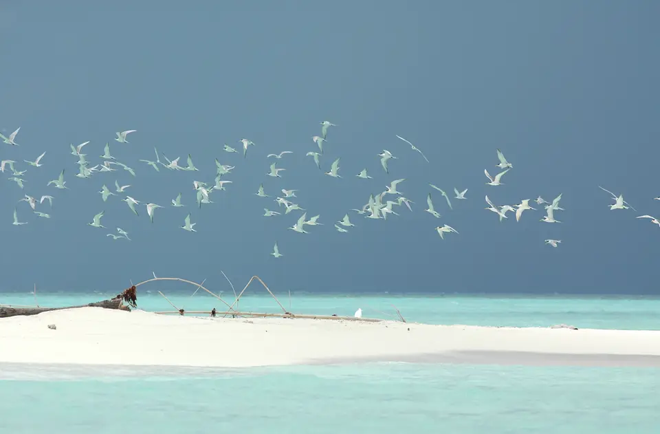
Where the shallow reef flats and extensive sandy lagoons drop abruptly down 100-metre perpendicular coral walls into the deep sea, strong currents sustain dense schools of pelagic and reef fishes, including giant trevally (jacks), barracuda, parrotfish, palm-sized Moorish idols, clownfish, lionfish, moray eels, and the endangered Napoleon wrasse. Eleven species of sharks and rays patrol the drop-offs, including whitetip reef sharks, tiger sharks, hammerhead sharks, whale sharks, and manta rays, alongside 13 species of cetaceans (dolphins and whales). On the uninhabited coral sandbars, especially the North Islet, critically endangered hawksbill sea turtles (Eretmochelys imbricata) and endangered green sea turtles haul out to nest alongside 100 recorded bird species that form one of the last major breeding seabird colonies in the region.
Because the low-lying atolls sit near busy shipping lanes in the Sulu Sea, several vessel groundings have tested park defences. During October 1945, the US Navy auxiliary motor minesweeper YMS 340 grounded on the reef before being towed free by USS Gillette (DE 681) and the US Navy tug Vireo after USS Leland E. Thomas (DE 420) radioed for help. On 31 October 2005, the Greenpeace vessel Rainbow Warrior ran aground and damaged roughly 100 m² (or 1,100 sq ft) of coral, paying a compensation penalty after Greenpeace official Red Constantino cited faulty government charts. Between 2011 and January 2013, eleven ship incidents occurred before the US Navy minesweeper vessel USS Guardian grounded on 17 January 2013; to prevent further coral destruction, the vessel was dismantled in place by 30 March 2013, five officers were relieved of duty, the Philippine Maritime Casualty Investigating Team (MCIT) investigated, and after the World Wide Fund for Nature in the Philippines and TMO measured 2,345.67 square metres (25,248.6 sq ft) of reef damage, the United States Government paid restitution to the Philippine government on 20 January 2015 covering both reef damage and Philippine Coast Guard services. Days after the Guardian removal, on 8 April 2013, the Chinese fishing vessel F/V Min Long Yu grounded 1.1 nmi (or 2.0 km; 1.3 mi) east of the ranger station with 12 crew members and 400 boxes of frozen pangolins on board.
Liveaboard Diving Season (Mid-March to Mid-June) and Ranger Station Protocol
After 1993, the UNESCO World Heritage Atlas in 1993 and extended in 2009, Tubbataha Reefs Natural Park has no hotels or permanent visitor facilities; all visitors arrive on liveaboard diving yachts taking roughly ten hours by boat from Puerto Princesa during the calm diving window between mid-March and mid-June (with peak bookings around Easter, April, and Golden Week when underwater visibility reaches 30 to 45 metres or 98 to 148 ft, and local residents of Palawan province granted conservation-fee exemptions since September 2010 under Governor Abraham Kahlil Mitra). You can locate the Sulu Sea atolls on our interactive world map. Sheer coral walls plunge into the blue abyss.
- Diving the 100-metre perpendicular walls of the North and South Atolls: Drift along the vertical drop-offs where shallow coral gardens meet the deep Sulu Sea to spot whitetip reef sharks, hammerhead sharks, tiger sharks, whale sharks, manta rays, Napoleon wrasse, giant trevally, and schooling barracuda in 30-to-45-metre visibility.
- Exploring the pelagic drop-offs of Jessie Beazley Reef: Sail 20 kilometres (12 mi) north of the two main atolls to dive the currents around Jessie Beazley Reef, incorporated into the 97,030-hectare natural park under Proclamation No. 1126 in August 2006.
- Visiting the Southeast Islet Ranger Station while respecting off-limits sandbars: While the nesting sandbars of the North Islet are strictly off-limits to protect breeding seabirds and hawksbill and green sea turtles, liveaboard guests may step ashore at the North Atoll Ranger Station to meet the rotating Navy, Coast Guard, Cagayancillo, and TMO rangers.
