Reykjavik
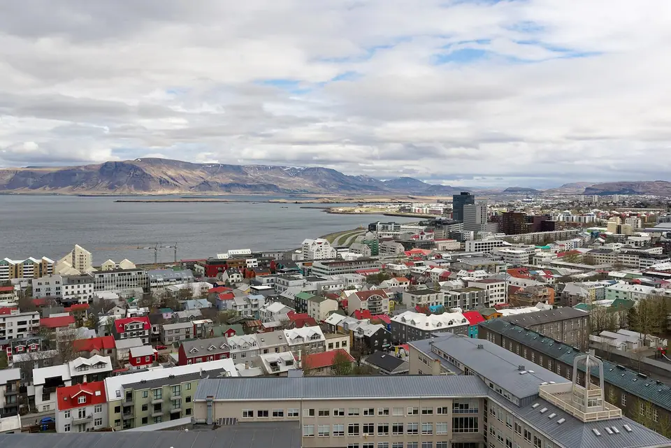
Jutting into Faxafloi Bay beneath the volcanic ridge of Mount Esja at 64° North, Reykjavik is the world's northernmost sovereign capital: a walkable peninsula of painted corrugated-iron houses, steaming geothermal pools, Viking longhouse ruins, and basalt-inspired landmarks that opens directly onto the Golden Circle, South Coast waterfalls, and the Aurora Borealis.
Quick decisions
- How many days? Allow 3 to 4 full days so you can spend one full day walking downtown Midborg, the Old Harbour, and a geothermal lagoon, a second day on the Golden Circle (Thingvellir, Geysir, and Gullfoss), and a third day along the South Coast waterfalls to Vik or out on the Snaefellsnes Peninsula.
- Where should I stay? Stay in walkable Midborg (postcode 101) around Laugavegur, Austurvollur, or Tjornin lake if relying on Tour Bus Stops 1 to 16, or near the Old Harbour and Laugardalur if hiring a car.
- Do I need a car? You do not need a car inside central Reykjavik; hire a 2WD (summer) or studded-tyre 4WD (winter) only for self-driving the Golden Circle, South Coast, and Snaefellsnes, or join small-group minibus excursions from the numbered pink downtown bus stops.
- Best for: Geothermal lagoon bathing, tectonic rift canyons and geysers, Northern Lights hunting, whale and puffin cruises, and Nordic design and food.
- Before you go: Leave cash at home (Iceland uses contactless Visa and Mastercard cards everywhere, down to public toilets and hot-dog stands), book timed entry slots in advance for Sky Lagoon and Blue Lagoon, and check `en.vedur.is` and `road.is` daily for wind and aurora updates.
- Getting around: Walk end to end across central Midborg in 25 minutes, use the Klapp app or a contactless bank card on yellow Straeto city buses, and ride the 45-minute Flybus from Keflavik International Airport (KEF).
- Continue your trip: Fly from Reykjavik Domestic Airport (RKV) to Akureyri or Isafjordur, drive the full Route 1 Ring Road around Iceland, or use Icelandair's transatlantic stopover links to London, Copenhagen, and New York.
Overview
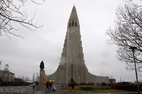
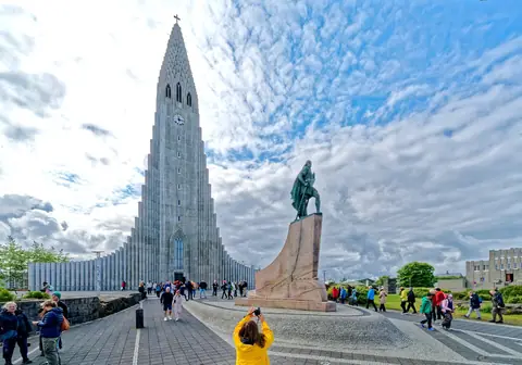
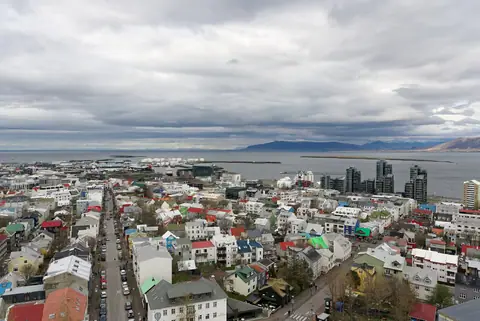
Named Reykjavík ("Smoky Bay") around 874 CE by Norse settler Ingólfur Arnarson after the plumes of geothermal steam rising along its shoreline, Iceland's capital sits at 64°08' North, making it the northernmost capital of a sovereign state on Earth. Built across the breezy Seltjarnarnes peninsula facing snow-streaked Mount Esja (914m) across Faxaflói Bay, the city combines the intimacy of a 19th-century Nordic harbour town with the cultural weight of a national metropolis. In central Miðborg, timber houses clad in scarlet, mustard, and cobalt corrugated iron climb toward the 74.5-metre stepped basalt concrete spire of Hallgrímskirkja and the crystalline glass waterfront of Harpa Concert Hall. Beneath the streets lie the excavated tenth-century turf walls of The Settlement Exhibition and a network of geothermal hot water that heats eighteen neighbourhood swimming pools, Sky Lagoon, and the nearby Blue Lagoon. Within an hour's drive east and south begin the tectonic fissures of UNESCO-listed Þingvellir, erupting Strokkur Geyser, and Gullfoss waterfall.
Getting there
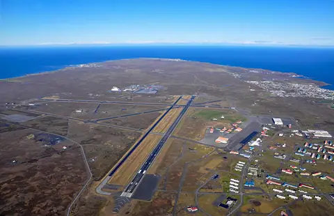
Fly into Keflavík International Airport (KEF), located 50 km south-west on the Reykjanes Peninsula (45 minutes by Flybus, Airport Direct, or rental car along Route 41), and use Reykjavík Domestic Airport (RKV) just 2 km south of downtown for internal flights across Iceland.
Where to stay
Base yourself in central Miðborg (101 Reykjavík) around Laugavegur, Austurvöllur, and Skólavörðuholt for step-free access to cafés and Tour Bus Stops, along the maritime Old Harbour and Grandi waterfront, or beside Tjörnin lake.
Things to do
Ascend Hallgrímskirkja and visit Harpa Concert Hall and the Sun Voyager, walk Laugavegur, Austurvöllur, and the Old Harbour, soak in Sundhöllin, Laugardalslaug, Sky Lagoon, or Blue Lagoon, tour the National Museum, Settlement Exhibition, and Perlan Ice Cave, and take day trips to the Golden Circle and South Coast waterfalls.
Food and drink
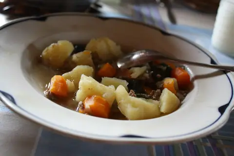
Warm up with a bowl of traditional Icelandic lamb soup (kjötsúpa) or creamy plokkfiskur fish gratin with dark geothermally baked rúgbrauð rye bread, order a lamb hot dog with remoulade and crispy onions at 1937 Bæjarins Beztu Pylsur, and taste pan-seared Arctic char and thick heirloom skyr.
Culture
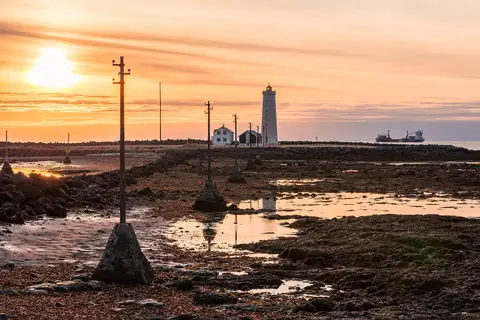
Experience Iceland's daily neighbourhood heitur pottur (geothermal hot-pot) bathing tradition, explore the world's oldest parliamentary heritage from 930 CE Alþingi to 1881 Alþingishúsið, and watch humpback whales in Faxaflói Bay and winter Northern Lights over Grótta Lighthouse.
Weather by month
Reykjavik is warmest in July, with average highs around 15°C, and coldest in January, when nights drop to about -2°C. January is the wettest month, with rain on about 13 days.
| Month | Low | Range | High | Rain | Rainy days |
|---|---|---|---|---|---|
| Jan | -2°C | 2°C | 91 mm | 13 d | |
| Feb | -2°C | 3°C | 91 mm | 13 d | |
| Mar | -1°C | 4°C | 91 mm | 13 d | |
| Apr | 1°C | 7°C | 70 mm | 10 d | |
| May | 4°C | 10°C | 63 mm | 9 d | |
| Jun | 8°C | 13°C | 63 mm | 9 d | |
| Jul | 10°C | 15°C | 63 mm | 9 d | |
| Aug | 9°C | 14°C | 77 mm | 11 d | |
| Sep | 6°C | 11°C | 84 mm | 12 d | |
| Oct | 3°C | 7°C | 84 mm | 12 d | |
| Nov | 0°C | 4°C | 84 mm | 12 d | |
| Dec | -2°C | 3°C | 91 mm | 13 d |
Averages of daily values from 2015 to 2024. Rainy days are days with at least 1 mm of rain. Source: Open-Meteo · Compare destinations by month.
Reykjavik on the map
Every place we cover in Reykjavik. Tap a category or pin to explore.
In-depth Reykjavik guides
Browse the guides grouped by topic: sights, neighbourhoods, food, transport, day trips and trip planning.
Sights, Landmarks & Parks
Key monuments, viewpoints, museums and nature trails.
- 12 Essential Landmarks & Geothermal Experiences in and around ReykjavikExplore the 12 defining sights of Reykjavik, Iceland: climb Hallgrimskirkja, admire Harpa Concert Hall and Sun Voyager, step inside the 871 CE Settlement Exhibition and Perlan Ice Cave, soak in Sky Lagoon, and tour the Golden Circle.
- Best Time to Visit Reykjavik: Midnight Sun, Puffins, Northern Lights & WMO ClimateMonth-by-month weather and daylight guide for Reykjavik using official 1991-2020 IMO/WMO climate normals: compare the 21-hour Midnight Sun and puffin season of May to August with the Aurora Borealis months of September to mid-April.
- 3 Days in Reykjavik: Midborg & Sky Lagoon, the Golden Circle, Plus South Coast WaterfallsA balanced 3-day Reykjavik itinerary: spend Day 1 exploring Hallgrimskirkja, Harpa, the 871 CE Settlement Exhibition, and Sky Lagoon, Day 2 on the Golden Circle, and Day 3 along the South Coast waterfalls to Reynisfjara.
- Hallgrimskirkja, Harpa Concert Hall & Sun Voyager: Reykjavik's Architectural TrioExplore the three defining modern landmarks of Reykjavik: ride the lift up Gudjon Samuelsson's 74.5m basalt-inspired Hallgrimskirkja, step inside Olafur Eliasson's crystalline glass facade at Harpa, and visit the Sun Voyager on Saebraut.
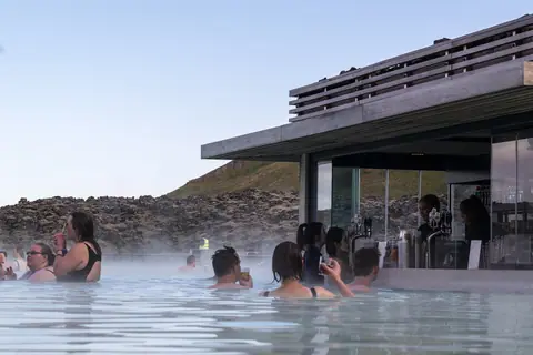
- Reykjavik Geothermal Pools, Sky Lagoon & Blue Lagoon: Complete Bathing GuideHow to experience Iceland's geothermal bathing culture in and around Reykjavik: compare local hot-pot pools (1937 Sundhollin, Laugardalslaug, and Nautholsvik Beach) with the oceanfront Sky Lagoon and the silica-rich Blue Lagoon.
- National Museum of Iceland, Perlan Ice Cave & the 871 CE Settlement ExhibitionExplore Reykjavik's three top museums: see the 1200 CE Valthjofsstadur Door at the National Museum of Iceland, walk around an excavated 871 CE Viking longhouse at The Settlement Exhibition, and enter the real-snow Ice Cave at Perlan.
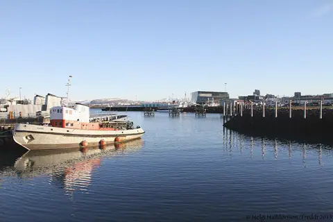
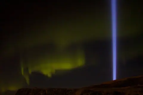
- Northern Lights (Aurora) Forecast & Old Harbour Whale Watching in ReykjavikHow to see the Northern Lights (Aurora Borealis) in Reykjavik between September and mid-April using the official IMO cloud-cover map, plus year-round humpback and minke whale watching and summer puffin cruises from the Old Harbour.
Neighbourhoods & Where to Stay
Districts, historic quarters and the best bases for your stay.
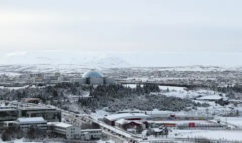
- Reykjavik Orientation: Midborg 101, Old Harbour, Perlan & Geothermal ValleysUnderstand how Reykjavik is laid out across the Seltjarnarnes peninsula: connect central Midborg (101), Tjornin lake, and Hallgrimskirkja with the Old Harbour, Oskjuhlid hill, and the Reykjanes Peninsula.
- What to Wear in Reykjavik: Three-Layer Shell System, Pool Shower Rules & CramponsHow to pack for Reykjavik in summer and winter: master the windproof 3-layer shell system, understand why umbrellas fail in North Atlantic gusts, pack microspikes for icy winter streets, and follow Icelandic geothermal shower etiquette.
- Where to Stay in Reykjavik: Midborg (101), Old Harbour & Grandi, Tjornin & LaugardalurCompare the four best neighbourhoods to stay in Reykjavik: central Midborg (101) around Laugavegur and Austurvollur, the maritime Old Harbour and Grandi waterfront, quiet Thingholt beside Tjornin lake, or car-friendly Laugardalur.
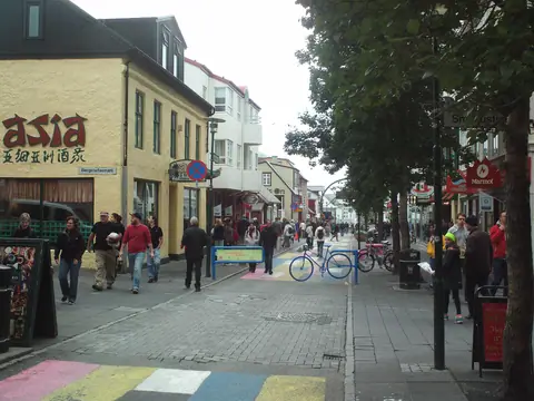
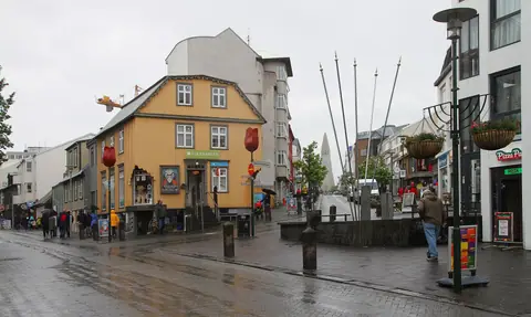
- Downtown Midborg Walk: Rainbow Street, Laugavegur, 1881 Parliament, Tjornin & Old HarbourA self-guided walking route through historic 101 Reykjavik: descend Rainbow-painted Skolavordustigur and Laugavegur, explore Austurvollur Square and the 1881 Althingishusid parliament, see the 3D map of Iceland on Tjornin lake, and stroll the Old Harbour.
Food & Drink
Local dishes, markets, cafés and dining districts.
Getting Around & Arrival
Airport transfers, public transit, passes and driving rules.
Day Trips & Excursions
Easy half-day and full-day trips from the city.
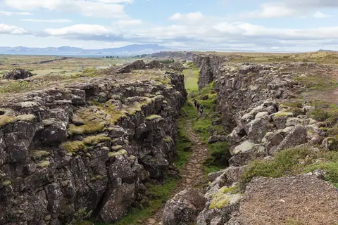
- The Golden Circle Day Trip from Reykjavik: Thingvellir, Strokkur Geyser & GullfossHow to plan Iceland's classic 230 km Golden Circle day trip from Reykjavik: walk between the North American and Eurasian tectonic plates at UNESCO-listed Thingvellir, watch Strokkur Geyser erupt every 6 to 10 minutes, and stand beside Gullfoss.
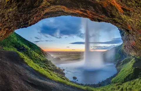
- South Coast (Seljalandsfoss, Skogafoss & Reynisfjara) & Snaefellsnes Day TripsCompare the two greatest full-day excursions beyond the Golden Circle: follow Route 1 along the South Coast to Seljalandsfoss, Skogafoss, Solheimajokull glacier, and Reynisfjara black-sand beach near Vik, or tour the Snaefellsnes Peninsula.
Reviews
Log in to write a review.
No reviews yet.