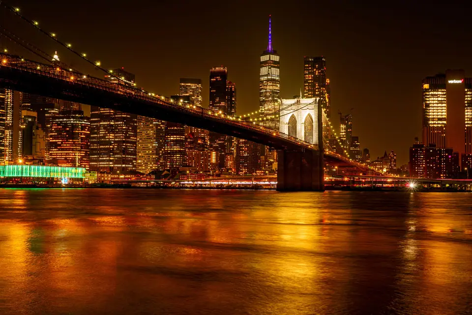
The Ultimate USA Itinerary: 5 Field-Tested Routes Across America (10 to 21 Days)
Five realistic, field-tested 10 to 21 day routes across the United States, complete with Amtrak rail pairings, National Park timed-entry strategies, road trip loops, and neighbourhood hotel bases.
Planning Around American Scale
Planning a United States itinerary is an exercise in continental geometry. On a world map, the forty-eight contiguous states look like a single country you could cross in a week or two. On the ground, the distance from New York City to San Francisco is roughly 4,130 kilometres (2,565 miles), wider than the entire distance from London to Baghdad. Even a single state can humble European or Asian transit assumptions: driving across Texas from Beaumont on the Louisiana border to El Paso on the New Mexico line covers more highway miles than driving from Boston to Washington, D.C. and back again.
The single biggest mistake first-time international visitors make is treating the United States as one continuous road trip. Travellers book an arrival flight into Manhattan, rent an SUV, and attempt to connect the Atlantic seaboard, Chicago, New Orleans, the Grand Canyon, Las Vegas, and the California coast in two weeks. The result is seventy hours behind a windscreen on monotonous interstate highways, punitive one-way rental car drop fees, and arriving at every major monument after the afternoon tour buses have already clogged the gates.
To spare your holiday from turning into an endurance test on Interstate 40 or Interstate 80, we have engineered this comprehensive master planner around how the country actually works. Instead of one impossible cross-country marathon, you should treat the United States as five distinct travel regions, each with its own climate calendar, transit rules, and pacing logic. Some corridors, such as the Northeast Megalopolis between Boston, New York, and Washington, D.C., punish anyone who brings a car and reward travellers who ride high-speed rail from city centre to city centre. Other regions, notably the Colorado Plateau of Utah and Arizona or California's Pacific Coast Highway and Sierra Nevada granite passes, are virtually inaccessible without your own four wheels and an early morning alarm clock.
Below, we break down five complete, field-tested USA itineraries ranging from 10 to 21 days, plus a transcontinental combination blueprint for travellers with three full weeks. Every route includes exact day-by-day sequencing, morning gate strategies to beat peak crowds, realistic driving times and flight connections, neighbourhood hotel bases, and local dining stops away from tourist traps.
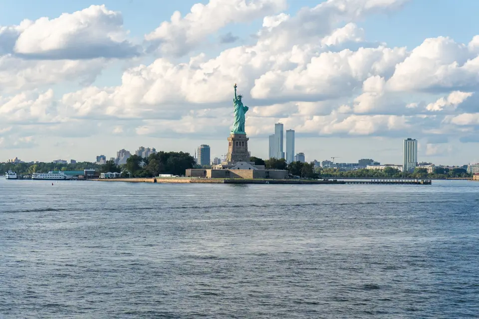
Comparing the 5 USA Routes
Before booking transatlantic or transpacific flights, match your travel dates, driving appetite, and primary interests against our five core American routes:
| Itinerary Route | Core Stops & Night Split | Ideal Duration | Best Season | Primary Transit Style |
|---|---|---|---|---|
| Route 1: The Northeast Megalopolis & Great Lakes | Boston (3N) → New York City (4N) → Washington, D.C. (3N) → Chicago (4N) | 10 to 14 Days | April to June & September to November | 100% Car-Free: Amtrak Northeast Corridor trains + 1 short domestic flight + subways |
| Route 2: The Golden State Classic (California Coast, Yosemite & SoCal) | San Francisco (3N) → Yosemite (2N) → Monterey & Big Sur (2N) → Santa Barbara & Los Angeles (4N) → San Diego (3N) | 14 Days | May to October (Year-round for coast only) | Public transit in San Francisco, then coastal & mountain rental car + Amtrak Pacific Surfliner option |
| Route 3: The Grand Southwest & Mighty 5 National Parks Loop | Las Vegas (2N) → Grand Canyon South Rim (2N) → Page / Antelope Canyon (1N) → Monument Valley (1N) → Moab / Arches & Canyonlands (3N) → Bryce Canyon (1N) → Zion (2N) | 12 to 14 Days | April to May & September to October | Closed-loop Las Vegas rental car or SUV (zero one-way drop fee) |
| Route 4: Southern Soul, Space City & The Sunshine State | New Orleans (3N) → Houston & NASA (3N) → Miami & South Beach (3N) → Everglades & Florida Keys (3N) | 12 Days | November to April (Dry, mild winter & spring window) | Walkable French Quarter + short domestic flights + rental car for Houston NASA & Overseas Highway |
| Route 5: The Coast-to-Coast Icons (East Coast + Canyon Country + California) | New York City (4N) → Washington, D.C. (2N) → Las Vegas & Grand Canyon (3N) → San Francisco (3N) → Los Angeles & San Diego (5N) | 17 to 21 Days | April to June & September to November | Hybrid: Amtrak train on East Coast + 2 transcontinental hub flights + Southwest/California car |
Route 1: The Northeast & Chicago
If this is your first journey to North America and you want dense urban history, world-class art museums, revolutionary landmarks, and iconic skylines without touching a steering wheel, Route 1 (covering Boston, New York City, Washington, D.C., and Chicago in 14 days) is the smartest way to begin. Along the Northeast Corridor between Boston, New York City, and Washington, D.C., driving a car is an expensive liability. Overnight hotel valet garages in Manhattan and downtown Boston regularly charge punitive nightly rates, bridge and tunnel tolls stack up rapidly, and Interstate 95 is notorious for multi-hour bottlenecks. Instead, you ride Amtrak trains directly from downtown South Station in Boston to Moynihan Train Hall in Midtown Manhattan, and onward to Union Station within sight of the U.S. Capitol dome, before taking a short two-hour flight west to Chicago on the shores of Lake Michigan.
Have only 10 days? Run Days 1 through 10 (Boston, New York City, and Washington, D.C.) as a pure East Coast rail itinerary, flying into Boston Logan (BOS) and home from Washington Dulles (IAD).
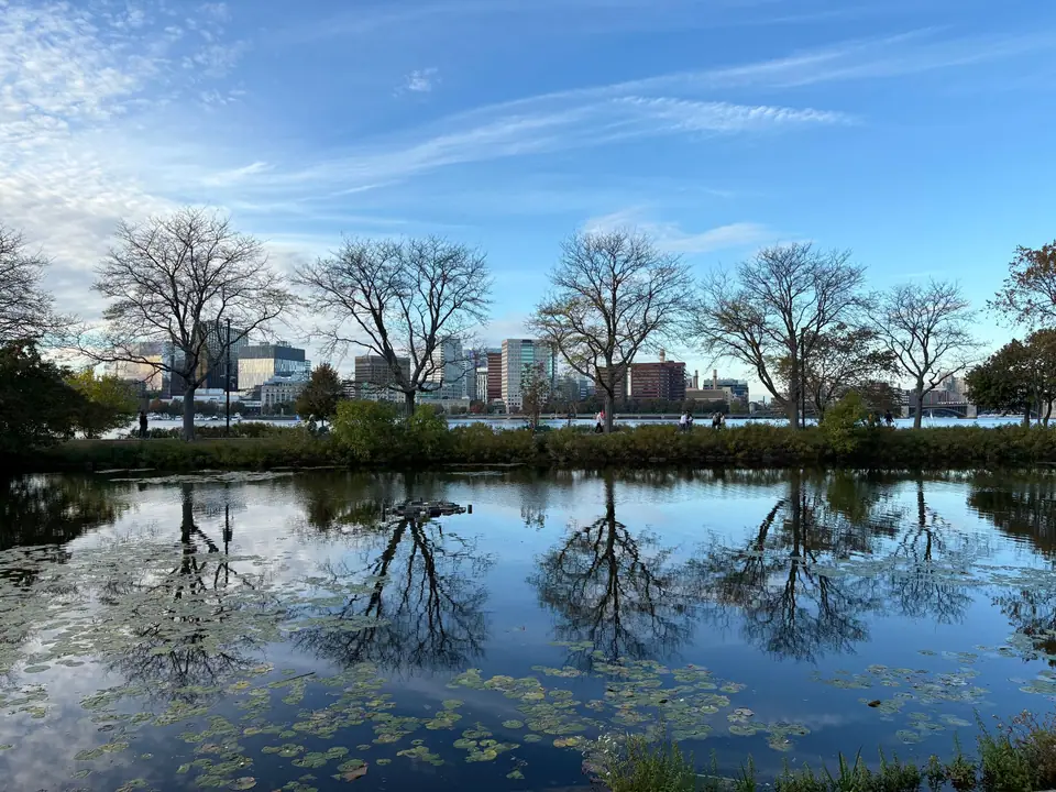
Day 1: Boston Arrival, Beacon Hill & Charles River
Land at Boston Logan International Airport (BOS), which sits just across the harbour from downtown and is one of the fastest major airports in America to exit. Skip the rideshare queues if you are staying near Back Bay or Copley Square: the Back Bay Logan Express bus departs directly from every terminal kerbside, receives priority tunnel access, and drops you at Boylston Street in twenty minutes. Alternatively, take the free airport shuttle to the MBTA Blue Line subway station or board the seasonal water taxi across the inner harbour to Long Wharf.
Afternoon: Acclimatising in Beacon Hill & Boston Public Garden
Drop your bags at a hotel in Back Bay or near Boston Common (see our Boston where to stay breakdown for exact neighbourhood comparisons) and fight jet lag with fresh air rather than a hotel nap. Walk into the Boston Public Garden to cross the cast-iron suspension footbridge over the lagoon, where the famous pedal-powered Swan Boats have operated since the 1870s. Continue uphill into Beacon Hill, Boston's best-preserved Federal-style brick neighbourhood. Turn onto Acorn Street, a narrow lane paved with original river cobblestones that once housed nineteen-century coachmen, then admire the purple-paned glass windows and Bulfinch architectural mansions lining Mount Vernon Street and Louisburg Square.
Sunset & Dinner: The Charles River Esplanade & Back Bay
From the base of Beacon Hill, cross the Arthur Fiedler Footbridge over Storrow Drive onto the Charles River Esplanade. In late afternoon light, collegiate rowing shells from Harvard and MIT slice across the Charles River Basin while the red-brick dormitories of Cambridge glow on the opposite bank. For your first dinner, stroll down Newbury Street or Boylston Street in Back Bay for fresh New England oysters, clam chowder, and warm buttered lobster rolls at a classic seafood raw bar.
Day 2: The Freedom Trail, Charlestown & North End
Your second day covers the Boston Freedom Trail, a 4-kilometre (2.5-mile) red-brick line embedded directly into the pavement that links sixteen Colonial and Revolutionary War sites. Walking the trail south-to-north from Boston Common to Charlestown keeps the sun behind you in the morning and places you in the Italian North End right at lunchtime.
08:30 AM: Boston Common to the Old State House
Begin at the Visitor Information Centre on Tremont Street inside Boston Common, America's oldest public park (founded in 1634). Follow the red bricks past the gold-leaf dome of the Massachusetts State House to Park Street Church and the Granary Burying Ground. Take twenty minutes inside this compact walled cemetery: here lie the graves of Samuel Adams, John Hancock, Paul Revere, and the five victims of the 1770 Boston Massacre. Continue two blocks east past King's Chapel to the Old South Meeting House, where five thousand colonists gathered on December 16, 1773, before marching to the harbour to dump chests of British East India Company tea into the tide. Just down Washington Street stands the 1713 Old State House, dwarfed by modern financial skyscrapers, with the cobblestones of the Boston Massacre site preserved in a traffic island below its east balcony.
11:30 AM: Faneuil Hall, Paul Revere House & North End Lunch
Pass through Faneuil Hall and Quincy Market, pausing to admire the historic assembly hall upstairs, but resist eating lunch at the crowded tourist food stalls in the central colonnade. Instead, cross the Rose Fitzgerald Kennedy Greenway into the North End, Boston's oldest residential district and historic Italian enclave. Tour the timber-framed 1680 Paul Revere House in North Square and step inside the Old North Church on Salem Street, where two lanterns were hung in the steeple on the night of April 18, 1775, to signal that British regular troops were rowing across the Charles River toward Lexington and Concord.
For lunch, walk down Hanover Street or Salem Street. Order a hot Sicilian slice or an overstuffed Italian cold-cut sub at a corner salumeria, then compare the flaky, ricotta-filled cannoli shells between the neighbourhood's century-old rival pastry shops (Mike's Pastry and Modern Pastry; carry cash, as several traditional counters still refuse cards).
Afternoon: USS Constitution & Bunker Hill Monument
From the North End waterfront, walk across the North Washington Street Bridge (or take the short MBTA water shuttle from Long Wharf to Pier 4) into the Charlestown Navy Yard. Present a government photo ID to board the USS Constitution ("Old Ironsides"), the world's oldest commissioned naval warship still afloat, launched in 1797. Active-duty U.S. Navy sailors lead tours across the gun decks and explain how the ship's dense live-oak hull deflected British cannonballs during the War of 1812. Finish the trail by climbing up Breed's Hill to the 67-metre granite obelisk of the Bunker Hill Monument before riding the water ferry back to downtown Boston at dusk.
Day 3: Harvard, MIT & The Gardner Museum
Dedicate your third morning to crossing the Charles River into Cambridge (detailed in our Cambridge and Harvard subguide) before exploring Boston's cultural institutions in the afternoon.
Morning: Harvard Yard, Brattle Street & MIT Architectural Walk
Ride the MBTA Red Line subway across the Longfellow Bridge to Harvard Square. Step through the wrought-iron Johnston Gate into Harvard Yard, the leafy heart of America's oldest university (founded in 1636). Walk past the red-brick Massachusetts Hall (1720), University Hall, and the monumental columns of Widener Library, one of the largest university library systems on earth. If you have time for a quiet residential stroll, walk west along Brattle Street ("Tory Row"), lined with preserved Georgian estates, including the yellow 1759 Vassall-Craigie-Longfellow House where George Washington established his headquarters during the Siege of Boston.
From Harvard Square, either hop two stops south on the Red Line to Kendall/MIT or walk thirty minutes along Massachusetts Avenue to the Massachusetts Institute of Technology campus. Do not miss Frank Gehry's surreal, tilting Ray and Maria Stata Center (Building 32) on Vassar Street and the neoclassical Great Dome (Building 10) overlooking the Charles River.
Afternoon: Isabella Stewart Gardner Museum & Fenway
Take the Green Line E branch to the Museum of Fine Arts stop in the Fenway cultural district. While the Museum of Fine Arts holds one of the most comprehensive collections in the Americas, first-time visitors with a single afternoon should prioritise the adjacent Isabella Stewart Gardner Museum. Modelled after a fifteenth-century Venetian palazzo around a glass-roofed central courtyard bursting with seasonal orchids and nasturtiums, the museum displays Titian, Rembrandt, and Sargent masterpieces exactly as its founder arranged them in her will. In the Dutch Room on the second floor, empty gilded frames still hang on the silk walls to mark the unsolved 1990 art heist in which thirteen works were stolen. Afterward, walk ten minutes north to Fenway Park (opened in 1912) to see the famed Green Monster left-field wall and grab dinner around Landsdowne Street or Kenmore Square. For a full three-day breakdown of the city, see our Boston 3-day itinerary and things to do in Boston pages.
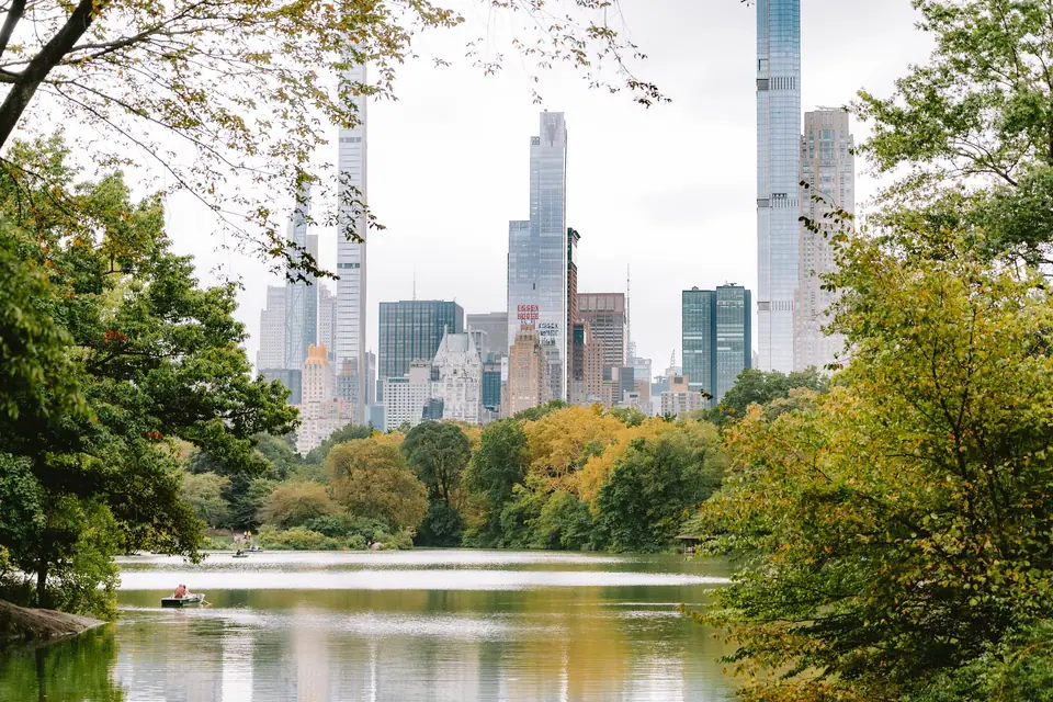
Day 4: Amtrak to New York & Midtown Icons
Board an early morning Amtrak Acela or Northeast Regional train at Boston South Station bound for New York Penn Station (Moynihan Train Hall). Sit on the left (east/south) side of the train: as the tracks hug the Connecticut shoreline between New London and New Haven, you get uninterrupted views of Long Island Sound inlets, historic lighthouses, and yacht harbours before crossing the dramatic steel arch of the Hell Gate Bridge into Queens and Manhattan.
Midday Arrival: Moynihan Train Hall to Fifth Avenue
Step off the train into the soaring glass-vaulted skylight of Moynihan Train Hall (housed inside the historic 1914 James A. Farley Post Office building). Drop your luggage at a Midtown, Bryant Park, or Chelsea hotel (consult our New York where to stay neighbourhood matrix to avoid noisy Garment District blocks). Walk east to Bryant Park to see the beaux-arts marble facade and Rose Main Reading Room of the New York Public Library (Stephen A. Schwarzman Building), then step inside the celestial turquoise zodiac ceiling of Grand Central Terminal at 42nd Street and Park Avenue. Head downstairs to the Grand Central Dining Concourse or the Whispering Gallery outside the Oyster Bar, where acoustic tile arches carry a whispered voice diagonally across the passageway.
Late Afternoon: Fifth Avenue, St. Patrick's Cathedral & Observation Deck
Stroll north up Fifth Avenue past the bronze Atlas statue at Rockefeller Center and the neo-Gothic spires of St. Patrick's Cathedral. Time your late afternoon for a timed-entry ascent to one of Manhattan's premier observation decks. As we compare in detail in our Top of the Rock vs Edge vs Summit One Vanderbilt experience comparison, Top of the Rock at 30 Rockefeller Plaza remains the classic choice for first-timers because its open-air upper terraces frame Central Park to the north and the Empire State Building directly to the south. If you prefer mirrored glass art installations and direct views into the Chrysler Building's Art Deco gargoyles, book Summit One Vanderbilt right next to Grand Central.
Evening: Broadway Theatre District & Hell's Kitchen
As dusk falls, walk through the neon canyon of Times Square on Broadway between 42nd and 47th Streets. Spend fifteen minutes taking in the multi-storey LED billboards from the red pedestrian steps above Father Duffy Square, then immediately walk one avenue west to Ninth Avenue in Hell's Kitchen for dinner, where dozens of independent Thai, Mexican, Italian, and Georgian bistros serve pre-theatre meals at half the price of the chain restaurants inside the Times Square bowtie.
Day 5: Brooklyn Bridge, Statue of Liberty & Lower Manhattan
Day 5 tackles New York's maritime origins and financial powerhouse in a single logical south-to-north loop. To experience the city's most famous suspension span without dodging thousands of selfie sticks, set an early alarm.
07:00 AM: Walking Across the Brooklyn Bridge & DUMBO
Ride the subway to Brooklyn Bridge-City Hall (or take the A/C train one stop further to High Street in Brooklyn so you walk toward the Manhattan skyline). As we detail in our walking across the Brooklyn Bridge at sunrise and Brooklyn pages, bikes now use a separate dedicated lane on the roadway level, leaving the elevated timber boardwalk exclusively for pedestrians. Spend forty-five minutes crossing beneath the neo-Gothic granite arches and diagonal steel stays completed by John, Washington, and Emily Roebling in 1883. On the Brooklyn side, walk down to the cobblestone intersection of Washington Street and Water Street in DUMBO, where the steel tower of the Manhattan Bridge frames the Empire State Building through its centre leg, then grab an espresso and pastry along the waterfront lawns of Brooklyn Bridge Park.
09:30 AM: Statue of Liberty & Ellis Island First-Boat Strategy
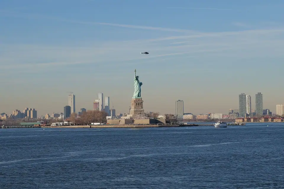
From Lower Manhattan, walk to Battery Park for your pre-booked Statue City Cruises ferry (the only authorised ferry operator that actually lands on Liberty Island and Ellis Island; ignore the aggressive street vendors in coloured vests around Battery Park selling overpriced third-party boat rides that never dock). Read our Statue of Liberty and visiting the Statue of Liberty and Ellis Island guides before booking: if you want Pedestal or Crown access inside Lady Liberty, you must reserve months in advance on the official concessionaire website. After walking the star-shaped walls of Fort Wood at the statue's base, take the ferry to Ellis Island to trace the Great Hall Registry Room, where twelve million immigrants were processed between 1892 and 1954.
Afternoon: Wall Street, 9/11 Memorial & West Village
Back at the Battery, walk north up Broadway past the Charging Bull bronze sculpture and Trinity Church (where Alexander Hamilton is buried in the churchyard) onto Wall Street to see Federal Hall and the New York Stock Exchange facade. Walk three blocks west to the 9/11 Memorial & Museum, where twin one-acre reflecting pools sit within the exact footprints of the original World Trade Center towers, surrounded by white oak trees and the ribbed white steel wings of Santiago Calatrava's Oculus transit hub. Finish the afternoon by riding the 1 or A/C/E subway uptown to 14th Street to walk the elevated rail garden of the High Line above Chelsea, ending at Little Island and the tree-lined brownstone streets of Greenwich Village and the West Village for dinner.
Day 6: Central Park, Museum Mile & SoHo
Your third full day in Manhattan trades downtown canyons for Frederick Law Olmsted and Calvert Vaux's 843-acre green masterpiece and two of the greatest art and science museums on the planet.
Morning: The Essential Central Park South-to-North Walk
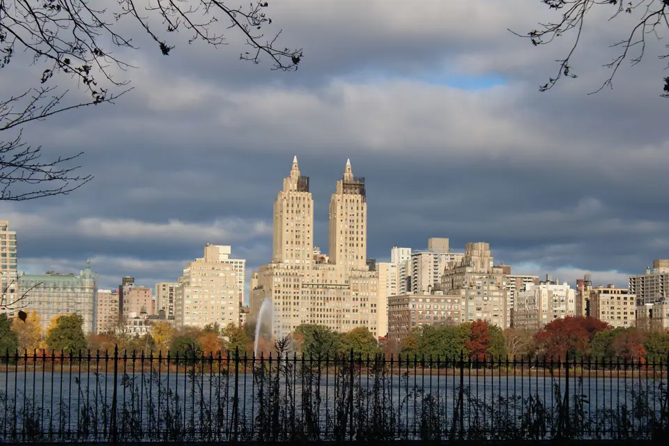
Enter Central Park at 59th Street and Fifth Avenue (Grand Army Plaza, opposite the Plaza Hotel). Follow our Central Park loop on foot route north along the elm-shaded cathedral of The Mall and Literary Walk to Bethesda Terrace and Fountain, where the Minton tile arcade overlooks rowboats on the Lake. Cross the cast-iron Bow Bridge into the woodland paths of The Ramble, pay a quiet visit to the Imagine mosaic at Strawberry Fields on the West 72nd Street edge (opposite the Dakota apartment building), and climb the schist rock outcrop of Belvedere Castle before jogging or strolling a section of the Jacqueline Kennedy Onassis Reservoir track with its classic view of the San Remo twin towers.
Afternoon: The Metropolitan Museum of Art or American Museum of Natural History
Exit the park on the east side at 82nd Street for The Metropolitan Museum of Art (The Met), or on the west side at 79th Street for the American Museum of Natural History (including the dramatic sculpted concrete canyon of the Richard Gilder Center). At The Met, do not try to see all two million objects in one visit: pick three focussed wings, such as the Temple of Dendur in the Sackler Wing, the European Paintings galleries (Vermeer, Rembrandt, Van Gogh), and the American Wing courtyard, then step up to the seasonal Cantor Roof Garden for views over the Central Park canopy.
Evening: SoHo Cast-Iron District, Chinatown & Little Italy
Ride the subway south to Spring Street or Canal Street. Walk the cobblestone blocks of Greene Street and Mercer Street in SoHo, home to the largest collection of nineteenth-century cast-iron commercial facades in the world, then head east into Chinatown for hand-pulled Lanzhou noodles, roast duck on Mott Street, or soup dumplings on Doyers Street, a curved historic lane just south of Pell Street.
Day 7: Queens or Williamsburg, Then Train to D.C.
Use your final morning in New York (see our New York 4-day itinerary and things to do in New York guides for extra options) to explore outside Manhattan before catching a mid-afternoon Amtrak train south from Moynihan Train Hall to Washington Union Station (2 hours 50 minutes on Acela; 3 hours 20 minutes on Northeast Regional).
- Option A (Williamsburg & East River Ferry): Ride the NYC Ferry along the East River from East 34th Street or Wall Street to North Williamsburg, browse the independent bookshops and vintage boutiques around Bedford Avenue, and eat wood-fired pizza or bagels overlooking the Manhattan skyline from Domino Park.
- Option B (Jackson Heights & Flushing Food Crawl): Ride the elevated 7 train into Queens, the most linguistically diverse county on earth, for Tibetan momos in Jackson Heights or authentic Sichuan and Taiwanese food courts in Flushing.
Arrive at Washington Union Station by early evening, check into a hotel near Penn Quarter, Dupont Circle, or Capitol Hill (see our Washington, D.C. where to stay guide), and take a post-dinner twilight walk to the illuminated Lincoln Memorial, which remains open 24 hours a day and is far more atmospheric after dark than at midday.
Day 8: Capitol Hill & Smithsonian National Mall
Washington, D.C. offers one of the greatest travel bargains in the Western Hemisphere: admission to every single Smithsonian Institution museum, the National Gallery of Art, the U.S. Capitol, and the Library of Congress is completely free of charge. However, free admission means the most popular buildings require advance timed-entry passes on official government portals.
08:45 AM: U.S. Capitol Visitor Center & Library of Congress
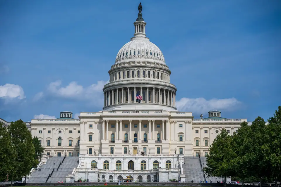
Begin on Capitol Hill at the underground U.S. Capitol Visitor Center on the East Front plaza. Book a guided tour in advance to stand beneath Constantino Brumidi's frescoed canopy inside the Capitol Rotunda and walk through National Statuary Hall (the original chamber of the House of Representatives). Immediately after your Capitol tour, ask a staff member for the underground pedestrian tunnel connecting directly to the Thomas Jefferson Building of the Library of Congress. Using this tunnel lets you bypass a second exterior security screening. Inside the Jefferson Building (requires a free timed-entry pass), step up to the Visitors' Gallery overlooking the octagonal Main Reading Room and examine Thomas Jefferson's personal third-floor library, whose 6,487 volumes formed the seed of the national collection after the British burned the Capitol in 1814.
Afternoon: The National Mall & Smithsonian Heavy Hitters
Walk west from Capitol Hill onto the two-mile green carpet of the National Mall. As we explain in our Smithsonian museums and Smithsonian museums on the National Mall guides, trying to visit five museums in one afternoon leads to instant museum fatigue. Pick two major institutions for Day 8:
- National Air and Space Museum (National Mall Building): Requires a free timed-entry pass even though its multi-year renovation has reopened key galleries. Here you stand feet away from the original 1903 Wright Flyer, Charles Lindbergh's Spirit of St. Louis, the Apollo 11 Command Module Columbia, and Neil Armstrong's lunar spacesuit.
- National Museum of American History or National Gallery of Art: At American History, see the original Star-Spangled Banner flag that inspired the national anthem and Abraham Lincoln's top hat. Across the Mall at the National Gallery of Art, walk between John Russell Pope's neoclassical West Building (home to the only painting by Leonardo da Vinci in the Americas, Ginevra de' Benci) and I.M. Pei's geometric East Building via the underground moving walkway beneath the glass waterfall skylight.
Day 9: National Archives, Tidal Basin & Georgetown
Morning: The Charters of Freedom & White House Exterior
Start at 09:30 AM at the National Archives Museum on Constitution Avenue (reserve a timed morning slot online to skip the pavement queue). Inside the dimly lit Rotunda for the Charters of Freedom, conservation-grade glass cases house the original parchment Declaration of Independence (1776), the Constitution of the United States (1787), and the Bill of Rights (1789), alongside a 1297 copy of the Magna Carta. From the Archives, walk fifteen minutes northwest up Pennsylvania Avenue to Lafayette Square on the north side of the White House for the clearest unobstructed view of the Executive Residence portico.
Midday & Afternoon: The Monumental Core & Tidal Basin
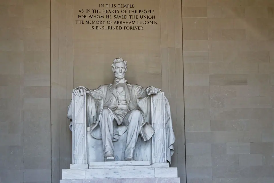
Follow our National Mall memorials walking circuit west past the 169-metre marble obelisk of the Washington Monument and the World War II Memorial. Walk alongside the Lincoln Memorial Reflecting Pool to the Vietnam Veterans Memorial (Maya Lin's sunken black granite wall inscribed with more than 58,000 names), the Korean War Veterans Memorial, and the Lincoln Memorial, where you can stand on the exact engraved granite step where Dr. Martin Luther King Jr. delivered his "I Have a Dream" speech during the 1963 March on Washington. Continue south around the Tidal Basin to the Martin Luther King Jr. Memorial, the Franklin Delano Roosevelt Memorial, and the columned rotunda of the Thomas Jefferson Memorial.
Late Afternoon & Evening: Georgetown Canal & Federal Rowhouses
From the Foggy Bottom area, walk or take the DC Circulator / Metrobus into Georgetown, a historic tobacco port founded in 1751, forty years before the federal capital itself. Note that Georgetown has no Metrorail station (nineteenth-century and twentieth-century residents famously lobbied against subway construction, though that is partially urban legend and partially engineering geology due to the steep Potomac River palisades). Stroll along the brick towpath of the Chesapeake and Ohio (C&O) Canal, walk the peaceful Federal and Victorian residential blocks of N Street and Dumbarton Street, climb the steep stone "Exorcist Steps" at 36th and Prospect Streets above the Potomac, and dine along M Street or the Washington Harbour waterfront. See our Washington, D.C. 3-day itinerary and things to do in Washington, D.C. guides for additional museum options like the National Museum of African American History and Culture.
Day 10: Flight to Chicago & Architecture River Cruise
Ride the Washington Metro Yellow or Blue Line directly into the terminal at Ronald Reagan Washington National Airport (DCA), just across the Potomac River from the National Mall, and take a two-hour morning flight west to Chicago (gaining one hour as you cross from the Eastern Time Zone into the Central Time Zone). If you land at O'Hare (ORD) on the CTA Blue Line or Midway (MDW) on the CTA Orange Line, Chicago's rapid transit trains carry you directly into the elevated steel tracks of The Loop in roughly forty-five minutes.
Afternoon: Millennium Park, Cloud Gate & Michigan Avenue
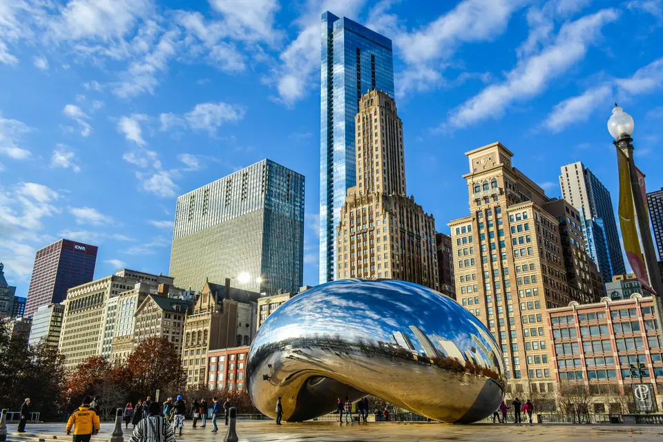
Check into a hotel along the Chicago River, the Magnificent Mile, or the Loop (see our Chicago where to stay guide). Walk into Millennium Park to see Anish Kapoor's seamless polished stainless-steel sculpture Cloud Gate ("The Bean"), Frank Gehry's curving brushed-steel Jay Pritzker Pavilion, and Jaume Plensa's Crown Fountain, where fifty-foot glass brick towers project video portraits of Chicago citizens spouting water into a black granite reflecting pool. Walk north across the Nichols Bridgeway or along Michigan Avenue across the DuSable Bridge, pausing to inspect the limestone bas-reliefs marking the site of Fort Dearborn and the 1871 Great Chicago Fire water tower.
Golden Hour: The Essential Chicago Architecture River Cruise
Late afternoon on your first day in Chicago belongs on the water. As we emphasise in our Chicago architecture boat tour guide, Chicago is the birthplace of the modern steel-framed skyscraper, and the three branches of the Chicago River form an open-air museum of structural engineering. Book the 90-minute cruise operated by the Chicago Architecture Center (CAC) aboard Chicago's First Lady from the Riverwalk at Michigan Avenue and Wacker Drive. Volunteer docents trained for hundreds of hours narrate more than fifty buildings across the Main, North, and South branches: from the neo-Gothic Tribune Tower and the wedding-cake terracotta Wrigley Building to Bertrand Goldberg's concrete corncob Marina City towers, Mies van der Rohe's modernist steel boxes, Jeanne Gang's undulating turquoise St. Regis Chicago (Vista Tower), and the 110-storey Willis Tower (formerly Sears Tower).
Day 11: The Art Institute, The Loop & Lakefront Trail
Morning: Masterpieces at The Art Institute of Chicago
Be at the Michigan Avenue entrance of the Art Institute of Chicago (guarded by its twin bronze lions) when the doors open. Consistently ranked among the top three art museums in the world, the Art Institute holds the largest collection of Impressionist and Post-Impressionist paintings outside Paris. Head straight to the second-floor galleries to stand before Georges Seurat's monumental pointillist canvas A Sunday on La Grande Jatte, Edward Hopper's Nighthawks, Grant Wood's American Gothic, Gustave Caillebotte's Paris Street; Rainy Day, and Claude Monet's stacks of wheat and water lilies before crossing into Renzo Piano's Modern Wing for Picasso, Chagall's sapphire-blue America Windows, and twentieth-century design.
Afternoon: Chicago Cultural Center, The Rookery & Lake Michigan Shoreline
Across Michigan Avenue from the Art Institute, step inside the Chicago Cultural Center (free entry) to look up at the world's largest stained-glass Tiffany dome (thirty-eight feet in diameter, composed of roughly 30,000 glass pieces). Walk west into the financial canyon of LaSalle Street inside The Loop to see the ground-floor light court of The Rookery Building (designed by Burnham & Root in 1888 and remodelled by Frank Lloyd Wright in 1905). Spend the late afternoon walking or cycling a stretch of the 29-kilometre (18-mile) Lakefront Trail from Grant Park and Buckingham Fountain out to the Museum Campus (the Adler Planetarium peninsula), which delivers the single best panoramic postcard view of the entire Chicago skyline rising above Lake Michigan.
Evening: Deep-Dish vs. Tavern-Style Pizza & Blues Club
Consult our Chicago deep-dish and food guide for dinner: if you order authentic Chicago deep-dish pizza at historic staples like Lou Malnati's, Pequod's (famous for its caramelised burnt-cheese crust edge), or Uno, remember that the thick butter-crust pie takes forty-five minutes to bake in a cast-iron pan, so place your pizza order the moment you sit down. Cap the night with live electric Chicago blues at a historic club in Lincoln Park (such as Kingston Mines) or the South Loop (Buddy Guy's Legends).
Days 12 to 14: Oak Park, Wrigleyville & West Loop
Rounding out a full two-week Route 1 itinerary gives you time to experience Chicago's distinct residential neighbourhoods (see our Chicago 3-day itinerary and things to do in Chicago pages):
- Day 12 (Oak Park Prairie Architecture & Wicker Park): Ride the CTA Green Line west to Oak Park to tour the Frank Lloyd Wright Home and Studio (where Wright invented the Prairie School of architecture in the 1890s) and Unity Temple, a UNESCO World Heritage site cast entirely in reinforced concrete. Return via the Blue Line to Wicker Park and Bucktown to walk The 606 elevated trail and browse independent record stores and cafés along Milwaukee Avenue.
- Day 13 (Lincoln Park, Wrigleyville & West Loop / Fulton Market): Spend the morning strolling through the Lincoln Park Conservatory and North Avenue Beach, then ride the Red Line north to Addison to see the hand-operated scoreboard and ivy-covered brick marquee of Wrigley Field (built in 1914). In the evening, head to Randolph Street ("Restaurant Row") and the former meatpacking warehouses of Fulton Market in the West Loop, now the most acclaimed culinary neighbourhood in the Midwest.
- Day 14 (Skydeck or 360 Chicago & Departure): Grab an Italian beef sandwich dipped in jus with hot giardiniera peppers at a classic counter, ascend 360 Chicago (in the former John Hancock Center on North Michigan Avenue) for views north up the Gold Coast shoreline, and ride the CTA Blue Line back to O'Hare for your flight home.
Route 2: The Golden State Classic
California is the only state in America where you can walk across a fog-draped suspension bridge in the morning, stand beneath thousand-metre glacial granite cliffs in the Sierra Nevada the next afternoon, drive along redwood-fringed Pacific sea cliffs, and finish your journey eating Baja fish tacos beside sea lions on a warm Southern California cove. Route 2 connects San Francisco, Yosemite National Park, the Central Coast, Los Angeles, and San Diego in a seamless two-week north-to-south trajectory.
Crucial Rental Car Rule for California: Do not pick up your rental car when you land at San Francisco International Airport (SFO). San Francisco has steep hills, expensive hotel garages (check your hotel's official site for overnight parking rates), and a well-documented epidemic of vehicle window break-ins at tourist viewpoints. Ride BART rapid transit from SFO into the city, spend your first three days using historic cable cars, ferries, and Muni transit, and pick up your rental car on the morning of Day 4 as you depart for Yosemite.
Day 1: San Francisco Waterfront, Chinatown & North Beach
Land at San Francisco International Airport (SFO) and board the BART train directly from the International Terminal to Embarcadero or Powell Street in thirty minutes. Check into a hotel around Union Square, Nob Hill, or the Embarcadero waterfront (see our San Francisco where to stay guide for exact block-by-block safety and transit advice).
Afternoon: Ferry Building Marketplace & Historic Cable Car Ride
Start your walk at the 1898 Ferry Building Marketplace at the foot of Market Street, whose clock tower was modelled after the Giralda bell tower in Seville. Browse the artisan cheese counters, Hog Island Oyster Bar, and Tartine Bakery kiosk overlooking the Bay Bridge. Walk two blocks west to the California Street cable car terminal (at Market and Drumm Streets). Here is a major time-saving secret from our riding a San Francisco cable car and cable cars and neighbourhoods guides: while up to two hundred tourists wait for ninety minutes at the Powell & Market turnaround, the California Street line two blocks away almost never has a queue and climbs straight up the steepest crest of Nob Hill past Grace Cathedral and the historic Fairmont and Mark Hopkins hotels.
Late Afternoon & Evening: Chinatown Dragon Gate to North Beach & Coit Tower
Hop off the cable car at Grant Avenue and walk through the Dragon Gate into the oldest Chinatown in North America (established in 1848). Skip the souvenir shops on Grant Avenue after two blocks and turn onto Stockton Street, where locals shop at open-air Cantonese produce markets, roast duck windows, and dim sum bakeries, then duck into Ross Alley to see the Golden Gate Fortune Cookie Factory. Continue north across Broadway into North Beach (San Francisco's Little Italy). Beat the Beat Generation literary trail at City Lights Bookstore (founded in 1953 by Lawrence Ferlinghetti), climb the Filbert Steps up Telegraph Hill to Coit Tower for late-afternoon views over the bay, and sit down for cioppino (San Francisco's signature Dungeness crab and seafood stew) or wood-fired Neapolitan pizza in North Beach.
Day 2: Golden Gate Bridge, Sausalito & Alcatraz Night Tour
Morning: Crossing the Golden Gate Bridge to Sausalito
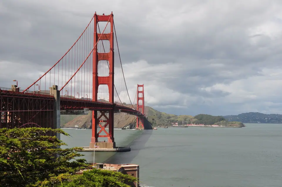
Head to the northern waterfront before the midday wind picks up across the Golden Gate Strait. Follow our Golden Gate Bridge and crossing the Golden Gate Bridge on foot or by bike guides: start at Crissy Field in the Presidio, warm up with an espresso overlooking the kiteboarders on the bay, and climb up to the Battery East Welcome Center. If you walk the 2.7-kilometre (1.7-mile) east pedestrian walkway or rent a bike from Fisherman's Wharf to coast downhill from Vista Point into the bayside village of Sausalito, dress in windproof layers (Mark Twain's apocryphal quip about cold San Francisco summers remains true whenever Pacific marine fog rolls through the strait). If cycling, board the Golden Gate Ferry or Blue & Gold Fleet boat from Sausalito back to Pier 41 or the Ferry Building with your bike.
Afternoon: Palace of Fine Arts, Presidio Tunnel Tops & Haight-Ashbury
Spend the early afternoon strolling the Greco-Roman rotunda and lagoon of the Palace of Fine Arts (built for the 1915 Panama-Pacific International Exposition) and the landscaped bluff parks of Presidio Tunnel Tops. If you want to see San Francisco's famous Victorian architecture, take a Muni bus up to Alamo Square Park to photograph the "Painted Ladies" rowhouses on Steiner Street backed by the downtown skyscraper skyline, then walk twenty minutes west through the Panhandle into Haight-Ashbury.
Evening: The Alcatraz Island Night Tour
Book the evening departure to Alcatraz Island from Pier 33 (Alcatraz City Cruises is the sole official National Park Service concessionaire; book sixty to ninety days ahead). As we explain in our Alcatraz Island night tour experience guide, the Night Tour is superior to daytime departures because the boat circles the entire island at sunset, passenger numbers are capped lower, rangers lead special evening cellhouse talks and hospital-wing demonstrations that are closed during the day, and the cellhouse audio tour ("Doing Time", narrated by actual former inmates and correctional officers) feels far more evocative once darkness settles over San Francisco Bay.
Day 3: Lands End, Golden Gate Park & The Mission
Dedicate your third day (see our San Francisco 3-day itinerary and things to do in San Francisco pages) to the wild Pacific oceanfront on the city's western edge:
- Morning (Lands End & Sutro Baths): Walk the dramatic cliffside trail from the ruins of the 1896 Sutro Baths around Lands End to Mile Rock Beach and the Legion of Honor art museum, where Rodin's The Thinker sits in a neoclassical courtyard overlooking the Golden Gate Bridge from the ocean side.
- Midday (Golden Gate Park): Explore Golden Gate Park (larger than New York's Central Park), choosing between the Japanese Tea Garden, the California Academy of Sciences (with its living roof and indoor rainforest), and the de Young Museum observation tower.
- Evening (Mission District Murals & Taquerias): Take BART to 16th Street or 24th Street Mission, commonly the sunniest microclimate in the city. Walk through the outdoor street-art galleries of Balmy Alley and Clarion Alley, relax on the hillside lawn of Dolores Park, and eat a foil-wrapped Mission-style super burrito along Valencia or Mission Street.
Day 4: Drive to Yosemite Valley & Tunnel View
Pick up your rental car from a downtown San Francisco or SFO airport depot at 07:30 AM and drive east across the Central Valley via Interstate 580 and Highway 120 (or Highway 140 via Mariposa in cooler months, which stays at a lower, snow-free elevation along the Merced River canyon) into Yosemite National Park (roughly 3.5 to 4 hours driving). Important logistics check: During peak spring waterfall and summer weekends, as well as the February "Firefall" horsetail period, the National Park Service frequently enforces a peak-hours vehicle reservation system on Recreation.gov in addition to the standard park entrance pass; check the official NPS Yosemite portal sixty days before your trip.
Midday Arrival: Tunnel View & Bridalveil Fall
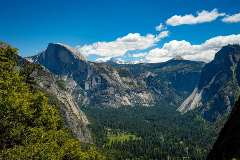
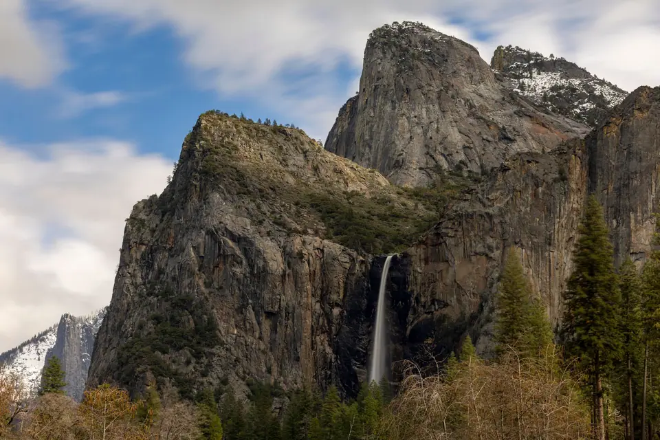
If you enter via Highway 41 (Wawona Road) or detour up from the valley floor, stop at the stone parking terrace of Tunnel View immediately outside the Wawona Tunnel. This single viewpoint delivers the most famous granite panorama in North America: the 900-metre (3,000-foot) vertical monolith of El Capitan on the left, Bridalveil Fall plunging on the right, and the sheer granite dome of Half Dome rising at the head of Yosemite Valley. Drive five minutes down into the valley to walk the paved ten-minute trail to the base of Bridalveil Fall, where snowmelt mist coats the boulders every spring and early summer.
Afternoon: Yosemite Falls, Meadow Boardwalks & El Capitan
Park your car at Yosemite Village or Curry Village for the rest of the day and use the free hybrid Yosemite Valley Shuttle buses (once you give up a parking space in Yosemite Valley between 10:00 AM and 4:00 PM in summer, finding another one can take an hour). Walk the flat, family-friendly loop to the base of Lower Yosemite Fall (part of North America's tallest waterfall system at 739 metres / 2,425 feet total drop), stroll the wooden boardwalks across Cook's Meadow for mirror reflections of Half Dome in the Merced River, and stop at El Capitan Meadow with binoculars to spot tiny rock climbers bivouacked on the vertical granite face of The Nose.
Day 5: The Mist Trail, Glacier Point & Mariposa Grove
Early Morning: The Mist Trail to Vernal Fall Footbridge (or Emerald Pool)
Start by 07:30 AM at the Happy Isles trailhead (Shuttle Stop 16) to hike the Mist Trail, Yosemite's signature day hike. The paved path climbs steadily alongside the roaring Merced River to the Vernal Fall Footbridge (2.6 kilometres / 1.6 miles round trip), offering a clear view of the 97-metre (317-foot) waterfall. Strong hikers with waterproof shells and grippy footwear can continue up the 600 granite steps carved directly into the cliffside through the rainbow spray zone to the top of Vernal Fall (and onward to Nevada Fall for a half-day loop via the John Muir Trail).
Afternoon: Glacier Point Panorama & Mariposa Grove
In the afternoon (typically late May through October, once Glacier Point Road is ploughed clear of winter snow), drive up to Glacier Point, perched 975 metres (3,200 feet) directly above Curry Village. From the railing at the amphitheatre overlook, you look straight across at the granite face of Half Dome and see Vernal and Nevada Falls stair-stepping down the canyon below. Before exiting the park's South Entrance toward Oakhurst or Wawona, take the shuttle into the Mariposa Grove of Giant Sequoias to walk the Grizzly Giant Loop Trail among more than five hundred mature Sequoiadendron giganteum trees, including the 3,000-year-old Grizzly Giant and the California Tunnel Tree.
Days 6 & 7: Monterey, Carmel & The Big Sur Coast
Day 6: Yosemite to Monterey & Carmel-by-the-Sea
Drive west across the agricultural heartland of the San Joaquin Valley and over Pacheco Pass (3.5 hours) to the Monterey Peninsula on the Pacific coast. Spend the afternoon at the Monterey Bay Aquarium on historic Cannery Row, built inside the former Hovden sardine cannery; its three-storey living Kelp Forest tank and Open Sea exhibit (housing sea otters, hammerhead sharks, and ocean sunfish) set the global standard for marine conservation. Afterward, pay the small gate toll to drive the scenic 17-Mile Drive through Pebble Beach past Spanish Bay, Bird Rock (crowded with harbour seals and cormorants), and the Lone Cypress clinging to its granite headland, exiting directly into the storybook coastal village of Carmel-by-the-Sea for dinner and an overnight stay.
Day 7: Big Sur's Bixby Bridge, McWay Falls & Santa Barbara
Set out early down Highway 1 into Big Sur, where the Santa Lucia Mountains plunge straight into the Pacific surf. Stop at the north turnouts of the 1932 concrete arch of Bixby Creek Bridge, hike the coastal bluff trail at Point Lobos State Natural Reserve or Andrew Molera State Park, and peer down into the turquoise cove of McWay Falls at Julia Pfeiffer Burns State Park, where an eighty-foot waterfall drops directly onto the beach. Essential Highway 1 Road Check: Winter rockslides occasionally close a short middle section of Highway 1 south of Big Sur (near Regent's Slide or Lucia). Always verify current Caltrans Highway 1 status before departing Monterey: if the southern pass-through to Cambria is closed, enjoy Big Sur as an out-and-back morning drive from Carmel down to Nepenthe or McWay Falls, then cut inland via Salinas onto U.S. Route 101 south through Paso Robles wine country and San Luis Obispo to reach the palm-lined Spanish Colonial Revival beachfront of Santa Barbara by evening.
Days 8 to 11: Los Angeles Coast, Hills & Studios
Los Angeles is not a single city with a single downtown: it is a sprawling basin of eighty-eight separate municipalities and distinct coastal and hillside neighbourhoods stitched together by freeways and expanding Metro rail lines. As we explain in our Los Angeles where to stay and Los Angeles 4-day itinerary guides, the secret to loving LA is grouping your days strictly by geography so you never cross the 405 and 10 freeways more than once a day.
Day 8: Malibu Coast, The Getty Center, Santa Monica Pier & Venice Beach
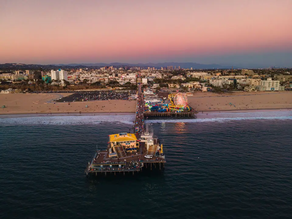
Drive south from Santa Barbara along the Malibu coastline (stopping at El Matador State Beach or Zuma Beach). Book a free timed-entry parking reservation for The Getty Center in Brentwood: ride the automated cable tram up the Santa Monica Mountains hilltop to explore Richard Meier's travertine marble pavilions, Robert Irwin's Central Garden, and Van Gogh's Irises with sweeping views from Downtown LA to the Pacific Ocean. Spend the late afternoon and sunset on the coast (detailed in our Santa Monica and Venice Beach guide): rent a beach cruiser bike along The Strand (the 35-kilometre Marvin Braude Bike Trail), walk the historic Venice Canals and Abbot Kinney Boulevard, and finish at the neon-lit Ferris wheel and Route 66 End of the Trail sign on Santa Monica Pier.
Day 9: Beverly Hills, Miracle Mile Museums, Hollywood & Griffith Observatory Sunset
Start the morning driving Sunset Boulevard and Rodeo Drive through Beverly Hills, then head to the Miracle Mile on Wilshire Boulevard. Here, three major institutions sit side-by-side: the Los Angeles County Museum of Art (LACMA, with Chris Burden's 202 cast-iron streetlamps of Urban Light out front), the Academy Museum of Motion Pictures (featuring Renzo Piano's glass sphere dome and historic Oscar props), and the La Brea Tar Pits, where Pleistocene mammoths and sabre-toothed cats are still being excavated from bubbling natural asphalt right in the middle of the city. In the afternoon, swing by the Original Farmers Market at 3rd and Fairfax for lunch, see the handprints in the forecourt of the TCL Chinese Theatre on Hollywood Boulevard, and head up Mount Hollywood for golden hour. Follow our Hollywood and Griffith Observatory and Griffith Observatory at sunset guides: take the DASH Observatory shuttle bus from the Vermont/Sunset Metro Red Line station to skip the hillside parking jam, walk the upper roof terraces for views of the Hollywood Sign and the entire Los Angeles Basin grid lighting up at dusk, and step inside to see the Foucault Pendulum and Zeiss telescope.
Days 10 & 11: Studio Backlot Tour or Theme Park + Downtown LA Arts District
Use Day 10 for film history or theme parks (covered in our Universal Studios and theme parks guide): either spend a full day at Universal Studios Hollywood (which includes the working 60-minute Studio Tour tram ride and Super Nintendo World) or book the intimate 3-hour Warner Bros. Studio Tour in Burbank to walk real soundstages and backlot streets. On Day 11, explore Downtown Los Angeles (DTLA) before heading south: see the stainless-steel sails of Frank Gehry's Walt Disney Concert Hall, step inside the honeycomb veil of The Broad contemporary art museum (free timed-entry tickets), ride the historic orange railway cars of Angels Flight down Bunker Hill into Grand Central Market for lunch (carnitas tacos at Villa Moreliana or egg sandwiches at Eggslut), and browse the converted industrial warehouses and coffee roasteries of the Arts District.
Days 12 to 14: San Diego, La Jolla & Coronado
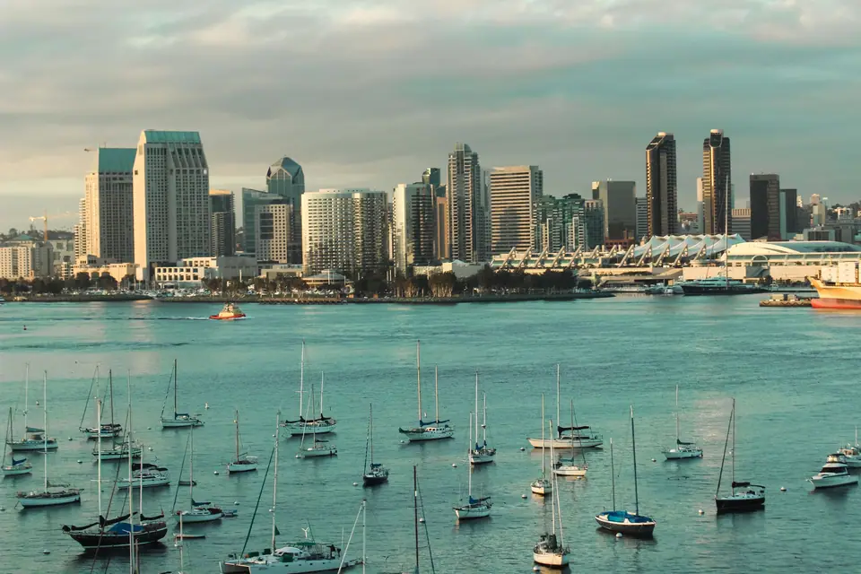
Drive two hours south from Los Angeles down Interstate 5 (or leave your car in LA and ride the Amtrak Pacific Surfliner train right along the ocean bluffs of San Clemente and Del Mar into Santa Fe Depot in downtown San Diego). With seventy miles of open Pacific coastline, year-round 22°C (72°F) sunshine, and our 40-subguide San Diego coverage, this is the most relaxed finale in American travel.
- Day 12 (Balboa Park, San Diego Zoo & Little Italy): Spend the morning in Balboa Park, America's largest urban cultural park (1,200 acres). Walk the Spanish Colonial Revival arcades of El Prado past the Botanical Building lily pond, the California Tower, and the Outdoor Organ Pavilion, and visit the world-renowned San Diego Zoo. In the evening, dine outdoors under the festoon lights of India Street in Little Italy or along Fifth Avenue in the historic Gaslamp Quarter.
- Day 13 (USS Midway Museum, Coronado Island & La Jolla Cove): Start at 10:00 AM along the Embarcadero aboard the USS Midway Museum, a 972-foot naval aircraft carrier where thirty restored fighter jets sit on the flight deck and former naval aviators narrate the bridge and engine rooms. Cross the sweeping blue curve of the bridge (or take the pedestrian ferry) to Coronado Island to see the 1888 red-turreted wooden Victorian landmark of the Hotel del Coronado. Spend the afternoon up the coast at La Jolla Cove watching wild California sea lions and harbour seals basking on the sandstone ledges (or kayaking the seven sea caves at La Jolla Shores), followed by a sunset bluff hike among rare coastal pines at Torrey Pines State Natural Reserve or Sunset Cliffs.
- Day 14 (Cabrillo National Monument, Baja Fish Tacos & Departure): Drive out the Point Loma peninsula to Cabrillo National Monument for morning tidepools and a 360-degree view encompassing the Naval Air Station, Downtown San Diego, Coronado, and the mountains of Tijuana, Mexico. Grab a final lunch of crispy battered fish tacos and a local West Coast IPA (see our Cali-Mex food and craft beer guide and San Diego 3-day itinerary) before flying home from San Diego International Airport (SAN), located just ten minutes from downtown.
Route 3: Grand Southwest Parks Loop
Nowhere on earth matches the geological theatre of the Colorado Plateau, where the Colorado, Virgin, and San Juan rivers have carved two billion years of exposed sandstone strata into mile-deep chasms, natural stone arches, slot canyons, and crimson hoodoo amphitheatres. Route 3 covers Las Vegas, the Grand Canyon, Antelope Canyon, Monument Valley, Moab, Bryce Canyon, and Zion in 12 to 14 days as a closed-loop road trip starting and ending at Harry Reid International Airport (LAS) in Las Vegas. Starting and finishing in Las Vegas saves substantial one-way rental car drop fees, gives you convenient international and domestic flight connections, and lets you contrast two nights of neon spectacle on the Las Vegas Strip with twelve days of star-filled desert silence.
Days 1 & 2: Las Vegas Strip, Fremont Street & Hoover Dam
Day 1: Arrival in Las Vegas, The Central Strip & Bellagio Fountains
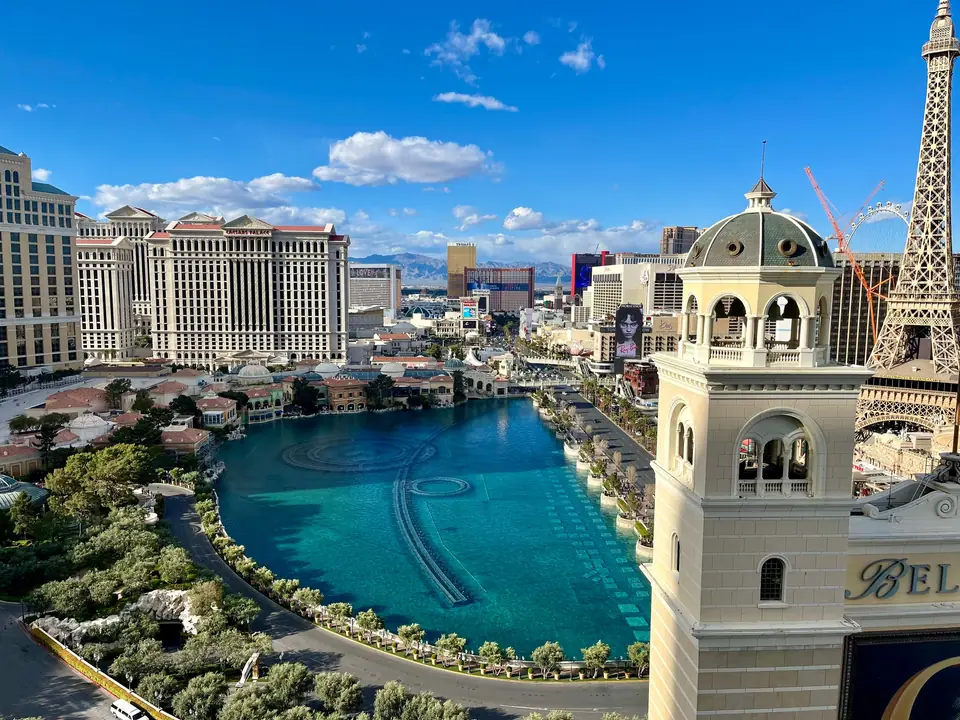
Land in Las Vegas, pick up a comfortable mid-size SUV or sedan at the Consolidated Rent-A-Car Facility, and check into a centre-Strip resort (between Aria/Cosmopolitan and Venetian/Wynn; see our Las Vegas where to stay and Strip hotels and shows guides). Remember that distances on the Strip are deceptive: walking from one mega-resort casino floor to the next often takes twenty-five minutes up and down pedestrian escalators. Spend your first evening walking the central boulevard: watch the choreographed water canons of the Fountains of Bellagio erupt across their eight-acre lake, step inside the Bellagio Conservatory & Botanical Gardens (rebuilt five times a year by a team of 120 horticulturists), walk under the painted sky ceiling along the Grand Canal Shoppes at The Venetian, and marvel at the 366-foot-tall LED exosphere of Sphere at The Venetian Resort.
Day 2: Welcome Sign, Neon Museum, Fremont Street & Cirque du Soleil
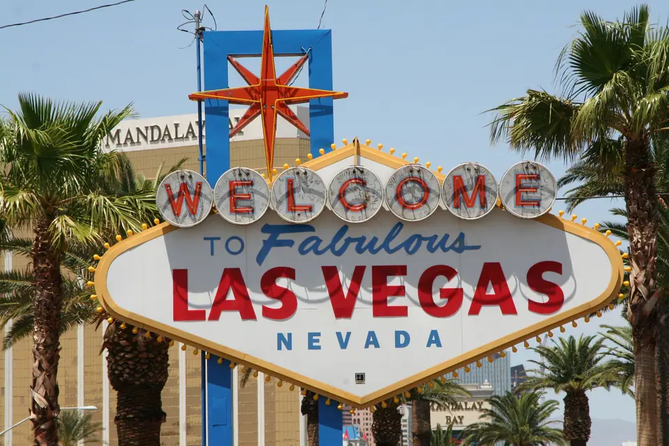
Drive to the south end of Las Vegas Boulevard before 08:30 AM to photograph the 1959 Googie-style Welcome to Fabulous Las Vegas sign without standing in a forty-minute midday queue. If you want a scenic morning desert warm-up just thirty minutes west of the Strip, drive the 21-kilometre (13-mile) scenic loop through the Aztec sandstone cliffs of Red Rock Canyon National Conservation Area. In the late afternoon and evening, head north to historical Downtown Las Vegas (covered in our Fremont Street and Downtown guide): book a twilight guided tour of The Neon Museum ("Neon Boneyard"), where more than two hundred restored vintage casino signs from the Stardust, Moulin Rouge, and Golden Nugget light up at dusk, then walk beneath the five-block Viva Vision LED canopy of the Fremont Street Experience or catch a flagship production show like Cirque du Soleil's O at Bellagio.
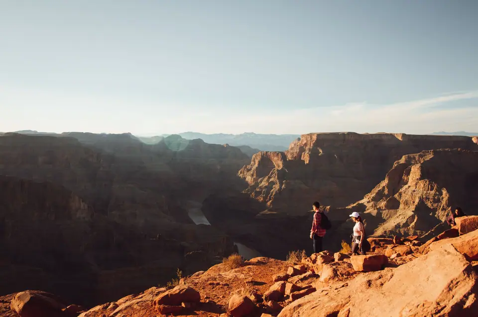
Days 3 & 4: Route 66 & The Grand Canyon South Rim
Day 3: Hoover Dam Bypass, Historic Route 66 & South Rim Sunset
Check out of Las Vegas early and drive southeast across the Mike O'Callaghan-Pat Tillman Memorial Bridge, pausing at the bridge walkway parking lot (detailed in our Grand Canyon and Hoover Dam trips guide) to look straight down at the 221-metre (726-foot) Art Deco concrete curve of Hoover Dam wedged into Black Canyon between Lake Mead and the Colorado River. Crucial Warning on "Grand Canyon West": Tour operators in Las Vegas heavily market "Grand Canyon West" and the glass Skywalk because it is closer to Nevada. That site is on tribal land outside the National Park, charges steep add-on fees for every viewpoint and camera locker, and sits at a lower, narrower section of the gorge. Always drive the extra two hours to the true Grand Canyon South Rim inside Grand Canyon National Park.
En route along Interstate 40 in Arizona, exit at Kingman or Seligman to drive a preserved stretch of Historic Route 66 past vintage 1950s motels, Burma-Shave signs, and Delgadillo's Snow Cap Drive-In before turning north on Highway 64 at Williams. Enter the South Rim by mid-afternoon, check into a historic lodge right on the rim (such as El Tovar, Bright Angel Lodge, or Yavapai Lodge, or stay ten minutes outside the south gate in Tusayan; see our Grand Canyon where to stay guide), and walk out to Mather Point and Yavapai Geology Museum for your first jaw-dropping sunset over the 1.6-kilometre-deep (one-mile-deep), 29-kilometre-wide chasm.
Day 4: South Rim Sunrise, South Kaibab Trail & Hermit Road Rim Walk
Follow our Grand Canyon South Rim sunrise and Rim Trail and Grand Canyon hiking trails guides to experience the park at its best. Board the early morning park shuttle to Yaki Point and hike the first section of the South Kaibab Trail down to Ooh Aah Point (2.9 kilometres / 1.8 miles round trip) or Cedar Ridge (4.8 kilometres / 3 miles round trip). Unlike the Bright Angel Trail, which starts in a shaded side fault, the South Kaibab Trail follows an exposed ridgeline that opens up 360-degree views up and down the entire inner gorge within twenty minutes of descending below the rim. Remember the golden rule of canyon hiking: going down is optional, coming back up is mandatory, and temperatures at the bottom are 10°C to 12°C (20°F) hotter than on the rim; never attempt to hike to the Colorado River and back in a single day.
In the afternoon, ride the car-free Red Route shuttle west along Hermit Road, hopping off to walk the paved Rim Trail between Powell Point, Hopi Point, and Mohave Point, where you can see and hear the muddy-green rapids of the Colorado River far below. For a shorter park visit, see our Grand Canyon 2-day itinerary and things to do at the Grand Canyon guides.
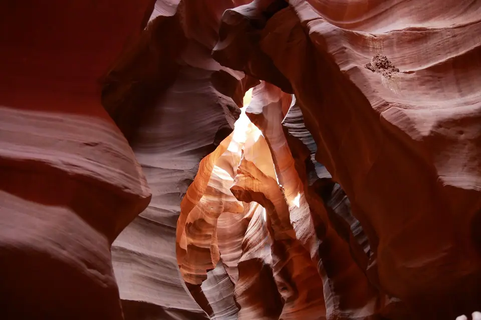
Days 5 & 6: Horseshoe Bend, Antelope Canyon & Monument Valley
Day 5: East Rim (Desert View Watchtower) to Page, Arizona (Horseshoe Bend & Lake Powell)
Depart Grand Canyon Village heading east along the 37-kilometre (23-mile) Desert View Drive (Highway 64 East), which remains open to private cars year-round. Stop at Grandview Point, Moran Point, Lipan Point (offering the widest view of the Unkar Delta and Colorado River S-curve), and Mary Colter's 1932 stone Desert View Watchtower at the East Entrance. Exit the park and drive two hours north along U.S. Route 89 past the vermilion cliffs of Echo Peaks to Page, Arizona. In the late afternoon, walk the 2.4-kilometre (1.5-mile) round-trip path from the Highway 89 overlook lot to the edge of Horseshoe Bend, where the emerald-green Colorado River carves a 270-degree gooseneck loop 300 metres (1,000 feet) below sheer Navajo sandstone cliffs. Spend the night in Page near Lake Powell.
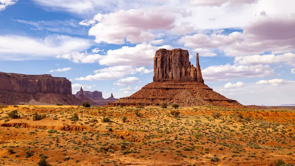
Day 6: Antelope Canyon Morning Tour & Afternoon Drive into Monument Valley
Both Upper and Lower Antelope Canyon (as well as quieter Canyon X) lie within the Navajo Nation just east of Page and can only be entered on a pre-booked timed tour with an authorised Navajo guide. Book a mid-morning departure (between 10:00 AM and 12:30 PM): Lower Antelope Canyon features V-shaped corkscrew sandstone passages accessed via metal staircases with brighter ambient light all day, while Upper Antelope Canyon is a flat walk along an A-shaped sandy floor famous for vertical sunbeams between April and September.
After lunch in Page, drive two hours northeast via Kayenta into Monument Valley Navajo Tribal Park on the Arizona-Utah border (note that because Monument Valley is a Navajo Tribal Park rather than a federal National Park, the U.S. "America the Beautiful" park pass does not apply; a separate tribal entry fee is collected at the booth). Check into The View Hotel or Goulding's Lodge so your balcony faces directly toward West Mitten Butte, East Mitten Butte, and Merrick Butte, and drive (or take an open-air Navajo jeep tour along) the 27-kilometre (17-mile) unpaved Valley Drive past John Ford's Point and Totem Pole before sunset.
Days 7 to 9: Moab, Arches & Canyonlands
Day 7: Forrest Gump Point to Moab & Dead Horse Point Sunset
Rise for sunrise over the Mittens in Monument Valley, then drive north on U.S. Route 163 through Mexican Hat, stopping at Milepost 13 ("Forrest Gump Point") where the straight desert highway frames the Monument Valley buttes on the horizon. Continue three hours north into Moab, Utah, the adventure capital of the Colorado Plateau situated between two major national parks. On your first late afternoon in Moab, drive forty minutes up the mesa to Dead Horse Point State Park, where a narrow neck of high plateau looks 600 metres (2,000 feet) straight down onto a sweeping gooseneck bend of the Colorado River and emerald potash evaporation ponds.
Day 8: Arches National Park (Devils Garden, The Windows & Delicate Arch Sunset)
Arches National Park protects more than 2,000 natural sandstone arches, the densest concentration on earth (note that from April through October, Arches requires an advance timed-entry vehicle ticket on Recreation.gov unless you enter before 07:00 AM or after 04:00 PM). Enter early via the switchbacks above Moab Canyon, drive past the towering sandstone fins of Park Avenue and Courthouse Towers, and hike the morning trail into Devils Garden to see Landscape Arch, whose ribbon of Entrada sandstone spans 88 metres (290 feet), longer than a football pitch. After a midday break in Moab to escape the afternoon sun, return to the park to walk the Windows Section (North Window, South Window, and Turret Arch) and hike the 4.8-kilometre (3-mile) slickrock trail up to Delicate Arch for sunset, where the 16-metre (52-foot) freestanding arch frames the snow-capped La Sal Mountains in the distance.
Day 9: Canyonlands National Park (Island in the Sky) & Scenic Byway 12
Spend the morning exploring the Island in the Sky district of Canyonlands National Park, a sheer-walled mesa wedged like a ship's prow between the deep canyons of the Colorado River and the Green River. Walk ten minutes out to Mesa Arch right after sunrise, when reflected morning light turns the underside of the cliff-edge arch a glowing molten orange, then stop at Grand View Point Overlook and Green River Overlook. In the afternoon, drive west via Interstate 70 and Utah Highway 24 past the petroglyphs and orchards of Capitol Reef National Park (stopping at the Gifford Homestead in Fruita for freshly baked fruit pies), or begin one of the greatest scenic drives in the world: Utah Scenic Byway 12 across Boulder Mountain and the razor-back hogsback ridge between Calf Creek and Escalante, arriving at Bryce Canyon by evening.
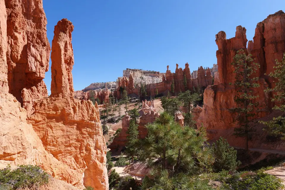
Days 10 to 12: Bryce Canyon, Zion & Return to Vegas
Day 10: Bryce Canyon Amphitheatre Sunrise & The Navajo-Queen's Garden Loop
Perched at an elevation of 2,400 to 2,700 metres (8,000 to 9,000 feet), Bryce Canyon National Park is not actually a river-carved canyon at all: it is a series of giant horseshoe-shaped natural amphitheatres eroded into the eastern edge of the Paunsaugunt Plateau, filled with thousands of frost-wedged pink, orange, and white limestone spires called hoodoos. Stand at Sunrise Point or Inspiration Point at dawn as first light ignites the Silent City formations. Immediately afterward, hike the Navajo Loop and Queen's Garden Combination Trail (4.6 kilometres / 2.9 miles, 2 to 3 hours): descend into the canyon floor via the steep switchbacks of Wall Street (flanked by towering Douglas firs wedged between narrow slot walls) or Two Bridges, wind among the hoodoo spires at the bottom, and climb back up the gentler Queen's Garden path to Sunset Point. In the late afternoon, drive ninety minutes southwest via Highway 89 and Route 9 through the red-asphalt switchbacks and 1.1-mile historic rock tunnel of the Zion-Mount Carmel Highway into Springdale at the entrance to Zion National Park.
Days 11 & 12: Zion National Park (Canyon Overlook, The Narrows & West Rim / Scout Lookout)
Unlike the Grand Canyon and Bryce Canyon, where you stand on the rim looking down, in Zion National Park you stand on the emerald floor of Zion Canyon looking straight up at 700-metre (2,300-foot) vertical walls of Navajo sandstone carved by the Virgin River. From spring through autumn, the main Zion Canyon Scenic Drive is closed to private cars; you leave your vehicle in Springdale or at the Visitor Center and ride the free, frequent electric Zion Canyon Shuttle up to the Temple of Sinawava (Stop 9).
- Morning 1 (West Rim Trail to Scout Lookout / Angels Landing): Ride the first morning shuttle to The Grotto (Stop 6) and hike up the paved, engineering-marvel switchbacks of Walter's Wiggles through Refrigerator Canyon to Scout Lookout (6.8 kilometres / 4.2 miles round trip), which commands a sweeping view down the length of Zion Canyon. (Note: continuing the final half-mile out onto the narrow chained spine of Angels Landing strictly requires a seasonal lottery permit on Recreation.gov; hiking to Scout Lookout and continuing higher up the West Rim Trail requires no permit and offers even higher views).
- Morning 2 (The Zion Narrows Riverside Walk): Ride the shuttle to the end of the line at Temple of Sinawava (Stop 9), walk the flat 3.5-kilometre (2.2-mile) paved Riverside Walk to the gateway where the canyon walls close in to twenty feet wide, and (if Virgin River flash-flood forecasts are clear and flow rates are safe) rent neoprene boots, dry bibs, and a wooden walking stick in Springdale to wade directly up the Virgin River into the slot gorge of The Narrows as far as Orderville Canyon and Wall Street.
On the afternoon of Day 12 (or Day 14 if you added an extra day in Moab and Zion), drive 2.5 hours southwest on Interstate 15 through the Virgin River Gorge (with an optional detour through the fiery red sandstone waves of Valley of Fire State Park in Nevada) back to Harry Reid International Airport in Las Vegas for your departure flight.
Route 4: The South & Florida Keys
While northern cities battle freezing winds between November and April, America's Gulf Coast and subtropical Atlantic peninsula enjoy warm, sun-drenched days and their liveliest cultural calendar of the year. Route 4 links three of the most distinct cultural capitals in the southern United States over 12 days: the Creole jazz courtyards of New Orleans, the space-age engineering and world-class museums of Houston, and the Art Deco beaches, Latin neighbourhoods, and coral islands of Miami, the Everglades, and the Florida Keys.
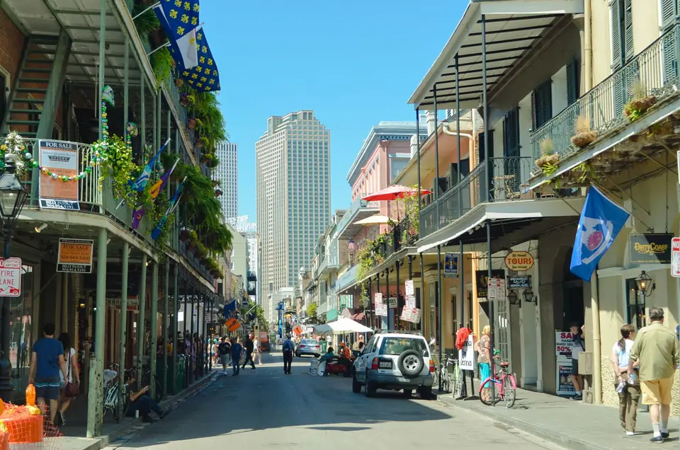
Days 1 to 3: New Orleans, French Quarter & Live Jazz
Day 1: Vieux Carré (French Quarter) Architecture, Jackson Square & Royal Street
Fly into Louis Armstrong New Orleans International Airport (MSY) and take a fixed-rate airport taxi or shuttle into the French Quarter or Warehouse/Arts District (see our New Orleans where to stay guide; staying on quiet Chartres or Royal Street or across Canal Street in the Warehouse District lets you sleep peacefully away from late-night Bourbon Street noise). As we explain in our French Quarter guide, although the neighbourhood is called the French Quarter (Vieux Carré), two catastrophic fires in 1788 and 1794 destroyed almost all original French timber structures; the wrought-iron and cast-iron galleries, lush hidden courtyards, and arched carriageways you walk past today were largely built under Spanish colonial rule and early nineteenth-century Creole architects.
Spend your first afternoon walking Royal Street past antique shops and open-air street brass bands to Jackson Square, framed by the triple spires of the 1794 St. Louis Cathedral alongside the Spanish colonial Cabildo and Presbytère museums. Cross Decatur Street to the original 1862 awning of Café Du Monde for a plate of three piping-hot French-style beignets buried under a drift of powdered sugar alongside a cup of chicory café au lait, then climb the steps to the Moon Walk riverfront promenade to watch historic paddlewheel steamboats and ocean freighters navigate the deep crescent bend of the Mississippi River.
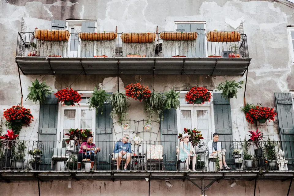
Day 2: St. Charles Avenue Streetcar, The Garden District & Frenchmen Street Live Jazz
Start at the corner of Canal and Carondelet Streets to board the dark-green Perley Thomas 900-series streetcars on the St. Charles Avenue Streetcar Line, the oldest continuously operating street railway system in the world (running since 1835). Pull down the mahogany sash window as the streetcar clatters beneath a tunnel of centuries-old southern live oaks draped in Spanish moss into the Garden District. Hop off at Washington Avenue to walk among Greek Revival and Italianate antebellum mansions framed by white cast-iron "cornstalk" fences, browse the independent Garden District Book Shop inside The Rink, and view the above-ground marble vaults of Lafayette Cemetery No. 1 from the gates before stopping along Magazine Street for a lunch of hot roast-beef or fried Gulf shrimp po'boys served on crisp-crusted Leidenheimer French bread (consult our Creole and Cajun food guide to distinguish rich, tomato-and-roux city Creole dishes like turtle soup and Oysters Rockefeller from smoky country Cajun dark-roux gumbos and boudin).
When darkness falls, skip the neon slushy bars of Bourbon Street and walk just two blocks northeast of Esplanade Avenue into the Faubourg Marigny to Frenchmen Street. Along a compact three-block stretch between Esplanade and Royal, authentic live music clubs like The Spotted Cat Music Club, Snug Harbor Jazz Bistro, d.b.a., and Blue Nile host rotating brass, traditional Dixieland, funk, and modern jazz ensembles every night of the week, while just inside the Quarter at 726 St. Peter Street, Preservation Hall presents acoustic, unamplified traditional New Orleans jazz in an intimate 1817 carriageway room.
Day 3: National WWII Museum, Tremé & Bayou Swamp Kayak or Airboat
Round out your New Orleans 3-day itinerary (and see our things to do in New Orleans guide) by spending the morning in the Warehouse District at the National WWII Museum, designated by Congress as America's official World War II institution; its Boeing Center pavilion hangs restored B-17 Flying Fortress and C-47 Skytrain aircraft overhead while immersive campaigns trace both the European and Pacific theatres. In the afternoon, walk through historic Tremé (America's oldest African American neighbourhood) and Louis Armstrong Park (Congo Square), or take a half-day excursion south to the Jean Lafitte Barataria Preserve or Manchac Swamp to paddle among bald cypress trees, tupelo gum swamps, and wild American alligators.
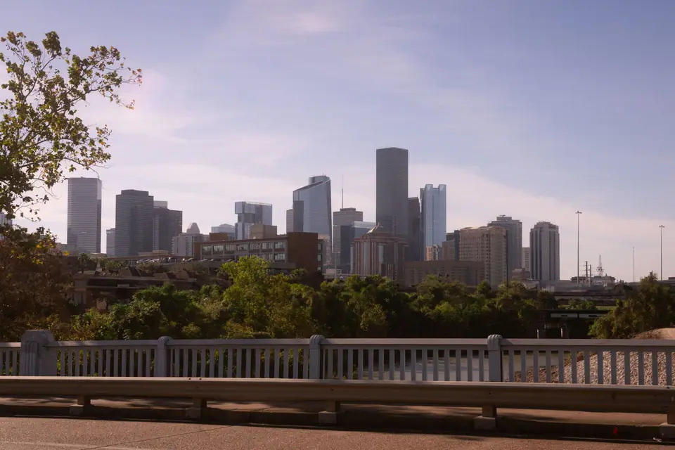
Days 4 to 6: Houston, NASA & Museum District
Take a 65-minute morning hop on United or Southwest Airlines (or drive 5.5 hours west on Interstate 10 across Cajun country via Lafayette) into Houston, the fourth-largest metropolis in the United States and the undisputed culinary and cultural powerhouse of the American South. We cover Houston across 40 dedicated neighbourhood and attraction subguides, making it easy to tailor your three days to space exploration, world-class art, and Texas barbecue.
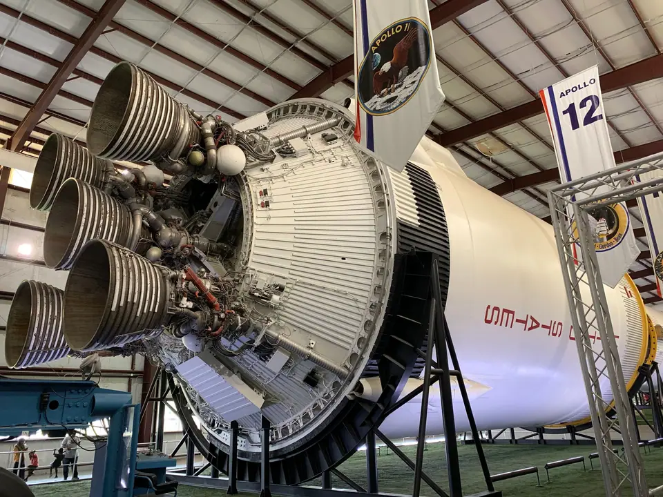
Day 4: Space Center Houston & NASA Johnson Space Center
Dedicate your first full day in Texas to Space Center Houston in Clear Lake, thirty-five minutes southeast of Downtown along Interstate 45. This is the official visitor complex of NASA Lyndon B. Johnson Space Center, home to America's astronaut corps and Mission Control since 1961. Here is the single most important rule before you arrive: book your timed NASA Tram Tour slot online at the same time you buy your admission ticket, selecting the Historic Mission Control Tour and the Astronaut Training Facility Tour before slots sell out.
In Independence Plaza out front, walk inside the full-scale shuttle replica Independence mounted atop the original NASA 905 Boeing 747 Shuttle Carrier Aircraft. Inside the main Starship Gallery, touch an actual lunar basalt rock brought back by Apollo 17 and inspect the scorched heat shield of the Apollo 17 Command Module America. Then board the open-air tram into the working NASA campus: sit in the visitor gallery overlooking the meticulously restored 1969 Apollo Mission Operations Control Room (MOCR 2, where "Houston" guided Neil Armstrong and Buzz Aldrin onto the Sea of Tranquility), walk the elevated catwalk through Building 9 where astronauts train inside full-scale International Space Station modules and Orion capsules, and finish inside the Rocket Park hangar standing beneath one of only three remaining complete, flight-certified 111-metre (363-foot) Saturn V rockets on earth.
Day 5: Houston Museum District, The Menil Collection, Rothko Chapel & Hermann Park
Spend Day 5 in the walkable, oak-canopied Houston Museum District and Menil campus, easily reached via the METRORail Red Line from Downtown. Start at the Museum of Fine Arts, Houston (MFAH), where underground light tunnels designed by James Turrell connect the classical Law and Beck buildings with Steven Holl's luminous translucent glass Nancy and Rich Kinder Building. Across Main Street, the Houston Museum of Natural Science boasts the Morian Hall of Paleontology (designed by Robert Bakker with sixty posed dinosaur and prehistoric mammal skeletons in dynamic action poses) and the Cullen Hall of Gems and Minerals.
After strolling through the Japanese Garden and McGovern Centennial Gardens in Hermann Park (or visiting the adjacent Houston Zoo), drive ten minutes west into Montrose to the 30-acre neighbourhood campus of The Menil Collection and Rothko Chapel (completely free admission). Renzo Piano's grey cypress-plank main gallery uses custom ferro-cement roof "leaves" to bathe Surrealist masterpieces, Byzantine icons, and African and Pacific island art in soft natural Texas daylight, while one block east sits the octagonal brick sanctuary of the Rothko Chapel, housing fourteen monumental dark-hued canvases painted by Mark Rothko.
Day 6: Buffalo Bayou Cistern, Central Texas Brisket, Viet-Cajun Crawfish & Galveston Option
Start your final Houston morning at Buffalo Bayou Park and the Cistern just west of the Downtown skyline: descend into the subterranean 1926 drinking-water reservoir supported by 221 slender twenty-five-foot concrete columns reflecting in a thin mirror of water, or walk the 11-kilometre air-conditioned Downtown Houston tunnel system six metres beneath the financial skyscrapers. For lunch and dinner, follow our Houston Tex-Mex and BBQ food guide: queue by 10:45 AM at an oak-smoked Central Texas craft barbecue pit (such as Truth BBQ in the Houston Heights or Pinkerton's) for peppery bark-encrusted brisket sliced to order, beef ribs, and jalapeño cheese sausage, then head west down Bellaire Boulevard into Asiatown for Houston's signature Viet-Cajun garlic-butter crawfish, sizzling beef fajitas in Montrose, or an evening game at Daikin Park (home of the Astros). If you visit in March, do not miss the world's largest live entertainment and rodeo event at Houston Rodeo and NRG Park, or use the afternoon for a coastal excursion down to historic Strand District and Gulf beaches on our Galveston Island day trip. See our Houston where to stay and Houston 3-day itinerary pages for full logistics.
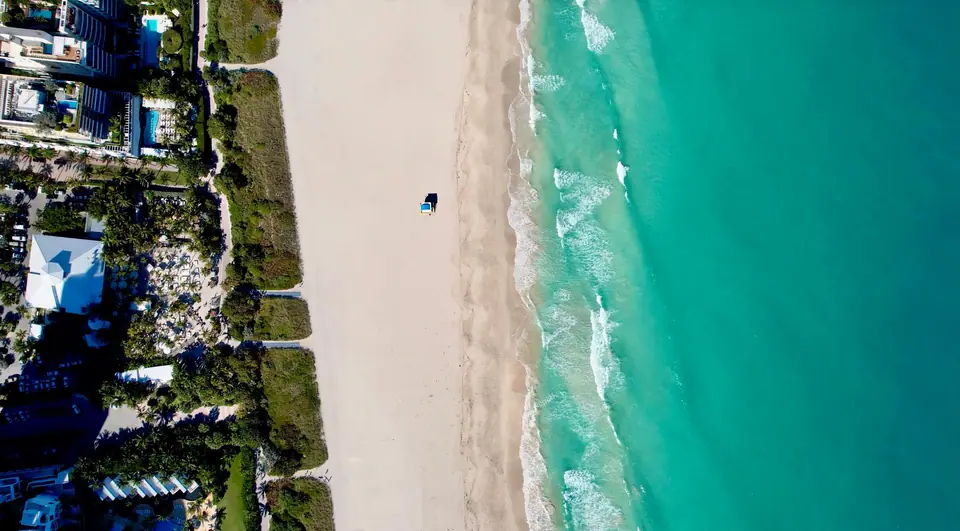
Days 7 to 9: Miami, South Beach & Little Havana
Board a two-hour morning flight across the Gulf of Mexico from Houston (IAH or HOU) to Miami International Airport (MIA). Check into a boutique Art Deco hotel along Ocean Drive, Collins Avenue, or Mid-Beach in Miami (see our Miami where to stay guide to choose between walkable South Beach, quieter Mid-Beach/Faena District, or mainland Brickell).
Day 7: South Beach Art Deco Walking Tour, Lummus Park & South Pointe Pier
Spend your first afternoon and evening on the barrier island of Miami Beach. Follow our South Beach Art Deco and South Beach Art Deco walk guides along Ocean Drive, Collins Avenue, and Washington Avenue between 5th and 23rd Streets. This single square mile protects more than eight hundred structures built between 1923 and 1943 in Tropical Art Deco, Streamline Moderne, and Mediterranean Revival styles. Stop at the Art Deco Welcome Center at 1001 Ocean Drive, spot the porthole windows, terrazzo floors, racing stripes, and "eyebrow" window ledges shading pastel facades like The Colony Hotel, The Carlyle, The Breakwater, and Casa Casuarina (the former Versace Mansion), and photograph the colorful wooden lifeguard towers lining the white sand of Lummus Park. At sunset, walk to the southern tip of the island at South Pointe Park and Pier to watch giant cruise ships glide down Government Cut out into the Atlantic Ocean while dining on fresh Florida stone crab claws (in season from October 15 to May 1) and key lime pie.
Day 8: Wynwood Street Art, Little Havana's Calle Ocho & Bayside
Cross the MacArthur or Venetian Causeway onto mainland Miami to explore two neighbourhoods detailed in our Wynwood and Little Havana guide:
- Morning (Wynwood Arts District): Walk through the open-air museum of Wynwood Walls and the surrounding fifteen blocks of former garment warehouses around NW 2nd Avenue and NW 25th Street, where world-famous muralists paint multi-storey building facades alongside specialty coffee roasteries, contemporary galleries, and Zak the Baker.
- Afternoon (Little Havana & Calle Ocho): Head south to SW 8th Street (Calle Ocho between 13th and 17th Avenues), the cultural heart of Miami's Cuban diaspora. Order a sweet, thimble-sized cafecito or cortadito and a guava-and-cheese pastelito from a walk-up street window (ventanita) at Versailles or La Carreta, watch hand-rolled cigars being crafted at El Titan de Bronze, listen to live son cubano while ordering fresh mango or mamey ice cream at Azucar Ice Cream Company, and watch neighbourhood elders slap ivory tiles on the tables of Máximo Gómez Park ("Domino Park") at SW 8th Street and 15th Avenue.
Day 9: Vizcaya Museum and Gardens, Coconut Grove & Pérez Art Museum Miami (PAMM)
Begin Day 9 on the shores of Biscayne Bay in Coconut Grove at Vizcaya Museum and Gardens, industrialist James Deering's 1916 Italian Renaissance-style winter villa. Surrounded by ten acres of formal European geometric gardens, mangrove shorelines, and a carved coral-stone barge breakwater moored in the bay, Vizcaya feels like a sixteenth-century Veneto estate transported to the subtropics. Spend the afternoon in Historic Coconut Grove or head north to Museum Park to visit Herzog & de Meuron's hanging-garden concrete verandas at Pérez Art Museum Miami (PAMM) and the adjacent Phillip and Patricia Frost Museum of Science (with its three-level Gulf Stream Aquarium oculus lens). See our Miami 3-day itinerary and things to do in Miami guides for evening rooftop and Design District options.
Days 10 to 12: Everglades & The Florida Keys
Pick up a rental car on the morning of Day 10 for one of the most unique ecological and engineering road trips on earth (covered in our Everglades and Key West trips subguide):
- Day 10 (Everglades National Park: Shark Valley & Anhinga Trail): Drive forty-five minutes west of Miami along the Tamiami Trail (U.S. Route 41) to the Shark Valley Visitor Center inside Everglades National Park, a 1.5-million-acre subtropical wilderness and UNESCO World Heritage "River of Grass". Rent a bicycle or board the two-hour naturalist-led open-air tram along the 24-kilometre (15-mile) paved loop road to the 20-metre concrete observation tower, passing dozens of wild American alligators, roseate spoonbills, great blue herons, and wood storks sunning right beside the path. In the afternoon, drive south via Homestead into the main Ernest F. Coe / Royal Palm entrance of the park to walk the elevated boardwalk of the Anhinga Trail before checking into a waterfront lodge in Key Largo or Islamorada at the top of the Florida Keys.
- Days 11 & 12 (The Overseas Highway & Key West): Drive southwest down U.S. Route 1, the 182-kilometre (113-mile) Overseas Highway, which island-hops across forty-two bridges dividing the turquoise Atlantic Ocean on your left from the shallow emerald flats of the Gulf of Mexico on your right. Pause in Islamorada to feed giant tarpon at Robbie's Marina, stop at Bahia Honda State Park just after crossing the dramatic Seven Mile Bridge out of Marathon, and arrive in Key West (closer to Havana than to Miami). Walk the conch-style wooden verandas of Old Town to tour the Ernest Hemingway Home and Museum on Whitehead Street (home to roughly sixty polydactyl six-toed cats descended from Hemingway's original cat, Snow White) and Harry S. Truman's Little White House, snap a photo at the Southernmost Point Buoy, watch the sunset street performers at Mallory Square, and consider booking the high-speed catamaran ferry or seaplane 110 kilometres (70 miles) west across open turquoise water to the nineteenth-century brick fortress of Dry Tortugas National Park (Fort Jefferson) before flying home directly from Key West International Airport (EYW) or driving back to Miami (MIA).
Route 5: 21-Day Coast-to-Coast Tour
If you are travelling from Europe, Asia, Australia, or South America for a once-in-a-lifetime three-week holiday and want to experience both East Coast history and the American West in a single trip, the secret is eliminating the 3,000-kilometre middle driving gap with two strategic nonstop hub flights. Never attempt to drive between Washington, D.C. and Las Vegas unless you have a full month. Instead, combine the best segments of Routes 1, 2, and 3 into this field-tested 21-day transcontinental blueprint:
| Days | Base City / Region | Transit Connection | Core Daily Focus |
|---|---|---|---|
| Days 1 to 4 | New York City (4 Nights) | Arrive JFK or EWR; use MTA subway & ferries | Midtown observation deck, Central Park loop, Brooklyn Bridge sunrise walk, Statue of Liberty & Ellis Island, 9/11 Memorial, The Met & Greenwich Village |
| Days 5 to 7 | Washington, D.C. (3 Nights) | Amtrak Acela / Regional from Moynihan Train Hall to Union Station (3 hrs) | U.S. Capitol, Library of Congress, National Archives, Smithsonian Air & Space and National Gallery, Lincoln Memorial & Georgetown |
| Days 8 to 11 | Las Vegas, Grand Canyon & Page / Zion (4 Nights) | Nonstop morning flight from Washington Dulles (IAD) or Reagan (DCA) to Las Vegas (LAS, 4.5 hrs; pick up SUV) | Las Vegas Strip & Bellagio Fountains, Hoover Dam, Route 66, Grand Canyon South Rim sunrise & Kaibab hike, Horseshoe Bend & Antelope Canyon (or Zion National Park) |
| Days 12 to 14 | San Francisco (3 Nights) | Return SUV at LAS; 90-minute flight to San Francisco (SFO; ride BART into city) | Cable cars, Chinatown, North Beach, crossing the Golden Gate Bridge to Sausalito, Alcatraz Island Night Tour & Lands End coastal trail |
| Days 15 & 16 | Monterey, Carmel & Big Sur Coast (2 Nights) | Pick up California rental car on Day 15 morning; drive Highway 1 south | Monterey Bay Aquarium, 17-Mile Drive, Carmel-by-the-Sea, Bixby Creek Bridge, McWay Falls & Santa Barbara beachfront |
| Days 17 to 19 | Los Angeles (3 Nights) | Continue south on Highway 1 / US-101 along Malibu to Santa Monica | Santa Monica Pier, Venice Beach, Getty Center, Beverly Hills, Griffith Observatory sunset over Hollywood Sign & Universal or Warner Bros. Studio Tour |
| Days 20 & 21 | San Diego (2 Nights) | Drive 2 hrs south on I-5 (or Amtrak Pacific Surfliner); fly home from SAN or LAX | Balboa Park, San Diego Zoo, USS Midway aircraft carrier, Coronado Island & La Jolla Cove sea lions |
Planning your trip around live arena concerts? If your American road trip coincides with major rock or stadium tours across North American arenas, see our dedicated Journey Final Frontier tour cities planner for city-by-city arena transit and pre-show neighbourhood tips.
Essential USA Travel Logistics
Even experienced international travellers get caught off guard by how American entry permits, national park reservations, rental car insurance, highway tolls, and restaurant bills operate compared with Europe or Asia. Read these five practical rules before locking in your bookings.
1. ESTA, Tourist Visas & Airport Entry
- Visa Waiver Program (ESTA): Citizens of more than forty Visa Waiver Program countries (including the UK, European Union nations, Australia, New Zealand, Japan, South Korea, and Singapore) do not need a traditional embassy visa for stays of 90 days or fewer. Instead, you must apply online for an ESTA (Electronic System for Travel Authorization) via the official U.S. Customs and Border Protection (CBP) portal at least 72 hours before departure. Never use third-party lookalike websites that charge four times the official government fee.
- The Cuba & Restricted Country Rule: Under current U.S. federal law, if you have travelled to Cuba on or after January 12, 2021 (or to Iran, Iraq, North Korea, Libya, Somalia, Sudan, Syria, or Yemen on or after March 1, 2011), you are automatically disqualified from entering on an ESTA and must apply in advance for a 10-year B1/B2 Visitor Visa at a U.S. Embassy or Consulate.
- Skip the 90-Minute Immigration Queue with MPC: If you are a returning ESTA traveller (entering the United States for at least the second time on the Visa Waiver Program), a Canadian B1/B2 visitor, or a U.S. citizen/green card holder, download the free official CBP MPC (Mobile Passport Control) app before your flight. Once your plane touches down at JFK, Newark, Boston, Dulles, Chicago O'Hare, Miami, Houston, San Francisco, or Los Angeles, submit your customs declaration and selfie inside the app while taxiing to the gate: you will be directed into a dedicated MPC express lane that frequently clears border control in ten minutes while the standard visitor queue snakes around the hall.
2. National Park Passes & Timed Entry
If you are running Route 2 (California & Yosemite) or Route 3 (The Grand Southwest Loop) and visiting three or more federal parks or monuments, pay close attention to how U.S. National Park Service (NPS) entry fees and timed-entry permits work:
- Individual Gate Fees vs. Annual Pass: Standard 7-day vehicle entry at flagship parks like Grand Canyon, Yosemite, Zion, Bryce Canyon, and Arches is charged per private vehicle. Since 1 January 2026, visitors who are not U.S. residents aged 16 and over also pay a $100 per-person nonresident fee at 11 popular parks, including Grand Canyon, Yosemite, Zion, Bryce Canyon, Yellowstone and Sequoia & Kings Canyon, unless they hold an America the Beautiful Annual Pass (which costs $250 for nonresidents). For international visitors seeing two or more of these parks, the annual pass is usually cheaper; check current prices on nps.gov before you go.
- Navajo Nation Parks Are Separate: Monument Valley Navajo Tribal Park, Antelope Canyon (Upper, Lower, and Canyon X), and Coal Mine Canyon are sovereign Navajo Nation lands, not U.S. federal national parks. Federal park passes are not valid there; book your Navajo guided tours and tribal park entry directly.
- Recreation.gov Timed-Entry Permits: You cannot simply drive up to the gate of every park at 11:00 AM in July anymore. Check Recreation.gov three to five months in advance for seasonal timed-entry vehicle reservations at Arches National Park (April to October between 07:00 AM and 04:00 PM), Yosemite National Park (select peak spring/summer weekends and February Firefall dates), Rocky Mountain National Park, and Glacier National Park (Going-to-the-Sun Road), as well as hiking permits for Angels Landing in Zion and Half Dome cables in Yosemite. At Muir Woods National Monument just north of San Francisco, every single vehicle and shuttle passenger requires an advance parking or shuttle reservation year-round on GoMuirWoods.com.
3. Amtrak, Domestic Flights & Rental Cars
Riding Amtrak Like a Pro
On the East Coast (Boston, Providence, New Haven, New York, Philadelphia, Baltimore, and Washington, D.C.) and Southern California (Santa Barbara, Los Angeles, Orange County, and San Diego), Amtrak is vastly more comfortable than flying or driving. Unlike airlines, Amtrak has no liquid size restrictions, no weight charges for two full-size carry-on suitcases, and generous legroom with 120V power outlets at every seat. Book 6 to 10 weeks in advance when Saver and Value fares are released; last-minute walk-up fares on the Northeast Corridor can triple in price. If you want dead silence for working or reading, select the designated Quiet Car upon boarding.
Domestic Airline Traps to Avoid
When booking internal flights across the continent (such as Washington to Chicago, or New York to Las Vegas/San Francisco), beware of Basic Economy fares on legacy carriers (United, American, Delta) and ultra-low-cost carriers (Spirit, Frontier). On United Basic Economy, for example, you are not permitted to bring a standard overhead-bin roller bag onto domestic flights unless you hold elite status or a qualifying co-branded credit card; if you show up at the boarding gate with a full-size carry-on, you will be charged a punitive gate-check fee. Always book standard Main Cabin / Economy or factor checked baggage into your comparison.
Rental Car Insurance, Electronic Tolls & The Break-In Rule
- Insurance for International Drivers: In Europe and Australia, basic third-party liability and collision cover with a deductible are legally bundled into the displayed rental rate. In the United States, state minimum liability limits are dangerously low. When booking from abroad, either book through your country's regional portal of a major agency (Hertz, Avis, Alamo, Enterprise, Sixt), which automatically bundles CDW/LDW (Collision/Loss Damage Waiver with zero deductible) and SLI/LIS (Supplemental Liability Insurance) at a fraction of walk-up counter rates, or verify that your premium travel credit card covers primary rental CDW in the USA.
- Cashless Highway & Bridge Tolls: Almost all major American bridges, tunnels, and express lanes (including the Golden Gate Bridge in San Francisco, the Florida Turnpike and Miami expressways, Houston's Sam Houston Tollway, and New York/New Jersey crossings) are now 100% cashless electronic tolling. You cannot pay cash at a booth. For the Golden Gate Bridge (which only tolls southbound into San Francisco), you can register your rental car's licence plate online at TheTollRoads.com within 48 hours of crossing to pay the exact toll with zero rental-agency admin fee. In Florida or the Northeast, check how your rental company bills tolls (Alamo, Enterprise, and National only charge a small convenience fee on the actual days you pass a toll gantry, whereas some budget brands charge a flat daily fee for every single day of your rental contract even if you only cross one bridge).
- Never Leave Bags Visible in San Francisco or Los Angeles: At urban viewpoints like Alamo Square, Lombard Street, Crissy Field, Fisherman's Wharf, or the Palace of Fine Arts in San Francisco, thieves target rental cars with luggage visible through the rear glass or Bluetooth signals emitting from laptops in the boot. Always tour San Francisco before picking up your car, or drop your luggage at a guarded hotel bell desk before sightseeing.
4. Sales Tax, Tipping & Resort Fees
First-time visitors are often surprised when a restaurant meal or a hotel room costs noticeably more at checkout than the menu or headline rate. Here is the exact maths of American pricing:
- State & Local Sales Tax: Menu prices, shop tags, and hotel room rates in the United States are always displayed before tax. Sales tax is added at the register and varies by state and city: 0% in Oregon and Delaware, 6.25% to 8.25% in Texas and Massachusetts, 7.75% to 9.5% in California, 8.875% in New York City, and up to 10.25% in Chicago.
- Hotel Resort Fees ("Destination Fees"): In Las Vegas, Miami Beach, New York City, San Francisco, and Honolulu, most major hotels tack on a mandatory nightly Resort Fee, Destination Fee, or Urban Fee plus tax on top of the room rate, ostensibly covering Wi-Fi, gym access, or pool towels. Under updated consumer transparency rules, most booking portals now show the "Total Price Including Fees" if you toggle it on, so always compare the final all-in nightly total rather than the base headline rate.
- Tipping Etiquette: In full-service sit-down American restaurants, servers earn a lower base wage and rely on tips as their primary income. The standard tip for good table service is 18% to 20% of the pre-tax bill. At bars, tip per drink or 15% to 20% on cocktail tabs; for hotel bellhops and housekeeping, leave a small cash gratuity per bag or per night with a "Thank You" note. At counter-service coffee shops and fast-casual bakeries where an iPad screen spins around asking for 20% to 25% just for handing you a croissant, you are under zero obligation to tip (hitting "No Tip" is completely normal for counter pickup).
5. Season-by-Season USA Climate Matrix
Because the United States spans arctic tundra, alpine granite passes, arid desert canyons, and subtropical coral keys, there is no single "best month" for the whole country. Use this seasonal matrix to pick the right route for your travel window:
| Season / Months | Best Routes to Run | Routes to Avoid or Modify | Key Field Notes |
|---|---|---|---|
| Spring (April & May) | Route 1 (Northeast & Chicago), Route 3 (Grand Southwest National Parks), Route 4 (South & Florida in April) | High Sierra passes in Yosemite (Tioga Road is usually closed by snow until late May or June) | Peak waterfall volume in Yosemite Valley; ideal 22°C to 27°C daytime hiking weather in Zion, Moab, and the Grand Canyon; cherry blossoms in Washington, D.C. (late March / early April). |
| Summer (June to August) | Route 2 (California Coast & Yosemite High Country), Route 1 (Boston & Chicago lakefront) | Route 4 (humid, stormy hurricane/rainy season in Florida & New Orleans) and low-elevation desert floors in July/August | Yosemite's Tioga Pass and Glacier Point are wide open; coastal California stays refreshingly cool (18°C to 25°C). If visiting Southwest parks in summer, start all hikes at 06:00 AM. |
| Autumn (September & October) | Route 1 (New England & Central Park fall foliage), Route 2 (California's warmest, clearest coastal months), Route 3 (Southwest golden cottonwoods) | Watch Atlantic tropical storm forecasts in Florida during September | Arguably the single best two-month window across the entire United States: San Francisco sheds its summer fog in September/October ("Indian Summer"), and desert canyon temperatures are crisp and comfortable. |
| Winter (November to March) | Route 4 (New Orleans, Houston, Miami, Everglades & Florida Keys), Southern California (Los Angeles & San Diego), Las Vegas | Chicago and Boston (sub-zero windchills in Jan/Feb); Bryce Canyon and Grand Canyon rims require traction/warm layers for snow | Dry season in the Everglades (best wildlife viewing at waterholes); Mardi Gras season in New Orleans (February/early March) and Houston Rodeo (March); festive holiday lights in New York City from Thanksgiving to New Year's Day. |