


























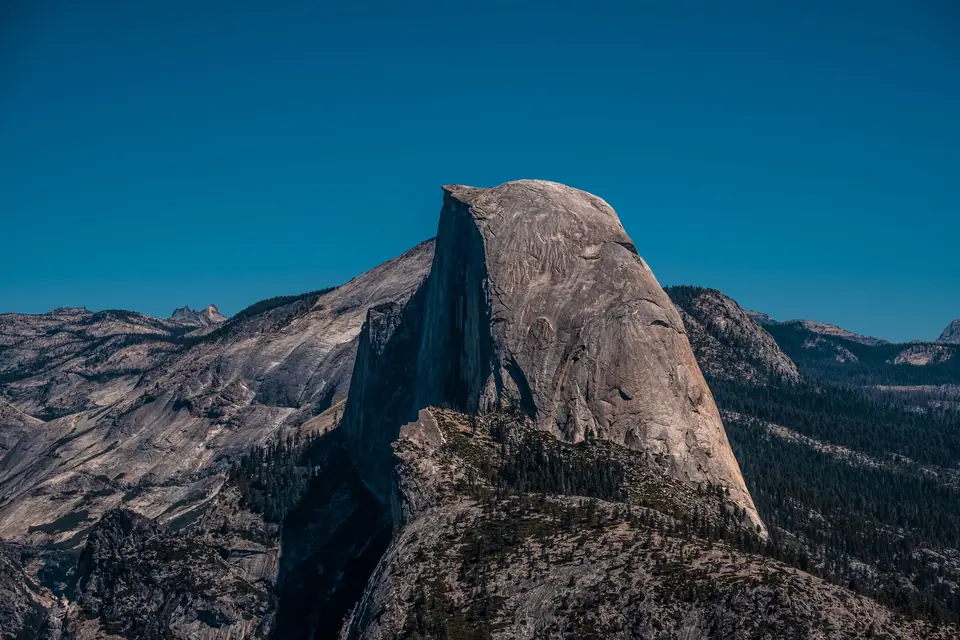
Driving Tioga Road (Highway 120 East): Olmsted Point, Tenaya Lake & Tuolumne Meadows
Climbing to 3,031 metres along seasonal Tioga Road, past the glacial boulders of Olmsted Point, turquoise Tenaya Lake and Tuolumne Meadows.
Running for 63 kilometres (39 miles) across the northern high country of Yosemite from Crane Flat over 3,031-metre (9,943-foot) Tioga Pass, the highest highway pass in California, Tioga Road (Highway 120 East) is a completely different world from Yosemite Valley. Instead of looking up at granite cliffs from a canyon, you drive across the top of a gleaming subalpine plateau of glacially polished white granite domes, turquoise lakes and wildflower meadows. (Because Tioga Pass receives 6 to 10 metres of winter snow, Tioga Road is closed from roughly November until late May or mid-June; check the NPS road status.)
The 4 Essential Stops Going West-to-East Along Tioga Road (Allow a Full Day)
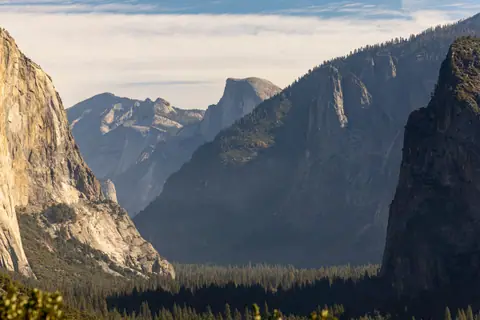
- Stop 1, Olmsted Point (km 45, See the 'Back' of Half Dome & Glacial Erratics): pull into the paved car park to look across smooth granite slabs dotted with giant boulders (glacial erratics dropped when the Ice Age glacier melted 10,000 years ago). Looking down Tenaya Canyon gives the only roadside view of the eastern and northern profile of Half Dome and Clouds Rest. Walk the 5-minute granite path out to the dome knob for a view toward Tenaya Lake.
- Stop 2, Tenaya Lake ('The Jewel of the High Country', km 48, 2,484m Elevation): bordered by smooth white granite domes (including Pywiack Dome and Polly Dome) and a wide white granite-sand beach at its eastern end. In July, August and September, Tenaya Lake is the #1 high-alpine picnic, kayaking and swimming spot in Yosemite, with a flat 4 km shore trail.
- Stop 3, Tuolumne Meadows, Soda Springs & Lembert Dome (km 60, 2,620m Elevation): stretching for 5 kilometres along the winding Tuolumne River beneath the granite spire of Cathedral Peak. Walk the flat 2.4-kilometre path across the wooden bridge to Soda Springs (where naturally carbonated cold mineral water bubbles out of reddish travertine rock beside John Muir's 1889 cabin), or hike 45 minutes up Lembert Dome (4.5 km round-trip) for a 360-degree panorama over the meadow.
- Stop 4, Tioga Pass Entrance (3,031m) & 25-Min Descent to 'Mono Lake Tufa Towers': 20 minutes down the eastern Lee Vining Canyon outside the Tioga Pass Gate lies ancient, hyper-saline Mono Lake, famous for its limestone South Tufa towers rising from the water.
Traveller tips
Real advice from people who have been to Driving Tioga Road (Highway 120 East): Olmsted Point, Tenaya Lake & Tuolumne Meadows. Every tip is read by our team before it goes live.
No tips yet. Been here? Yours could be the first.
Thank you! Your tip will appear here after a quick review.
More in Yosemite
Continue exploring Yosemite with related neighbourhood, food, and planning guides
Quiet Northern Yosemite: Hetch Hetchy (Wapama Falls) & Tuolumne / Merced Sequoia Groves
Yosemite, United States
February's 'Firefall' at Horsetail Fall & Visiting Yosemite in Winter (Badger Pass & Ice Rink)
Yosemite, United States
Summer on the Merced River: Rafting, Sentinel & Cathedral Beaches, and Camp 4 Rock Climbing
Yosemite, United States
Where to Eat in Yosemite: The 1927 Ahwahnee Dining Room, Curry Village Pizza Deck & Trail Picnics
Yosemite, United States
