Quick Field Data
- UNESCO Inscription: Natural World Heritage Site (Ref. 701), inscribed in 1994 under Criteria (vii), (viii), (ix), and (x).
- Scale & Footprint: 3,000,000 hectares (30,000 square kilometres) in Bolivar State along the borders with Guyana and Brazil, roughly 65 percent covered by flat-topped sandstone tepuis protecting the right-bank watershed of the Caroni River.
- Access & Ticketing: Managed as a Venezuelan national park (established 12 June 1962) with a monthly climbing quota of 200 hikers on Mount Roraima; western camps depend on Pemon community river transport and park entry permits while few roads enter the park.
- Arrival Logistics: No commercial airport sits directly inside the wilderness perimeter. Travellers fly by light plane from Maiquetia Airport, Puerto Ordaz, or Ciudad Bolivar to Canaima camp airstrip, or take eastern Venezuelan roads toward Mount Roraima. Georgetown lies 459 km to the northeast.
Precambrian Sandstone Plateaus and Hydrography of La Gran Sabana
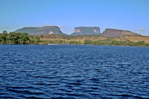
Stretching across 30,000 square kilometres of southeastern Venezuela in Bolivar State to meet the borders of Brazil and Guyana, Canaima National Park encompasses roughly the geographic span of Belgium or Maryland, ranking as Venezuela's second-largest national park after Parima-Tapirapeco and the sixth-largest national park worldwide. Established on 12 June 1962 to guard the right-bank catchment of the Caroni River inside the Guayanan Highlands moist forests ecoregion, the reserve takes its character from flat-topped table mountains known locally as tepuis, which cover approximately 65 percent of its 3-million-hectare expanse.
Geologically, tepuis rank among Earth's oldest exposed rock landforms. Nearly 3-billion-year-old igneous granite and gneiss basement rocks form the foundation beneath Proterozoic sedimentary sandstone strata laid down between 1.5 and 2 billion years ago, when South America and Africa still joined in a single supercontinent. Formerly buried beneath Mesozoic clay, conglomerate, and diorite beds, intense uplift and 180 million years of tropical erosion stripped away softer overlying rocks to expose sheer vertical cliffs 400 to 1,000 metres high capped by fractured plateaus. At Mount Roraima, the sandstone reaches 98 percent silica purity, crystallising in places into white and pink quartz deposits several centimetres long.
Intense equatorial rainfall shapes these ancient rock summits like limestone karst despite their virtually insoluble quartzite. On Mount Roraima, annual temperatures stay between 20 and 22 degrees Celsius with 75 to 85 percent humidity under prevailing northeasterly and southeasterly trade winds. Yearly rainfall tops 1,500 mm and reaches 1,800 to 3,000 mm during the April-to-November wet season. Percolating rainwater has etched a remarkable pseudo-karst landscape containing over 15 km of subterranean quartz caves across a 73.21-metre vertical drop. Discovered jointly by the Oxford University Cave Club and the Venezuelan Speleological Society, it forms the world's largest known quartz cave system. When sudden storms strike the plateau, dry galleries turn rapidly into roaring underground rivers that burst from sheer cliff walls as waterfalls.
Angel Falls, Mount Roraima, and Summit Endemism
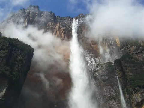
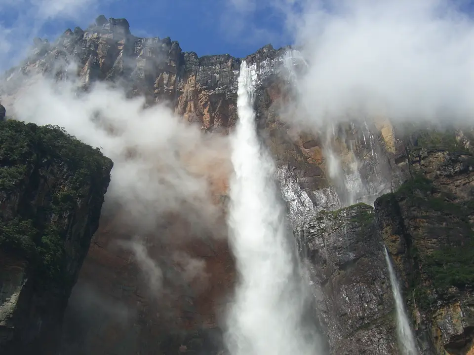
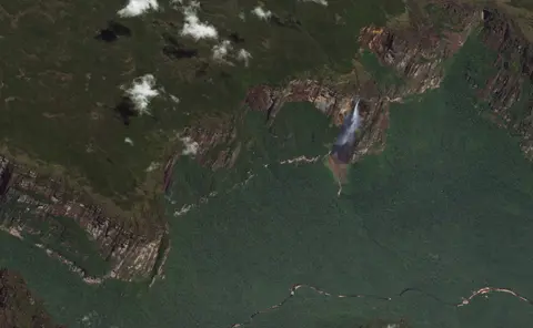
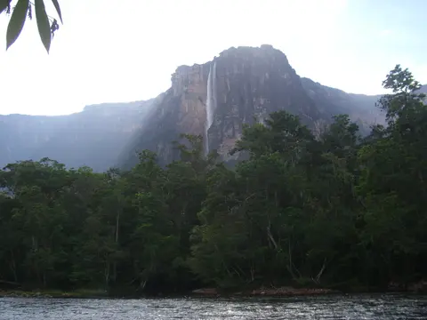
Two colossal tepuis anchor exploration across Canaima: sprawling Auyan-tepui in the west and triple-border Mount Roraima in the east. Dropping off Auyan-tepui's sheer northern rim along a fork of the Rio Korepa into the Churun, Carrao, and Orinoco system plunges Angel Falls (Spanish Salto Angel; Pemon Kerepakupai Vena). Its total height measures 979 metres (3,212 feet), comprising an 807-metre main sheer plunge, roughly 400 metres of sloped boulder rapids, and a final 30-metre drop. While ranking as Earth's tallest uninterrupted waterfall, researchers note ongoing survey discussions comparing it with South Africa's Tugela Falls. Nearby Kukenan Falls adds another vertical cascade inside the same Caroni drainage basin.
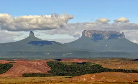
Mount Roraima ('great blue-green' in Pemon) sits in the Pacaraima chain where Venezuela (85 percent of the plateau), Guyana (10 percent), and Brazil (5 percent) meet. Its flat-topped summit stretches over 10 km long and up to 5 km wide, covering 33 to 50 square kilometres above 2,200 metres and averaging 2,600 to 2,700 metres. The highest cliff point reaches 2,810 metres in Venezuela. A northern protrusion attains 2,772 metres as Guyana's highest elevation, while the international border marker stands at 2,734 metres.
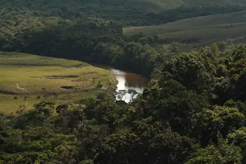
Extreme summit isolation and leached, hyper-acidic, nitrate-poor sandy soils forged sharp biological divergence between plateau tops and surrounding evergreen rainforests. Lowland canopy trees rise 25 to 45 metres, and occasionally 60 metres, among Arecaceae palms and Astragalus shrubs. Forest wildlife includes howler monkeys, capuchins, tapirs, giant armadillos, giant anteaters, giant otters, cougars, jaguars, harpy eagles, red-shouldered macaws, dusky parrots, bush dogs, yellow-banded poison dart frogs, green iguanas, and South American bushmasters. On bare sandstone summits, by contrast, only dwarfed 8-to-15-metre scrub, lichens, algae, cyanobacteria, and over 300 endemic Gran Sabana plant species survive. Because summit soils lack nitrates, specialised carnivorous plants evolved to digest scarce insects. Examples include pitcher plants (Heliamphora nutans), insect-trapping Brocchinia bromeliads, Gran Sabana sundews (Drosera felix), corkscrew plants (Genlisea), and bladderworts (Utricularia quelchii). Endemic summit genera also include Achnopogon, Adenanthe, Chimantaea, Mallophyton, and Tepuia. Summit fauna differs sharply from lowland forest wildlife. Notable species include the endemic Roraima climbing mouse (Rhipidomys macconnelli roraimae), rare Roraima mouse (Podoxymys roraimae), Tyleria mouse opossum, greater flowerpiercer, and miniature black Roraima toad (Oreophrynella quelchii).
Pemon Heritage, Aviation Expeditions, and IUCN Conservation Concerns
Long before European explorers entered the Guiana Shield, ancient indigenous cultures painted pictographic rock art estimated at 4 to 7 thousand years old, predating the arrival of today's Carib-speaking Pemon inhabitants. For the Pemon, tepuis remain sacred dwellings of Mawari spirits and cultural anchors of savanna life. European accounts began in 1595 when Walter Raleigh wrote of a crystal mountain gushing waterfalls during his El Dorado quest (though historians dismiss older rumours linking Raleigh, Fernando de Berrio, or even 1927 explorer Felix Cardona to sighting Angel Falls directly). German scientist Robert Hermann Schomburgk observed Roraima during 1835 to 1839 and 1844 British Guiana surveys and declared its cliffs inaccessible; in 1864 Carl Ferdinand Appun and Charles Barrington Brown even proposed reaching the summit by hot-air balloon. Only on 18 December 1884 did British explorers Everard im Thurn and Harry Perkins ascend Roraima's southern natural boulder ramp, guided by local Pemon who knew the slope already.
Auyan-tepui's hidden cataract entered international geography on 16 November 1933 when US gold-prospecting pilot Jimmie Angel flew over the gorge. On 9 October 1937, he returned with his wife Marie and two companions. When his Flamingo monoplane El Rio Caroni crash-landed in marshy summit turf, all four hiked down the sloping rear flank over 11 days. The name Salto del Angel first appeared on a Venezuelan government map in December 1939. The aircraft remained atop Auyan-tepui for 33 years until helicopter extraction and restoration at Maracay, and now stands outside Ciudad Bolivar airport. Angel's ashes were scattered over the falls on 2 July 1960, while in 2009 President Hugo Chavez publicly backed the indigenous Pemon name Kerepakupai Vena without decreeing a formal rename. Earlier, in 1946, Latvian explorer Aleksandrs Laime reached the falls' base alone and cleared the visitor trail from Isla Raton camp to Mirador Laime. Reaching the upper brink in the late 1950s, he named the summit creek Gauja on 18 November 1955 with the National Cartographic Institution. Between 23 April and 13 May 1949, journalist Ruth Robertson's expedition surveyed the official 979-metre height. Rock climbers failed on wet stone in 1968 and below a 120-metre overhang in 1969. Then, on 13 January 1971, George Bogel's four-man Pittsburgh team scaled the sheer face over nine and a half days up and one and a half down. Max Botto and Jerry Bird made the first parachute BASE jumps from the brink in November 1983, and the plateau later inspired films such as Arachnophobia (1990) and Pixar's Up (2009).
Despite UNESCO listing in 1994 and BirdLife International's Important Bird Area designation, conservation monitoring remains troubling. In 1990, Amazonian Cooperation Treaty nations proposed linking Canaima southward with Brazil's Monte Roraima National Park under joint governance. However, the IUCN's 2017 conservation assessment classified Canaima National Park as an area of significant concern. Evaluators cited ineffective on-the-ground protection and weak management capacity across remote mining, fire, and uncontrolled tourism frontiers. Even early 1993 records logged around 100,000 annual visitors, with 90 percent drawn to Auyan-tepui and Roraima.
Western Lagoon Sector, Eastern Gran Sabana, and Park Access Rules
Because Canaima National Park covers 30,000 square kilometres with almost no internal connecting highways, travel divides sharply between the fly-in western lagoon gateway for Angel Falls and the overland eastern Gran Sabana highway corridor leading to Mount Roraima.
| Complex Zone | Key Highlights | Access & Ticket Rule |
|---|---|---|
| Canaima Lagoon and Carrao River | Pink-sand lagoon cascades, Capuchin mission airstrip, and canoe launch point for western tepui excursions | Fly-in arrival from Maiquetia, Puerto Ordaz, or Ciudad Bolivar; Pemon community permits and park registration required |
| Auyan-tepui and Angel Falls | 979-metre waterfall, Churun River canyon, Isla Raton camp, and Mirador Laime trail | Guided Pemon motorised canoes operate mostly June to December when river water is deep enough; dry season (December to March) curtails boats |
| Mount Roraima (Eastern Sector) | 2,810-metre summit plateau, triple-border monument, quartz caves, and carnivorous pitcher-plant bogs | Overland approach via Venezuelan Gran Sabana; 3 to 5 day guided trek subject to a 200-person monthly quota and cliff-base camping around 2,000 metres |
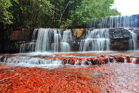
| Quebrada de Jaspe and Gran Sabana Creeks | Polished red jasper creek beds, Kurun, Kusari, and Kuravaina vistas, and lowland gallery forest | Reached along the paved eastern Gran Sabana corridor; avoid chemical sunscreens or soaps on exposed jasper bedrock |
Confirm current domestic air routes, Pemon community permit fees, and Mount Roraima's 200-hiker monthly quota registration with Venezuelan park authorities before planning logistics in either sector.
Quartz Caves, Pitcher Traps, and Talus Trails in Canaima
Examining rock outcrops and wet summit hollows across Auyan-tepui and Mount Roraima reveals three natural features defining this Guiana Shield landscape:
- Subterranean quartz dissolution caves on Roraima: Inside the summit's 15 km pseudo-karst maze, look closely at 98-percent silica sandstone walls where tropical rainwater carved smooth galleries lined with translucent pink and white quartz crystals without conventional carbonate limestone.
- Rainwater-brimming pitcher leaves of Heliamphora nutans: On nutrient-starved summit peat bogs, observe rolled tubular leaves crowned by tiny nectar-secreting spoons that trap insects and drain excess storm water through a small vertical slit so digestive pools never overflow.
- Three-stage cascade profile beneath Auyan-tepui: From Mirador Laime across the Churun valley, trace how Angel Falls' 979-metre drop divides into an initial 807-metre free-falling veil that atomises into mist before re-forming across 400 metres of steep boulder rapids and a final 30-metre plunge.
Seasonal River Windows and Pairing Canaima with Georgetown
Planning Canaima depends on which half of the park you target. River journeys up the Carrao and Churun rivers to Angel Falls operate best from June through December, when monsoon rains deepen channels for Pemon dugout canoes and swell the falls. By contrast, climbing Mount Roraima favours the drier December-to-March window despite harsh equatorial sun along the open savanna trail. April-to-November downpours can make summit streams dangerous to cross. Because Venezuela's Guiana Shield extends straight east into Guyana's rainforest interior, travellers can pair Canaima with Georgetown, 459 km northeast across the border. You can also compare wider natural reserves in the UNESCO World Heritage Atlas.