Quick Field Data
- UNESCO Inscription: 2004 (Ref. 1149), natural Arctic fjord and glacier reserve in western Greenland (Kingdom of Denmark); Criteria (vii) and (viii).
- Scale & Footprint: 399,800 hectares spanning the 40-kilometre Ilulissat Icefjord (Ilulissat Kangerlua) from the Greenland ice sheet to Disko Bay.
- Access & Ticketing: Protected wilderness with no roads or permanent settlements inside the reserve; walking boardwalks to Sermermiut are open, while the Ilulissat Icefjord Centre and boat excursions require local tickets.
- Arrival Logistics: Regional and seasonal flights arrive at Ilulissat Airport (JAV), 2.8 kilometres northeast of Ilulissat town (63 kilometres from central fjord coordinates), with coastal links south to Nuuk (560 kilometres).
Sermeq Kujalleq Ice Streams and Grounded Disko Bay Icebergs
Stretching 40 kilometres west from the Greenland ice sheet to Disko Bay, Ilulissat Icefjord sits in western Greenland. Known in Greenlandic as Ilulissat Kangerlua or Kangia, the 399,800-hectare reserve lies 250 to 350 kilometres north of the Arctic Circle in Avannaata municipality, immediately south of Ilulissat town. This deep tidal trench marks the sea outlet of Sermeq Kujalleq, also called Jakobshavn Isbræ or Jakobshavn Glacier. Among the rare channels where the continental ice sheet touches open sea directly, Sermeq Kujalleq ranks as the fastest and most active glacier outside Antarctica.
Measured ice speeds reach 20 to 40 metres per day, driving massive annual calving into the ice-choked fjord. Scientific calculations place yearly calf-ice production around 20 billion tonnes, or between 35 and 46 cubic kilometres of ice per year, accounting for roughly 10 percent of all Greenland calf ice. No other glacier outside Antarctica sheds a greater annual volume of ice into the sea, and advancing ice continues scouring the deep rocky fjord bed beneath the surface.
As the sole surviving continental ice sheet from the Quaternary Ice Age in the Northern Hemisphere, Greenland's inland cap preserves ancient ice layers estimated at 250,000 years old. Ice cores capture dramatic swings between extreme glacial cold and milder intervals from 250,000 down to 11,550 years ago, when regional climate stabilised. Today, annual snow accumulation across the upper ice cap roughly balances losses from margin melting and iceberg calving, offering scientists a direct laboratory for studying ice-sheet behaviour under changing global temperatures.
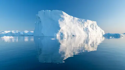
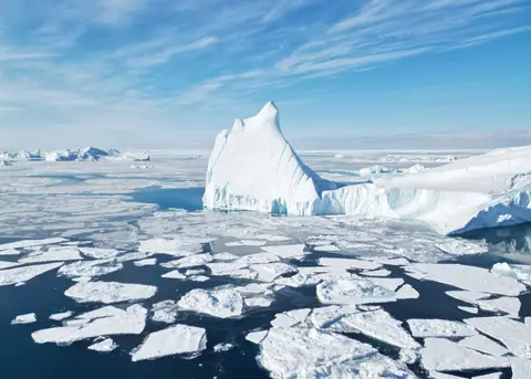
Towering icebergs breaking free from Sermeq Kujalleq can measure up to one kilometre in total height from submerged base to peak. Because shallow bedrock and moraine bars guard the fjord entrance, many colossal bergs run aground on the fjord floor for months or even years. Advancing glacier pressure and tidal surges eventually fracture and overturn these trapped monoliths, releasing them into Disko Bay. Ocean currents then steer floating icebergs northward before looping southward down Baffin Bay into the open North Atlantic, where large bergs endure to 40 or 45 degrees north latitude, farther south than the United Kingdom and level with New York City.
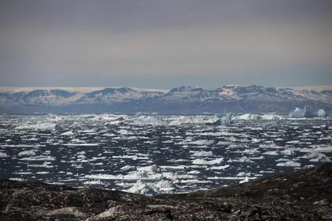
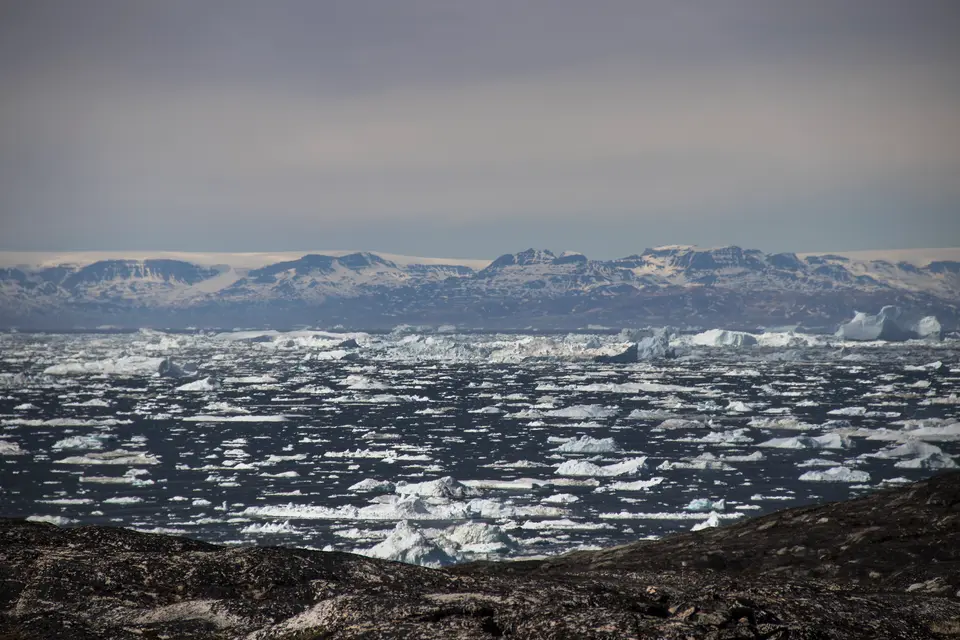
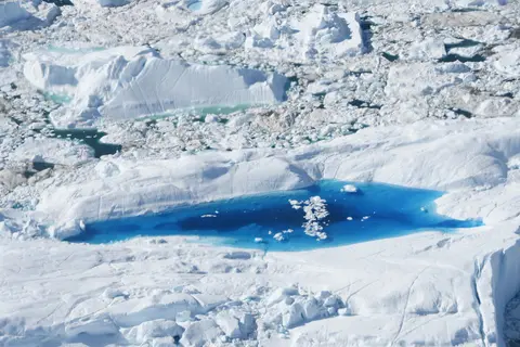
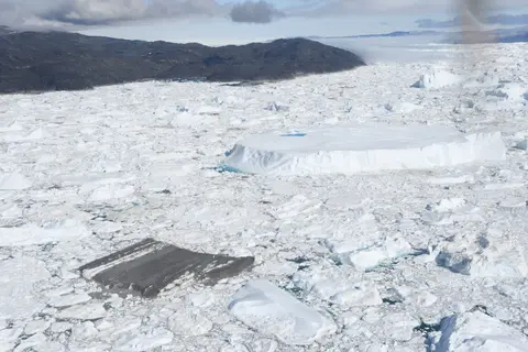
Moving ice masses and roaring acoustic bursts from fracturing glacier walls turn the 40-kilometre trench into a constantly shifting marine landscape. In winter, surface pack ice freezes into a solid white plain stretching from the calving cliff to the sea mouth. During warmer summer months, bright meltwater lakes pool atop drifting bergs while open coastal channels let excursion vessels approach the outer grounded ice field.
Four Millennia of Inuit Settlements From Sermermiut to Jakobshavn
Rich marine waters bordering the fjord supported human communities beside the ice for nearly 4,000 years. Directly south of Ilulissat along the rocky mouth lies Sermermiut, an open coastal valley preserving overlapping archaeological layers from three Inuit cultures. Field surveys document Saqqaq occupation around 1500 BC, Early Dorset habitation around 300 AD and subsequent Thule settlements, before the final Sermermiut resident relocated into Ilulissat in 1850.
During the seventeenth and eighteenth centuries, Dutch whalers sailed Disko Bay to trade extensively with local communities, calling the coast Maklykout, a name scholars trace to the Greenlandic term magdliukait meaning tidal wave. In 1741, merchant Jacob Severin established a Danish trading station named Jakobshavn after the Battle of Jacobshavn against Dutch crews. Late eighteenth-century carpenters built Zion Church (Zions Kirke), then the largest man-made structure in Greenland. Known today as Ilulissat, literally meaning icebergs, the town grew over eight percent above 1990 population levels to 4,670 inhabitants in 2020 and 5,149 residents in 2025, ranking as Greenland's third-largest city after Nuuk and Sisimiut.
Tourism has become Ilulissat's principal industry since the 1980s, though traditional Arctic life endures across town and coastal hamlets. Nearly as many sled dogs as human residents live in Ilulissat today, supported by a town sporting identity led by ten-time Greenland football champions Nagdlunguaq-48. Native polar explorer Knud Rasmussen became the first man to cross the Northwest Passage via dog sled, while fellow local explorer Jørgen Brønlund joined the 1902 Danish Literary Expedition and 1906 Danmark Expedition. Municipal leader Kristine Raahauge and coat-of-arms designer Jens Rosing also hail from Ilulissat, whose streets later hosted filming for Borgen and Smilla's Sense of Snow.
Residents of Ilulissat, Ilimanaq and Qasigiannguit still hunt ringed seals and fish for Greenland halibut inside the fjord. Local fishers prefer catch taken inside the icefjord because low fishing intensity and scarcity of predators like Greenland sharks and polar bears allow fish to grow larger than in outer Disko Bay. While fishermen traditionally crossed solid winter sea ice by dog sled, more frequent ice clearances now allow seasonal boat fishing. In May 2008, Ilulissat hosted Canada, Denmark, Norway, Russia and the United States for the Arctic Ocean Conference, addressing territorial discussions such as Hans Island and issuing the Ilulissat Declaration reaffirming the existing law of the sea.
Wilderness Governance, Climate Science, and Cruise Regulations
Observed by scientists and navigators for more than 250 years, Sermeq Kujalleq remains central to global research on ice-cap glaciology, sea-level change and fjord-bed erosion. Because the glacier accelerates during warm cycles and calves thunderous ice mountains within walking reach of town, researchers monitor daily ice movement, meltwater lakes and retreating ice fronts through field measurements and satellite imagery. As tourism expanded sharply after UNESCO listing in 2004, managing cruise ship crowds, port development and coastal trail erosion close to Ilulissat has become a leading local priority. Planned harbour upgrades and airport expansions aim to handle steady international arrivals cleanly without breaching wilderness rules.
Long before modern field stations, early polar researchers studied Sermeq Kujalleq to understand how continental ice sheets scoured northern landscapes during the Quaternary Ice Age. Today, continuous monitoring pairs satellite elevation records with ocean-temperature surveys across Disko Bay to measure how warming sea currents undercut the floating glacier tongue. Keeping wilderness access tightly managed preserves both raw Arctic scenery and undisturbed scientific baselines.
Protected under Greenland Parliament Act No 29 of 2003 on nature protection and Greenland Home Rule Government Order No 10 of 15 June 2007, all 399,800 hectares inside the Ilulissat Icefjord reserve are state-owned, excluding the urban boundaries of Ilulissat and Ilimanaq. Mining, roads and permanent settlements are prohibited across the wilderness core. Surrounding borders enforce strict national controls covering waste disposal, snowmobile tracks and building restrictions so urban expansion stops cleanly outside the natural watershed boundary. A cooperative Board uniting the Ministry of Environment and Nature and the Municipality of Ilulissat regulates boat tours, foot trails, helicopter traffic, dog sledges, waste disposal, cultural ruins at Sermermiut and sustainable hunting quotas while advancing plans for a formal protective buffer zone.
Improving visitor infrastructure near Ilulissat keeps heavy cruise tourism and hiking concentrated along hardened paths close to town rather than pushing deep into fragile tundra. Clearly marked trails, upgraded boardwalks and interpretive signage guide day visitors safely toward prime iceberg overlooks while protecting prehistoric turf mounds at Sermermiut and uninterrupted Inuit hunting areas farther inside the fjord.
Access Zones Across Ilulissat Icefjord and Disko Bay
Because zero roads cross the 399,800-hectare wilderness reserve, visiting Ilulissat Icefjord means walking town-edge paths, touring the visitor centre and boarding regulated vessels from Ilulissat harbour. Check municipal trail updates and licensed tour operator safety briefings before departing town.
| Complex Zone | Key Highlights | Access & Ticket Rule |
|---|---|---|
| Icefjord Centre & Sermermiut | Architectural exhibition pavilion, coastal boardwalks and 4,000-year-old Saqqaq, Dorset and Thule settlement ruins. | Walkers follow open boardwalk trails to viewpoints free of charge; Icefjord Centre exhibitions require admission tickets. |
| Fjord Mouth & Iceberg Shoal | Shallow submerged moraine where giant calved icebergs jam together, viewed from coastal headlands or boat tours. | Regulated tourist boats depart Ilulissat harbour in summer; private vessel approach distances follow marine codes. |
| Ilimanaq & Southern Shore | Small Greenlandic settlement just south of the fjord mouth offering quiet views toward Disko Bay bergs. | Reached by local boat transfer across the fjord mouth; respect residential dog yards and subsistence hunting zones. |
| Sermeq Kujalleq Glacier Front | Forty-kilometre glacier-choked trench terminating at the active calving wall of the Greenland ice sheet. | Inaccessible by road or normal vessels due to dense pack ice; observed mainly on permitted flightseeing routes. |
Three Glacial and Coastal Details at Ilulissat Icefjord
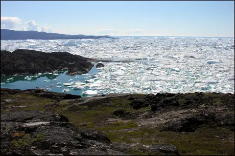
- Grounded Moraine Jam at the Fjord Entrance: Stand on the Sermermiut headland to observe why towering icebergs stall in rows along the mouth before ocean tides lift and rotate them out into Disko Bay.
- Meltwater Lagoons and Blue Compressed Ice: Look closely on boat tours for overturned icebergs exposing dense blue ancient ice carved smooth below sea level and vivid turquoise melt pools sitting inside hollowed ice tops.
- Prehistoric Turf House Hollows at Sermermiut: Trace low mossy mounds beside the timber boardwalk overlooking the ice mouth, marking winter dwellings inhabited across Saqqaq, Dorset and Thule periods.
Best Time to Visit Ilulissat, Boat Tours, and Arctic Transit
Selecting the best time to visit Ilulissat Icefjord hinges on whether travellers want midnight-sun boat navigation or frozen winter dog-sled landscapes. Despite its far northern setting, Ilulissat experiences a dry, sunny tundra climate averaging just 271 millimetres of precipitation a year, making it one of Greenland's driest and sunniest settlements. Winter freezes the fjord solid, with March averaging coldest and holding an all-time low of -40.5 degrees Celsius, whereas summer opens navigable water lanes for scheduled Ilulissat Icefjord boat tour excursions gliding safely past grounded icebergs. Travellers frequently check local forecasts and Disko Bay harbour webcams before booking marine trips or coastal walks.
Cultural and interpretive stops in town add depth between coastal boat departures and headland walks toward Sermermiut. Opened to explain 250,000 years of Quaternary climate evidence and local Greenlandic heritage, the Ilulissat Icefjord Centre leads straight onto timber boardwalks overlooking Disko Bay. Inside town, visitors also explore the Ilulissat Art Museum and eighteenth-century Zions Kirke along the harbourfront while watching working sled dogs resting near residential yards.
Planning how to get to Ilulissat centres on air and coastal ferry connections along western Greenland. Built in 1983, Ilulissat Airport (JAV) lies 2.8 kilometres northeast of town (63 kilometres from central fjord coordinates) and expanded its runway in 2026 to handle direct flights from Copenhagen. Air services also connect via Keflavik with Icelandair and regionally through Air Greenland to Nuuk (560 kilometres south) and northwestern towns, supplemented in ice-free months by the Arctic Umiaq coastal ferry calling via Sisimiut and Nuuk. Travellers planning multi-day stops book marine excursions and Sermermiut headland walks from Ilulissat harbour directly. Explore further polar and geological natural sites inside our UNESCO World Heritage Atlas.