Quick Field Data
- UNESCO Inscription: 1996 (Ref. 754); Criteria (vii), (viii), (ix) and (x)
- Scale & Footprint: 8,800,000 hectares protecting the 31,722-square-kilometre (3.15-million-hectare) lake surface and surrounding mountain parks; 636 kilometres long, 79 kilometres wide and 1,642 metres deep
- Access & Ticketing: Shoreline towns, coastal tracks and Olkhon Island ferries remain accessible to independent visitors, while surrounding national parks and strict reserves require official park permits
- Arrival Logistics: Stretched across southern Siberia between Irkutsk Oblast on its northwestern shore and the Republic of Buryatia on its southeastern Transbaikalia rim, with overland entry routes serving western coastal hubs, Olkhon Island and eastern Buryat shores
An Active Continental Rift That Never Froze Solid
Lake Baikal owes every superlative to geology rather than glacial carving. The basin occupies the heart of the Baikal Rift Zone in southern Siberia between Irkutsk Oblast to the northwest and the Republic of Buryatia (Transbaikalia) to the southeast. Here Earth's continental crust slowly tears apart at roughly 4 millimetres per year. Its water surface stands 455.5 metres above sea level, yet its deepest bed plunges 1,186.5 metres below sea level to a maximum sounding of 1,642 metres (cited at 1,700 metres in earlier surveys). Roughly 7 kilometres of sedimentary fill underlie the basin, placing the true tectonic floor 8 to 11 kilometres below the surface as the deepest continental rift on Earth. Frequent earthquakes and coastal hot springs plus deep thermal vents venting water near 50 degrees Celsius remind researchers that the fault remains geologically active.
Its tectonic trough deepened gradually over 25 to 30 million years without ever being scoured empty by overriding continental ice sheets, unlike virtually every other large lake at high northern latitudes. As a result, Baikal ranks as the oldest lake in geological history. Cooperative Russian, United States and Japanese deep-drilling cores recovered in the 1990s captured an unbroken sediment record of climate shifts spanning 6.7 million years, with deeper drilling anticipated. Baikal also remains the only confined freshwater lake known to hold direct and indirect evidence of natural gas hydrates. Across a surface area of 31,722 square kilometres (slightly larger than Belgium), it ranks seventh globally by surface area and second in Eurasia after the Caspian Sea. Despite this, the lake holds 23,615.39 cubic kilometres of fresh water, more than all North American Great Lakes combined. That volume equates to 22 to 23 percent of Earth's fresh surface water and roughly 19 to 20 percent of all unfrozen planetary fresh water. Geographers refer to the eastern lands beyond the shore as Transbaikalia and to the basin around the water as Baikalia.
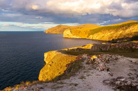
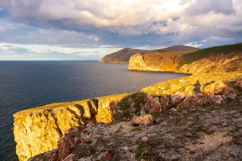
Subsurface accommodation ridges divide the rift trough into three distinct basins: the North Basin near 900 metres deep, the Central Basin plunging past 1,600 metres, and the South Basin near 1,400 metres. Separating them are the Academician Ridge and the Selenga Delta, with the Buguldeika Saddle rising to 300 metres depth. Steep mountain chains rim the water: the Baikal Mountains along the north shore, the Barguzin Range on the northeast and the Primorsky Range tracing the western flank. Lakeside taiga parklands protect dramatic headlands such as Cape Ryty on the northwest coast. Regular rift-valley winds sweep the corridor, while around 330 inflowing rivers feed the lake, led by the Selenga, Barguzin, Upper Angara, Turka, Sarma and Snezhnaya. Only a single outlet, the Angara River, drains Baikal northward toward the Yenisey system. Twenty-seven islands punctuate the lake, dominated by 72-kilometre Olkhon Island, the third-largest lake island in the world.
Full-Depth Oxygenation, Ice Cycles and Thermal Inversions
Unlike deeply stratified basins such as Lake Tanganyika or the Black Sea where bottom layers stagnate without oxygen, Baikal circulates dissolved oxygen all the way down to its 1,642-metre abyssal floor. Twice each year, during May to June after ice breakup and again in October to November as surface waters cool, temperature shifts reach the upper 300 metres. Solar warming and autumn chilling bring this layer to a uniform homothermic 4 degrees Celsius, triggering vertical mixing that refreshes deep habitats. Below 300 metres, water temperatures hold consistently steady at 3.1 to 3.4 degrees Celsius all year long with minimal seasonal variation. Even where deep and shallow hydrothermal vents release 50-degree thermal plumes, the vast volume of cold water absorbs the heat locally without shifting basin-wide temperatures.
Seasonal extremes turn the lake surface from frozen white plain to stormy inland sea. From early January until early May or June, lasting longest in the far north, ice covers Baikal for roughly four to five months. Thicknesses average 0.5 to 1.4 metres, though wind-driven pressure hummocks pile blocks higher than 2 metres. Under winter ice, clear open water reaches extraordinary vertical visibility of 30 to 40 metres compared with 5 to 8 metres during summer plankton growth. Water temperature rises gently downward from freezing at the surface to 3.5 to 3.8 degrees Celsius at 200 to 250 metres. By August, sun warms open water up to 16 degrees Celsius and shallow southern bays to 20 to 24 degrees Celsius. Average surface warmth has climbed roughly 1.5 degrees Celsius over the past 50 years, trimming annual ice duration. Summer and autumn gales whipping down the narrow rift valley still raise dangerous 4.5-metre waves.
Endemic Seals, Translucent Oilfish and Buryat Shorelines
Twenty-five million years of isolation and deep oxygen circulation forged an evolutionary laboratory often termed the Galápagos of Russia. Scientists document more than 1,000 plant species and over 2,500 animal species across the basin, with true counts widely judged significantly higher. Its most famous mammal is the endemic Baikal seal or nerpa (Pusa sibirica), the world's most strictly freshwater seal population, whose primary prey is neither coastal perch nor salmon but the extraordinary endemic golomyanka oilfish (Comephorus baicalensis and Comephorus dybowskii). Translucent and scaleless, these long-finned pelagic fish inhabit open water mainly between 100 and 500 metres yet descend all the way to the abyssal bed together with deep-water abyssocottid sculpins, forming the largest fish biomass in Baikal.
Altogether, fewer than 65 native fish species live in the basin, yet over half are endemic. They include three entire sculpin and oilfish families (Abyssocottidae, Comephoridae and Cottocomephoridae), all part of Cottoidea and typically under 20 centimetres long. Commercially prized species include the endemic omul whitefish (Coregonus migratorius), a second whitefish (Coregonus baicalensis), Baikal black grayling (Thymallus baicalensis), Baikal white grayling and Baikal sturgeon (Acipenser baerii baicalensis). Invertebrates diversify even further across freshwater snails, ostracod crustaceans, annelid worms and turbellarian worms. More than 350 endemic amphipod crustaceans fill every aquatic niche, from pelagic krill-like Macrohectopus branickii, the sole freshwater amphipod spending its entire life in the open water column, to deep-water Abyssogammarus and Garjajewia. Other forms include tiny herbivorous Micruropus, parasitic Pachyschesis and spiny deep-oxygen giants (Acanthogammarus and Brachyuropus) reaching 7 centimetres long. In a parallel to Antarctic marine gigantism, research shows a positive correlation between habitat depth and body length.
Aquatic flora transitions cleanly down the sunlit coastal shelf. Submerged vascular macrophytes such as Ceratophyllum, Myriophyllum, Potamogeton and Sparganium remain restricted mainly to calm shallow bays, accounting for over 85 species joined since the 1950s by invasive Elodea canadensis. Clear open shallows under 20 metres are dominated by endemic green algae genera Draparnaldioides and Tetraspora plus Ulothrix. Below 30 metres, flora shifts to deeper Aegagrophila, Cladophora and Draparnaldioides colonies and more than 400 benthic and planktonic diatom species, half endemic to Baikal.
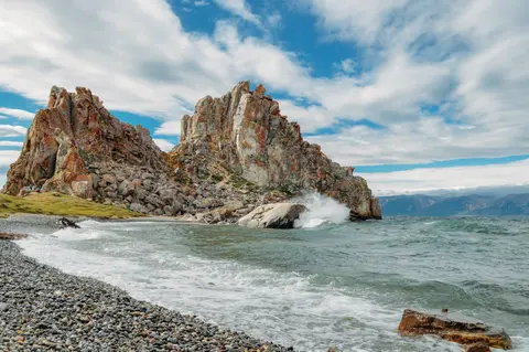
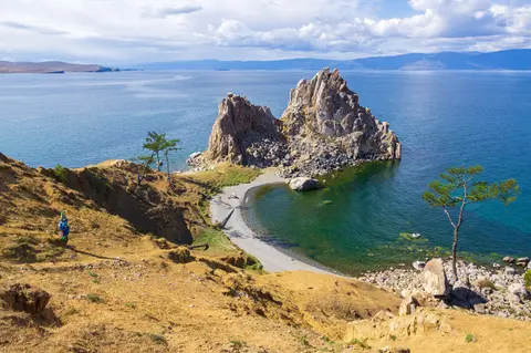
Beyond the shoreline, surrounding taiga and mountain parks shelter 236 bird species, including 29 waterfowl, though both the Baikal teal and Baikal bush warbler range widely across eastern Asia. Surrounding forests and highlands support mammals ranging from brown bear, sable, Eurasian wolf, red fox, stoat, least weasel and Eurasian otter to snow leopard, Siberian tiger and Amur leopard. Herbivores and smaller species include moose, elk, reindeer, Siberian roe deer, Siberian musk deer, wild boar, red squirrel, Siberian chipmunk, marmots, lemmings and mountain hare. These habitats sit near the historic eastern limit of early medieval European bison and marsh thistle (Cirsium palustre). On the eastern shore within Buryatia, mean temperatures range from minus 19 degrees Celsius in winter to 14 degrees Celsius in summer. Buryat communities herd goats, camels, cattle, sheep and horses here and revere sacred coastal formations such as Cape Burhan (Shamanka Rock) on Olkhon Island.
Access Zones Around Lake Baikal's Basins and Islands
| Complex Zone | Key Highlights | Access & Ticket Rule |
|---|---|---|
| Olkhon Island & Cape Burhan | 72-kilometre central island, white marble Shamanka Rock, shamanic ritual pillars and winter ice caves | Reached by seasonal ferry or regulated winter ice routes; national park entrance permits required |
| Western Rim (Primorsky Range & Irkutsk Coast) | Angara River outlet, steep western headlands, Cape Ryty and mountain taiga trails | Coastal settlements open freely; national park trails require day permits and strict reserves restrict entry |
| Eastern Shore (Buryatia & Barguzin Range) | Selenga River delta wetlands, Barguzin valley beaches, coastal hot springs and Buryat pastures | Open village shorelines paired with regulated protected reserves safeguarding delta waterfowl and habitats |
| Northern Basin & Baikal Mountains | 900-metre northern basin, Upper Angara inflows and remote alpine mountain reserves | Seasonal boats and regional overland roads serve northern hubs; wilderness park permits apply |
Baikal's 8,800,000-hectare World Heritage perimeter spans multiple national parks, strict nature reserves and coastal settlements across Irkutsk Oblast and the Republic of Buryatia, often grouped culturally as Baikalia and Transbaikalia. Visitors must verify local park pass rules and seasonal ferry or ice-road regulations before heading onto remote capes. Scientists and reserve wardens closely monitor surface warming across the past half-century, shoreline pressures around popular Olkhon bays and invasive Elodea spread inside sheltered shallows to protect evolutionary habitats found nowhere else on Earth.
Three Natural Phenomena to Observe at Lake Baikal
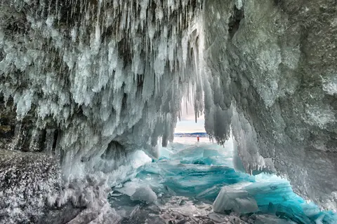
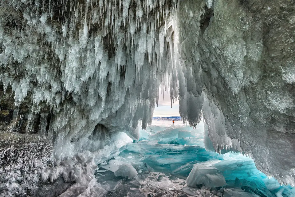
- Winter Ice Grottos and 40-Metre Water Clarity on Olkhon: Between mid-winter and early spring, translucent ice sheets 0.5 to 1.4 metres thick reveal blue depths and wind-driven pressure hummocks above 2 metres while freezing spray into crystalline caves along Olkhon's cliffs.
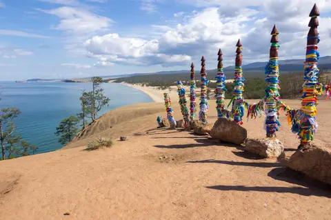
- Metamorphic Marble and Graphite Outcrops at Shamanka Rock: Examine the white marble, dolomite and limestone cliff of Cape Burhan, flecked with inclusions of quartz, garnet and graphite beside traditional Buryat wooden ritual poles.
- Smoked Omul and the Ice-Free Angara River Outlet: Watch the lake's sole draining channel carry oxygenated surface waters westward toward the Yenisey system. Around 330 rivers including the Selenga, Barguzin, Upper Angara, Turka, Sarma and Snezhnaya feed Baikal's three tectonic basins, while shoreline markets sell locally caught, smoked omul whitefish.
Choosing Between Frozen Winter Ice and Summer Coastal Trails
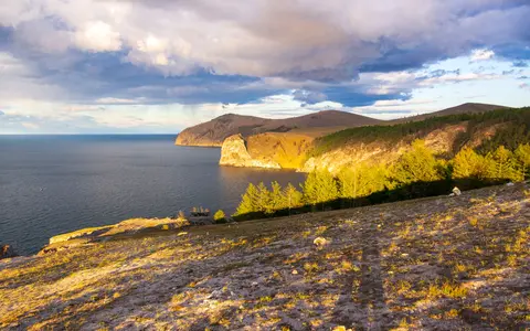
Decide between two completely different seasons before planning a Siberian journey. January through April reveals hard frozen surfaces averaging 0.5 to 1.4 metres thick and wind-sculpted pressure hummocks over 2 metres high. Winter brings water visibility down to 30 to 40 metres, crystalline ice caves and eastern Buryat winter averages near minus 19 degrees Celsius. By contrast, July through September opens ferry crossings across the 72-kilometre span of Olkhon Island and hiking along the Primorsky, Baikal and Barguzin foothills. Calm morning bays reach 20 to 24 degrees Celsius in the south before late-season gales raise 4.5-metre swells during autumn's 4-degree vertical turnover. Cooperative 1990s sediment cores showed Baikal escaped Pleistocene glacial scouring to preserve 6.7 million years of unbroken palaeoclimate history. Across this vast basin, wilderness distances separate western Irkutsk trails from eastern Buryat steppes. Treat Olkhon Island, the Angara outlet or the Selenga wetlands as dedicated regional bases and explore comparative natural heritage listings inside the UNESCO World Heritage Atlas.