Quick Field Data
- UNESCO Inscription: 2004 (Ref. 1161), natural coastal and volcanic reserve in southwestern Saint Lucia; Criteria (vii) and (viii)
- Scale & Footprint: 2,909 hectares within the Soufrière Volcanic Centre, pairing terrestrial slopes around Gros Piton (770 metres) and Petit Piton (743 metres) with an 11-kilometre marine strip extending roughly one kilometre offshore to the 75-metre depth contour
- Access & Ticketing: The reserve operates under multiple-use national zoning regulations, and climbing Gros Piton requires official guiding and trail admission paid at the Fond Gens Libre reception centre. Sulphur Springs entry and Soufrière Marine Management Area (SMMA) mooring or diving permits follow local authority rules (check official Saint Lucia tourism and PMA sites).
- Arrival Logistics: International flights land at Hewanorra International Airport (UVF) in southern Saint Lucia, just 15 kilometres east of the Pitons Management Area via the West Coast road through Vieux Fort and Choiseul. Regional air and sea routes also connect south to the South American gateway of Georgetown (842 kilometres).
Collapsed Stratovolcano Plugs and the Qualibou Depression
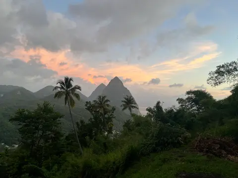
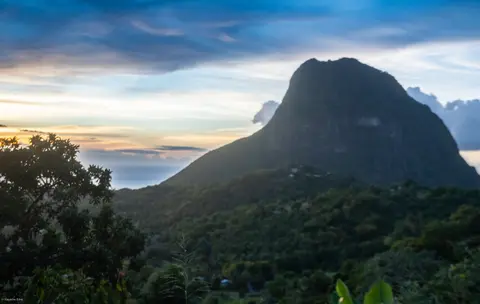
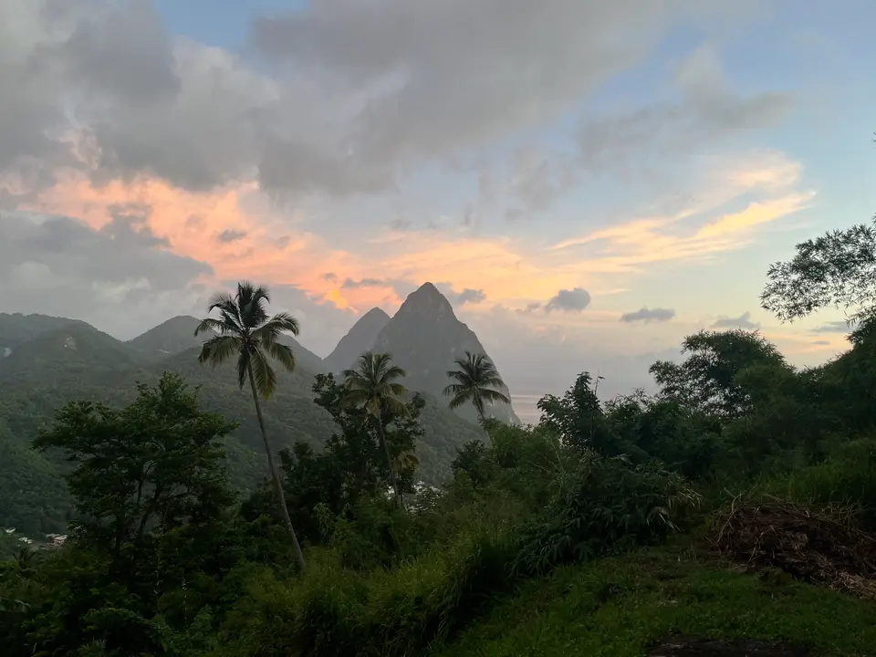
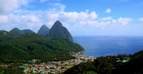
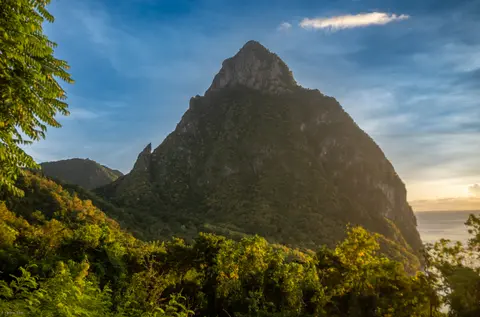
Rising out of the eastern Caribbean along the Windward Islands arc of the Lesser Antilles, the Pitons Management Area anchors southwestern Saint Lucia immediately south of the historic bay town of Soufrière. Geologists classify the terrain as the exposed heart of the Soufrière Volcanic Centre, an andesitic composite volcano built where oceanic crust plunges beneath the Caribbean tectonic plate. Two sheer forest-draped volcanic spires dominate the horizon: Gros Piton climbing to 770 metres above sea level and Petit Piton reaching 743 metres above sea level, joined inland by the narrow Piton Mitan ridge.
Those twin pinnacles tower above the rim of a collapsed caldera-like geological basin known as the Qualibou Depression. Rather than representing isolated sea stacks, Gros Piton and Petit Piton are remnant volcanic domes and plugs exposed together with a full suite of eruption products: smaller cumulo-domes, ancient explosion craters, broad lava flows and layered pyroclastic deposits of pumice and volcanic ash. Collectively, these interlocking formations illustrate the volcanic history of an andesitic composite volcano driven by oceanic crustal plate subduction beneath the Lesser Antilles island arc, giving earth scientists an accessible outdoor laboratory within a single compact coastal amphitheatre.
Subsurface heat remains active directly inside the collapsed depression. At Sulphur Springs in the dormant Qualibou volcanic basin near Soufrière town, pressurised steam fumaroles and boiling mud pools breach fractured volcanic bedrock. These sulphurous vents and mineral-rich hot springs lent Soufrière its French colonial name and draw visitors to the drive-through crater. Downslope toward the bay, geothermal streams feed historic waterworks at Soufrière Estate (also called Diamond Estate), where warm mineral water cascades over dark volcanic rock at Diamond Falls beside botanical gardens and sulphur baths.
Coral Reef Shelves, Elfin Woodland, and Island Endemics
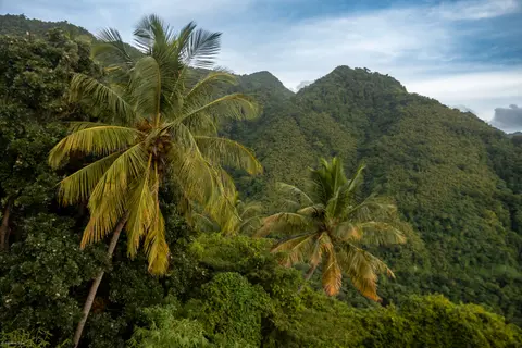
Vertical elevation from coral seafloors to misty volcanic peaks packs strikingly distinct ecological zones into 2,909 hectares of land and sea. On land, vegetation transitions smoothly from patchy coastal dry forest through dominant tropical moist forest and subtropical wet forest up into scarce, wind-pruned elfin woodland clinging to the twin summits. Steep precipices discouraged agricultural clearing across upper crags, leaving small patches of undisturbed natural forest standing high above rural settlements. Botanists have catalogued at least 148 plant species on Gros Piton and 97 on Petit Piton and the intervening Piton Mitan ridge, including 8 rare tree species.
Isolated island topography supports specialised terrestrial wildlife as well. Field surveys on Gros Piton alone record 27 bird species (5 of them endemic to Saint Lucia), accompanied by 3 indigenous rodents, 1 opossum, 3 bat species, 8 reptiles and 3 amphibians. Inland beyond the coastal plugs, Saint Lucia's broader mountain rainforest trails around Enbas Saut Falls protect dense canopy habitat, while the Volga Nature Trail delivers close mountain viewpoints overlooking both Pitons above Sugar Beach and Anse Chastanet connects coastal trails directly with sheltered shoreline coves.
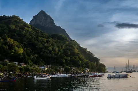
Offshore, the continental shelf drops steeply just beyond the beach line, forming the 11-kilometre-long, roughly one-kilometre-wide Soufrière Marine Management Area (SMMA) running down to the 75-metre depth contour. Healthy fringing and patch coral reefs blanket more than 60 percent of this marine floor, interspersed with volcanic boulder tumbles and sandy plains. Marine biologists have documented 168 finfish species, 60 species of cnidaria including reef-building corals, 8 molluscs, 14 sponges, 11 echinoderms, 15 arthropods and 8 annelid worms, while hawksbill turtles forage near coastal reefs and whale sharks and pilot whales cruise deeper offshore waters.
Kalinago Petroglyphs, Soufrière Estates, and Zoning Controls
Human life along this volcanic coast traces back to Saint Lucia's earliest maritime settlers across a 617-square-kilometre island now home to over 184,100 residents. Arawak communities arrived from northern South America around AD 200 to 400, naming it Louanalao (Island of the Iguanas). Around AD 800, Kalinago (Island Caribs) took control, naming it Hewanorra and leaving rock petroglyphs plus ceramic and stone artefacts inside the Pitons basin. The island appeared as El Falcon on Juan de la Cosa's 1500 chart, in a 1511 Spanish cédula and as Sancta Lucia on a 1520 Vatican globe. From the late 1550s, French pirate François le Clerc raided passing Spanish ships from Pigeon Island. In 1605, 67 English colonists aboard the Oliphe Blossome landed briefly before attacks by Carib chief Augraumart left only 19 survivors. A 1638 settlement also failed before French settlers claimed Saint Lucia in 1650 and signed a treaty with Carib leaders in 1660.
England and France fought 14 times over Saint Lucia, earning it the nickname Helen of the West. Power shifted through the 1722 Duke of Montagu venture at Petit Carenage, the 1763 Treaty of Paris and the 1778 to 1783 war before final British possession under the 1814 Treaty of Paris. Earlier, French planters made Soufrière the first colonial capital and expanded sugar cane across volcanic terraces from 1765. Revolutionary upheaval in 1791 and French abolition in February 1794 sparked guerrilla resistance by maroons and French troops of the Armée Française dans les Bois during the Brigand Wars (1794 to 1796), when Castries burned. British troops recaptured Saint Lucia in 1803, moved the capital north to Castries, ended the slave trade in 1807 and abolished slavery in 1834, with full emancipation after four years of apprenticeship in 1838. Representative government arrived in 1924 with elections in 1925, followed by universal suffrage in 1951 and West Indies Federation membership from 1958 to 1962. During the Second World War, a German U-boat sank two ships in Castries harbour on 9 March 1942. Meanwhile, United States forces ran a Gros Islet naval base and a southern air base that evolved into Hewanorra International Airport. Saint Lucia gained full independence on 22 February 1979, joining the United Nations, Organization of American States, CARICOM, OECS and Organisation internationale de la Francophonie.
Today, Soufrière town and district house roughly 7,935 people around historic plantations including Soufrière Estate, Fond Doux Estate (where cacao is still processed) and Rabot Estate. Unlike uninhabited wilderness parks, roughly 1,500 residents live inside the Terrestrial Multiple Use Zones of the 2,909-hectare Pitons Management Area. That footprint pairs 1,134 hectares of primary land conservation zones and 875 hectares of marine area with surrounding buffers, slightly over half government-owned and the rest private. Protection rests on Cabinet Decree, the Physical Planning and Development Act (2001), the Fisheries Act (1994 SMMA), Environmental Protection Area designation (2003) and Special Enforcement Area rules (2011). Managers consult local stakeholders to curb hotel sprawl, reef-smothering soil erosion and invasive plants while preparing for natural hazards like the hurricanes of 1780, 1817, 1831, 1898 and 1980, the 1955 fire and the 1991 earthquake.
Access Zones Within the Pitons Management Area
Because the reserve balances steep volcanic conservation cores against multiple-use village zones and protected marine shelves, visitor access varies sharply between land trails, geothermal craters and coastal moorings.
| Complex Zone | Key Highlights | Access & Ticket Rule |
|---|---|---|
| Gros Piton Guided Trail (770 m) | Steep forest climb through dry, moist and summit elfin woodland with views across the Piton Mitan ridge and Caribbean coast, home to 148 plant species and 27 bird species | Guided climbs only; register and pay official community guide and conservation fees at the Fond Gens Libre trailhead |
| Petit Piton & Piton Mitan Ridge (743 m) | Near-vertical andesitic volcanic plug, 97 documented plant species, rare trees and sheer coastal cliff faces rising from Soufrière Bay | Severely steep volcanic rock terrain without casual public footpaths; technical ascents require specialised alpine equipment and official clearance |
| Qualibou Caldera & Sulphur Springs | Active fumaroles, bubbling mud pools, geothermal vents and surrounding historic estates including Diamond Falls botanical gardens and Fond Doux cacao estate | Managed visitor site marketed as a drive-through volcano; paid admission tickets checked through official Saint Lucia tourism channels |
| Soufrière Marine Management Area (SMMA) | 11-kilometre coastal strip covering over 60 percent coral reef cover down to 75 metres depth, 168 finfish species, hawksbill turtles and reef fish | Regulated marine zoning separating dive sites, fishing zones and yacht moorings; marine park user fees apply to snorkellers and divers |
Three Geological and Reef Details Around the Twin Pitons
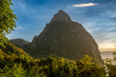
- Distant Lava Plug Silhouettes vs Close Andesitic Grain: View Gros Piton and Petit Piton first from the northeastern coastal approach above Soufrière town or from the Volga Nature Trail above Sugar Beach, then inspect exposed volcanic outcrops up close along trails. Up close, coarse andesitic plug stone and layered pumice ash show how viscous magma solidified inside volcanic vents while softer outer crater walls weathered away.
- Active Fumaroles Inside Qualibou Depression: Standing along the safe boardwalk edges at Sulphur Springs, trace rising plumes of sulphurous steam escaping cracked caldera rock. Those hot springs reveal that the collapsed stratovolcano beneath Soufrière's historic estates remains geothermally alive beneath modern rainforest slopes and feeds nearby mineral baths.
- Rapid Coral Drop-Off Off the Volcanic Shelf: Swimming or diving inside the Soufrière Marine Management Area immediately off the Piton base, notice how volcanic boulder talus plunges steeply down to the 75-metre boundary contour roughly one kilometre offshore. That steep shelf explains how healthy fringing reefs thrive within sight of dry coastal cliffs just metres ashore.
Dry-Season Trails and Caribbean Basin Connections From Soufrière
Drier trade-wind weather in the first half of the year gives hikers steadier footing on Gros Piton's steep forest steps and clearer visibility over the SMMA's fringing coral shelves. By contrast, late-summer rainstorms and Atlantic hurricanes bring heavy rainfall, slope sedimentation and rough waves across coral colonies. Managers maintain surveillance of private lands through conservation agreements and potential targeted acquisitions to protect forest habitats and reef water quality. Allow two to three days in Soufrière or neighbouring estate valleys, just 15 kilometres west of Hewanorra International Airport (UVF). That leaves time for a guided Gros Piton ascent, Sulphur Springs, Fond Doux cacao estates, Enbas Saut waterfalls and marine reserve snorkelling. Regional flights connect south toward Georgetown on the South American coast, or you can browse island landmarks in the UNESCO World Heritage Atlas.