Quick Field Data
- UNESCO Inscription: 1995 · Criteria (i), (iii) and (v) · Ref. 715
- Scale & Footprint: 6,666 hectares (nearly seven thousand hectares including four offshore islets), covering roughly 40 percent of Easter Island's 16,628-hectare landmass measuring 23 kilometres long by 11 kilometres wide
- Access & Ticketing: Administered by the indigenous Ma'u Henua Polynesian community since December 2017; visitors require a valid park pass and certified local guides to enter protected archaeological zones including Orongo and Rano Raraku
- Arrival Logistics: Reached via Mataveri International Airport (IPC, 12 kilometres from the park interior), positioned 3,700 kilometres west of continental Chile and 2,200 kilometres east of Pitcairn Island
Volcanic Tuff Quarries, Coastal Ahu and Polynesians in Isolation
Positioned at the southeastern tip of the Polynesian Triangle 3,700 kilometres off the Chilean coast and 2,200 kilometres east of Pitcairn Island, Rapa Nui ranks as the remotest inhabited island on Earth. Early inhabitants called it Te Pito o Te Henua, while Dutch explorer Jacob Roggeveen named it Easter Island after landing on Easter Sunday in 1722 and observing three distinct physical complexions among islanders. Polynesian voyagers settled the volcanic triangle sometime between 300 and 1200 AD (around the late first millennium in archaeological syntheses). They brought East Polynesian maritime traditions into total isolation from outside cultural influence for more than a thousand years. Measuring 23 kilometres by 11 kilometres, the island rises from coastal cliffs to 300 metres (980 feet) elevation across extinct volcanic craters and freshwater lakes. The triangular park preserves 40 percent of the island's territory under IUCN Category II protection.
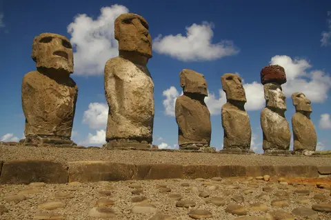
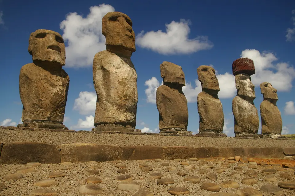
Between the tenth and seventeenth centuries, Rapa Nui's clans expressed ancestral reverence by sculpting monumental stone statues known as moai, erected atop rectangular ceremonial coastal shrines called ahu to project spiritual power (mana) over living leaders. Today 887 extant moai (estimated at around 900 in wider UNESCO totals) and over 300 ahu survive across the park, ranging in height from 2 to 20 metres (6 to 65 feet), supplemented by burial caves, domestic habitation ruins and rock art paintings and petroglyphs. Each ahu shared core architectural features: a raised masonry platform built from large dressed stones filled with rubble, a seaward or inland approach ramp paved with rounded beach pebbles, and a levelled ceremonial plaza in front.
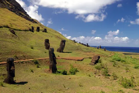
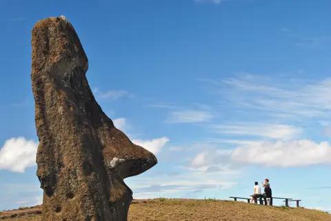
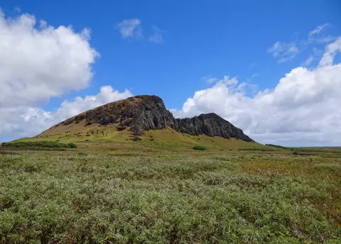
Almost all moai were carved using simple hand picks (toki) shaped from hard basalt. Sculptors worked the distinctive yellow-brown volcanic tuff forming the crater walls of Rano Raraku volcano on the southeastern side of the island. Red scoria stone from other vents supplied select carvings and topknots. Unfinished figures still anchored in the quarry bedrock show the full carving sequence before statues were lowered down quarry slopes into previously dug holes. Workers then hauled the monoliths kilometres overland to coastal platforms, most famously at Ahu Tongariki, whose colossal restored platform supports 15 upright moai facing inland across the island.
Ecological Crisis, Toppled Statues and the Orongo Birdman Cult
Centuries of monument quarrying and population growth transformed the island's fragile volcanic ecology. Before Polynesian arrival in the fourth century, broadleaf forests, ferns and giant endemic palms (Paschalococos, related to the Chilean palm Jubaea chilensis, with native Sophora toromiro trees) covered the slopes. Islanders harvested this timber for rollers and sledges to transport heavy stone moai until palm wood disappeared around the seventeenth century according to radiocarbon dating. Resource depletion, deforestation and social upheaval eventually triggered an acute cultural and ecological crisis across the sixteenth and seventeenth centuries.
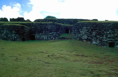
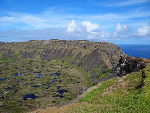
As tribal rivalry disrupted ancestral platform building, clan warfare toppled every standing coastal moai between 1837 and 1864, leaving most monoliths relatively lightly damaged on the ground. Careful scientific anastylosis beginning in 1950 later re-erected select platforms such as Ahu Tongariki with international assistance. Replacing the moai ancestor worship rose the Tangata Manu (Birdman) fertility and leadership cult centred at Mata Ngarau inside the ceremonial village of Orongo. Orongo sits balanced 250 metres (820 feet) above the ocean on a narrow ridge between crashing sea cliffs and the collapsed caldera of Rano Kau volcano. Rano Kau last erupted between 150,000 and 210,000 years ago. The village preserves fifty-four semi-subterranean elliptical basalt slab houses richly incised with petroglyphs depicting birdmen and fertility symbols.
The Birdman cult vanished in the mid-nineteenth century following devastating external shocks. Peruvian slave raids, foreign epidemics and missionary conversion reduced Rapa Nui's indigenous population to little more than one hundred people before Chile formally annexed the island in 1888. During the nineteenth century, a visiting Tahitian coined the Polynesian name Rapa Nui (Big Rapa, thinking the island resembled a larger Rapa) while the Spanish designation Isla de Pascua also gained currency. Chile declared both a National Park and National Monument in 1935, adding protection for offshore islets in 1976. Paradoxically, much of the island was leased to sheep ranchers while native islanders remained confined to a reserve outside the capital Hanga Roa. After the 1964 independence movement, pastoral leases ended during the 1980s and the wider island became a historic park as population rebounded from 2,770 in 1972 to 3,792 by 2002.
Ma'u Henua Stewardship, Wildfire Risks and Endemic Island Flora
Early conservation struggled from low state funding after 1935 until Chile created a Rapa Nui Monuments Board and the World Monuments Fund joined field restoration in 1968. Airport construction in 1965 and expansion in 1985 brought growing numbers of scientific teams. From 1972 to 2015, Chile's National Forest Corporation (CONAF) administered the park under its first comprehensive management plan initiated in the 1980s. Following joint co-management in 2016, President Michelle Bachelet returned ancestral park administration on 1 December 2017 to the autonomous indigenous Ma'u Henua Polynesian Community under a 50-year renewable mandate. Park entrance revenue is reinvested directly on Rapa Nui for archaeological care and community conservation, working with the R. P. Sebastian Englert Museum of Anthropology and sister-park ties to Teide National Park on Tenerife.
Active zoning divides the 6,666-hectare park into five management classes: intangible preservation cores, primitive areas, extensive-use sectors, service and CONAF zones, and special-use areas. These zones balance archaeological research with traditional fishing, orchards, livestock grazing and small-scale farming. Park managers still confront illegal land occupation, staff training needs, visitor carrying capacity limits and calls for a unified monitoring database connecting field researchers with island community elders. Invasive pasture grasses introduced during sheep-ranching decades dominate steppes with Austrostipa and Nassella species, while wandering cattle sometimes intrude illegally inside reserve boundaries and coastal wave erosion undercuts cliff platforms. Soft Rano Raraku volcanic tuff suffers severe rain weathering, salt spray and thermal cracking. Those vulnerabilities were underscored dramatically in October 2022 when a destructive wildfire swept across park grasslands, causing severe damage to crater wetlands and scorching moai stone surfaces.
Historic deforestation left most slopes grassland with scattered ornamental trees and shrubs, while native Coprosma vanished from the landscape. Even so, Rapa Nui retains distinctive island biology, with botanical inventories recording 150 to 166 vascular plant species (including 45 to 46 indigenous taxa and between 9 and 45 endemics). Endemic flora includes three grasses, four ferns (Doodia paschalis, Polystichum fuentesii, Elaphoglossum skottsbergii and Thelypteris espinosae), and the shrub hau hau (Triumfetta semitriloba), feared extinct until rediscovery in 1988. Tall totora bulrushes likely brought by ancient South American seafarers grow inside the lower level of Rano Raraku's crater. Native fauna consists exclusively of three marine turtle species, two terrestrial lizards (Lepidodactylus lugubris and Ablepharus boutoui poecilopleurus), nesting frigatebirds, red-tailed tropicbirds (Phaethon rubricauda) and Kermadec petrels. Rodents, carnivorans and three micro-lepidopteran moths such as Asymphorodes trichogramma, which have zero links to South American species, complete the fauna.
Complex Access Zones and Protected Archaeological Sectors on Rapa Nui
Scattered across 23 kilometres of volcanic coastline and interior craters, the park operates strict path barriers and Ma'u Henua ranger checks protecting soft volcanic tuff and sacred stone platforms across every island sector.
| Complex Zone | Key Highlights | Access & Ticket Rule |
|---|---|---|
| Rano Raraku Quarry & Crater Lake | Volcanic tuff workshop supplying almost all of the island's 887 moai, unfinished bedrock carvings and totora-lined crater wetlands | Mandatory park pass and Ma'u Henua certified guide check at the quarry gate; visitors stay strictly inside roped walkways away from statues |
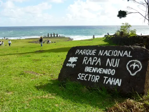
| Ahu Tongariki & Coastal Platforms | Restored 15-moai ceremonial platform, pebble-paved coastal ramps and toppled volcanic figures scattered along sea cliffs | Controlled ticket checkpoints along paved coastal spurs; stepping onto stone ahu platforms or crossing perimeter stone lines is strictly banned |
| Orongo Ceremonial Village & Rano Kau | Fifty-four semi-subterranean basalt stone houses, Mata Ngarau Birdman petroglyphs and sheer 250-metre cliff overlooking the Rano Kau crater | Timed ranger checkpoint at the ridge entrance; entry is restricted during extreme wind or wildfire risk periods |
| Hanga Roa Museum & Peripheral Ahu | R. P. Sebastian Englert Museum of Anthropology, coastal rock art caves and restored village-edge ceremonial platforms | Museum maintains separate entry schedules in Hanga Roa while outdoor platforms around town remain subject to heritage boundary respect |
Three Stoneworking and Landscape Details to Examine on Rapa Nui
Walking across the craters and coastal platforms reveals impressive stonecraft and environmental history recorded directly in volcanic rock:
- Quarry Trenches and Unfinished Basalt-Cut Moai at Rano Raraku: Study the upper yellow-brown tuff niches inside Rano Raraku's outer and inner slopes. Sculptors carved statues face-up or upright still attached to living bedrock by a narrow stone keel before severing them with hard basalt toki picks.
- Beach-Pebble Ceremonial Ramps at Restored Ahu Platforms: Look at the inland slope fronting major ceremonial platforms such as Ahu Tongariki to spot carefully sorted smooth coastal beach cobbles forming ritual aprons linking clan settlements toward ancestral stone platforms.
- Elliptical Dry-Stone Corbelling at Orongo Village: Inspect the low doorways and layered basalt wall slabs of Orongo's fifty-four elliptical semi-subterranean houses, engineered to resist fierce southern ocean gales sweeping across the narrow rim of Rano Kau crater.
Seasonal Trade Winds and Exploring the Pacific Heritage Atlas
Rapa Nui enjoys a warm subtropical marine climate moderated by steady southeast trade winds blowing from October to April. Winter rains contribute most of the 1,250-millimetre (49-inch) annual precipitation, while average seasonal temperatures stay mild between 19 degrees Celsius (66 degrees Fahrenheit) in winter and 24 degrees Celsius (75 degrees Fahrenheit) in summer. Packing rain protection and windproof outer layers year-round keeps open cliff walks around Rano Kau and quarry circuits at Rano Raraku comfortable through sudden ocean squalls and shifting coastal sea mist across exposed volcanic headlands.
Positioned 3,700 kilometres off South America via Mataveri International Airport (IPC, 12 kilometres from the park), Rapa Nui sits isolated across the southeastern Pacific with no adjacent city destination guide on the mainland. Visitors arriving on flights routed from continental Chile should coordinate entry passes, certified guide bookings and island transport early through Ma'u Henua channels in Hanga Roa. Early coordination helps coastal ahu circuits, volcanic quarry hikes, crater-rim walks and anthropological museum stops fit smoothly around changing maritime weather and guided entry schedules. Continue comparing island sanctuaries, Pacific archaeology and remote megalithic landscapes across our UNESCO World Heritage Atlas or explore global heritage coordinates across Polynesia and South America on our world heritage atlas map.