


























Quick Field Data
- UNESCO Inscription: 1991 under natural criteria vii and x as Indonesia's first proposed national park to receive World Heritage designation.
- Scale & Footprint: Covering 1,056.95 km² (408.09 sq mi, or 122,956 acres), of which 443.37 km² (171.19 sq mi) is marine, across the Ujung Kulon peninsula, Mount Honje, offshore islands, and the Krakatoa nature reserve.
- Access & Ticketing: Managed by the Ministry of Environment and Forestry; verify entry permits, ranger accompaniment, and boat transfers on the official national park portal.
- Arrival Logistics: Located in Sumur District, Pandeglang Regency, Banten Province at the westernmost tip of Java, with Cilegon as the nearest major city.
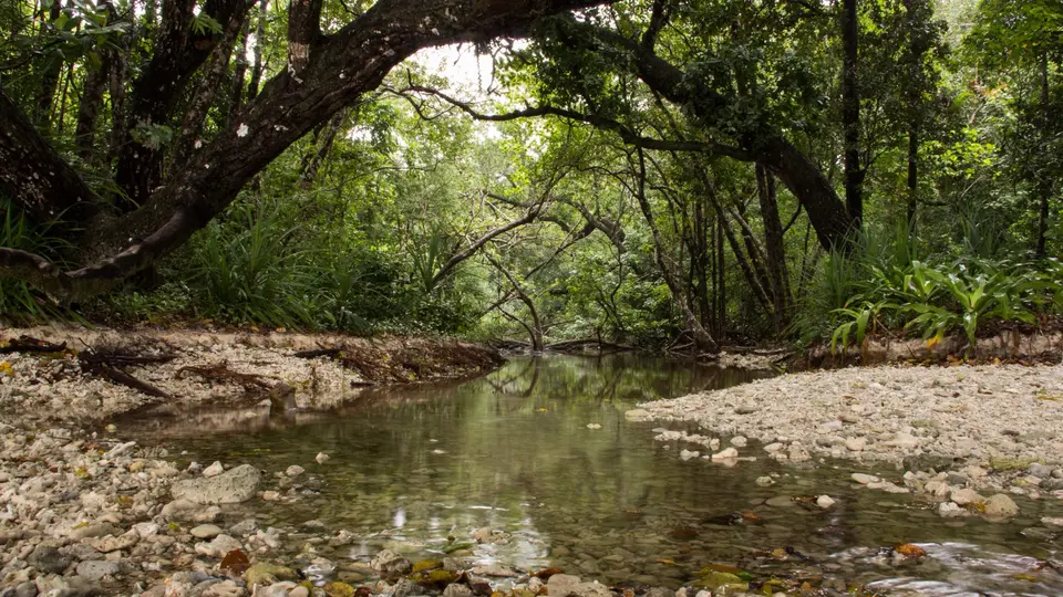
Situated at the extreme southwestern tip of Java on the Sunda shelf in Sumur District of Pandeglang Regency, Banten Province, Ujung Kulon National Park (Taman Nasional Ujung Kulon) protects the largest remaining area of lowland tropical rainforest on the densely populated island of Java. Within Indonesia, the UNESCO World Heritage Atlas in 1991, shortly before its formal establishment as a national park on 26 February 1992, the reserve encompasses the Ujung Kulon peninsula (a Banten Sundanese phrase translating as "Western End" or "Point West"), several offshore islands, the Gunung Honje mountain range, and the natural reserve of Krakatoa in Lampung Province (also mapped as the Pulau Anak Krakatau Marine Nature Reserve). Globally, the park is recognized as the last and most critical natural habitat of the endemic, single-horned Javan rhinoceros (Rhinoceros sondaicus). Dense forest meets the sea.
The 1883 Krakatoa Eruption, Tsunami Recovery, and Conservation History
Western scientific interest in the peninsula began in 1846 when Dutch-German botanist Franz W. Junghuhn visited Ujung Kulon during an expedition and published accounts of its biological abundance in a scientific journal. Few written records survive from the decades immediately preceding August 1883, when the nearby Krakatoa (Krakatau) volcano erupted in one of the most devastating and intensively studied volcanic events of modern times, registering effects across the northern hemisphere and killing 36,000 people.
During the 1883 eruption, a tsunami reported at 15 metres in height swept across the Ujung Kulon peninsula, destroying its coastal settlements, while an average 30-centimetre (12-inch) layer of volcanic ash buried the landscape and wiped out large portions of the local plant and animal life. The destroyed human settlements were never completely rebuilt, and the ecosystem recovered rapidly on the ash-enriched soils, transforming the peninsula into a vast natural repository for Java's lowland forest and wildlife.
Formal protection started in the early 20th century under the colonial Dutch East Indies administration: Pulau Panaitan was designated a nature reserve (Suaka Alam) in 1921 and combined with Pulau Peucang in 1937 to form a wildlife sanctuary (Suaka Margasatwa). After Indonesian independence, the peninsula and islands regained nature-reserve status, incorporating the southern part of the Gunung Honje Protection Forest in 1967 and the northern portion in 1979. Following its 1991 World Heritage inscription and 1992 national park declaration, border reconstructions around Mount Honje were finalised in 2004, and in 2005 the park was designated an ASEAN Heritage Park. Annual visitor numbers rose from 2,385 in 2007 to about 12,000 in 2014.
Peninsula Topography, Lowland Flora, and the Arenga Palm
Ujung Kulon National Park covers a total area of 1,056.95 square kilometres (408.09 square miles), including 443.37 square kilometres (171.19 square miles) of marine waters. On the mainland Ujung Kulon Peninsula, elevations reach 480 metres (1,570 feet) at Mount Payung in the southwest, while the eastern boundary is marked by the Honje mountain range, culminating at Mount Honje at 620 metres (2,030 feet). Together with Baluran and Alas Purwo in East Java, Ujung Kulon is one of only three national parks on Java protecting a lowland rainforest ecosystem, though Ujung Kulon is significantly wetter under the Köppen-Geiger climate classification.
Botanical surveys have recorded 175 plant species inside the park, 57 of which are protected. Coastal zones feature mangroves (Sonneratia alba, Excoecaria agallocha, Rhizophora apiculata, and Aegiceras corniculatum) and beach forests (Nypa fruticans, Calophyllum inophyllum, Terminalia catappa, and Hibiscus tiliaceus), transitioning inland to figs (Ficus benjamina, Ficus deltoidea, Ficus racemosa, and Ficus septica) and lowland trees including Durio zibethinus, Sterculia foetida, Melastoma malabathricum, and Oroxylum indicum. Three rare protected tree species occur here, specifically Intsia bijuga, Vatica bantamensis, and Heritiera percoriacea, alongside the parasitic bloom Rafflesia patma. In recent years, rapid growth of the native Arenga palm (Arenga obtusifolia) has shaded out undergrowth plants, prompting ongoing eradication efforts to protect the food supply of the Javan rhinoceros.
- Last Refuge of the Javan Rhinoceros: Following the death of the last individual in Vietnam's Cát Tiên National Park (where 10 or fewer remained in 2010), Ujung Kulon holds the world's only surviving wild population of Rhinoceros sondaicus; estimated at 40 to 60 in the 1980s, camera and video traps recorded 14 births between 2001 and 2010, 35 identified rhinos in 2011 (22 males and 13 females, comprising 7 old, 18 adults, 5 youngsters, and 5 infants), and 8 calves (including 3 females) plus 50 teenage and adult rhinos (including 20 females) in 2013 tracked by 120 night-vision motion-sensor cameras using unique eye-wrinkle morphology, with recent estimates reaching about 82 rhinos.
- Endemic Javan Mammals: Supporting roughly 35 mammal species endemic to Java, including three endemic primates, the Javan gibbon (silvery gibbon), Javan leaf monkey (Javan lutung), and silvered leaf monkey, plus the crab-eating macaque, banteng, Javan rusa, Java mouse-deer, Javan leopard, wild dog (dhole), leopard cat (Sunda leopard cat), fishing cat, Javan mongoose, smooth-coated otter, and several civet species (Javan tigers survived here until the mid-1960s).
- Birds, Reptiles, and Coral Reefs: Between 197 and 270 bird species have been recorded across the lowland forests, grasslands, and mangroves, alongside two python species, two crocodile species, numerous frogs and toads, and offshore coral reefs.
- Eupatorium Odoratum Feeding Areas: By 2013, open feeding areas of Eupatorium odoratum vegetation had been reduced from 10 locations comprising 158 hectares (390 acres) to 5 locations comprising 20 hectares (49 acres), increasing foraging competition between the Javan rhino and local banteng herds.
Recreational Villages and Visitor Orientation
Surviving communities around the perimeter hold cultural status as Kampung Wisata (Recreational Villages), with plans developing the hamlet of Cimenteng into an ecovillage and the westernmost village of Ujungjaya serving as a companion tourist gateway. From the nearest major city of Cilegon, travellers journey southwest into Sumur District in Pandeglang Regency to arrange park entry permits and boat transport to Pulau Peucang and Pulau Panaitan. You can view the southwestern tip of Java and the Sunda Strait on the Atlas. Always follow Ministry of Environment and Forestry ranger regulations to avoid disturbing the strictly protected rhino sanctuary zones.
Spending several days exploring the coastal trails, offshore islands, and river estuaries of Ujung Kulon National Park reveals how a landscape reshaped by the 1883 Krakatoa eruption and 15-metre tsunami became Java's most important biodiversity sanctuary. Across the 1,056.95-square-kilometre reserve, stretching from the 480-metre summit of Mount Payung on the western peninsula to the 620-metre ridge of Mount Honje in the east and encompassing 443.37 square kilometres of marine waters, intact lowland rainforests, coastal beach forests, mangroves, and coral reefs support 175 recorded plant species and up to 270 bird species. Because the single-horned Javan rhinoceros depends entirely on this peninsula for its survival alongside endemic primates such as the Javan gibbon, Javan lutung, and silvered leaf monkey, careful management of open feeding grounds and invasive Arenga palms, combined with community-based ecotourism in peripheral Kampung Wisata villages like Cimenteng and Ujungjaya, remains central to safeguarding Indonesia's first World Heritage national park.
Travellers who arrange official permits through Sumur District in Pandeglang Regency and travel by boat to Pulau Peucang or Pulau Panaitan can observe wild banteng, Javan rusa deer, crab-eating macaques, and forest birds along the coastal clearings while leaving the strictly protected interior rhino habitats undisturbed. Along the quiet tidal rivers and mangrove channels of the mainland peninsula, guided canoe excursions glide past overhanging palms, freshwater swamps, and coastal mudflats where estuarine crocodiles, monitor lizards, and kingfishers hunt in the shaded shallows. Offshore, the fringing coral reefs and seagrass beds surrounding Pulau Peucang and Pulau Panaitan shelter giant clams, clownfish, butterflyfish, and angelfish in clear tropical waters that contrast sharply with the volcanic ash layers still visible beneath the forest soil. This careful balance between scientific night-camera monitoring, strict limits on visitor numbers, and low-impact coastal visitation ensures that the westernmost tip of Java continues to shelter its rare lowland flora, mangrove estuaries, and coral reefs for future generations of researchers and nature travellers.
