Quick Field Data
- UNESCO Inscription: Ref. 764 · Natural Site · Inscribed 1996 · Criteria (vii), (ix), (x)
- Scale & Footprint: Seven serial marine protected areas covering 96,300 hectares (roughly 960 square kilometres), representing 12 percent of the 300-kilometre Belize section within the 900-kilometre Mesoamerican Barrier Reef System
- Access & Ticketing: Co-managed by Belize government ministries, the Coastal Zone Management Authority and Institute (CZMAI), and partner NGOs; licensed tour boats and marine park entry passes apply across all reserves, so check official Belize protected area portals before travelling
- Arrival Logistics: Primary international gateway via Philip S. W. Goldson International Airport (BZE, 77 kilometres) near Belize City, feeding main northern and central boat gateways at Belize City, Ambergris Caye, Caye Caulker, and Placencia. Dangriga Airport (DGA, 35 kilometres) operates only as a small domestic hopper strip.
Karst Shelf Architecture and the Three Offshore Atolls
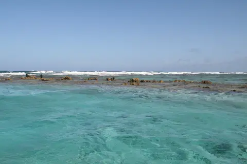
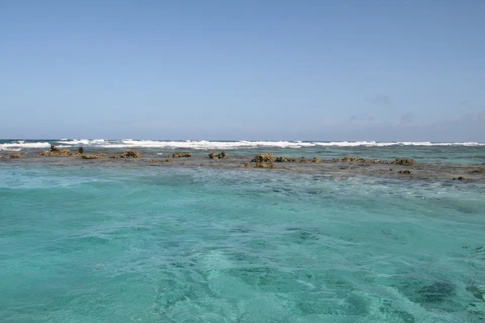
Stretching 300 kilometres down Belize's Caribbean coast from the Mexican border toward Guatemala, the Belize Barrier Reef forms the core southern section of the 900-kilometre Mesoamerican Barrier Reef System extending from Cancun down to Honduras, second in scale globally only to Australia's Great Barrier Reef. Off northern Ambergris Caye at Rocky Point, the reef crest comes within roughly 300 metres of dry land before stepping gradually eastward to lie 40 kilometres offshore in southern Belize. When Charles Darwin examined Caribbean reefs in 1842, he praised the Belize barrier above all others in the West Indies for the clarity and exuberance of its coral architecture. Today the reef remains Belize's foremost magnet for diving, snorkelling, and coastal fisheries, attracting almost half of the country's 260,000 visitors.
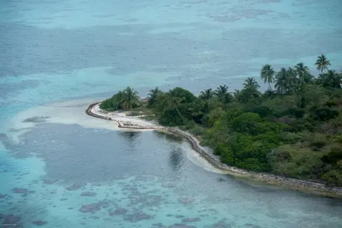
Instead of enclosing one continuous block of ocean, the 1996 World Heritage designation binds together seven distinct protected marine zones totalling 96,300 hectares, representing 12 percent of a wider reef complex holding approximately 450 sand and mangrove cayes. From north to south, these seven components are Bacalar Chico National Park and Marine Reserve, Blue Hole Natural Monument, Half Moon Caye Natural Monument, South Water Caye Marine Reserve, Glover's Reef Marine Reserve, Laughing Bird Caye National Park, and Sapodilla Cayes Marine Reserve. Notable cayes scattered across the lagoon and barrier shelf include Ambergris Caye, Caye Caulker, Caye Chapel, Carrie Bow Caye, St. George's Caye, English Caye, Rendezvous Caye, Gladden Caye, Ranguana Caye, Long Caye, Moho Caye, Blackbird Caye, Three Corner Caye, Northern Caye, Tobacco Caye, and Sandbore Caye.
Seaward of the main continental shelf barrier rise three oceanic Caribbean atolls: Turneffe Atoll (lying directly east of Belize City as the nearest atoll to the city), Glover's Reef, and Lighthouse Reef (the most easterly diving zone). Cycles of Pleistocene sea-level rise and fall carved karst topography beneath clear tropical waters, leaving nearly every known reef morphology compacted into a single coastal horizon. Features span fringing reefs, lagoon patch reefs, faros, pinnacle reefs, sheer outer barrier walls, rare deep-water coral habitats, brilliant white sand cayes, and green mangrove caye nurseries.
Inside the Great Blue Hole and Lagoonal Seagrass Chains
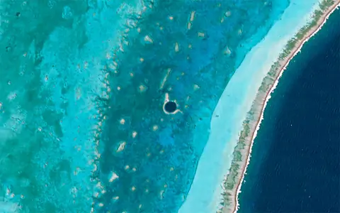
At the centre of Lighthouse Reef, 70 kilometres east of Belize City and the mainland, sits the Great Blue Hole, one of Earth's sharpest underwater records of Ice Age glaciation. Circular in plan, the sinkhole spans 318 metres across (a surface area of 70,650 square metres) and plunges 124 to 125 metres deep. Around its shallow rim, living corals and tropical fish inhabit depths near 5 metres, sloping gradually to 10 metres before dropping down a near-vertical limestone wall carved when glacial sea levels stood far below modern waves. Shallow reef fauna around the upper lip includes groupers, squirrelfish, angelfish, butterflyfish, midnight parrotfish, Caribbean reef sharks, blacktip sharks, nurse sharks, sea anemones, Pederson's cleaner shrimp, and neon gobies.
Jacques Cousteau brought his vessel Calypso to chart the Great Blue Hole in 1971 after famously placing it among the world's top five dive sites in 1970. His survey proved its dry-cave karst origins and mapped horizontal wave-cut ledges formed during pauses in sea-level rise at 21, 49, and 91 metres. Radiometric dating of recovered stalactites established dry cave formation pulses 153,000, 66,000, 60,000, and 15,000 years ago prior to marine flooding. Crucially, submerged stalactites hang 5 degrees off vertical along a single axis, recording tectonic tilting of the underlying limestone plateau rather than simple sea-level rise alone. Certified cave-diving and mixed-gas teams returned in summer 1997 to pull floor sediment cores. In December 2018 two submarines descended for sonar 3-D mapping featured on Discovery Live with Erika Bergman, Fabien Cousteau, and Richard Branson. Their sonar run mapped a dense hydrogen sulfide layer starting near 91 metres (300 feet), below which dark anoxic water becomes completely devoid of marine life. Out of respect, the crew left two deceased divers found on the floor undisturbed after notifying Belizean authorities.
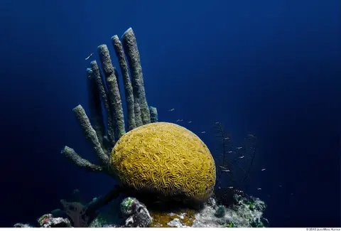
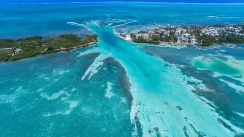
Closer to shore, shallow protected parks demonstrate how reefs, seagrass meadows, and mangroves link into one continuous biological engine. As fish stocks dwindled and tourism rose around Ambergris Caye and Caye Caulker in the early 1980s, fishing bans initially stalled. Between 1985 and 1987, Janet Gibson led community education campaigns and drafted the 1986 management plan endorsed by the Fisheries ministry, local fishermen's cooperatives, the New York Zoological Society, Peace Corps, WWF, and USAID. Founded in July 1987 (with active enforcement in 1989 and Zone A visitor fees starting in 1990), Hol Chan Marine Reserve protects roughly 18 square kilometres across four zones. Zone A centres on Hol Chan Cut (Mayan for little channel), a 23-metre-wide, 9-metre-deep reef break bordered by 1.5-metre shallows. It hosts over 160 fish species, 40 coral types (brain, elkhorn, and finger coral), five sponges, two sea grasses, and three sea turtles. Marine life includes short-beaked common dolphins, pantropical spotted dolphins, spotted eagle rays, southern stingrays, lobsters, moray eels, jacks, groupers, snappers, and barracudas. Zone B spans lagoon seagrass beds and the hazardous Boca Ciega Blue Hole cavern. Zone C shields southern Ambergris Caye mangrove swamps sheltering blue-striped grunts, French grunts, white grunts, grey snappers, French angelfish, grey angelfish, and seahorses. Zone D (annexed in 1999) protects Shark Ray Alley, where traditional net-cleaning by fishers drew nurse sharks and stingrays.
Reef Biodiversity, Bleaching Stress, and Belizean Marine Laws
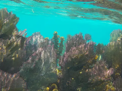
Taxonomic surveys record 70 hard coral species (65 scleractinian builders in UNESCO syntheses), 36 soft corals, 45 hydroids, and 350 molluscs. Inventories also document 246 to 247 marine flora taxa, 178 terrestrial plants on littoral caye forests, and more than 500 fish species, plus hundreds of sponges, marine worms, and crustaceans. Yet researchers stress that roughly 90 percent of reef species remain unstudied, leaving only an estimated 10 percent scientifically described. That dense marine food web supports apex predators in every habitat: jaguars patrol coastal forests at Bacalar Chico, and ospreys hunt above Glover's Reef. Great hammerheads cruise Lighthouse Reef with Caribbean reef, blacktip, and nurse sharks. Major seabird rookeries populate outer cayes, with red-footed boobies on Half Moon Caye, brown boobies on Man O'War Caye, and common noddies on Glover's Reef. Threatened species inside the reserves include West Indian manatees, American crocodiles, green, hawksbill, and loggerhead turtles, and spawning aggregations of three grouper species.
Sparse coastal settlement has kept industrial runoff far below levels hurting heavily urbanised Caribbean reefs, making Belize a key natural laboratory for separating thermal climate impacts from local urban pollution inside a relatively enclosed reef lagoon. Even so, marine warming and tropical storms have struck hard. Belize's first mass coral bleaching hit in 1995, killing roughly 10 percent of coral colonies according to Belize's Coastal Zone Management Institute. In 1998, severe bleaching paired with Hurricane Mitch slashed live coral cover by 48 percent, and scientists estimate over 40 percent of Belize's reef suffered lasting damage since 1998. Opportunistic disease frequently kills more thermally weakened corals than the original bleaching episode itself, leaving low odds of full recovery where thermal stress persists. In the shallow lagoon off Wee Wee Cay, continuous water loggers between 2004 and 2014 documented temperatures climbing from roughly 22.3 degrees Celsius to 32.4 degrees Celsius.
Belize backed scientific monitoring with pioneering marine legislation under its National Constitution, Fisheries Act, National Parks Act, Protected Areas Conservation Trust, and COMPACT international funding programmes. The revitalised Coastal Zone Management Authority and Institute (CZMAI) coordinates these multi-ministry conservation plans. In December 2010, Belize became the first country on Earth to ban bottom trawling completely. In December 2015, the government enacted a statutory ban on offshore oil drilling within 1 kilometre of the entire barrier reef. At Hol Chan, after WWF project funding ended in 1995, a formal Hol Chan Marine Reserve Trust Fund Committee replaced the earlier informal advisory body in 1994. Financed through yearly tour-boat licence fees, it pursues four founding goals: preserving reef ecosystems, maintaining fishery-linked tourism utility, supporting scientific education and research, and conserving genetic diversity. Managers continue confronting mangrove clearance outside park borders, Boca Ciega Blue Hole diving hazards for inexperienced divers, and rising visitor traffic across San Pedro and Caye Caulker.
Zoning Across the Seven Reserves and Nearby Marine Parks
Moving across Belize's barrier system requires booking licensed local boat operators and carrying valid marine reserve passes issued at park stations or through authorised tour-boat licensing schemes.
| Complex Zone | Key Highlights | Access & Ticket Rule |
|---|---|---|
| Lighthouse Reef (Blue Hole & Half Moon Caye) | 318-metre-wide Great Blue Hole ledges, groupers, reef sharks, and Half Moon Caye red-footed booby littoral forest | Remote offshore boat trip from Belize City or Ambergris Caye; certified diving rules and reserve entry passes apply |
| Glover's Reef & South Water Caye Reserves | Southern offshore atoll walls, common noddy colonies, Wee Wee Cay lagoon habitats, and deep coral shelves | Accessed by licensed charters out of Dangriga or Placencia; strict zoning separates conservation areas from fishing zones |
| Bacalar Chico, Laughing Bird & Sapodilla Cayes | Rocky Point barrier junction, southern caye sandbars, faro reefs, and coastal jaguar-mangrove corridors | Guided boat excursions require park check-ins; anchoring directly on living coral formations is prohibited |
| Hol Chan Marine Reserve (Zones A to D) | 23-metre-wide Hol Chan Cut, seagrass meadows, southern mangroves, and shallow Shark Ray Alley | Accessed daily from Ambergris Caye and Caye Caulker; separate fee passes managed by licensed tour-boat schemes cover Zones A and D |
Three Underwater and Caye Features to Spot on Site
Whether floating above shallow lagoon cuts or diving outer atoll walls, three physical features reveal how Belize's reef formed and functions today.
- The 5-Degree Tilted Stalactites Inside the Blue Hole: Certified divers descending past the 10-metre overhang at the Great Blue Hole observe submerged stalactites hanging consistently 5 degrees off vertical, preserved evidence that tectonic tilting shifted the underlying limestone platform after dry cave growth.
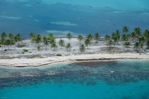
- Mangrove Prop Roots Acting as Juvenile Nurseries: Along caye shorelines in Half Moon Caye or southern Ambergris Caye, dense red mangrove root tangles trap coastal silt and shelter juvenile grunts, snappers, angelfish, and seahorses. Growing fish later migrate out over seagrass beds to the outer barrier reef.
- Tidal Exchange Through Natural Reef Cuts: At narrow breaks like Hol Chan Cut (9 metres deep), watch how rising tides funnel ocean water across brain and elkhorn corals while falling tides draw rays, parrotfish, and barracudas through the channel between lagoon and open Caribbean sea.
Plan diving and caye boat crossings during calmer winter and spring dry-season trade winds while tracking Caribbean storm alerts from summer through autumn. Combine Belize's barrier reefs with overland Mesoamerican heritage stops in our Oaxaca travel guide or discover more oceanic reserves in the UNESCO World Heritage Atlas.