Quick Field Data
- UNESCO Inscription: Ref. 682 · Natural Site · Inscribed 1994 · Criteria (vii), (x)
- Scale & Footprint: 32,092 hectares (roughly 321 square kilometres across two linked forest blocks) sitting 29 kilometres northwest of Kabale along the Democratic Republic of the Congo border
- Access & Ticketing: Managed by the Uganda Wildlife Authority (UWA) with foot-only access across four tracking sectors (Buhoma, Ruhijja, Rushaga, and Nkuringo); strict advance gorilla tracking permits and mandatory armed ranger escorts apply, so verify rules via official UWA portals before travelling
- Arrival Logistics: Primary arrival via Kigali International Airport (KGL, 114 kilometres south across the Rwanda border) or long overland routes via Entebbe International Airport (EBB) and Kampala. Domestic private charters reach local airstrips, whereas unscheduled Savannah Airstrip (KHX, 37 kilometres away) handles no scheduled commercial flights.
Albertine Rift Uplift, Impermeable Catchments, and Forest Continuity
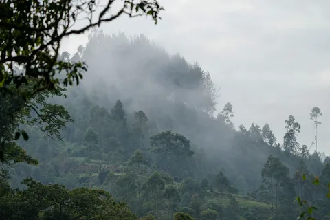
Draped over the steep eastern rim of the Albertine (Western) Rift Valley in southwestern Uganda's Kigezi Highlands, Bwindi Impenetrable National Park protects 32,092 hectares of primeval forest across a rugged landscape accessible strictly on foot. Lying 29 kilometres northwest of Kabale by road, the reserve shares an international boundary with the Democratic Republic of the Congo. Across the frontier, it directly abuts the roughly 900-hectare protected Sarambwe forest and sits close to Virunga National Park. Uplift and up-warping along the Western Rift Valley folded Precambrian shale phyllite, quartz, quartzite, schist, and granite into razor-backed ridges and narrow, river-cut gorges. Elevations span from 1,160 or 1,190 metres at its northern lowland tip up to 2,607 or 2,706 metres atop Rwamunyonyi Hill along the eastern rim, with 60 percent of the park lying above 2,000 metres.
Unlike volcanic rift soils elsewhere that drain rapidly underground, Bwindi's impermeable Precambrian bedrock prevents deep aquifer storage, forcing heavy rains into surface faults and hundreds of tumbling forest streams. Annual precipitation averages 1,400 to 1,900 millimetres, peaking during wet seasons in March to April and September to November, while annual mean temperatures range from 7 to 15 degrees Celsius minima up to 20 to 27 degrees Celsius maxima. Major rivers rising under the canopy include the Ivi, Munyaga, Ihihizo, Ishasha, and Ntengyere rivers draining into Lake Edward, while southern catchments feed Lakes Mutanda and Bunyonyi. High evapotranspiration from Bwindi's unbroken canopy boosts regional rainfall for adjacent farms while curbing soil erosion and dry-season drought across southwestern Uganda.
Bwindi's hourglass two-block shape reflects early colonial conservation history rather than natural geography. British authorities gazetted northern Kayonza and southern Kasatora Crown Forest Reserves in 1932 across 207 square kilometres, merging and enlarging them into the 298-square-kilometre Impenetrable Central Crown Forest in 1942 under joint game and forest oversight. Upgraded to an animal sanctuary in 1964, it expanded to 321 square kilometres in 1966 when two adjacent forest reserves were folded into the main boundary. The forest gained National Park status in 1991 at 330.8 square kilometres, designated on the same conservation schedule as Mgahinga Gorilla National Park and Rwenzori Mountains National Park to safeguard endangered mountain wildlife. It incorporated an extra 10 square kilometres upon UNESCO inscription in 1994, and absorbed a further 4.2-square-kilometre parcel purchased in 2003.
Pleistocene Refugium Flora, Mountain Gorillas, and Chimpanzee Counts
Because thick evergreen cover persisted here while Ice Age aridity shrank surrounding African forests during Pleistocene glaciations, Bwindi functioned as a critical Pleistocene refugium sitting at the crossroads of Congo Basin, Albertine Rift, and East African ecological zones. It remains one of the very few large tracts in East Africa preserving an unbroken vegetation gradient from lowland Guineo-Congolian rainforest to high Afromontane slopes. Botanical inventories record more than 1,000 flowering plants, 104 fern species, and over 200 to 220 tree species (over 50 percent of Uganda's tree diversity, including 10 endemics and endangered brown mahogany and Brazzeia longipedicellata in the lower northern sector).
Faunal endemism matches that floral richness. Surveys identify roughly 120 mammal species (10 primates and over 45 small mammals) plus 27 amphibian and reptile species including frogs, chameleons, and geckos. Butterfly surveys count 202 to 310 species (roughly 84 percent of Uganda's total), featuring eight Albertine endemics such as the African giant swallowtail and cream-banded swallowtail. Forest birds total 347 to 350 species, hosting at least 70 of the 78 Albertine Rift montane bird species and 22 of its 36 endemics. Key rare birds draw specialist ornithologists searching for the African green broadbill, Grauer's swamp warbler, Turner's eremomela, Chapin's flycatcher, Shelley's crimson-wing, hornbills, and turacos.
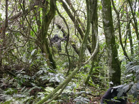
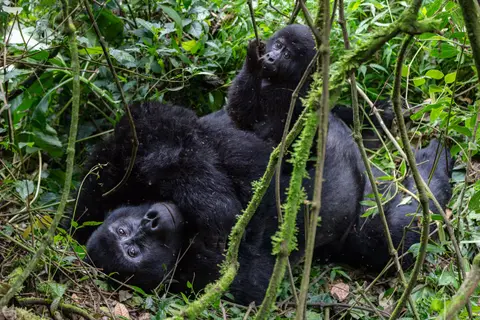
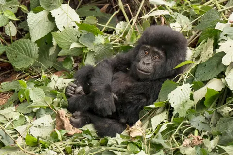
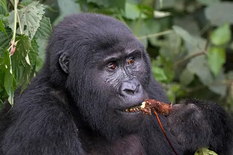
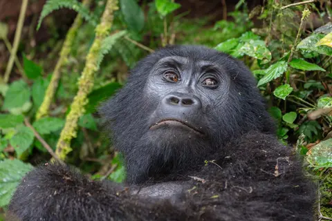
Above all, Bwindi anchors global conservation for the endangered mountain gorilla (Gorilla beringei beringei), holding roughly half of Earth's wild population (none survive in captivity despite 1960s and 1970s capture attempts). Repeated park censuses document steady population growth under strict protection, rising from an estimated 300 individuals in 1997 to 320 in 2002 and 340 in 2006. The 2018 census counted 459 mountain gorillas across 36 social groups (plus 16 solitary individuals), a population distinctive enough that primatologist Craig Stanford proposed classifying Bwindi gorillas as a separate subspecies. Fourteen habituated gorilla families are tracked daily across four Uganda Wildlife Authority (UWA) sectors: Buhoma, Ruhijja, Rushaga, and Nkuringo across Kanungu, Kabale, and Kisoro districts. Beyond gorillas, Bwindi's first dedicated chimpanzee census in 2025 confirmed 426 common chimpanzees living inside the forest with L'Hoest's monkeys, black-and-white colobus, red-tailed monkeys, vervets, African elephants, and giant forest hogs. Only roughly 650 wild mountain gorillas were estimated globally in earlier baseline conservation surveys, making Bwindi's sustained recovery vital.
Border Pressures, Batwa Displacement, and Ranger Escort Rules
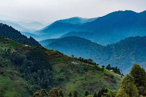
Conservation inside Bwindi operates on one of Africa's sharpest forest-agriculture borders. Concrete boundary pillars and planted boundary trees mark non-river borders. Outside the park, cultivated hillsides hold rural densities exceeding 300 to 350 inhabitants per square kilometre, where ninety percent of local residents rely on subsistence farming among some of Uganda's poorest communities. Apart from a narrow 4-square-kilometre buffer donated by southern communities, dense farmland presses straight against ancient forest walls, pinching wildlife movement through narrow central corridors linking Bwindi's two main forest blocks. Where tree clearing stopped at park lines, that geometry creates a high boundary-to-area ratio impossible to expand easily. Cross-border dispersal into Sarambwe's 900 hectares in the DRC provides an essential gene-flow safety valve for primates.
Creation of the national park in 1991 ended decades of lenient forest reserve logging, pit-sawing, mining, beekeeping, and hunting overnight. That abrupt closure struck hardest at the Indigenous Batwa people, forest-dwelling hunter-gatherers who harvested wild yams and honey and tended ancestral sites inside Bwindi without harming the canopy. Batwa residents were evicted without land rights recognition or national compensation while non-Batwa agricultural settlers who had cleared forest fringes received formal land compensation. That exclusion sparked lasting local resentment and conflict, partially eased over time through community revenue-sharing from gorilla permits and regulated boundary plant-use programmes that sustain local livelihoods with zero commercial extraction inside park borders other than ecotourism.
Gorilla tourism itself began in April 1993 and now finances park operations, community projects, and the permanent research institute inside Bwindi under parastatal Uganda Wildlife Authority oversight (replacing earlier Uganda National Parks governance). Legal protection rests on Uganda's 1995 Constitution, Wildlife Act Cap 200 of 2000, National Environment Act (2000), Local Government Act (1997), and Land Act (1998). Statutory oversight also builds on the Forest and Tree Planting Act 2003 and Uganda Wildlife Policy (1999), following the 1952 National Parks Act and Game Act. International conventions including the 1992 Convention on Biological Diversity, CITES, and the 1971 Ramsar Convention provide additional safeguards. Security and wildlife health remain intense daily priorities. In March 1999, 100 to 150 former Rwandan Interahamwe guerrillas crossed from the DRC and kidnapped 14 tourists and a Ugandan guide from park headquarters. They released six before murdering eight tourists and killing the guide to destabilise tourism revenue. Following a multi-month closure, UWA overhauled field security so armed rangers accompany every tracking group today. Equally urgent are strict visitor health distances to guard closely related primates against human respiratory diseases. Rangers also enforce anti-trafficking measures against criminal networks targeting mountain gorilla infants and chimpanzees, and manage crop-raiding where habituated gorillas lose fear of farmers and damage neighbouring livestock and fields. Continuous ranger patrols, community benefit-sharing projects, and scientific tracking inside Bwindi's permanent research institute keep pressure on illegal forest encroachment while maintaining habitat connectivity across narrow central forest bottlenecks linking the northern and southern mountain blocks. Travellers preparing for foot treks across Buhoma, Ruhijja, Rushaga, and Nkuringo should train for steep wet clay ascents between 1,160 and 2,706 metres and carry waterproof shells for sudden equatorial downpours. Verify permit sector assignments well ahead of arrival via Kigali International Airport (KGL, 114 kilometres south across the Rwanda border) or long overland routes from Entebbe International Airport (EBB) via Kampala and Kabale. High vegetation evapotranspiration off Bwindi's dense canopy boosts local rainfall across adjacent Kigezi farms and dampens flash flooding during March-to-April and September-to-November storms. It also checks severe hillside soil erosion across southwestern Uganda and keeps agricultural streams running steadily through dry months. Those essential watershed services give farming communities surrounding Kabale, Kanungu, and Kisoro a direct stake in defending forest boundaries next to ecotourism revenue sharing. Together, these measures have helped gorilla and chimpanzee populations recover steadily over the decades following the 1999 park shutdown.
Gorilla Tracking Sectors and Trailhead Entry Rules
Because steep terrain separates park corners by hours of winding mountain roads, visitors select one of four UWA sector trailheads matched to specific habituated gorilla groups and permit allocations.
| Complex Zone | Key Highlights | Access & Ticket Rule |
|---|---|---|
| Buhoma Sector (Kanungu District) | Lowest northern valley elevations (starting near 1,160 metres), Mubare gorilla group, Munyaga river trails, and historic park headquarters | Foot-only forest entry with advance UWA gorilla permits and armed ranger escort mandatory; no private vehicles inside park |
| Ruhijja Sector (Eastern High Ridge) | High-altitude montane forest approaching 2,607 metres near Rwamunyonyi Hill and prime Albertine endemic birding slopes | Requires sector-specific UWA tracking or guided bird-walk permits booked prior to arrival |
| Rushaga Sector (Kisoro District) | Southern hillside zone hosting dense habituated gorilla groups, habituation study access, and rugged forest valleys | Trailheads operate under strict daily group-size caps and minimum viewing distance health protocols |
| Nkuringo Sector (Southwestern Ridge) | Steep Rift escarpment ridge facing Sarambwe border forest and the 4-square-kilometre southern community buffer | Physically demanding foot climbs require sector permits, porters if needed, and certified UWA guide teams |
Three Forest and Watershed Details Along the Steep Trails
Climbing steep foot trails behind UWA trackers puts three ecological forces shaping Bwindi in clear view.
- Sharp Agricultural Clearing at Concrete Boundary Pillars: Just before crossing into dense tree ferns and tangled lianas, observe the razor-sharp boundary line marked by concrete pillars and planted boundary trees where steep terraced bean and banana plots stop abruptly against primary rainforest.
- Continuous Surface Streams on Impermeable Bedrock: Every deep valley fold carries rushing clear water over Precambrian schist and quartzite rather than disappearing underground, demonstrating how Bwindi's non-porous bedrock turns 1,400 to 1,900 millimetres of mountain rain into year-round rivers feeding Lake Edward and surrounding farms.
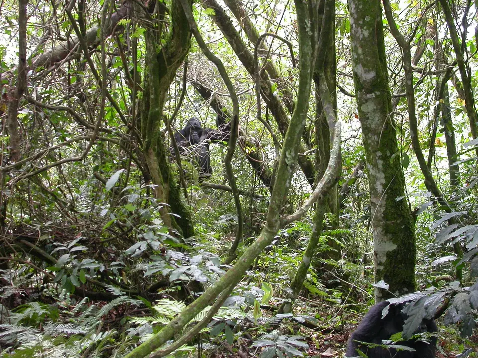
- Tangled Montane Vine Canopy (The Impenetrable Understorey): Where tree falls or steep sunlight slopes let daylight hit the forest floor, dense thickets of thorny vines, giant tree ferns, and herbs knit the lower canopy together. This dense foliage gave Bwindi its name and supplies gorillas with root and shoot forage.
Plan mountain gorilla treks during drier windows between June and August or December and February when steep clay trails are firmer underfoot than during March-to-April and September-to-November rain peaks. Pair southwestern Uganda's forests with capital logistics in our Kampala travel guide or explore more African wildlife refuges inside the UNESCO World Heritage Atlas.