Quick Field Data
- UNESCO Inscription: 2001 (Ref. 1000), serial natural marine and island reserves offshore from northeastern Brazil; Criteria (vii), (ix) and (x).
- Scale & Footprint: 43,270 hectares (42,270 hectares in initial reserve boundaries) plus a 140,713-hectare buffer zone uniting the main volcanic archipelago with distant Atol das Rocas Biological Reserve.
- Access & Ticketing: Managed by ICMBio under separate conservation plans; marine park beaches regulate daily capacity and diving, whereas Atol das Rocas remains strictly closed to tourism.
- Arrival Logistics: Direct commercial flights land at Fernando de Noronha Airport (FEN), 78 kilometres east of the serial midpoint, linking to Recife (506 kilometres southwest).
Submarine Volcanic Peaks and South Atlantic Island Ecology
Rising straight from the crest of a submerged South Atlantic mountain chain roughly 340 to 354 kilometres (191 nautical miles) off Brazil's northeastern coast, this twin reserve anchors a fertile marine oasis in deep open water. Together, the volcanic archipelago and Atol das Rocas encompass over half of all insular coastal waters across the entire Southern Atlantic Ocean. Their nutrient-rich currents support essential breeding, feeding and natural fish restocking grounds for pelagic tuna, billfish, sharks, cetaceans and marine turtles migrating across open waters toward the African coast. Administratively, the islands form a unique Brazilian state district governed directly by Pernambuco (despite sitting closer to Rio Grande do Norte), extending jurisdiction onward to the remote Saint Peter and Saint Paul Archipelago 624 kilometres (337 nautical miles) northeast.
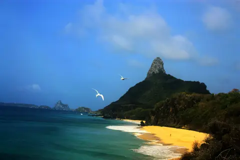
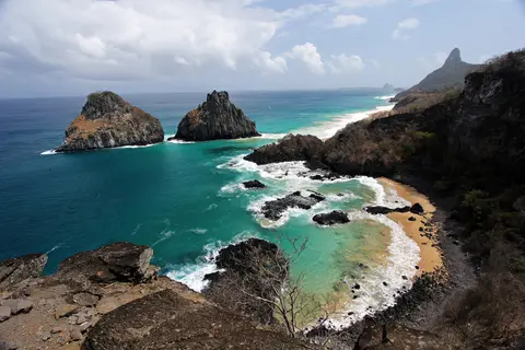
Covering 26 square kilometres across 21 islands and islets, the eastern archipelago centres on a single inhabited main island measuring 18.4 square kilometres with 3,101 residents estimated in 2020. Steep volcanic formations lift wide plateaux above 100 metres elevation, crowned by the sharp phonolite spire of Morro do Pico at 323 metres. Designated in 1988 after its earlier Federal Territory period ended, the Marine National Park protects 70 percent of the main island, every smaller satellite islet and adjacent coastal waters down to 50 metres depth.
Roughly 150 kilometres west across deep ocean sits the second heritage component, Atol das Rocas Biological Reserve, founded in 1979 as the South Atlantic's sole coral atoll. Built as an elliptical reef cradling two small sandy islands, Rocas reveals shallow sunlit lagoons and tidal pools teeming with fish, sponges, corals, shellfish and molluscs whenever Atlantic tides drop. Jointly, both reserves host the largest tropical seabird concentration in the Western Atlantic Ocean, earning Global Centre of Bird Endemism recognition while preserving the South Atlantic's sole Insular Atlantic Forest and oceanic mangrove.
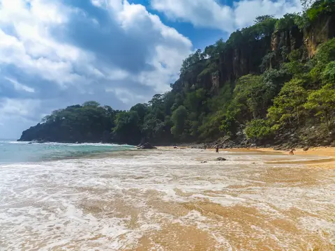
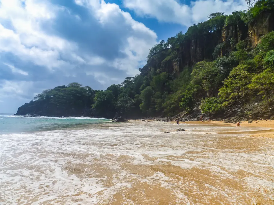
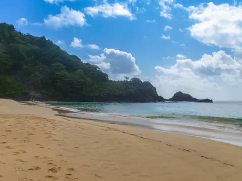
Undersea clarity and resident marine mammals define the archipelago's standing among divers worldwide. Sheltered Baía dos Golfinhos (Dolphin Bay) supports an exceptional resident population of spinner dolphins monitored daily without boats entering the cove. Meanwhile, crescent beaches at Baía do Sancho and Praia do Leão protect nesting sand for threatened hawksbill turtles and green turtles, making Atol das Rocas Brazil's second most crucial marine turtle breeding ground.
Early Portuguese Charts, Fernão de Loronha, and Prison-Era Forest Loss
Positioned far out along transatlantic sailing lanes, the archipelago appeared on European nautical charts immediately following the 1500 Portuguese arrival in Brazil. Spanish cartographer Juan de La Cosa plotted an island here in 1500, and the anonymous Portuguese Cantino planisphere completed before November 1502 depicted an island labelled Quaresma (Lent) near an enigmatic red mark. Historians have proposed several possible sightings, including Cabral's returning 1500 supply ship under Gaspar de Lemos or André Gonçalves, the 1501 Portuguese mapping voyage carrying Amerigo Vespucci and João da Nova's Third India Armada stopping near Cape Santo Agostinho. Yet tight spring sailing dates leaving Lisbon around March or April 1501 complicate João da Nova reaching Brazilian waters before Lent ended. In addition, Vespucci himself claimed in letters to Piero Soderini and Lorenzo di Pierfrancesco de' Medici that his first sight of the island occurred in 1503. Alternatively, historian Roukema argued in 1963 that Quaresma and the adjacent red mark depicted Atol das Rocas sighted on 16 March 1502 by a returning vessel matching Venetian envoy Pascualigo's July 1502 dispatch mentioning a ship back from the land of parrots. Other chroniclers such as Gaspar Correia, João de Barros and Damião de Góis record conflicting early island landfalls.
Written accounts confirm clear landfall on 10 August 1503, when a commercial expedition led by captain Gonçalo Coelho and accompanied by Amerigo Vespucci wrecked its flagship on an offshore reef. While Coelho's remaining ships sailed south, Vespucci anchored here for one week until 18 August 1503, naming the uninhabited sanctuary Saint Lawrence in his Letter to Soderini. On 16 January 1504, King Manuel the First of Portugal issued a charter granting the island, initially titled São João, as a hereditary captaincy to wealthy Lisbon merchant Fernão de Loronha, chief financier of the voyage.
Between 1503 and roughly 1512, Loronha held a lucrative Portuguese Crown trade monopoly across coastal Brazil. His agents constructed coastal trading warehouses (feitorias) where indigenous harvesters delivered red dyewood called brazilwood for shipment to a central depot on the island awaiting larger Europe-bound vessels. Even after the Crown took over mainland trade in 1512, Loronha's descendants kept private island ownership down to the 1560s. Although a 20 May 1559 royal letter still cited São João, Martim Afonso de Sousa's 1530s logbook and sailors already favoured the informal spelling Noronha.
Later maritime centuries brought privateers, convicts and severe forest clearing. In July 1719, Welsh pirate Bartholomew Roberts, remembered as Black Bart, anchored offshore for nine weeks before sailing northwest to hunt Portuguese vessels in the West Indies. Subsequent eras turned the remote main island into a prison and later a military garrison, periods during which native forests were completely cleared. Introduced black rats, mice, domestic dogs and tegu lizards devastated ground-nesting seabird colonies, replacing primeval coastal woodland with scrubby secondary growth.
ICMBio Marine Zoning, Invasive Predators, and Atol das Rocas Closure
Contemporary conservation works to repair centuries of deforestation while capping tourism pressure on fragile volcanic slopes. Brazil's federal agency ICMBio enforces two separate management plans across the serial site, backed around Atol das Rocas by Brazilian Navy and Air Force surveillance against illegal fishing and unauthorised tourist yachts. Atol das Rocas remains strictly off-limits to general tourism, reserved exclusively for species protection and permitted scientific research. Scientists also highlight the value of mapping submerged underwater ecological links connecting Atol das Rocas to the eastern archipelago. Because both sites share migratory pelagic currents and larval fish dispersal across open Atlantic waters, protecting the twin reserves jointly remains far more effective than guarding isolated islands alone.
On the inhabited main island, a Sustainable Development and Ecotourism Management Plan shaped with local residents governs park carrying capacity, urban boundaries outside park lines, navigation and licensed diving permits. Dedicated conservation initiatives run through ICMBio, namely the Tamar Project for marine turtles and the Spinner Dolphin Project, anchor public education and reef protection. Both programmes generate crucial local employment and scientific data while financing nesting beach patrols and acoustic dolphin studies. Urgent ecological priorities continue focusing on restoring native Insular Atlantic Forest canopies, regulating surrounding offshore fisheries and eradicating introduced rats, mice, dogs and tegu lizards threatening endemic island birds. Balancing steady visitor demand against strict water and habitat limits defines conservation policy across the reserve.
Maintaining two distinct reserves across open ocean ensures pelagic fish restocking functions cleanly across the Tropical South Atlantic. While Atol das Rocas acts as an undisturbed natural aquarium for juvenile reef species, controlled diving and cliff trails on the main volcanic island sustain regional conservation backing. Constant navy surveillance keeps illegal fishing fleets outside reserve lines across the 140,713-hectare buffer zone. Together with ecological education centres on the main island, strict biological reserve boundaries protect deep reef food chains across the central Atlantic. Visitors joining licensed boat excursions outside Dolphin Bay directly observe how steady conservation enforcement sustains dense fish schools, resident turtles and thriving seabird colonies.
Access Zones Across the Volcanic Archipelago and Atol das Rocas
Clear zoning rules dictate where visitors may swim, snorkel or hike across the eastern islands while keeping outer sanctuaries undisturbed. Verify current ICMBio park entry passes, tide timetables and trail access schedules before visiting coastal bays.
| Complex Zone | Key Highlights | Access & Ticket Rule |
|---|---|---|
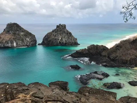
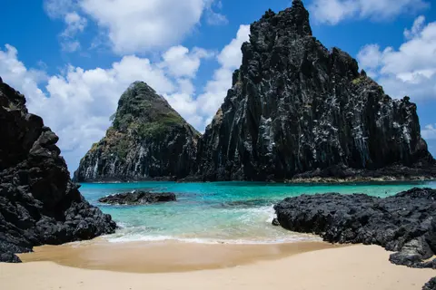
| Baía do Sancho and Porcos | Cliff-walled crescent cove, volcanic tide pools and shallow nearshore coral reefs facing Morro Dois Irmãos. | Inside Marine National Park; entry requires valid park passes, cliff-stair scheduling and strict no-touch coral codes. |
| Baía dos Golfinhos Overlook | Sheltered deep bay hosting resident spinner dolphin pods monitored continuously from landward research stations. | Swimming and boat entry banned inside the bay; observe morning dolphin activity from the designated cliff overlook path. |
| Praia do Leão South Coast | Wild volcanic surf shoreline acting as a primary green and hawksbill sea turtle nesting beach with Tamar patrols. | Daytime pedestrian beach access under park passes; night-time nesting seasons close beaches and forbid artificial light. |
| Atol das Rocas Reserve | Elliptical South Atlantic coral atoll 150 kilometres west with tidal pools, seabird colonies and turtle rookeries. | Strictly closed to all public tourism and pleasure craft under Biological Reserve law; scientific and naval patrol access only. |

Three Coastal and Ecological Details on Fernando de Noronha Island
- Phonolite Volcanic Spire of Morro do Pico: Rising 323 metres above central plains on Fernando de Noronha Island, this vertical volcanic plug reveals the eroded submarine mountain core supporting all 21 islands and islets.
- Tide-Synchronised Baía dos Porcos Pools: Exploring the rocky basalt shelf beside Cacimba do Padre at low tide exposes clear shallow stone pools cut behind outer reef ledges facing the twin stacks of Morro Dois Irmãos.
- South Atlantic's Sole Oceanic Mangrove: Sheltered along coastal inlets within the reserve grows the only true oceanic mangrove habitat in the Southern Atlantic, creating nursery waters for juvenile reef fish.
How to Get to Fernando de Noronha Brazil and Time Marine Conditions
Planning how to get to Fernando de Noronha Brazil relies entirely on scheduled air connections rather than public passenger ferries. Regular flights land at the main island's airport, located 78 kilometres east of the serial site's central marine coordinate and linked straight to mainland Pernambuco via Recife (506 kilometres southwest). Because carrying capacity limits cap overnight stays and park entry, arranging passes and flights early avoids disappointment.
Seasonal Atlantic swells flip marine visibility across opposite shores throughout the year, shaping the best time to visit Fernando de Noronha Brazil. Calmer northern sea phases deliver glassy snorkelling across Baía do Sancho and Baía dos Porcos, whereas winter swells shift calmer swimming conditions toward southern bays and attract surfers along northern beaches. Combining morning dolphin overlooks from cliff paths with midday low-tide coral pools lets visitors read both volcanic geology and reef rhythms clearly. Respecting marine park sanctuary zones, plastic limits and wildlife distance rules ensures nesting sea turtles and resting spinner dolphins face minimal human disruption. Dividing stays across three to five days gives calm breathing room for shifting ocean swells around northern and southern headlands.
Regular flights arrive at the main island's airport from Recife, while domestic connections link onwards across northeastern Brazil. Check ICMBio reservation systems well ahead because capped visitor numbers fill peak drier seasons quickly across the archipelago. Browse further oceanic and South American reserves in our UNESCO World Heritage Atlas.