


























Quick Field Data
- UNESCO Inscription: 1979 (extended to include Glacier Bay and Tatshenshini-Alsek) · Natural Criteria across an International Biosphere Reserve
- Scale & Footprint: Includes the 13,175,799.07-acre (53,320.57-square-kilometre) Wrangell-St. Elias National Park and Preserve (with 9,078,675 acres or 3,674,009 hectares of designated wilderness) alongside Kluane and Glacier Bay plus Tatshenshini-Alsek
- Access & Ticketing: Open year-round with no general entrance fee at Wrangell-St. Elias; backcountry camping requires no permit, while off-road vehicles require permits and seasonal visitor centres operate from May to September
- Arrival Logistics: Spans the frontier of the United States (Alaska) and Canada (British Columbia and Yukon Territory), reached by road from Anchorage via the Edgerton Highway to Copper Center and Chitina, then along the 97-kilometre (60-mile) McCarthy Road or the Nabesna Road
Terrane Accretion and the Bagley Icefield
The transboundary wilderness of Kluane and Wrangell-St. Elias alongside Glacier Bay and Tatshenshini-Alsek spans the mountain frontier of the United States (south-central and southeastern Alaska) and Canada (British Columbia and Yukon Territory), protecting the largest non-polar icefield on the planet. On the American side alone, Wrangell-St. Elias National Park and Preserve (first proclaimed as a National Monument on 1 December 1978 by President Jimmy Carter under the Antiquities Act prior to the 1980 Alaska National Interest Lands Conservation Act) covers 13,175,799.07 acres (53,320.57 square kilometres, or 20,587.19 square miles), an area surpassing nine U.S. states or Croatia and exceeding the combined acreage of the 47 smallest out of 63 American national parks. It is divided into 8,323,147.59 acres (33,682.58 square kilometres) of national park (where only local rural subsistence hunting is allowed) and 4,852,652.14 acres (19,637.99 square kilometres) of national preserve (where sport hunting is permitted under the National Park Service and Alaska Department of Fish and Game), while 9,078,675 acres (36,740.09 square kilometres, or roughly 66 percent) form the Wrangell-St. Elias Wilderness, over 43 million times the size of Gateway Arch National Park. Across the Canadian border to the east and south lie Kluane National Park and Reserve alongside the Tatshenshini and Alsek river valleys and Glacier Bay National Park.
This extreme vertical relief, rising from 500 metres below sea level in coastal marine basins up to 5,000 metres and peaking at 5,489-metre (18,008-foot) Mount Saint Elias just 16 kilometres (10 miles) from tidewater, was forged by plate tectonics. Moving northwestward at 5.1 to 6.4 centimetres (2 to 2.5 inches) per year after the ancient Kula Plate subducted 50 million years ago, the Pacific Plate subducts beneath the North American Plate in the Gulf of Alaska, pushing six crustal terranes and one sedimentary belt against the continent from north to south: the Windy or Yukon-Tanana terrane (180 million years old), the Gravina-Nutzotin Belt (120 million years), the Wrangellia composite terrane (joining the Wrangellia, Alexander, and Chugach terranes 110 to 67 million years ago), the Prince William terrane (50 million years), and the colliding Yakutat terrane (beginning 26 million years ago). This ongoing collision triggers massive seismic shocks along the Border Ranges, Denali-Totchunda, and Fairweather faults, including four earthquakes between magnitude 7 and 8 in 1899, a 7.7 quake in 1958, the 9.2 Alaska earthquake in 1964, and the 7.9 St. Elias earthquake in 1979.
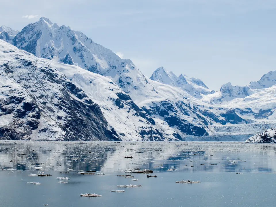
Inland from the subduction trench, magma fed ten documented volcanoes across the western Wrangell Range alongside the Saint Elias, Chugach, Nutzotin, Granite, and Robinson plus Mentasta mountains. Unlike typical explosive subduction cones, the western Wrangell peaks (which hold nine of the 16 highest summits on U.S. soil and 35 of Alaska's 70 tallest mountains, including seven of the top ten) are voluminous andesite shield volcanoes with summit collapse calderas, led by Mount Blackburn and active 4,317-metre (14,163-foot) Mount Wrangell. Built between 600,000 and 200,000 years ago with a 3,965-metre (13,009-foot) northwest cinder cone at Mount Zanetti under 25,000 years old, Mount Wrangell erupted in 1784 and in 1884 to 1885 as well as 1900; geothermal heat from three fumarole craters inside its 5.8-by-4.0-kilometre (3.6-by-2.5-mile) ice-filled caldera melted 100 million cubic metres of ice during the 1980s before ice re-accumulated after 1986, while westernmost 3,660-metre (12,010-foot) Mount Drum blew apart its 4,300-to-4,900-metre (14,000-to-16,000-foot) summit 250,000 to 150,000 years ago and now feeds eleven glaciers. Across the central plateau, more than 200 glaciers coalesce around the Bagley Icefield (holding 60 percent of Alaska's permanent ice) to feed Nabesna Glacier (the longest valley glacier in the world), Malaspina Glacier (North America's largest piedmont glacier), and Hubbard Glacier at Yakutat Bay (North America's longest tidewater glacier).
Ice-Free River Corridors and the Kennecott Copper Boom
Because the coastal Saint Elias and Chugach mountains trap heavy maritime precipitation from the Gulf of Alaska while the interior basins remain cold and dry, the protected parks compress coastal marine waters, temperate coastal forest, montane woodland, sub-alpine scrub, and high alpine tundra into a single contiguous reserve. Crucially, the deep valleys of the Tatshenshini and Alsek rivers slice right through the coastal ice barrier, forming low-elevation, ice-free biological linkages that allow plants and animals, including grizzly bears and caribou alongside Dall's sheep, to migrate between the Pacific coast and the northern interior.
On the western and northern flanks of Wrangell-St. Elias, glacial meltwater from the Copper Glacier and surrounding icefields feeds the Copper River alongside the Chitina and Nizina plus the Kennicott, Chisana, and Nabesna rivers, bordering the Tetlin National Wildlife Refuge to the north and the Chugach and Tongass national forests to the south. As tidewater and valley glaciers advance and retreat across the fjords of Yakutat Bay and Icy Bay alongside Glacier Bay, they leave classic terminal moraines and hanging valleys colonized by pioneer plants in various stages of ecological succession.
At the geographic centre of Wrangell-St. Elias stands the historic mining boomtown of Kennecott, a National Historic Landmark district perched above the Kennicott Glacier. Between 1903 and 1938, the Kennecott mines exploited one of the richest deposits of copper ore ever discovered in the world, leaving behind multi-storey timber concentrator mills and mine buildings connected to Chitina and the Edgerton Highway along the railbed that is now the 97-kilometre (60-mile) gravel McCarthy Road. Today the wider park complex balances strict wilderness preservation with traditional rural subsistence use and backcountry recreation across a handful of tiny frontier communities, including McCarthy, Kennicott, Slana, Nabesna, and Chisana.
Driving the Gravel Roads to Kennecott and Cruising Hubbard Glacier
Receiving 79,450 visitors in 2018 across an expanse larger than nine American states, Wrangell-St. Elias and its sister parks demand self-reliant logistics along two rough gravel roads, charter bush planes, or coastal expedition ships. The icefields stretch endlessly.
- Entry and Route via Copper Center and the McCarthy Road: Drive from Anchorage along the Edgerton Highway into the Copper River valley, stopping first at the main park headquarters and visitor centre at mile 106.8 near Copper Center (which remains open on weekdays in winter) or the ranger station in Chitina. From Chitina, follow the 97-kilometre (60-mile) gravel McCarthy Road past the information station at Mile 59 to the footbridge at the end of the road, then cross into McCarthy to walk or shuttle up to the Kennecott visitor centre and inspect the 1903-to-1938 timber copper mills above the Kennicott Glacier.
- Tickets, Interiors and Viewpoints on the Nabesna Road and Air Strips: For northern interior access, check in at the Slana Ranger Station and drive the gravel Nabesna Road to the Kendesnii campground (the sole campground managed by the National Park Service in the reserve) beneath Mount Wrangell and Mount Drum. Because maintained hiking trails are scarce and summer tundra is boggy for mountain biking, book a bush-plane air taxi from McCarthy, Nabesna, Chitina, or Glennallen (using the three improved airstrips at Chisana, May Creek, and McCarthy or fourteen public-use cabins) to view the Bagley Icefield, 5,489-metre Mount Saint Elias, and Malaspina Glacier from the air.
- Timing and Onward Connections to Yakutat Bay and Kluane: Plan overland visits between late May and mid-August or September when visitor facilities are staffed, river float trips run down the Copper and Chitina or Nizina and Kennicott rivers, sea kayaks launch into Icy Bay, and cruise ships enter Yakutat Bay (served by the joint ranger station in Yakutat shared with Glacier Bay) to watch Hubbard Glacier calve into tidewater. Link your Alaskan journey eastward into Canada's Kluane and Tatshenshini-Alsek reserves via our UNESCO World Heritage Atlas.
