Quick Field Data
- UNESCO Inscription: 2024 (Ref. 1611), natural coastal dune reserve in Maranhão State, Brazil; Criteria (vii) and (viii).
- Scale & Footprint: 156,562 hectares (155,000 hectares in early park decrees) holding 90,000 hectares of dunes and over 40,000 hectares of restinga, inside a 268,231-hectare buffer zone.
- Access & Ticketing: Managed by Brazil's Chico Mendes Institute for Biodiversity Conservation (ICMBio) under integral protection rules; check licensed 4x4 shuttle rules in Barreirinhas, Santo Amaro or Atins.
- Arrival Logistics: Closest major flights arrive at Marechal Cunha Machado International Airport (SLZ) near São Luís, 130 kilometres west. Domestic links continue toward Recife (1,095 kilometres southeast).
Quaternary Dune Migration, Impermeable Rock, and Biome Crossroads
Stretching along northeastern Brazil's Maranhão coast just east of Baía de São José, this coastal sanctuary sits inside the Barreirinhas Basin at a rare biological crossroads. Three major Brazilian biomes converge across its margins: tropical Cerrado savannah, semi-arid Caatinga scrub and humid Amazon forest fringes. Protected by federal decree on 2 June 1981 and inscribed by UNESCO in July 2024, the 156,562-hectare national park contains South America's largest expanse of both stable and shifting coastal dunes. Inland, the Parnaíba River, São José Basin and the Itapecuru, Munim and Periá rivers tie interior watershed sediments directly to Atlantic beaches.
Although orbital views make the sand sheets look like an arid Sahara desert, coastal climate tells an entirely different story. Deserts receive under 250 millimetres (10 inches) of rainfall annually, whereas this Maranhão coast receives roughly 1,200 millimetres (47 inches) of rain every year. About 70 percent of that annual total arrives between January and May, synchronised with marine sedimentation built over Quaternary sea-level regressions and transgressions along beaches spanning 70 to 80 kilometres. Mean annual air temperatures stay warm between 26 and 28.5 degrees Celsius, fluctuating barely 1.1 degrees across the year.
Continent-derived sand travels seaward along the Parnaíba and Preguiças rivers before unidirectional trade winds push dry quartz grains back inland across a flat deflation plain 600 to 2,000 metres wide. Near the surf line, brisk winds gather loose grains into starter barchans standing 50 centimetres to one metre high. Climbing downwind atop older dune generations, these crescent ridges soar 30 to 40 metres tall in sweeping chains reaching 75 kilometres long, advancing 20 to 50 kilometres inland at 4 to 25 metres annually.
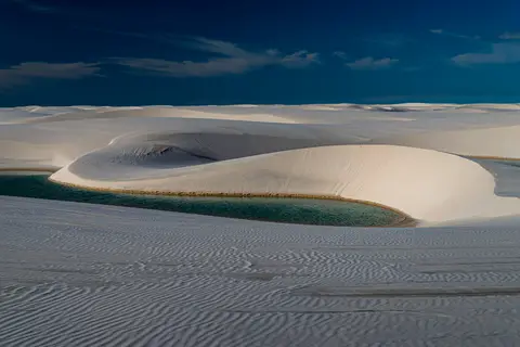
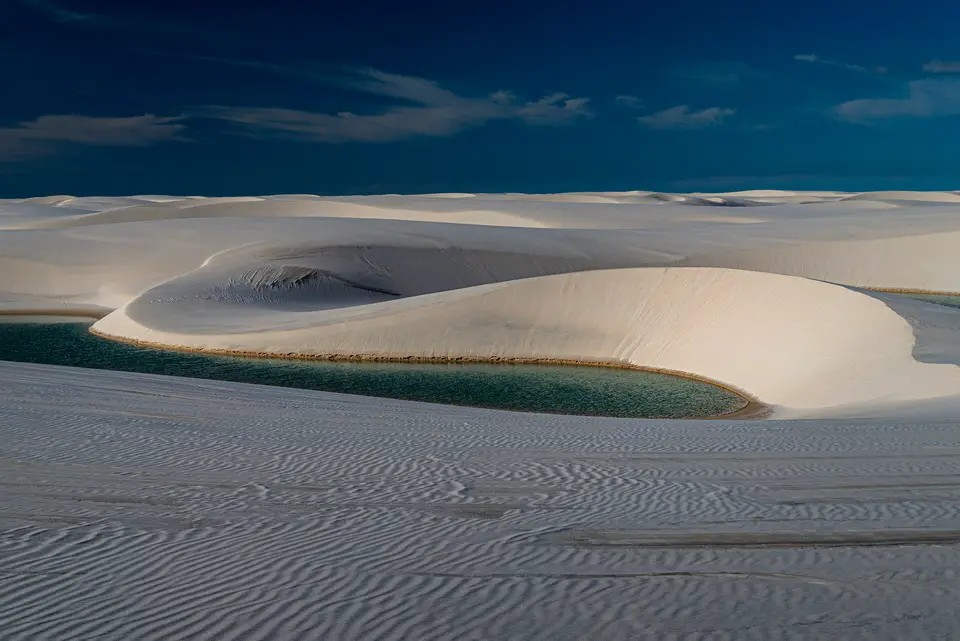
Earth scientists prize this coastal basin because wind-blown aeolian processes operate directly over an impermeable bedrock floor. Across 90,000 hectares of shifting dune fields, that dense underlying rock blocks rainwater from percolating downward into deep aquifers. Geomorphologists examine these barren inter-dunal floodplains as a rare modern analogue illustrating ancient pre-vegetation fluvial landscapes on Earth. Every wet season, accumulated rainfall turns dry sand troughs into vivid freshwater basins lacking any external river inlets or outlets. Because shifting dunes reshape every hollow across centuries, no two wet seasons repeat an identical lagoon map across the white sand plain.
Studying this uninterrupted sedimentary archive helps coastal scientists model how ancient rivers once behaved across barren terrestrial continents before land plants colonised riverbanks. Protecting both mobile sand corridors and coastal mangrove nurseries ensures natural wind transport keeps renewing the entire dune field.

Rain-Fed Lagoons, Dormant Wolf Fish, and Restinga Oases
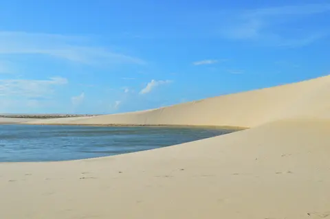
Between January and June, rising groundwater tables and heavy tropical cloudbursts flood low inter-dunal corridors into crisp freshwater lagoons measuring up to 100 metres long and 3 metres deep. At peak rainy-season volume, temporary and perennial pools cover up to 41 percent of the park's surface area. Thin living biofilms of brown and green algae and cyanobacteria line the pure quartz floors underneath, shifting water hues across emerald, turquoise and deep cobalt. Measured pool temperatures sit between 27.5 and 32 degrees Celsius with acidic pH readings from 4.9 to 6.2 and sparse dissolved nutrients.
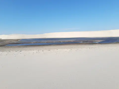
Dry-season evaporation alters the terrain rapidly once midyear storms subside. Relentless sun and steady coastal breezes strip lagoon depths by up to one metre per month until shallow pools vanish completely into crisp sandy hollows. Because trade winds simultaneously shift the surrounding barchan dunes 4 to 25 metres downwind every year, lagoons reappear in subtly relocated positions and outlines when January rains return.
Native fauna survives these drastic wet-dry swings through specialised evolutionary adaptations. Once standing lagoons evaporate, native wolf fish burrow deep into moist mud below sand crusts and enter seasonal dormancy until fresh storms reconnect flooded basins with coastal streams. Vegetated margins, coastal mangroves and two fertile interior restinga oases, Queimada dos Britos covering 1,100 hectares and Baixa Grande covering 850 hectares, anchor rich terrestrial biodiversity across more than 40,000 hectares of restinga and alluvial communities.
Ecological inventories across the park list 133 plant species, 112 bird species and at least 42 reptile species thriving across dune margins and wetlands. Four animals listed on Brazil's National List of Endangered Species rely directly on these connected coastal habitats. Conservation teams monitor scarlet ibis (Eudocimus ruber), neotropical river otter (Lontra longicaudis), small spotted oncilla wildcat (Leopardus tigrinus) and coastal West Indian manatee (Trichechus manatus) across estuarine channels.
Low-nutrient freshwater pools sustain specialised food webs despite their austere mineral chemistry. Isolated rainwater lagoons hold little dissolved phosphorus or nitrogen, relying on thin algal mats, drowned grasses and intermittent river connections during peak floods to replenish aquatic insects and amphibians. Protecting coastal restinga vegetation and mangrove corridors keeps these fragile water chains healthy across dry and wet seasons alike. Seasonal flood links to coastal streams also replenish fish and insect communities before dry winds evaporate standing surface pools again.

Protected Status Under ICMBio and Traditional Resident Communities
Administered federally by Brazil's Chico Mendes Institute for Biodiversity Conservation (ICMBio) under the National System of Protected Areas (SNUC), the reserve falls inside Brazil's integral protection tier allowing only indirect natural resource use. Binding Management Plans and Public Use Plans govern licensed vehicle corridors, dune footpaths and lagoon access across the 156,562-hectare sanctuary. Wrapping both coastline and inland municipalities lies a 268,231-hectare buffer zone linked to Brazil's National Coastal Management Plan and Ecological Economic Coastal Zoning (ZEEC), though managers seek stronger marine enforcement offshore.
More than 4,000 residents continue living inside park boundaries in small coastal hamlets and interior restinga oases such as Queimada dos Britos and Baixa Grande. Participatory governance boards including the Lençóis Maranhenses National Park Council and the Regional Governance Instance Lençóis-Delta bring multi-level public officials together with community delegates. Formal Terms of Commitment recognise traditional resident rights and sustainable livelihoods while steadily strengthening official recognition of historic local groups.
Roughly 60,000 ecotourists visit the dunes each year for guided hikes, lagoon swimming, canoeing, surfing and horseback rides along approved outer zones. Film crews have also brought global attention to these surreal sand plains, featuring them in Brazilian drama The House of Sand, Tamil feature song Enthiran, Avengers: Infinity War and Avengers: Endgame depicting planet Vormir and a 2022 RY X concert film. Keeping motorised 4x4 trucks confined strictly to perimeter sand tracks prevents tyre ruts from scarring delicate windward crests.
Regular management effectiveness evaluations conducted by ICMBio remain publicly reviewed to keep visitor recreation aligned with conservation law. Canoeing along sheltered rivers, surfing outside reef breaks, riding horses on outer margins and guided walking tours operate cleanly under Public Use Plans. Enforcing boat and 4x4 access quotas keeps growing visitor interest from overwhelming fragile dune oases. Educating visitors about non-motorised trail etiquette and seasonal freshwater ecology builds broader local and international backing for protecting Brazil's newest natural World Heritage park.
Access Zones Across Lençóis Maranhenses National Park, Brazil
Three coastal and river gateways regulate licensed 4x4 approaches and footpath trails into Lençóis Maranhenses National Park, Brazil. Check seasonal lagoon water levels and authorised ICMBio guide rules before arranging day loops or multi-day oasis crossings.
| Complex Zone | Key Highlights | Access & Ticket Rule |
|---|---|---|
| Barreirinhas and Lagoa Azul | Tall 30-to-40-metre barchan dunes overlooking clear seasonal pools reached across the Preguiças River. | Licensed 4x4 trucks cross sandy tracks to park drop-off points; finish climbs on foot along approved dune ridges. |
| Atins and River Mouth | Quiet coastal dunes, restinga vegetation, Preguiças estuary kite breezes and shallow lagoon pockets. | Reached by river boat from Barreirinhas or sand tracks; non-motorised walking paths operate inside park borders. |
| Santo Amaro do Maranhão | Immediate roadside dune ridges and wide freshwater lagoons bordering the western park edge. | Road approach via Sangue junction; licensed 4x4 shuttles transfer visitors across seasonal shallow stream crossings. |
| Queimada dos Britos Oasis | 1,100-hectare and 850-hectare interior restinga oases housing traditional families amidst shifting white sands. | Multi-day guided foot crossings only; arrange local community hosts and ICMBio-registered guides before entry. |
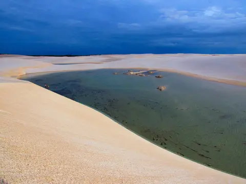
Three Geomorphological and Ecological Details in the Dune Field
- Asymmetric Barchan Dune Slip-Faces: Study sharp crests separating long wind-packed windward ramps from steep soft leeward slip-faces dropping straight into lagoons. Steady coastal winds push these sand waves inland by 4 to 25 metres annually.
- Bio-Coated Lagoon Floors Over Quartz Sand: Peer into clear pools around Lagoa Bonita or Lagoa Azul to spot thin biofilms of brown and green algae and cyanobacteria resting on pure white sand. Combined with sky reflection, these microscopic films shift lagoon shades between emerald and deep turquoise.
- Dormant Wolf Fish Beneath Dried Lakebeds: Walking across crusted dry flats late in the year, remember that burrowing wolf fish wait dormant inside damp subterranean mud below hard mineral crusts until January rains refill every hollow.
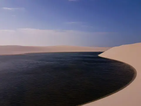
Rainy-Season Lagoon Peaks and Routes From São Luís
Rainwater hydrology shapes travel calendars across Maranhão far more strongly than seasonal temperature shifts. Because 70 percent of the 1,200-millimetre annual rain falls between January and May, lagoons swell through June before solar evaporation lowers pool depth by up to one metre each month. Early dry-season weeks right after June capture full clear pools beneath sunny blue skies, whereas late dry-season months reveal stark dry basins between soaring wind-carved sand ridges.
Allowing two or three days lets travellers split time smoothly between Barreirinhas's classic Lagoa Azul and Lagoa Bonita circuits and quieter coastal trails near Atins or Santo Amaro. Allowing two or three days lets travellers split time smoothly between Barreirinhas's classic Lagoa Azul and Lagoa Bonita circuits and quieter coastal trails near Atins or Santo Amaro. Guided multi-day foot traverses link interior restinga oases Queimada dos Britos and Baixa Grande across endless sand horizons for fit hikers seeking deeper insight into rural park life. Walking between coastal rivers and central dunes reveals how traditional fishing families share seasonal rainwater plains with nesting shorebirds. Respect ICMBio trail rules by packing out every scrap of litter and keeping off fragile restinga vegetation.
Beyond seasonal pool views, visitors observe how wind energy, ocean tides and river quartz build living coastal landscapes continuously. Each June brings distinct shoreline lagoons shaped differently from previous decades as barchans march inexorably southwest across the coastal plain. Watching sunset reflection across rain-filled troughs proves why Brazil elevated this dynamic dune ecosystem into national protection four decades before World Heritage listing.
Travellers generally land at Marechal Cunha Machado International Airport (SLZ) near São Luís, 130 kilometres west of the dunes, before taking coastal coaches or highway transfers east to Barreirinhas or Santo Amaro. Longer Brazilian itineraries connect southeast toward Recife (1,095 kilometres) across northeastern states. Explore other dynamic coastal landscapes worldwide inside our UNESCO World Heritage Atlas.