


























Quick Field Data
- UNESCO Inscription: 1981 · Criteria (vii), (viii)
- Scale & Footprint: 726,927 hectares (7,269.27 square kilometres) across southwestern Santa Cruz Province in Argentine Patagonia, divided between a National Park and a National Reserve
- Access & Ticketing: Managed by the National Parks Administration; the southern Perito Moreno boardwalks and boat excursions from El Calafate charge a park entrance fee, while northern trekking trails radiating from El Chaltén follow regulated mountain routes
- Arrival Logistics: Split into two primary visitor gateways along the eastern Andean flank, with El Calafate serving Lake Argentino in the south and El Chaltén village sitting at the foot of Mount Fitz Roy in the north
Quaternary Glaciation and the Two-Basin Layout
Established as a federal protected area on 11 May 1937 and inscribed on the World Heritage List in 1981, Los Glaciares National Park (Parque Nacional Los Glaciares) spans 726,927 hectares (7,269.27 square kilometres) along the southwestern border of Santa Cruz Province in Argentina. Roughly thirty percent of the protected territory lies buried beneath permanent ice fed by the South Patagonian Ice Field, which represents the largest continental ice cap outside Antarctica, Greenland, and Iceland. This immense Quaternary Period ice sheet nourishes 47 large valley glaciers, 13 of which flow toward the Pacific Ocean while the eastern tongues descend into the Atlantic watershed. Whereas alpine glaciers in other parts of the world originate above 2,500 metres above mean sea level, the sheer mass and high precipitation of the Patagonian ice field force these glaciers to form at just 1,500 metres and slide all the way down to 200 metres above sea level, bringing active ice walls directly into subpolar forest zones.
Spatial orientation within the park is defined by two vast, elongated glacial lakes that collect meltwater from the eastern slopes of the Andes and drain eastward via the Santa Cruz River to Puerto Santa Cruz on the Atlantic coast. In the southern sector lies Lake Argentino, the largest freshwater lake in Argentina, stretching 160 kilometres in length and covering a surface area of 1,466 square kilometres. In the northern sector lies Lake Viedma, which spans 1,100 square kilometres and receives the massive ice tongue of the Viedma Glacier. Separating these two lake basins is a remote, lake-free interior sector known as the Zona Centro, while the southern boundary of the park adjoins Torres del Paine National Park in neighbouring Chilean territory. No roads cross this central divide.
A sharp west-to-east climatic and ecological gradient shapes the terrain between the high granite divide and the eastern lake shores. Rugged granite peaks exceeding 3,000 metres trap moisture-laden winds blowing off the Pacific Ocean, creating heavy snowfall across the upper ice field while releasing cold winds downward across the Argentine slopes. Mean temperatures in the lower valleys range from 0.6 degrees in winter to 13.4 degrees in summer, with an annual average temperature of 7.5 degrees, whereas high-altitude zones average around minus 3 degrees. Annual precipitation drops from 900 millimetres to 500 millimetres across the park zones, creating a narrow, fertile belt of Magellanic subpolar forest composed of lengas, guindos, and ñires situated directly between the descending glaciers and the dry western Patagonian steppe.
Calving Ice Dams, Granite Massifs, and Subpolar Ecology
The southern basin of Lake Argentino centres on three major tidewater glaciers that calve directly into milky grey glacial water: the Perito Moreno Glacier, the Upsala Glacier, and the Spegazzini Glacier, alongside the Onelli Glacier in Onelli Bay. Among these, the Perito Moreno Glacier demonstrates a rare glaciological cause-and-effect cycle that draws glaciologists and travellers from around the world. Advancing eastward from the ice field across a narrow channel of Lake Argentino, the glacier tongue periodically strikes the opposite rock peninsula and seals off the southern arm of the lake (Lago Roca) from the main basin. Deprived of its natural outlet, water in the dammed southern channel rises significantly above the level of Lake Argentino until hydrostatic pressure tunnels beneath the ice barrier, triggering a thunderous structural collapse of the ice bridge that restores equilibrium across the lake.
While Perito Moreno is directly accessible by paved road and viewing boardwalks, the neighbouring Upsala, Spegazzini, and Onelli glaciers occupy deep western fjords of Lake Argentino that can only be reached by excursion boats navigating among floating tabular and igloo icebergs. Although Perito Moreno was long regarded as one of the few stable glaciers in Patagonia, glaciological monitoring documented significant thinning after 2019, reflecting broader climatic pressures across the South Patagonian Ice Field. Together, the southern glaciers act as a continental freshwater reservoir, grinding bedrock into fine rock flour that remains suspended in the water column and gives Lake Argentino its distinctive opaque turquoise-grey hue.
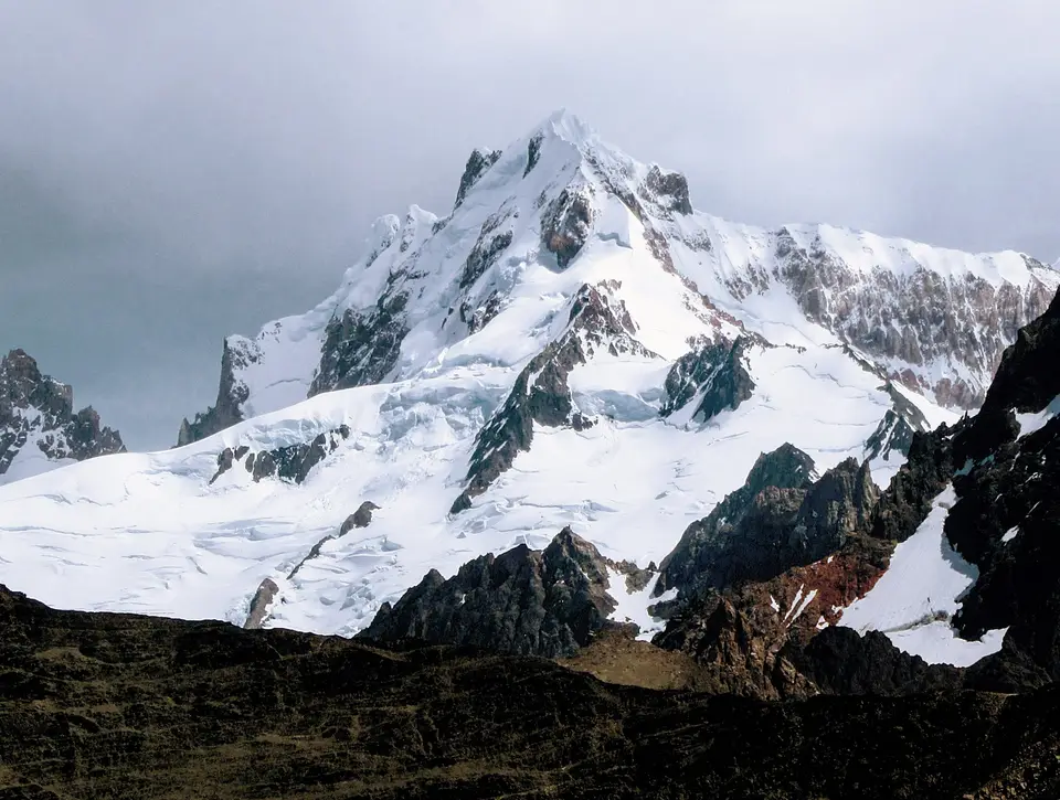
North of the Zona Centro, the park shifts from boat-based glacier viewing to high-alpine mountaineering and foot trails around Lake Viedma and Lago del Desierto. Here, sheer granite plutons rise directly above the Viedma Glacier and surrounding glacial valleys, led by Mount Fitz Roy and the vertical granite needle of Cerro Torre. Exposed to severe Patagonian windstorms and rime ice accumulating from Pacific moisture, these granite towers rank among the most technically demanding climbing peaks in the Andes, while a network of valley footpaths allows trekkers to reach glacial lagoons at their bases without technical gear.
Across both sectors, the juxtaposition of ice, Magellanic subpolar forest, and arid Patagonian steppe supports specialized southern wildlife. Within the sheltered lenga and guindo forests live the endangered huemul deer and the fast-water torrent duck, which dives through glacial rapids. Out on the open steppe east of the forest margin, herds of guanaco graze alongside flightless rheas, cougars, and the endangered South American grey fox, while over 100 bird species including condors and eagles patrol the thermals. Conservation management by the National Parks Administration, which recorded 688,837 visitors in 2023, focuses on protecting these native habitats against historical overgrazing by domestic cattle alongside forest fires and invasive species such as European hares and introduced trout. Protecting the fragile transition between the high Andean ice cap and the Magellanic subpolar forest alongside the dry Patagonian steppe requires strict trail zoning and livestock exclusion across the 600,000 to 726,927 hectares of federal parkland and national reserve.
Planning the Split Gateway Route Across Los Glaciares
Because no internal road crosses the mountainous Zona Centro inside the park boundaries, visiting Los Glaciares requires treating the southern and northern basins as two separate field operations linked by highway through the Patagonian steppe outside the park. Attempting to cover both Lake Argentino and the Mount Fitz Roy trails in a single rushed day is impractical; travellers should divide their stay between the southern lakeshore hub of El Calafate and the northern trekking village of El Chaltén.
Use the following three-part field strategy to sequence the southern ice fronts and northern granite valleys efficiently.
- Base in El Calafate for Perito Moreno and Lake Argentino: Start in the southern gateway city of El Calafate, which sits on the shore of Lake Argentino outside the park boundary and houses the headquarters of the National Parks Administration. Travel westward by road to the Perito Moreno peninsula to walk the multi-level steel balconies facing the advancing ice wall and narrow channel where periodic ruptures occur, or board an excursion vessel on Lake Argentino to navigate through iceberg fields toward the remote ice faces of the Upsala Glacier, Spegazzini Glacier, and Onelli Bay.
- Transfer north to El Chaltén for Mount Fitz Roy and Viedma: From El Calafate, drive north around the eastern perimeter of Lake Argentino and Lake Viedma to reach El Chaltén village, situated inside the northern sector at the foot of Mount Fitz Roy. Unlike the southern glacier overlooks, the northern zone is designed for self-guided day treks and multi-day alpine climbs leading toward the viewpoints beneath Mount Fitz Roy, Cerro Torre, the Viedma Glacier, and the northern watershed at Lago del Desierto.
- Time your visit for summer daylight and southern links: Plan your trip during the warmer southern hemisphere months when mean valley temperatures climb toward 13.4 degrees and daylight hours allow full-day hikes, while carrying windproof layers for sudden subpolar squalls and year-round snowfall on high passes. From Santa Cruz Province, travellers frequently link Los Glaciares southward with neighbouring Torres del Paine National Park in Chilean territory or explore further natural monuments through our UNESCO World Heritage Atlas.
