Quick Field Data
- UNESCO Inscription: 2001 (Ref. 1040), cultural archaeological fortress and Roman siege landscape in southeastern Israel; Criteria (iii) and (iv).
- Scale & Footprint: 276 hectares encompassing the rhomboid 550-by-270-metre summit plateau, surrounding Judaean Desert cliffs, eight legionary siege camps and the western assault ramp.
- Access & Ticketing: Protected as a National Park under the 1978 Antiquities Law and 1998 National Parks Act, managed by the Israel Nature and Parks Authority with the Israel Antiquities Authority; confirm timed cable-car or foot-trail entry online.
- Arrival Logistics: Direct commercial international flights land at Ben Gurion International Airport (TLV), 89 kilometres northwest of Masada, Israel. Queen Alia International Airport (AMM) sits 76 kilometres away across the Jordan Valley, modern Arad lies 20 kilometres west, and regional travel links southeast toward Petra (110 kilometres).
Herodian Cliffside Palaces and Desert Water Engineering
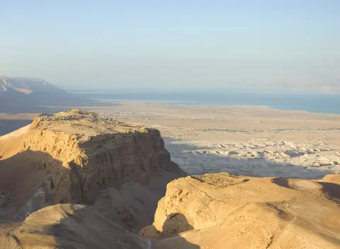
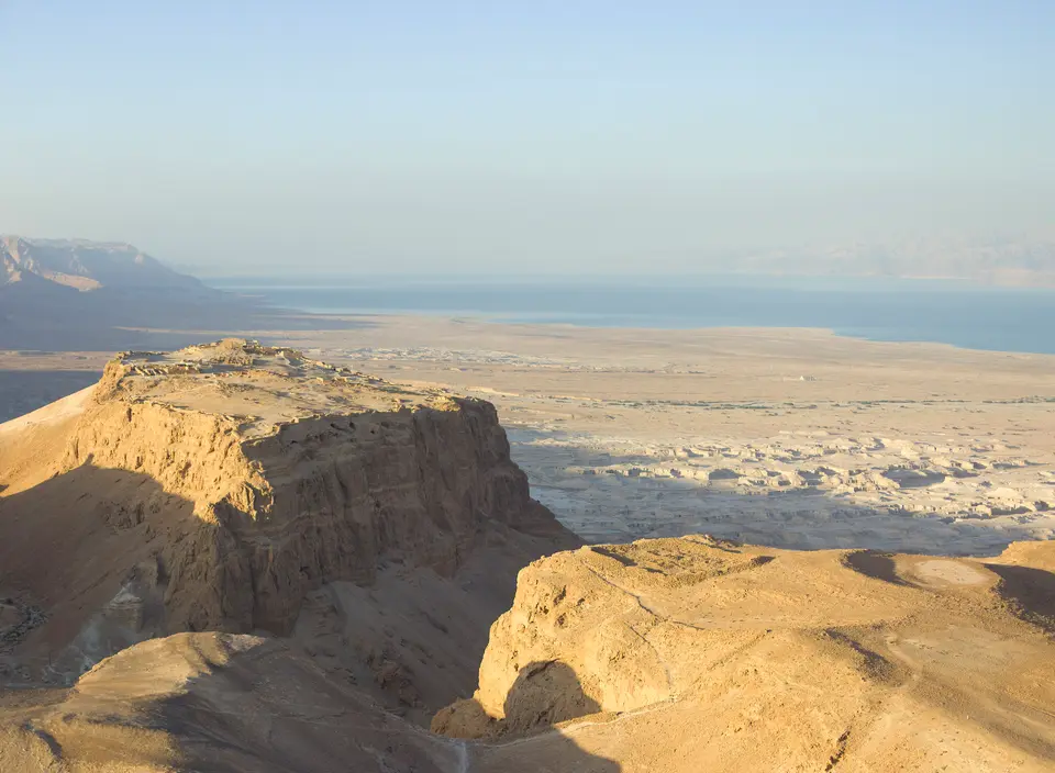
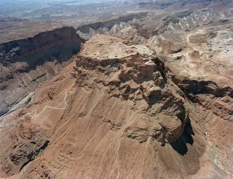
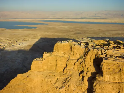
Looming above the western Dead Sea shoreline 20 kilometres east of Arad, the Masada fortress crowns an isolated geological horst rising steeply in sheer limestone cliffs. On its eastern face facing the Dead Sea basin, the cliff plunges more than 400 metres, while the western drop measures roughly 90 metres toward the Judaean Desert plain. Three narrow winding footpaths originally climbed to fortified summit gates atop a flat rhomboid table measuring 550 metres north to south by 270 metres across.
Almost all contemporary historical reporting about Masada comes from first-century Jewish-Roman historian Josephus, supplemented by archaeological texts in the Judean Desert Documents. Josephus records that Hasmonean ruler Alexander Jannaeus initially fortified the height in the first century BC, though excavators have not yet confirmed physical Hasmonean buildings. After Herod the Great captured the plateau during succession turmoil following his father Antipater's death in 43 BC, the summit survived a Parthian-backed siege by the last Hasmonean ruler Antigonus the Second Mattathias. Between 37 and 31 BC, Herod transformed the mesa into a vast fortified refuge in case of domestic revolt, stocking its storehouses with ample long-term provisions.
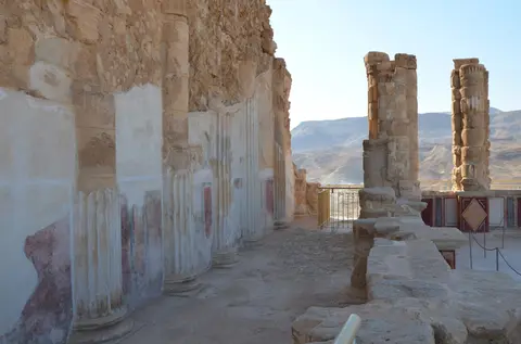
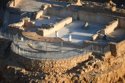
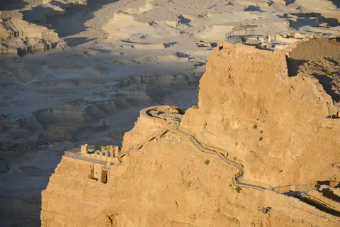
Herod wrapped the entire plateau rim in a 1,300-metre casemate wall standing 4 metres high and reinforced with defensive towers. Inside, military planners set barracks, an armoury, vast storehouses and two elaborate Roman-style palaces. On the western flank stood a large residential palace compound, while across the dramatic northern cliff Herod raised a three-tiered hanging palace stepped down sheer rock ledges with fluted colonnades, frescoed plaster halls, multi-coloured stone mosaics and Roman bathhouses. To sustain 1,000 defenders indefinitely in barren desert terrain, engineers carved rock cisterns holding 40,000 cubic metres two-thirds down the cliffside. Elaborate stone channels diverted seasonal runoff from nearby wadis, capturing enough rainwater during a single storm to sustain a thousand inhabitants for two to three years. Gravity conduits first passed winter flash-flood waters through settling basins before filling rock vaults, supplying multi-room Roman bathhouses, heated floors and residential plunge pools high above the arid Dead Sea valley floor.
The First Jewish-Roman War and Tenth Legion Siege Works
Masada's lasting historical renown centres on the final battle of the First Jewish-Roman War (66 to 73 AD). When Jewish rebels known as the Sicarii seized the Roman summit garrison by ruse in 66 CE, the remote plateau became the last major rebel holdout after Jerusalem fell. Led by Eleazar ben Ya'ir, this radical faction (antagonistic toward the larger Zealot coalition) raided surrounding towns, including Ein Gedi, where Josephus writes 700 women and children died. In 73 AD (or 73 to 74 CE), Roman Judaean governor Lucius Flavius Silva marched into the desert commanding Legio X Fretensis.
Employing auxiliary units and Jewish prisoners of war to field roughly 15,000 personnel, including 8,000 to 9,000 fighting men, Silva enclosed the mountain perimeter with a continuous metre-high stone circumvallation wall linking eight quadrilateral military camps. Across the lower western cliff, Roman engineers raised a 114-metre-high assault ramp. Geological surveys conducted in the early 1990s confirmed earlier observations that this ramp consists mostly of a natural bedrock spur built up over two to three months until a giant battering-ram siege tower breached the summit wall on 16 April 73 AD.
Entering the plateau, Josephus writes (drawing on Roman commander field commentaries) that legionaries found food stores untouched and 960 men, women and children dead by mutual suicide after Eleazar ben Ya'ir delivered two speeches rejecting enslavement. Only two women and five children survived in hiding. Modern archaeology confirms substantial details in Josephus's account, including Roman bathhouses, rock-cut cisterns and floors paved with multi-coloured mosaic stones, yet reveals clear discrepancies too. Excavators uncovered two palaces instead of one, multiple fire scars across separate structures and skeletal remains of at most 28 individuals rather than 960. Still, outside the Northern Palace teams recovered 11 small pottery ostraca bearing single names, including one reading ben Ya'ir and ten others possibly tied to final lots.
Yoram Cave Barley, Marda Monastery and Modern Excavations
After Roman garrisons withdrew, Masada held a small Byzantine monastic community identified by hagiographers as the monastery of Marda in the lives of Saint Sabbas and Saint Euthymius. Because Aramaic marda translates as fortress, the desert complex corresponds closely to the contemporary monastery of Kastellion before dissolving in the sixth century. Harsh climate and isolation kept the summit virtually untouched for more than thirteen centuries until American scholars Edward Robinson and Eli Smith identified Masada in 1838 and missionary Samuel W. Wolcott and English painter W. Tipping made the first modern climb in 1842.
Prehistory adds an unexpected scientific record directly into Masada's sheer southern cliff. High inside nearly inaccessible Yoram Cave, opening 100 metres beneath the plateau and 4 metres above an exposed access ledge, archaeologists uncovered Chalcolithic plant remains containing 6,000-year-old domesticated barley seeds. Yielding the oldest Chalcolithic plant genome ever sequenced, those grains differed markedly from wild varieties while matching cultivated regional barley closely. This proved barley domestication moved early from the northern Upper Jordan Valley after Fertile Crescent origins 10,000 years ago, while researchers speculate Chalcolithic refugees fleeing crisis briefly sheltered inside the cliff cave.
Following initial probes by Shmarya Guttman in 1959, Israeli archaeologist Yigael Yadin led sweeping excavations between 1963 and 1965, publishing a widely read expedition account in 1966. Yadin's teams cleared Herod's palaces, storehouses, columbaria, rebel rooms and an ancient synagogue containing the tithe ostracon ma'aser cohen plus hidden fragments of Deuteronomy and Ezekiel under a back-room floor. Other chambers yielded biblical and liturgical scrolls including Genesis, Leviticus, Psalms, Sirach and Songs of the Sabbath Sacrifice. Designated a National Park in 1966, Masada gained statutory protection under the 1978 Antiquities Law and the 1998 National Parks, Nature Reserves, National Sites and Memorial Sites Law. Surrounded by the Judean Desert Nature Reserve, the site operates under joint Israel Nature and Parks Authority and Israel Antiquities Authority oversight. Current conservation policy prohibits new exploratory research excavations on the summit plateau, permitting only limited digging required for structural repair and maintenance.
Conservation guidelines balance historical readability with minimal intrusion across the exposed plateau. After more than thirteen centuries of desert wind and collapse left buildings buried under rubble until 1960s excavations, restorers practised limited anastylosis while steadily replacing flawed early conservation mortars. Although the modern eastern visitor complex sits nearly out of sight below the plateau, debate continues around the visual footprint of the summit cable-car station. Rigorous site regulations ban all commercial activity and summit picnicking to preserve the bleak desert atmosphere around Herod's walls and the intact Roman siege camps below. Every excavated Roman military camp and the metre-high stone circumvallation wall remain virtually untouched by modern development, safeguarded by the surrounding Judean Desert terrain.
Access Zones From the Eastern Cable Car to Western Siege Camps
An eastern visitor centre opened in 2000 almost invisible from the plateau above. It replaced the 1970s cable car with a gentler gondola designed for 1.25 million annual guests, contrasting sharply with the rugged western Roman siege sector. Both historic pedestrian ascent routes remain walkable for hikers seeking traditional mountain approaches up the cliffs. Walking up the eastern Snake Path demands steady stamina across long sun-exposed switchbacks rising over 400 metres from the Dead Sea side, whereas approaching from Arad lets foot visitors climb the shorter 90-metre western Roman assault ramp directly into the historic wall breach. Together these lower gateways and upper ruins let visitors pair imperial palace engineering with intact Roman military works in a single circuit.
| Complex Zone | Key Highlights | Access & Ticket Rule |
|---|---|---|
| Eastern Visitor Centre & Cable Car | Subterranean visitor hall opened in 2000, Snake Path trailhead and summit gondola. | Managed by the Israel Nature and Parks Authority; cable-car rides and entry require tickets. |
| Northern Palace & Summit Plateau | Three-tiered Herodian hanging palace, synagogue, casemate wall, bathhouse and storehouses. | Pedestrian footpaths cover the plateau; commercial stalls and picnicking are banned atop the summit. |
| Western Siege Ramp & Roman Camps | 114-metre Roman assault ramp, circumvallation wall and Camp F legionary outlines. | Reached by road from Arad; climbing the ramp on foot brings hikers straight to the breach. |
| Herodian Cliff Cisterns & Desert Rim | Rock-cut water reservoirs fed by wadi channels two-thirds down the northwest cliff. | Viewed from cliffside overlooks and perimeter guard towers above steep desert ravines. |
Three Military and Architectural Details on the Masada Plateau
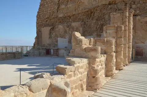
- Black Mortar Lines Separating Ancient Stone From Restoration: Inspect any restored wall inside Herod's bathhouses, storerooms or synagogue to locate the crisp thin black line set into mortar joints. Conservators placed this marker across every repaired wall so visitors distinguish original first-century masonry instantly from modern stabilisation courses.
- Unbroken Geometry of the Roman Circumvallation and Camp F: Look straight west from the casemate wall edge down toward the western desert floor to trace Roman Camp F, the continuous stone siege wall and the sloping 114-metre assault ramp preserved almost untouched since 73 AD.
- Hanging Lower Reception Terrace of the Northern Palace: Descend the cliff staircases at Masada's northern prow to stand on Herod's colonnaded reception terrace. Enclosed once by four-sided porticoes and frescoed stone panels, it balances dramatically above a 400-metre desert drop.
Planning Desert Ascents Across the Dead Sea Basin
Deciding the best time to visit Masada hinges on desert heat along the Dead Sea depression. Late autumn through early spring (November to March) keeps daytime temperatures comfortable for walking across exposed Herodian terraces. In hot summer months, climb the Snake Path or western assault ramp right at first light before fierce midday sun arrives. Even during mild winter mornings, carry ample drinking water, broad sun hats and sturdy treaded shoes because dry canyon winds dehydrate walkers quickly over pale limestone gravel without shade. Begin atop the Northern Palace and Western Palace before cool morning shadows disappear, then trace Camp F and the Roman siege ring from western casemate overlooks. Descending afterward down either the western ramp or eastern cable car completes a clear architectural circuit spanning royal cliff palaces and imperial siege lines.
For travellers considering how to get to Masada and choosing things to do in Masada, the eastern Dead Sea highway serves roughly 750,000 annual visitors 89 kilometres southeast of Ben Gurion International Airport (TLV), while the western road links directly from Arad. Many regional itineraries pair the fortress across the Rift Valley with our guide to Petra (110 kilometres southeast), or browse wider desert monuments in the UNESCO World Heritage Atlas.