





Petra
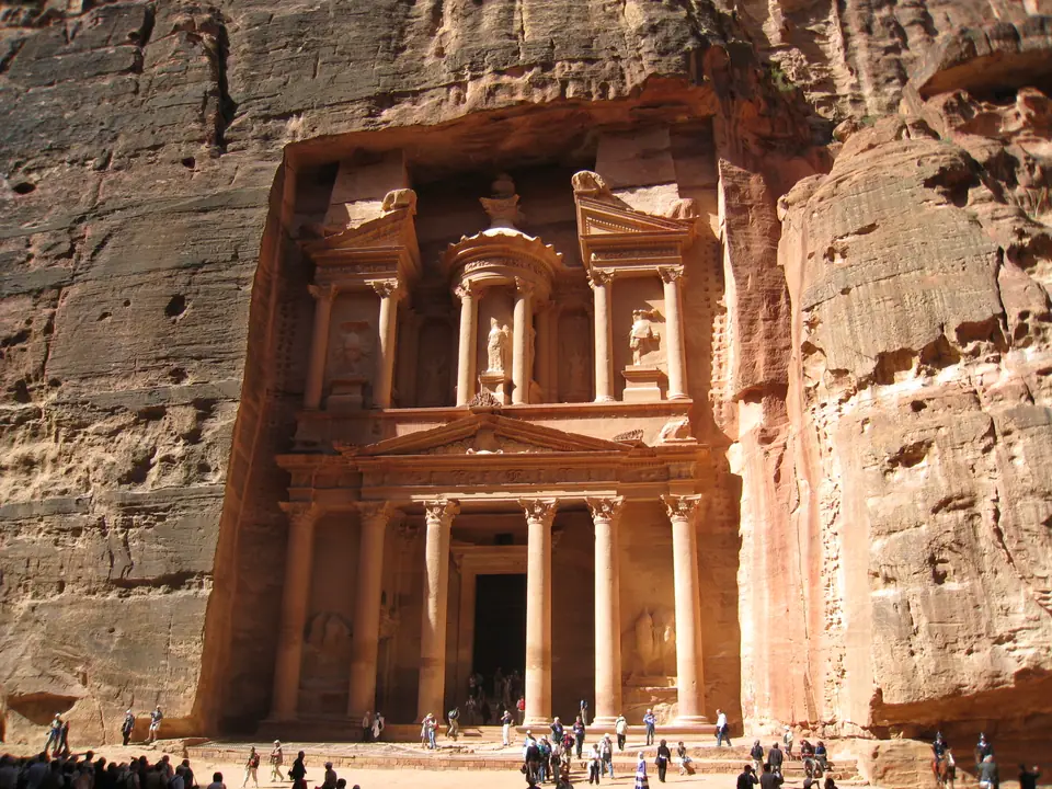
Carved into Palaeozoic rose-red sandstone cliffs between the Dead Sea and the Gulf of Aqaba, UNESCO-listed Petra was the hydraulic and caravan capital of the Nabataean Kingdom, linking the 1.2-kilometre Siq canyon and 39.5-metre Treasury with royal cliff tombs, Roman colonnades, and the 800-step climb to Ad-Deir.
Quick decisions
How many days?
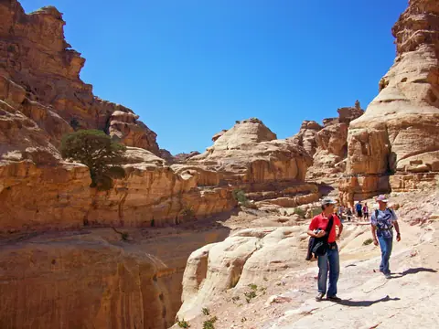
Allow 2 to 3 full days: one day for Bab al-Siq and the 1.2 km Siq canyon, Al-Khazneh (The Treasury), and the Royal Tombs, a second day for the Little Petra Back-Door hike to Ad-Deir, and a third day for the High Place of Sacrifice and Wadi Farasa.
Where should I stay?
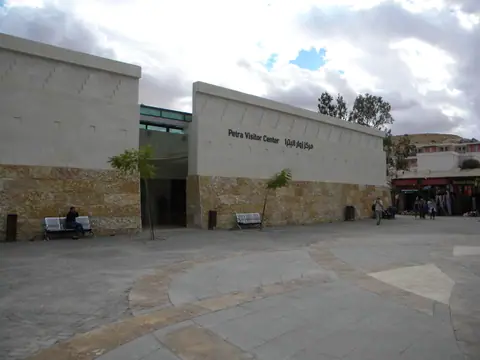
Book a hotel on Lower Tourism Street within 300 metres of the Petra Visitor Center so you can enter the canyon at dawn on foot without climbing the steep 300-metre hill back to Upper Wadi Musa.
Do I need a car?
Inside the 26,171-hectare archaeological park, private motor vehicles are banned; for regional travel, JETT coaches run down Highway 15 from Amman, while a rental car unlocks Route 35 (King's Highway) and Shobak Castle and Wadi Rum.
Best for
Rock-cut Nabataean and Hellenistic facades, ancient desert flash-flood engineering, multi-hour sandstone ridge hikes, Bedouin hospitality, and Jordanian slow-cooked lamb dishes.
Before you go
Buy the official Jordan Pass online before flying if staying at least 3 nights (4 days) in Jordan, and study our field guide to horse, donkey, and viewpoint scams before stepping through the turnstiles.
Getting around
Expect to walk 12 to 18 kilometres per day on stone cobbles and canyon sand; pack lug-soled trail shoes and carry cash if you need the official PDTRA electric club cars.
Continue your trip
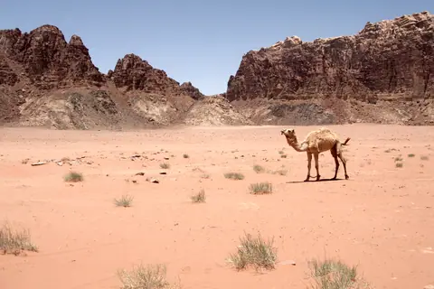
Head 110 kilometres south to Wadi Rum and Aqaba on the Red Sea, or pair Jordan with regional flights to Cairo and Dubai.
Overview
Hidden inside a fault-block mountain basin on the western flank of the Jabal ash-Sharah highlands in southern Jordan's Ma'an Governorate, Petra (known to its ancient builders as Raqmu, pronounced RAHK-moo) is no solitary monument standing in flat sand. Instead, the 26,171-hectare UNESCO World Heritage park (inscribed in 1985 under Reference 326) is a vast, multi-level hydraulic city carved into Cambrian and Ordovician sandstone between 1,100 and 850 metres elevation. From the fourth century BCE until Roman Emperor Trajan annexed the kingdom as Arabia Petraea in 106 CE, the Nabataeans controlled the frankincense, myrrh, and spice caravan routes linking South Arabia with the Mediterranean. By constructing diversion dams, settling tanks, and over 200 kilometres of rock-cut channels and terracotta pipes, they sustained an urban population of 20,000 to 30,000 residents inside an arid canyon gorge.
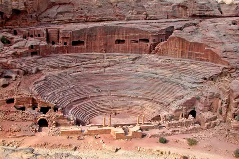
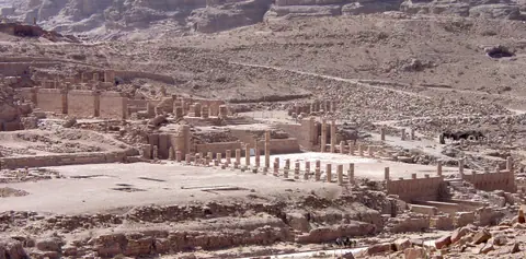
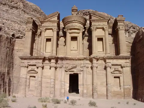
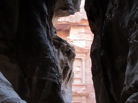
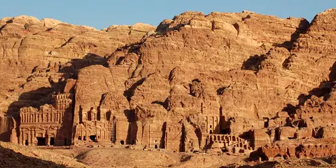
Every visit begins at the Wadi Musa Visitor Center and follows an 8-kilometre round-trip main spine that drops downhill through the Bab al-Siq and the 1.2-kilometre Siq slot canyon to the 39.5-metre facade of Al-Khazneh (The Treasury). Beyond the outer gorge, the canyon widens into the Street of Facades, the 7,000-seat Theater, and the Royal Tombs on the cliff of Jabal al-Khubtha, before reaching the Colonnaded Street, Great Temple, and Qasr al-Bint in the central Basin. From the Basin floor, over 800 rock-cut steps climb northwest to the 45-metre Ad-Deir (The Monastery), while sacrificial staircases ascend to the High Place of Sacrifice and Wadi Farasa.
Getting there
Land at Queen Alia International Airport (AMM) south of Amman (235 km north) or King Hussein International Airport (AQJ) in Aqaba (125 km south), then ride the daily air-conditioned JETT coach down Highway 15 (Desert Highway) in 3 to 3.5 hours directly to the Wadi Musa Visitor Center car park, or drive the scenic mountain switchbacks of Route 35 (King's Highway).
Where to stay
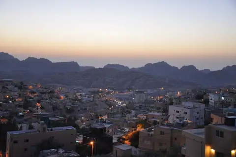
Stay on Lower Tourism Street in Wadi Musa (postal code 71810) at 1,080 metres elevation to walk straight to the Visitor Center gate at sunrise, choose Upper Wadi Musa around the town circle for local bakeries and lower room rates (requiring a taxi back up the 300-metre hill), or sleep in Uum Sayhoun or Taybeh Village.
Things to do
Walk past the Djinn Blocks and hydraulic channels of Bab al-Siq and the Siq, see Al-Khazneh and climb the legal Al-Khubtha Trail and High Place of Sacrifice, inspect the Urn, Silk, Corinthian, and Palace Tombs, tour the Great Temple, Byzantine Church mosaics, Qasr al-Bint, and the JICA Petra Museum, hike from Little Petra (Siq al-Barid) to Ad-Deir, and continue south to Wadi Rum and Aqaba.
Food and drink
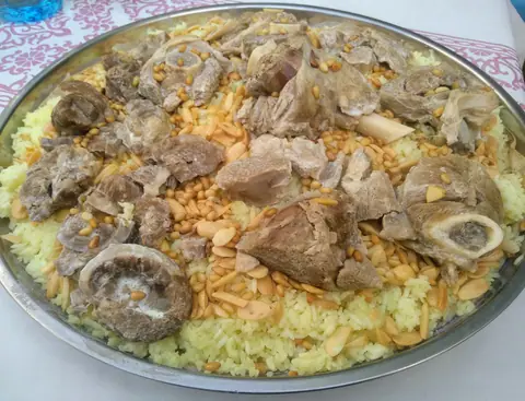
Refuel in Wadi Musa with a platter of Jordanian mansaf (lamb simmered in fermented jameed ewe's-milk yogurt, inscribed by UNESCO in 2022), upside-down spiced rice maqluba, subterranean sand-pit zarb barbecue, warm Nabulsi cheese kunafa, and sweet Bedouin tea infused with desert sage (maramiyya).
Culture
Blending indigenous Nabataean stone-carving traditions (betyl god-blocks and crow-stepped crenellations) with Alexandrian Hellenistic facades, Roman civic engineering, fifth-century Byzantine cathedral conversions, and the living oral heritage of the Bdoul and Ammarin Bedouin tribes, Petra reveals over two millennia of desert resilience.
Weather by month
Petra is warmest in July, with average highs around 33°C, and coldest in January, when nights drop to about 3°C. January is the wettest month, with rain on about 6 days. For mild weather with fewer rainy days, aim for May and October.
| Month | Low | Range | High | Rain | Rainy days |
|---|---|---|---|---|---|
| Jan | 3°C | 13°C | 42 mm | 6 d | |
| Feb | 4°C | 14°C | 42 mm | 6 d | |
| Mar | 6°C | 18°C | 35 mm | 5 d | |
| Apr | 9°C | 22°C | 21 mm | 3 d | |
| May | 13°C | 27°C | 7 mm | 1 d | |
| Jun | 16°C | 31°C | 0 mm | 0 d | |
| Jul | 18°C | 33°C | 0 mm | 0 d | |
| Aug | 18°C | 33°C | 0 mm | 0 d | |
| Sep | 16°C | 30°C | 0 mm | 0 d | |
| Oct | 12°C | 26°C | 14 mm | 2 d | |
| Nov | 8°C | 20°C | 28 mm | 4 d | |
| Dec | 4°C | 14°C | 35 mm | 5 d |
Averages of daily values from 2015 to 2024. Rainy days are days with at least 1 mm of rain. Source: Open-Meteo · Compare destinations by month.
Petra on the map
Every place we cover in Petra. Tap a category or pin to explore.
In-depth Petra guides
Browse the guides grouped by topic: sights, neighbourhoods, food, transport, day trips and trip planning.
Sights, Landmarks & Parks
Key monuments, viewpoints, museums and nature trails.
- Best Things to Do in Petra: The Siq, Treasury, Monastery, High Place & Little PetraExplore the essential monuments and hikes in Petra, from the 1.2 km Siq slot canyon and Al-Khazneh to the Royal Tombs, Qasr al-Bint, Ad-Deir Monastery, and Little Petra.
- Petra 3-Day Itinerary: Main Spine, Little Petra Back-Door Hike & High Place of SacrificeFollow a step-by-step 3-day Petra itinerary that links the Siq, Treasury, Royal Tombs, Al-Khubtha Trail, Little Petra Back-Door hike to Ad-Deir, and High Place of Sacrifice without backtracking.
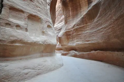
- Bab al-Siq & The Siq Walk: Djinn Blocks, Obelisk Tomb, Dam & Nabataean Water ChannelsWalk the 800-metre Bab al-Siq and 1.2-kilometre Siq canyon in Petra with our guide to the Djinn Blocks, Obelisk Tomb, Nabataean flood dam, terracotta water pipes, and votive niches.
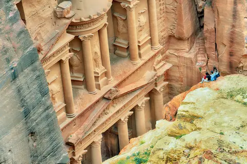
- Al-Khazneh (The Treasury): Architecture, Cliff Viewpoint Scams, Lighting & Crowd TimingExplore Al-Khazneh (The Treasury) in Petra: its 39.5-metre Hellenistic rock-cut facade, newly excavated subterranean tombs, lighting angles, and how to avoid cliff viewpoint and camel scams.
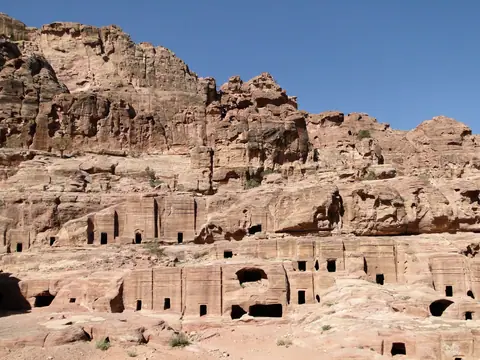
- Street of Facades, Nabataean Theater & The Royal Tombs: Urn, Silk, Corinthian & Palace TombsWalk from the Outer Siq and Street of Facades past the 7,000-seat bedrock Nabataean Theater to the four monumental Royal Tombs carved into Jabal al-Khubtha.
- The Basin Core: Colonnaded Street, Great Temple, Qasr al-Bint, Byzantine Church & Petra MuseumExplore the urban centre of Petra along the Roman Colonnaded Street, including the 7,560 sq m Great Temple, Qasr al-Bint, the Byzantine Church mosaics, and the JICA Petra Museum.
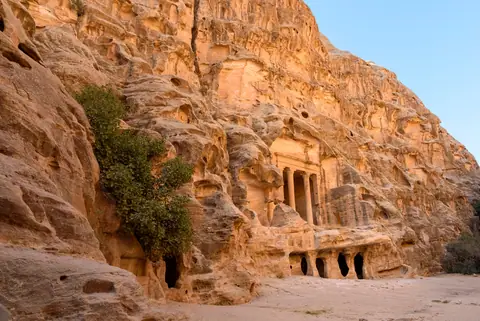
- Ad-Deir (The Monastery) & Little Petra Back-Door Hike: 800 Steps vs 4x4 Shuttle RouteCompare the two routes to Ad-Deir (The Monastery), Petra's largest monument: the 800-step climb from the Basin vs the scenic Back-Door hike from Little Petra (Siq al-Barid), plus how to avoid donkey scams.
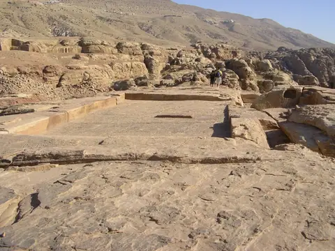
- Elevated Trails of Petra: High Place of Sacrifice (Al-Madbah), Wadi Farasa & Al-KhubthaHike Petra's two finest high-altitude ridge trails: the High Place of Sacrifice (Al-Madbah) and Wadi Farasa loop on the south ridge, and the legal Al-Khubtha Trail to the aerial Treasury viewpoint.
Neighbourhoods & Where to Stay
Districts, historic quarters and the best bases for your stay.
- Petra Orientation: Wadi Musa Layout, Main Trail Spine, Jordan Pass Rules & Field TrapsMaster the physical layout of Petra and Wadi Musa, how the 8 km main trail and elevation drop work, Jordan Pass visa rules, and how to avoid horse, donkey, and viewpoint scams.
- Best Time to Visit Petra: Wadi Musa Climate Normals, Flash Floods, Heat & Crowd StrategyPlan your visit around Jordan Meteorological Department 1991-2020 climate normals for Wadi Musa, winter wadi flash-flood safety, summer canyon heat, and daily crowd waves.
- What to Wear in Petra: Sandstone Canyon Footwear, Sun & Dust Protection & Modest DressPack the right footwear and clothing for Petra: lug-soled trail shoes for polished sandstone steps, desert sun and dust protection, modest local dress, and highland layers.
- Where to Stay in Petra: Lower Tourism Street vs Upper Wadi Musa, Uum Sayhoun & TaybehCompare the four hotel zones around Petra: Lower Tourism Street by the Visitor Center gate, Upper Wadi Musa town, Bedouin Uum Sayhoun, and high-altitude Taybeh Village.
Food & Drink
Local dishes, markets, cafés and dining districts.
Getting Around & Arrival
Airport transfers, public transit, passes and driving rules.
Day Trips & Excursions
Easy half-day and full-day trips from the city.
Reviews
Log in to write a review.
No reviews yet.