Quick Field Data
- UNESCO Inscription: Ref. 1430 · Natural Site · Inscribed 2013 · Criteria (vii), (viii), (ix), (x)
- Scale & Footprint: 3,077,700 hectares (30,777 square kilometres) plus an 899,500-hectare buffer zone wholly inside the 49,768-square-kilometre Namib-Naukluft Park
- Access & Ticketing: Protected conservation estate managed by Namibia for more than 50 years with zero permanent tourist lodges inside UNESCO boundaries; day-entry vehicle permits are issued at Sesriem Gate, so verify rules and permit prices via official Namibian park portals before driving
- Arrival Logistics: 309 kilometres southwest of Windhoek, Namibia's capital and main international air gateway, with tarmac and gravel desert access via Solitaire, Sesriem, Swakopmund, and Walvis Bay
The River, Ocean, and Wind Conveyor Behind the Red Dunes
Running along Namibia's South Atlantic seaboard inside Namib-Naukluft Park, the Namib Sand Sea forms the core dune heart of a hyper-arid coastal desert. Its Khoekhoegowab name (Namib) means vast place or an area where there is nothing. Under its widest definition, the greater Namib Desert stretches more than 2,000 kilometres along the Atlantic from the Carunjamba River in Angola to the Olifants River in South Africa's Western Cape. Along that coastal strip, it climbs inland up to 200 kilometres toward the Great Escarpment. Its northernmost 450-kilometre stretch south from Angola's border is known as the Mocamedes Desert, leading northward into the Kaokoveld and meeting the Kalahari and Karoo semi-deserts south and east. Namibia's main sector between the Uniab River and Luderitz spans roughly 80,950 square kilometres across 1,600 kilometres north to south and 50 to 160 kilometres east to west. Around Walvis Bay, the desert pinches to a hyper-arid 50-kilometre coastal band. Having endured arid or semi-arid conditions for roughly 55 to 80 million years, the Namib ranks with South America's Atacama as the oldest desert on Earth.
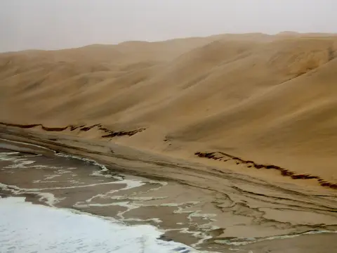
Unlike inland deserts whose dunes weather directly from local bedrock underneath them, the 3,077,700-hectare Namib Sand Sea is engineered by a continent-scale three-part geological conveyor system. Quartz sand grains eroded from southern Africa's interior travel thousands of kilometres westward down the Orange River into the South Atlantic. Powerful cold ocean currents running northward sweep that sand along the coast before strong onshore southerly and westerly winds blow beach grains inland. This process earned the Namib Sand Sea the nickname wind-displaced delta of the Orange River, with smaller seasonal sediment pulses arriving from eastern ephemeral streams. Over deep geological time, that conveyor built two stacked dune architectures: an ancient semi-consolidated and lithified sandstone base overlain by younger active shifting dunes sculpted by daily and seasonal wind reversals.
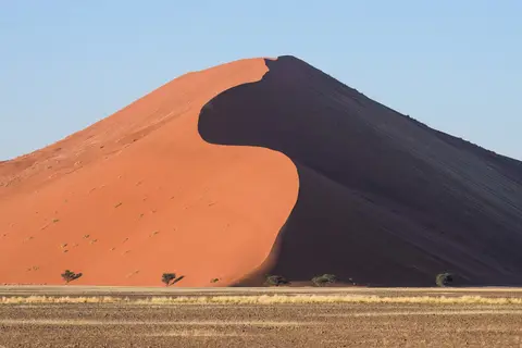
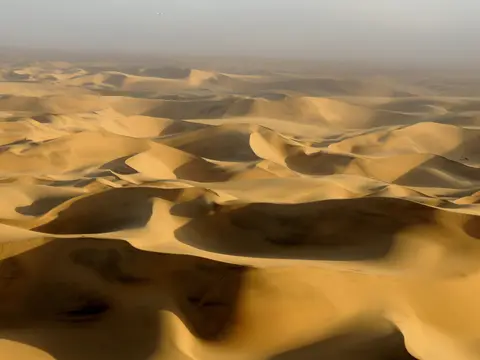
Across the roughly 32,000-square-kilometre southern sand sea between the Koichab and Kuiseb rivers, dunes tower among the highest on Earth (second globally only to China's Badain Jaran Desert). Many crests surpass 200 to 300 metres high and stretch 32 kilometres long, glowing progressively deeper pink, vivid orange, and rusty red with age as iron coatings on quartz grains oxidise over millennia. Around Sossusvlei, Big Daddy rises roughly 325 metres (300 to 400 metres across adjacent basin measurements), facing the neighbouring giant dune nicknamed Big Mama. Completely distinct from Dune 7 near Walvis Bay, roadside Dune 45 stands 80 metres tall out of sands dated to 5 million years ago.
Fog Beetles, Camelthorn Skeletons, and Fairy Circles
Rainwater barely wets the Namib Sand Sea. Hot dry air descending out of the tropical Hadley cell collides offshore with chilled waters of the northbound Benguela Current, trapping moisture below an atmospheric inversion. Meanwhile, Atlantic winds lose eastern humidity over the Drakensberg before reaching the escarpment. Total rainfall drops below 10 millimetres across western belts, averaging just 2 to 5 millimetres near the coast versus 85 to 200 millimetres at the eastern escarpment. Rare interruptions occur roughly mid-decade during Benguela El Nino surges, catalogued by researcher L. V. Shannon and recorded at Gobabeb Desert Research Station in 1974, 1986, 1994, 1995, and 2006. Coastal air remains cool and steady between 9 and 20 degrees Celsius under more than 180 days of dense ocean fog a year. That fog is famed for stranding over a thousand ships along the Skeleton Coast, including the Eduard Bolen wreck now resting 400 metres inland as shifting dunes reclaim coastline. Inland Sossusvlei averages 24 degrees Celsius with winter night lows near 10 degrees Celsius and summer daytime heat surpassing 40 to 45 degrees Celsius.
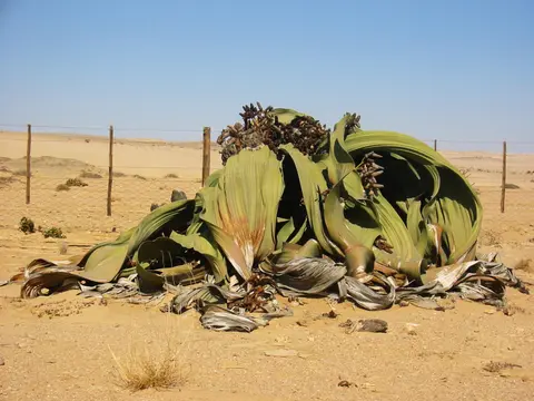
That daily Atlantic fog bank supplies the primary freshwater lifeline driving extraordinary evolutionary specialisation across endemic desert plants and animals. Endemic darkling fog beetles evolved divergent harvesting techniques: Onymacris unguicularis climbs dune crests before dawn and tilts its body into incoming mist so droplets condense across smooth wing covers and roll straight to its mouth. By contrast, Lepidochora discoidalis excavates perpendicular sand trenches and ridges to trap drifting fog moisture, helped by specialised microscopic bumps across its back. Farther north around the rocky Moon Valley and Welwitschia Plains between Sossusvlei and the Swakop River (near the Husab uranium mine), the ancient shrub-like Welwitschia mirabilis survives well over a millennium. Drawing solely from fog condensation, it grows two continuous, wind-twisted strap-shaped leaves from a flat concave disc taproot. Lichens and succulents thrive along coastal beaches, with mountain zebras, grasses, and shrubs inland near Namib-Naukluft escarpments. Farther north toward the Skeleton Coast live brown fur seals, shorebirds, elephants, rhinos, and desert lions.
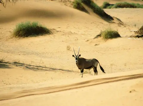
Larger desert wildlife navigates heat and scarce surface moisture just as resourcefully. Gemsboks (South African oryxes) can safely raise body core temperatures up to 40 degrees Celsius during scorching afternoons to avoid sweating away water, sharing gravel plains and ephemeral washes with springboks, ostriches, meerkats, and black-backed jackals that lick morning dew off cool stones. Across arid grasslands near Wolwedans and inner park margins, mysterious barren discs called fairy circles measure 2 to 12 metres across, each framed by a stimulated collar of tall desert grass. Before the 20th century, San hunters gathered tsamma melons for water across these flats, while Topnaar Nama herders along the Kuiseb River and Ovahimba and Obatjimba Herero pastoralists farther north still navigate sparse desert waterholes today, bordering Karakul sheep ranches raised on southern grassy steppes.
Two Dune Ages and Ephemeral Pan Hydrology at Sossusvlei
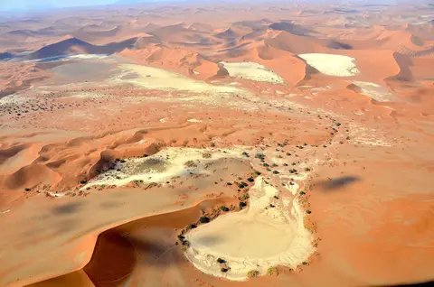
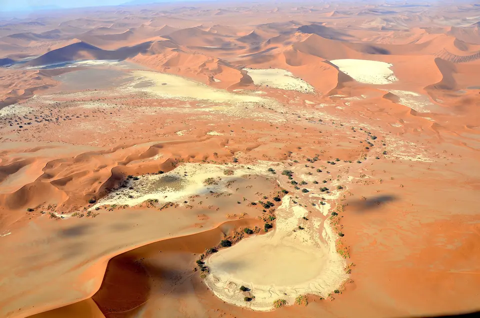
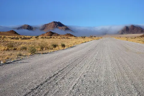
Almost no surface streams survive crossing the sand sea. Every river between the Cunene and Orange rivers runs ephemerally after summer highland storms, draining underground or stalling in blind endorheic clay basins (only the Swakop and Omaruru occasionally break through to the Atlantic). Around Sossusvlei, named from Nama sossus (dead end or no return) and Afrikaans vlei (marsh), seasonal summer floods down the Tsauchab River hit an impenetrable wall of towering dunes 66 kilometres west of Sesriem Gate. Floodwaters pool rarely into shallow white salt-crusted pans that may wait several years between flood events.
Two kilometres from Sossusvlei lies Deadvlei (Afrikaans Dooie Vlei, meaning dead marsh rather than dead valley). Centuries ago, heavy Tsauchab floods nourished a lush shallow oasis supporting tall camelthorn trees (Vachellia erioloba). As shifting dunes eventually sealed the river channel off from the basin, trees died roughly 600 to 700 years ago (circa 1340 to 1430), leaving sun-scorched blackened trunks standing upright against blinding white clay and vivid orange sand because hyper-arid air prevents wood decay. Only hardy clumps of nara and salsola scrub persist on Deadvlei's crust today, sustained by nocturnal sea fog.
Conservation boundaries shield these fragile dunes from permanent hotels and mining threats. The Namib Sand Sea lies within Namib-Naukluft Park, originally protected in part as a buffer around the diamond-restricted Sperrgebiet to the south near the mouth of the Orange River. Tungsten and salt mining belts lie farther across the wider desert. For over 50 years, formal conservation management has kept permanent buildings and asphalt out of the core UNESCO boundary itself. Visitor facilities cluster instead along park gateways at Sesriem and Solitaire, on private ranches outside park fences, and in coastal hubs at Walvis Bay, Swakopmund, and Luderitz. Built in the early 2000s, the 60-kilometre asphalt highway connecting Sesriem Gate to Sossusvlei's 2x4 parking lot ranks among the very few non-urban metalled roads anywhere in Namibia. It passes Elim Dune 5 kilometres inside the gate (named after an older farm prior to park establishment) and Dune 45 at 45 kilometres, with quiet Hiddenvlei lying 4 kilometres on foot from 2x4 parking. Small scenic planes launch from Swakopmund and Walvis Bay, while hot-air balloons lift off near Sesriem at dawn. Long-term planning focuses on precluding mineral exploration rights while accommodating rising tourism cleanly across fragile desert trails. Dry atmospheric clarity yields sharp daylight views across distant inselbergs, gravel plains, coastal playas, and dark southern hemisphere night skies free of urban glare. Potential future serial extensions could also link dune fields inside Namib-Naukluft Park with adjacent protected coastal desert zones stretching across Namibia's borderlands, safeguarding the full wind-swept transition from South Atlantic beaches up toward the Great Escarpment. Visitors driving between Swakopmund, Walvis Bay, Solitaire, and Sesriem should check local desert park notices before setting out and carry generous drinking water and fuel reserves across isolated gravel roads. Keep in mind that Big Daddy beside Deadvlei stands roughly 325 metres tall, separate from Dune 7 near coastal Walvis Bay.
Visitor Corridors Within Namib-Naukluft Park
Because core UNESCO sectors contain zero permanent tourist infrastructure, visitor traffic concentrates neatly along the single 66-kilometre Tsauchab river corridor entering from Sesriem Gate.
| Complex Zone | Key Highlights | Access & Ticket Rule |
|---|---|---|
| Sesriem Gate to 2x4 Parking (60 km Tarmac) | Sesriem settlement, Elim Dune (5 km past gate), and 80-metre-tall Dune 45 (45 km past gate) | Park entry permits paid at Sesriem Gate; paved asphalt road accommodates standard passenger cars cleanly to the 60-km lot |
| Sossusvlei & Deadvlei Clay Pans | Final 6-kilometre deep sand track, 325-metre Big Daddy dune, Big Mama, and blackened camelthorns of Deadvlei | Strictly limited to high-clearance 4WD vehicles or authorised park shuttles departing from 2x4 parking; walking tracks enter Deadvlei on foot |
| Hiddenvlei & Tsauchab Side Basins | Isolated white salt pan located 4 kilometres from 2x4 parking with far lighter foot traffic | Accessed purely on foot along flagged desert paths across dry sand; carry full water and sun protection |
| Unmarked Inner Dune Wilderness | Active shifting star dunes, coastal fog lagoons, lithified sandstone outcrops, and fog-beetle habitats | Closed to off-road driving and unpermitted camping to keep wind-sculpted ridges undisturbed |
Three Natural Formations to Examine Around Sesriem
Travelling down the Tsauchab Valley from Sesriem Gate into Deadvlei puts three physical proofs of Namib geology directly underfoot.
- Dune Colour Shifts From Coast to Interior: Compare pale golden sands near coastal Swakopmund and Walvis Bay against deep rusty-orange slipfaces at Dune 45 and Big Daddy. Longer atmospheric exposure inland oxidises thin iron skins around individual quartz grains, turning 5-million-year-old eastern dunes intensely crimson.
- Lithified Sandstone Outcrops Beneath Loose Sand: Around valley margins and Sossusvlei ledges, spot flat-bedded stone pavements protruding from dune bases. These lithified dunes represent an older fossilised sand sea cemented underground long before modern shifting star dunes piled above them.
- Sun-Scorched Camelthorn Wood at Deadvlei: Inspect the smooth, jet-black trunks standing on Deadvlei's cracked white clay floor. Unlike petrified stone wood, these 600-to-700-year-old trees remain genuine timber preserved purely because dry desert air suppresses fungal rot.
Arrive at Sesriem Gate for early-morning shadow contrast along dune spines before midday sand heat builds past 40 degrees Celsius, keeping in mind wind-driven morning fog along Atlantic coast towns. Pair Namibian dune fields with highland capital planning via our Windhoek travel guide or explore additional arid World Heritage reserves inside the UNESCO World Heritage Atlas.