Quick Field Data
- UNESCO Inscription: 2011 (Ref. 1369), natural marine and terrestrial reserve in Western Australia; Criteria (vii) and (x).
- Scale & Footprint: 705,015 hectares (604,500 hectares in early nomination counts; 7,050 square kilometres) spanning the 260-kilometre Ningaloo Reef, Cape Range National Park, Jurabi and Bundegi coastal parks and Muiron Islands.
- Access & Ticketing: Protected under Australia's Environment Protection and Biodiversity Conservation Act 1999 (EPBC); check Western Australia Parks and Wildlife notices for park passes and wildlife zoning rules.
- Arrival Logistics: Direct commercial regional flights land at Learmonth Airport (LEA), 37 kilometres northeast near Exmouth, connecting along coastal highways roughly 1,200 kilometres south to Perth.
Cape Range Karst Conduits and Australia's Longest Fringing Reef
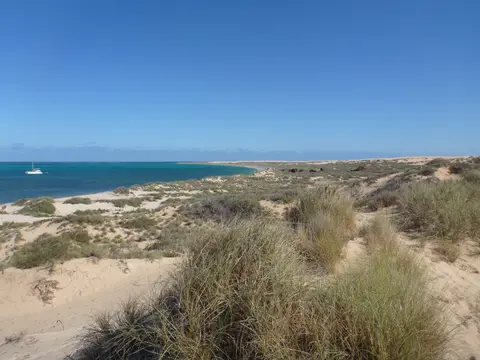
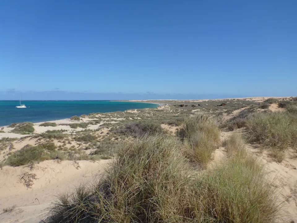
Stretching 260 kilometres (160 miles) along Western Australia's remote northwest peninsula, the Ningaloo Coast sets Australia's largest fringing coral reef directly against an arid desert shoreline. Unlike distant barrier reefs lying hours offshore, living coral colonies at bays such as Coral Bay begin less than 500 metres (1,600 feet) from sandy beaches. Situated roughly 1,200 kilometres (750 miles) north of Perth across 705,015 hectares (1,742,130 acres), this continuous reserve spans tropical ocean to dry spinifex ridges. Its coastal waters integrate coral lagoons, outer reef crests, deep open ocean, continental shelf slopes, rocky intertidal shelves, sandy beaches, estuaries and mangroves.
Long before European surveys, Yamatji traditional owners of the Baiyungu and Yinigudura peoples harvested coastal reefs and seasonal springs along this peninsula. The name ningaloo derives from the Wajarri word meaning promontory, deep water or high land jutting into the sea. Immediately landward of the living reef rises the rugged limestone massif of Cape Range, exposing uplifted ancient fossil reef rocks that form a geological twin to the living coral shelf offshore.
Beneath that dry spinifex landscape hides an extensive subterranean karst system carved by hundreds of limestone caves, surface dolines and underground groundwater streams. Because flooded aquifers connect inland rocks toward coastal lagoons, scientists record Australia's highest diversity of troglomorphic cave fauna here, ranking among the richest subterranean faunas worldwide. Blind aquatic invertebrates share these dark flooded caverns with tiny relict rainforest fauna sheltered underground from wetter geological ages, creating a rare species mix largely absent elsewhere across the Southern Hemisphere.
Designated initially as Ningaloo Marine Park in 1987, the coast gained placement on the Australian National Heritage List on 6 January 2010 before UNESCO inscribed the 705,015-hectare reserve in 2011. Its boundaries integrate Commonwealth and State waters of Ningaloo Marine Park, the North and South Muiron Islands Marine Management Area, Cape Farquhar, Bundegi and Jurabi coastal parks, Cape Range National Park and the Learmonth Air Weapons Range. Although no formal outer buffer boundary surrounds the line, Australia's federal Environment Protection and Biodiversity Conservation Act 1999 (EPBC) requires environmental assessments on external proposals affecting heritage values, acting legally as an outer buffer.
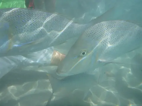
Whale Shark Aggregations, Sea Turtles, and Subterranean Relicts
Sitting squarely across the ecological ecotone where warm tropical northern currents meet cooler temperate southern waters drives intense biological richness. Scientific inventories catalogue more than 300 documented coral species, between 500 and over 700 reef fish species, roughly 600 to 650 mollusc species, around 600 crustaceans and more than 1,000 marine algae species. During 2006 surveys, researchers from the Australian Institute of Marine Science mapped deep-water sponge gardens containing 155 sponge species and 25 new echinoderms, while biologists rediscovered the short-nosed sea snake on Ningaloo Reef in December 2015 after 17 years presumed extinct.
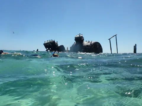
Seasonal ocean upwellings trigger Ningaloo Reef's signature biological convergence between March and August. Coinciding with mass coral spawning events and localized plankton blooms, an estimated 300 to 500 whale sharks (Rhincodon typus) congregate along the reef front to feed. This annual gathering represents the largest documented whale shark aggregation known anywhere on Earth, turning northwest Western Australia into a flagship study ground for filter-feeding ocean megafauna.
Complex food webs support these giant ocean visitors every season without depleting lagoon coral reefs. Nutrient upwellings pulse across the continental slope just outside the reef crest while coral spawning releases massive biological energy into nearshore waters. Protected sanctuary zoning ensures licensed wildlife swimmers follow strict distance protocols around passing sharks, keeping marine feeding cycles undisturbed.
Cooler winter months draw steady coastal migrations of humpback whales, seagrass-foraging dugongs, giant manta rays and resident dolphins cruising past lagoon passes. Along undisturbed sandy beaches on both mainland dunes and the Muiron Islands, loggerhead, green and hawksbill turtles crawl ashore to lay an estimated 10,000 nests annually, depending directly on nearby reefs for shelter and foraging. Above high-water marks, arid Cape Range drylands remain globally important for endemic reptiles, birds and vascular plants adapted to severe coastal heat.
Offshore depth zones widen this coastal diversity far beyond sunlit snorkelling lagoons. Beyond the shallow fringing reef crest, continental shelf drops descend rapidly toward deep ocean trenches where the 2006 deep-water sponge gardens thrive unseen from shore. Meanwhile, shallow nearshore estuaries, sandy intertidal flats and coastal mangroves shelter juvenile fish and shorebirds inside protected sanctuary pockets across the entire 260-kilometre stretch. Protecting both North and South Muiron Islands keeps offshore coral formations and secluded turtle nesting beaches connected directly to mainland reef waters.
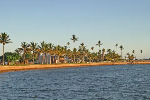
Traditional Yamatji Stewardship, Mauds Landing, and Thermal Bleaching
Keeping 705,015 hectares ecologically intact roughly 1,200 kilometres north of Perth demanded determined civic campaigns during early 2000s coastal controversies. When developers proposed building a major resort and marina at Mauds Landing, conservationists warned construction would destroy key loggerhead turtle nesting grounds and degrade marine park water quality. Local author Tim Winton voiced fierce opposition, donating his 2002 Western Australian Premier's Book Award prize to the community effort that defeated the resort before writing and narrating the 2023 ABC documentary series Ningaloo Nyinggulu.
Collaborative science expanded management planning between 2006 and 2011 through the CSIRO Ningaloo Collaboration Cluster, part of the flagship Collaboration Fund Research Initiative. Uniting CSIRO and the Sustainable Tourism Cooperative Research Centre with Curtin University, Murdoch University, the University of Western Australia, Australian National University and the University of Queensland, the project built integrated models linking human tourism pressures with reef ecology. Today, roughly 200,000 visitors arrive annually according to 2025 estimates, straining fragile arid coastal facilities.
Rising visitor arrivals expand water demand across remote towns where groundwater abstraction risks draining submerged karst habitats critical to troglomorphic cave species. Park rangers also balance recreation against vegetation trampling, illegal fishing, waste disposal, pastoral grazing leases, traditional indigenous fire regimes and invasive foxes, cats, goats and weeds on land plus invasive marine organisms. Additional risks sit inside Defence-owned land holding the ancient reef-complex and Bundera sinkhole inside Learmonth Air Weapons Range, an active bombing range until around 1990.
Ocean warming and industrial proximity add long-term ecological challenges across this isolated peninsula. Because the 260-kilometre coastline lies far from major cities, potential offshore hydrocarbon extraction nearby demands rigorous emergency spill preparedness and well-funded ranger patrols. Meanwhile, marine heatwaves hit Ningaloo Reef with coral bleaching events in 2011 and again in 2025, even though high ecological resilience has helped recovery compared with heavily polluted coastlines. Ongoing co-management through the Ningaloo Coast World Heritage Advisory Committee linking Baiyungu and Yinigudura traditional owners, local councils and marine scientists remains vital.
Balancing visitor access across vast distances requires sustained funding, active ranger staffing and strict fishery patrols from Cape Farquhar north to the Muiron Islands. Negotiating native title arrangements and pastoral lease guidelines respectfully helps protect coastal dunes and arid plains outside town borders. Active fire management historically practised by indigenous peoples also informs dryland vegetation stewardship across Cape Range canyons. Combined with continuous groundwater monitoring across Exmouth and Coral Bay, cooperative management preserves both coral reefs offshore and flooded cave faunas inland. Enforcing strict speed limits, mooring zones and anchor-free coral sanctuary areas protects fragile lagoon coral gardens from accidental boat damage across peak tourist seasons. Ongoing scientific partnerships also monitor water temperatures, turtle hatchling survival rates and migratory whale routes across both State and Commonwealth waters. Keeping coastal development low-density shields shallow breeding bays from artificial night-time glare and coastal erosion. Visitor monitoring ensures snorkelling boats and dive groups leave reef structures intact across both shallow lagoons and outer oceanic channels.
Access Zones Along the Ningaloo Reef and Cape Range Coastline
Two gateway towns anchor coastal visits across the 260-kilometre reserve: Exmouth beside northern Cape Range National Park, and Coral Bay along southern shallow lagoons. Check current marine sanctuary zone boundaries before swimming, snorkelling or casting fishing lines from shore.
| Complex Zone | Key Highlights | Access & Ticket Rule |
|---|---|---|
| Cape Range National Park Coast | Turquoise Bay drift waters, Milyering Discovery Centre, Yardie Creek gorge and limestone canyon walking trails. | National park entry permits apply; respect signed sanctuary no-take zones along nearshore coral lagoons. |
| Coral Bay and Southern Lagoon | Shallow coral heads within 500 metres of sandy beaches, sheltered manta habitats and boat ramp excursions. | Public pedestrian beach entry is free; book licensed tour vessels for outer-reef whale shark or manta swims. |
| Jurabi and Bundegi Coastal Parks | Critical loggerhead, green and hawksbill turtle rookeries along Jurabi dunes and calm gulf waters at Bundegi. | Follow strict night-time turtle watching codes and red-light rules during summer nesting and hatching months. |
| Muiron Islands and Cape Farquhar | North and South Muiron Islands marine management zone, deep sponge slopes and remote southern reef cliffs. | Access by permitted boats or remote coastal tracks; no permanent shops, water or visitor lodgings exist on site. |
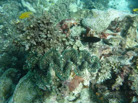
Three Coastal and Ecological Details Across Ningaloo Coast
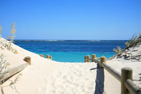
- Nearshore Reef Crest at Coral Bay and Turquoise Bay: Wade straight off pale coastal sand to watch Indian Ocean swells break neatly over coral heads less than 500 metres offshore, keeping inner lagoons calm for swimmers.
- Uplifted Fossil Reef Terraces Inside Cape Range: Driving toward Yardie Creek gorge reveals dry limestone canyon benches formed from ancient Pleistocene coral terraces now lifted high above sea level and hollowed into karst caves.
- Winter Overlap of Reef Turtles and Cetaceans: Look seaward beyond the outer breaker line during cooler mid-year months to watch spouting humpback whales travelling parallel to shallow lagoon meadows grazed by green turtles and dugongs.
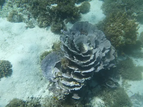
Best Time to Visit Ningaloo Reef for Whale Sharks and Seasonal Weather
Determining the best time to visit Ningaloo Reef for whale sharks tracks directly with the March-to-August feeding pulse following mass coral spawning. Mid-year winter months inside that window also pair whale shark encounters with migrating humpback whales, calmer morning breezes and comfortable daytime warmth, whereas summer peaks bring fierce outback heat and seasonal turtle nesting along dark coastal beaches. The Bureau of Meteorology designates the Ningaloo Coast as its own coastal weather forecast zone, helping vessels track Indian Ocean swells and wind shifts before departing shore.
Travellers reach Ningaloo Reef in Western Australia by flying regionally from Perth into Learmonth Airport (LEA), 37 kilometres northeast near Exmouth, or by driving the scenic coastal highway roughly 1,200 kilometres north from Perth. Splitting time between Exmouth and Coral Bay works well across three to five unhurried coastal days. Exmouth opens Cape Range gorges, Turquoise Bay and northern whale shark departures, while Coral Bay places shallow fringing coral steps from beachfront paths and boat ramps. Explore other Australian and Indo-Pacific natural reserves in our UNESCO World Heritage Atlas.