Quick Field Data
- UNESCO Inscription: 2015 (Ref. 1466), serial cultural site across Bexar County and adjacent ranchlands in southern Texas; Criterion (ii).
- Scale & Footprint: 300.8 hectares along a 12.4-kilometre stretch of the San Antonio River basin, uniting five frontier compounds plus Rancho de las Cabras ranch 37 kilometres south.
- Access & Ticketing: Four southern sites operate as active Catholic parishes inside the federal historical park, while downtown's Alamo follows Texas General Land Office entry rules checked online.
- Arrival Logistics: Direct commercial air travel arrives at San Antonio International Airport (SAT), 24 kilometres north of the southern river corridor. Austin Bergstrom International Airport (AUS) sits 122 kilometres northeast near Austin (124 kilometres).
Spanish Frontier Settlement Along the San Antonio River
Stretching along a 12.4-kilometre green corridor of the San Antonio River basin in southern Texas, these five Spanish frontier compounds mark New Spain's eighteenth-century northern border. Early East Texas outposts founded in 1690 and 1716 suffered extreme isolation, lying over 400 miles (644 kilometres) from Spain's nearest settlement at San Juan Bautista in Coahuila. To anchor a mid-route supply waystation, governor Martín de Alarcón led an expedition in April 1718 and founded Misión San Antonio de Valero on 1 May 1718 in a preserved charter entrusted to Father Antonio de San Buenaventura y Olivares. Two kilometres north he built Presidio San Antonio de Béxar and the civilian town that grew into modern San Antonio.
Within two decades, Franciscan missionaries raised a fortified defensive line spaced less than five kilometres apart along fertile river terraces. Mission San José y San Miguel de Aguayo opened in 1720 under Father Antonio Margil, joined in 1731 by three East Texas complexes relocated to the river: Mission Concepción, Mission San Juan Capistrano and Mission Espada. Surrounded by thick perimeter walls against Apache and Comanche raids, each walled compound held stone churches, convento residences, granaries, textile rooms, lime kilns, wells and outlying grazing grounds such as Rancho de las Cabras, located 22 miles southeast. Rather than isolated chapels, these fortified quadrangles operated as self-contained agrarian towns where indigenous families, friars and soldiers shared daily craft workshops, stone building yards and defensive duties under one courtyard plan.
Inside one generation, nomadic Coahuiltecan hunter-gatherers transitioned into settled farmers, builders and artisans, forging a shared Spanish-indigenous identity that outlasted Spanish secularisation. Skilled Coahuiltecan masons merged local limestone construction methods with Spanish colonial church geometry, carving doorways, domes and belfries that anchored community life long after royal garrisons withdrew. Originally grouped in 1975 across 84 historical river sites as the Mission Parkway, San Antonio Missions National Historical Park was authorised on 10 November 1978, established on 1 April 1983 and expanded by 137 acres in fiscal year 2015. Inscribed on the World Heritage List on 5 July 2015 together with the Alamo, the federal park appeared on the US Mint's 2019 America the Beautiful commemorative quarter.
Five Mission Compounds From the Alamo to Mission Espada
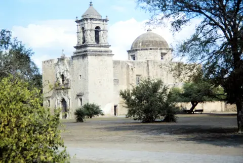
Travellers asking how many San Antonio missions are there trace five distinct complexes ordered cleanly from north to south. Upstream in Alamo Plaza stands Misión San Antonio de Valero, known everywhere as the Alamo. Its name came either from cottonwood trees (álamo) nearby or from the Second Flying Company of San Carlos de Parras from Álamo de Parras garrisoned there in 1803. Within a year, the outpost moved to the river's western bank. Relocated again opposite La Villita after a 1724 hurricane, Valero supported 328 indigenous residents by 1756, grazing 2,000 cattle and 1,300 sheep while harvesting 2,000 bushels of corn, 100 bushels of beans and cotton annually. When 300 Apaches surrounded the presidio in 1745, a hundred converts repelled the raid to save town and garrison. Thick 8-foot perimeter walls 2 feet deep enclosed a 480-by-160-foot courtyard holding 30 adobe buildings by 1758, backed by a three-cannon turret in 1762 and a one-pounder rampart gun by 1793.
Construction on a permanent cruciform stone chapel began in 1758 after an earlier 1744 church and sacristy collapsed. Cut from 4-foot limestone blocks quarried near today's San Antonio Zoo, it was designed for three storeys beneath a dome and twin towers. Facade niches framed statues of Saint Francis, Saint Dominic, Saint Clare and Saint Margaret of Cortona, though only two roofless storeys finished. Secularised in 1793 with just 12 converts remaining after Teodoro de Croix's 1778 livestock ruling claimed unbranded cattle for Spain, the compound served as a political prison and San Antonio's first hospital from 1806 to 1812. Naturalist Jean Louis Berlandier admired its ornate limestone portals in 1828. In December 1835, Mexican General Martín Perfecto de Cos surrendered the fort after the two-month Siege of Béxar, having demolished four unfinished dome arches to build an artillery ramp and leaving 19 cannons including a 16-pounder.
Commanding 100 men initially, Colonel James C. Neill and engineer Green B. Jameson mounted Cos's captured cannons along the perimeter walls until General Sam Houston sent reinforcement volunteers. Texian defenders including James Bowie and Davy Crockett died fighting at the Battle of the Alamo on 6 March 1836 as retreating Mexican troops dismantled sections of outer wall. Rented later as a US Army quartermaster depot from 1849 until Fort Sam Houston opened in 1876, remaining wings operated as a wholesale grocery store until 1905. That year Adina Emilia De Zavala and Clara Driscoll led state acquisition, placing the Alamo under Daughters of the Republic of Texas care until custody passed to the Texas General Land Office in 2015.
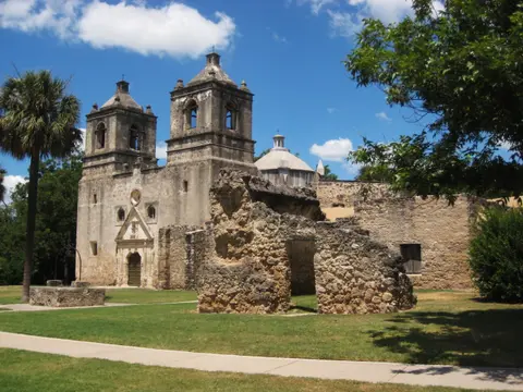
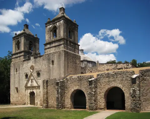
Downstream begins the federal historical park, protecting four active Archdiocese parishes plus the 1964 National Historic Landmark Espada Aqueduct and the 2001-listed Ethel Wilson Harris House. First at 807 Mission Road stands Mission Nuestra Señora de la Purísima Concepción de Acuña, moved in 1731 from East Texas's 1716 Mission de los Hainais. Designated a National Historic Landmark on 15 April 1970 as Texas's best-preserved colonial church, its twin towers and frescoed sanctuary underwent six months of interior restoration completed in March 2010 under Father Jim Rutkowski, appointed in 2002 by Archbishop Patrick Flores. Further south at 6519 San Jose Drive rises Mission San José y San Miguel de Aguayo, founded in 1720 and designated a National Historic Site in 1941, anchoring the park's main visitor centre beside its 1768 church. Downstream follow Mission San Juan Capistrano (moved in 1731 from 1716 San Jose de los Nazonis and National Register-listed in 1972) and Mission San Francisco de la Espada, founded in 1690 as San Francisco de los Tejas and renamed in 1721 before moving in 1731.
Acequia Irrigation, Secularisation and Shared Management
Gravity irrigation turned dry south Texas scrubland into reliable orchards and cornfields across all five riverfront enclaves. Coahuiltecan masons and Franciscan friars built stone diversion dams on the San Antonio River feeding stone-lined irrigation canals (acequias) into mission fields and cisterns. West of Mission San Juan, the arched limestone piers of the Espada Aqueduct still carry river water across Piedras Creek exactly as engineered in the eighteenth century. Seeing live river water flowing over colonial stone arches today clarifies how fragile frontier survival depended on careful civil hydrology before pumping machinery arrived.
Spanish secularisation divided farmland among surviving resident families beginning in 1793, ending royal subsidies while leaving deep community identity intact across Mexican independence in 1821 and modern city expansion. Although nineteenth- and twentieth-century additions appear at several compounds, original colonial strata remain clearly legible across stone churches and courtyard footings, with Espada, San Juan and Rancho de las Cabras retaining quiet rural settings. Protected by federal acts, Texas Antiquities Landmark rules and City of San Antonio heritage ordinances with advance design review by the Texas Historical Commission, nine distinct property owners coordinate management through a 2012 advisory committee defending riverfront buffer views against high-rise downtown encroachment.
Access Zones Along the Five-Mission River Corridor
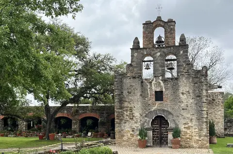
Completed in October 2013, the Mission Reach Ecosystem Restoration and Recreation project connected all four southern sites across 15 miles of riverside walking, bicycling and paddling paths linking straight to downtown's River Walk. Visitors comparing these four southern compounds trace sharp architectural contrasts south of Alamo Plaza. Mission Concepción preserves twin limestone bell towers and vaulted stone interiors. Mission San José displays a monumental sculpted portal inside complete quadrangle walls, whereas Mission San Juan retains a modest triple-bell stone belfry. Further downstream, rural Mission Espada anchors quiet southern farmland beside historic irrigation channels, workshops and surviving courtyard foundations. Linking the four park compounds along shaded riverfront trails allows clear orientation between Franciscan church complexes and surviving agricultural fields.
| Complex Zone | Key Highlights | Access & Ticket Rule |
|---|---|---|
| Alamo Plaza (Mission Valero) | 1758 limestone chapel facade, Long Barrack museum and Battle of the Alamo grounds. | Owned by the State of Texas; confirm timed church entry passes through official booking channels. |
| Mission Concepción & San José | Twin-tower frescoed church, 1768 carved stone facade, convento arcade and main visitor centre. | Public grounds remain accessible under National Park Service rules; active parish services continue indoors. |
| Mission San Juan & Espada | Open triple-bell chapel, compound walls, Espada Aqueduct and restored colonial farmland. | Connected cleanly along the 15-mile Mission Reach greenway and local VIVA Culture bus routes. |
| Rancho de las Cabras | Protected archaeological traces of Mission Espada's outlying livestock ranch 37 kilometres south. | Managed under federal preservation rules; confirm guided ranger access before visiting. |
Three Masonry and Hydraulic Details Across the Missions
- Polychrome Stucco Traces at Mission Concepción: Inspect the carved limestone portal and sheltered outer walls of Mission Concepción closely. Protected stone crevices still retain mineral ochre, red and blue geometric fresco traces that once covered colonial Texas churches.
- Stone Arches of the Espada Aqueduct: Walk out to the stone bridge carrying the Espada acequia ditch across Piedras Creek west of Mission San Juan. Built from rough quarried masonry and lime mortar, the gravity channel shows colonial hydraulic engineering still flowing.
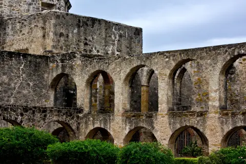
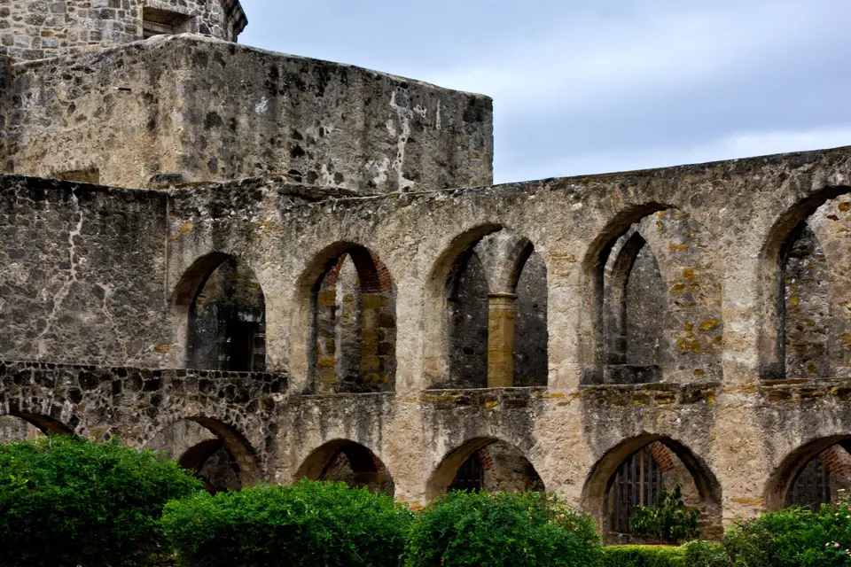
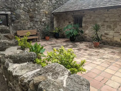
- Walled Perimeter Rooms at Mission San José: Stand inside the broad grassy quadrangle of Mission San José to trace how stone Indian living quarters were integrated directly into the defensive outer wall ringing church, granary and workshops.
Planning Riverfront Trail Visits Between San Antonio and Austin
Knowing what are the 5 missions found in San Antonio lets travellers visit all five smoothly in one well-paced day along the San Antonio Missions trail. Begin at downtown's Alamo early before humid south Texas afternoon heat peaks. Then move downstream by walking, paddling, bicycling the 15-mile greenway, riding VIVA Culture buses or driving the San Antonio mission trail by car across Mission Road, San Jose Drive and Espada Road. Because four southern sanctuaries remain active Catholic parishes, dress respectfully, keep camera shutters silent during parish services and check church bulletins before entering worship rooms.
Carry broad-brimmed sun protection and extra drinking water along sunny trail sections connecting Mission San José, Mission San Juan and Mission Espada, where limestone plazas offer limited afternoon shade. Morning or late afternoon sunlight sharpens shallow relief carving on the Mission San José facade far better than flat overhead noon sun. Spring and autumn provide crisp outdoor conditions for exploring plazas and aqueduct banks. Pair Bexar County's colonial corridor with nearby hill-country stays in our Austin destination guide (124 kilometres northeast), or explore more heritage monuments across the UNESCO World Heritage Atlas.