Quick Field Data
- UNESCO Inscription: Reference 721, inscribed in 1995 as a Natural World Heritage Site under criteria (vii) and (viii).
- Scale & Footprint: Covers 18,926 hectares in New Mexico's Guadalupe Mountains (with roughly two-thirds protected wilderness), safeguarding more than 120 caves anchored by Carlsbad Cavern's 1,220-metre-long Big Room.
- Access & Ticketing: Surface desert drives and 10 hiking trails remain accessible on National Park Service entry. Self-guided walks into Carlsbad Cavern via the natural entrance or elevator require timed reservations. Slaughter Canyon Cave and Spider Cave open strictly via ranger-led tours, while Lechuguilla Cave remains closed except to permitted scientific teams. Check official NPS portals before travelling.
- Arrival Logistics: El Paso International Airport (ELP, 177 km) is the primary commercial passenger gateway, with Albuquerque (ABQ) further north (Cavern City Air Terminal, CNM, 34 km, is a small regional commuter airstrip). The park entrance sits along US Highway 62/180 roughly 29 km (18 miles) southwest of Carlsbad, New Mexico, named after the Czech spa town of Karlovy Vary (formerly Karlsbad). In the same state, our closest city guide covers Santa Fe (415 km north).
The Permian Capitan Reef and Sulfuric Acid Speleogenesis
Roughly 250 million years ago during the Permian Period, the arid canyons of southeastern New Mexico lay beneath the edge of an inland tropical sea. Instead of modern stony corals, bryozoans, sponges, and marine microorganisms built the sweeping Capitan Reef along that ancient shoreline. Once the inland sea evaporated, thick evaporites and sediments buried the fossilised reef intact. Later Cenozoic tectonic uplift then raised the Capitan limestone above surrounding plains. Surface erosion subsequently sculpted the Guadalupe Mountains, exposing reef cross sections along canyon walls and hollowing deep subterranean passages inside.
Most limestone caves worldwide form slowly from the top down as slightly acidic rainwater dissolves rock along fractures. Carlsbad Caverns formed largely from the bottom up through aggressive sulfuric acid speleogenesis. Deep below the Capitan limestone sit petroleum deposits belonging to the Mid-Continent Oil Field. Near the end of the Cenozoic, hydrogen sulfide (H2S) migrated upward from those hydrocarbon reserves into oxygen-rich groundwater, reacting chemically to produce potent sulfuric acid (H2S + 2O2 forming H2SO4). Rising acidic water violently hollowed out cavernous voids through the Capitan Reef, leaving behind massive gypsum deposits as a direct chemical byproduct confirming the acid reaction.
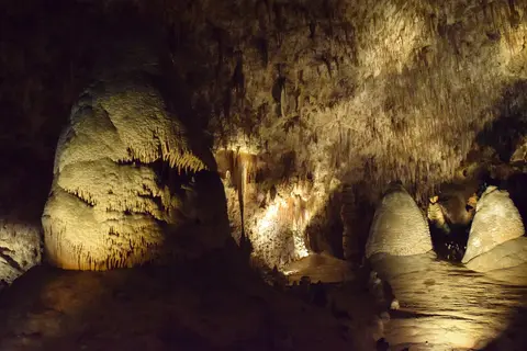
Once tectonic uplift dropped the water table and drained the acidic water, surface erosion breached Carlsbad Cavern's natural opening within the past million years. Rainwater and snowmelt percolating downward from the Chihuahuan Desert surface absorbed carbon dioxide before dripping through cave ceilings. As water evaporated, it precipitated calcium carbonate speleothems including downward stalactites, upward stalagmites, columns, delicate soda straws, draperies, cave popcorn, and underwater helictites. Their growth rates respond directly to surface rainfall and soil temperature, while trace minerals lend varied colours to the stone.
Jim White's Early Exploration and the Big Room Chambers
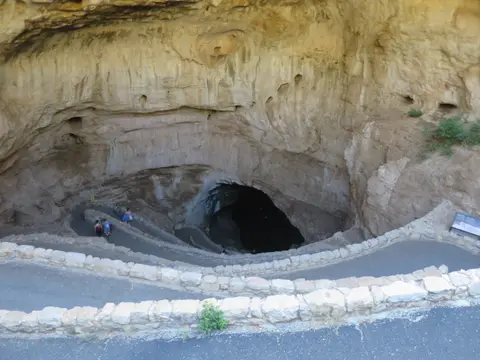
In 1898, local teenager Jim White spotted what looked from afar like a volcanic plume or whirlwind rising out of the hills, actually a massive evening emergence of Mexican free-tailed bats. He descended into the dark cave mouth using a homemade wire ladder. White mapped and named key chambers including the Big Room, New Mexico Room, King's Palace, Papoose Room, and Queen's Chamber, where his lantern once failed for over half an hour in complete darkness. He also named Green Lake Room, tested in the early 1960s as a potential nuclear fallout shelter by watching its malachite pool for shock ripples that never appeared. Notable speleothems he named include Totem Pole, Witch's Finger, Giant Dome, Bottomless Pit, Fairyland, Iceberg Rock, Temple of the Sun, and Rock of Ages. Early twentieth-century guano mining operated inside the unadorned Bat Cave corridor near the main entrance before federal protection arrived.
Preservation followed swiftly under the 25 August 1916 National Park Service Organic Act. President Calvin Coolidge proclaimed Carlsbad Cave National Monument on 25 October 1923, expanded by executive orders on 2 April 1924 and 3 May 1928. An Act of Congress (46 Stat. 279) established Carlsbad Caverns National Park on 14 May 1930, followed by President Herbert Hoover's expansion via Executive Order 5370 on 17 June 1930. On 10 November 1978, President Jimmy Carter signed formal Carlsbad Caverns Wilderness protection into law, securing both The Caverns Historic District and Rattlesnake Springs Historic District on the National Register of Historic Places. Until 1932, visitors walked down and back up a tiring 230-metre (750-foot) switchback ramp. That year a new Visitor Centre opened with twin elevators descending straight into the Big Room complex, joined in the 1950s by the Underground Lunchroom at the head of Left Hand Tunnel.
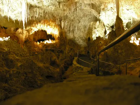
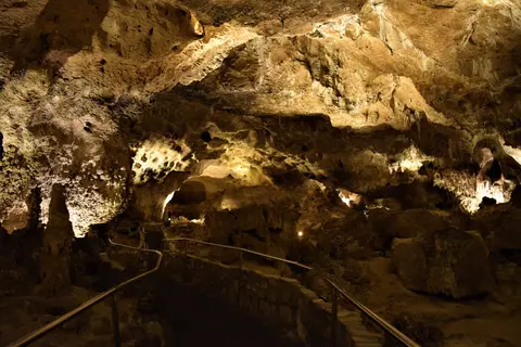
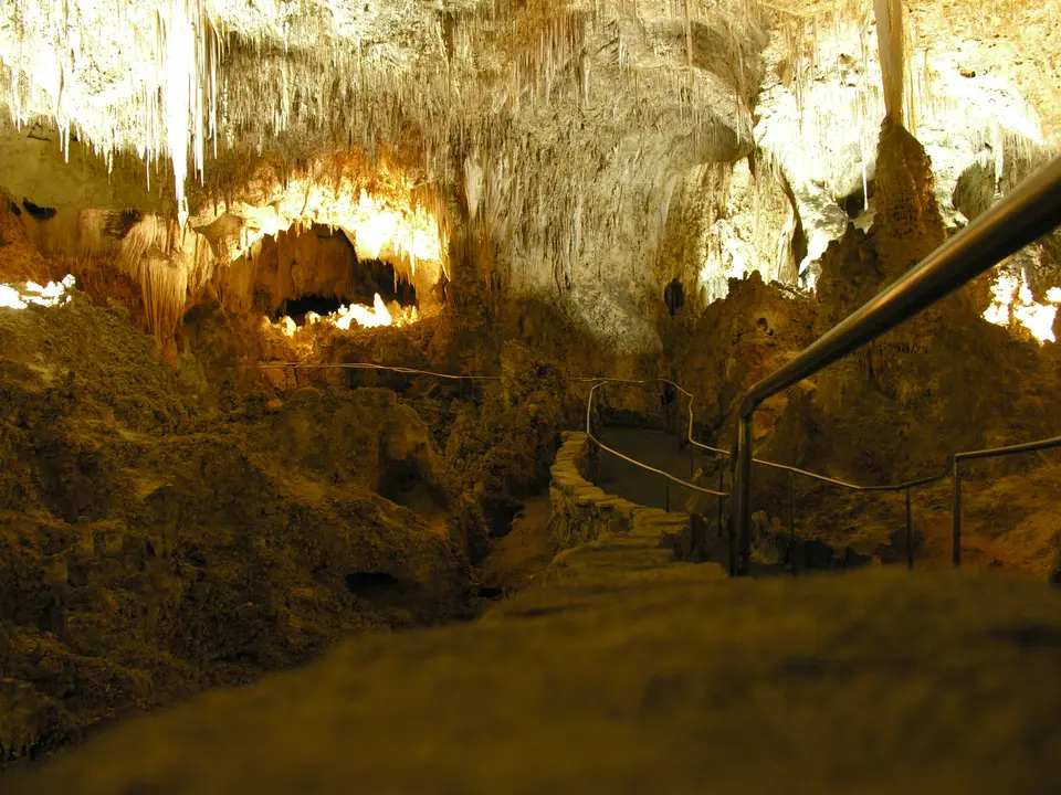
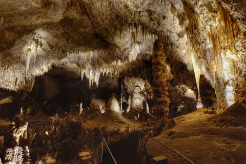
At the heart of the show cave, the Big Room (Hall of the Giants) spans 1,220 metres long, 191 metres wide, and 78 metres high at its tallest point. Covering 33,210 square metres (357,469 square feet) of floor area, it ranks as North America's largest cavern chamber and the 32nd largest worldwide. Exploration uncovered the soda-straw-filled Guadalupe Room in 1966, Lil' Lechuguilla in 1976, and the oxide-stained Bifrost Room above Lake of the Clouds in 1982. In 1985, explorers floated helium balloons with a balsa-wood loop 78 metres up from the Big Room floor to climb into Spirit World, repeating the technique to reach Balloon Ballroom. Further pushes found Chocolate High (1,500 metres of passages above Chocolate Drop in 1993) and Halloween Hall, 30 metres wide with over 1,000 bat bones, discovered on 31 October 2013. In 2018, a tight crawl from the Mystery Room (famous for an unexplained heartbeat-like sound) reached Lake of Muddy Misery, Tomb of the Sky Bears, Ladies' Lament, and Wriggler's Relief four metres above Lake of the Clouds. Together with Hall of the White Giant, Mabel's Room, The Rookery's cave pearls, and Bell Cord Room, Carlsbad Cavern's surveyed passages stretch to nearly 40 miles.
Lechuguilla Cave, Microbial Biothem Growth, and Bat Colonies
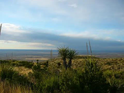
Carlsbad Cavern is only one of more than 119 or 120 limestone caves inside the park. In 1986, cavers with park permission dug through a wind-whistling rubble pile at the bottom of an old 1910s guano-mining pit and broke into Lechuguilla Cave. Explorers have since mapped over 190 km (120 miles) of passages down to 490 metres (1,600 feet) deep, making Lechuguilla the second-deepest limestone cave in the United States. Protected under the 1988 Federal Cave Resources Protection Act and the 1993 Lechuguilla Cave Protection Act, access stays restricted solely to scientific expeditions. Its pristine chambers guard rare subaqueous helictites, massive six-metre (18-foot) gypsum "chandeliers", and microbial "biothems" where subterranean bacteria directly assist mineral formation. Isolated rock pools inside Lechuguilla have also yielded ancient antibiotic-resistant bacterial strains.
Above ground and inside the main entrance corridor, wildlife conservation bridges subterranean biology and Chihuahuan Desert ecology. Seventeen bat species inhabit the park, led by Mexican free-tailed bats migrating in from April or May through October or early November. At sunset, the colony spirals counter-clockwise out of the cave mouth for roughly three hours. Modern populations declined sharply from historical highs, linked partly to organochlorine pesticides like DDT and dieldrin. A 2005 thermal imaging count estimated 793,000 peak bats, while a 2009 Boston University study reviewed historical colony estimates. Evening bat flights and possibly the world's largest cave swallow colony at the entrance remain signature park spectacles. Elsewhere, the detached Rattlesnake Springs Historic District riparian oasis hosts over 300 recorded bird species out of 500 known across New Mexico, making it an Important Bird Area together with Oak Spring and multiple desert tinajas.
Managing roughly 410,000 annual visitors (2007 to 2016) together with external pressures demands constant monitoring. Inside Carlsbad Cavern, visitor infrastructure, lint, and hair have altered delicate invertebrate habitats. Surrounding oil and gas drilling, seismic testing, and municipal groundwater pumping from the underlying Capitan Aquifer pose ongoing threats. Guided by the park's General Management Plan and Cave and Karst Management Plan, the National Park Service Inventory and Monitoring Chihuahuan Desert network tracks vital-sign indicators. These checks cover air quality, volatile organic compounds, springs, landbirds, invasive plants, and upland soils.
Surface Trails, Show Cavern Routes, and Restricted Backcountry
While paved trails, electric lighting, and elevators make Carlsbad Cavern accessible year-round, remaining park caves stay deliberately undeveloped to preserve fragile gypsum and microbial ecosystems.
| Complex Zone | Key Highlights | Access & Ticket Rule |
|---|---|---|
| Carlsbad Cavern (Natural Entrance & Big Room) | 230-metre switchback descent, Big Room (1,220 m), King's Palace, Queen's Chamber, Bottomless Pit | Requires park entry and timed cavern reservations; elevators serve the Underground Lunchroom level, while Scenic Rooms need ranger tours. |
| Slaughter Canyon & Spider Caves | Undeveloped gypsum, flowstone, and wild-cave passages reached by desert trailheads | Accessible strictly on ranger-led adventure tours booked ahead; visitors carry helmets, headlamps, and sturdy boots. |
| Lechuguilla Cave (Wilderness Reserve) | Six-metre gypsum chandeliers, 190 km of pristine passages, microbial biothems | Closed to all general tourism under federal law; entry limited solely to permitted scientific and survey expeditions. |
| Surface Trails, Bat Amphitheatre & Oak Spring | 10 desert hiking trails, Caverns Historic District, Oak Spring trail, evening bat flight amphitheatre | Surface park trails and sunset bat talks run seasonally on park entry; backcountry camping requires a Visitor Centre permit. |
| Rattlesnake Springs Historic District | Detached Chihuahuan Desert riparian oasis and Important Bird Area with over 300 bird species | Day-use picnic grounds and birding trails remain accessible on foot; check local refuge rules before entry. |
Gypsum Rinds, Underwater Helictites, and Reef Fossils Underground
On the paved Big Room circuit and Visitor Centre approach, three subtle geological details prove how radically Carlsbad differs from ordinary rainwater caves.
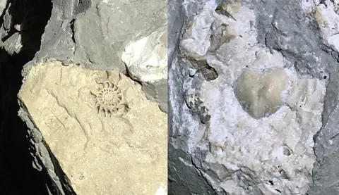
- Permian Reef Fossils in the Cavern Walls: Near the Top of the Cross seating bay inside the Big Room, inspect exposed limestone walls closely for embedded Permian nautiloid and brachiopod shells. These fossils preserve the marine organisms that built the Capitan Reef 250 million years ago before sulfuric acid hollowed the rock.
- Acid-Formed Gypsum Dust and Rinds: Look along side alcoves and Lower Cave corridors like Talcum Passage (or unwashed gypsum floors), where powdery white calcium sulfate confirms sulfuric acid dissolved limestone from below rather than surface carbonic dripwater alone.
- The 43-Metre Bottomless Pit Shaft: Along the Big Room trail, peer down the vertical fissure once believed bottomless because tossed stones vanished silently; later explorations revealed a 43-metre (140-foot) drop lined with soft dirt that muffled every impact.
Timing Bat Flights, Cave Routes, and the Drive from Santa Fe
Carlsbad Caverns Visitor Centre sits in a cool semi-arid climate where summer desert heat contrasts with steady cool cave air underground. Visitation peaks around Memorial Day and Fourth of July weekends, with fee-free days traditionally held on selected federal holiday weekends. Plan cave entry early to walk down the Natural Entrance switchbacks into the Big Room before taking elevators back up. Between Memorial Day weekend and mid-October, save late afternoon for ranger talks at the entrance amphitheatre ahead of the sunset bat emergence. Flights peak in July and August when young bats join the colony, complemented by an annual pre-dawn bat flight breakfast and ranger-led night star parties with telescopes.
Travellers flying into El Paso International Airport (ELP, 177 km) or Albuquerque (ABQ) further north (Cavern City Air Terminal, CNM, 34 km away, is a small regional commuter airstrip) can drive across southern New Mexico. Desert limestone wilderness pairs easily with high-altitude Pueblo and Spanish colonial heritage in our Santa Fe travel guide (415 km north). Readers comparing karst landscapes can also browse comparable caves across the UNESCO World Heritage Atlas. Packing sturdy walking shoes with good traction for damp paved grades underground and layered clothing for cooler subterranean air keeps both surface desert trails and Big Room walks comfortable year-round.