


























Quick Field Data
- UNESCO Inscription: 1981 (5th session; also designated the Nan Sdins National Historic Site on 15 January 1981) · Cultural Criterion (iii).
- Scale & Footprint: Wholly contained within the natural island boundaries of SGang Gwaay (Anthony Island) within the 147,000-hectare Gwaii Haanas park reserve and protected Haida Heritage Site.
- Access & Ticketing: Co-managed by Parks Canada and the Haida Watchmen programme; access is exclusively by sea or air from northern Haida Gwaii towns with advance permits and mandatory visitor orientation.
- Arrival Logistics: Tucked inside a protected bay along the eastern shore of Anthony Island opposite Kunghit Island, at the southern end of Haida Gwaii (formerly the Queen Charlotte Islands) along Canada's British Columbia North Coast.
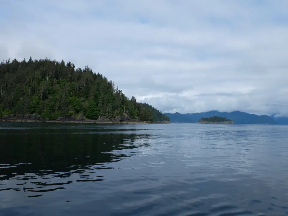
Red Cod Island and the Sheltered Bay Facing Kunghit Island
Occupying Anthony Island along the western outer edge of the southern Haida Gwaii archipelago (formerly the Queen Charlotte Islands) on the British Columbia North Coast of Canada, the ancestral Haida village of SGang Gwaay Llnagaay, widely known in English as Ninstints and also spelled Nan Sdins or Nans Dins, was placed on the UNESCO World Heritage Atlas in 1981 under cultural criterion (iii) and designated a Canadian National Historic Site on 15 January 1981. The Haida name SGang Gwaay Llnagaay refers to Anthony Island, where the village sits, and translates as "Red Cod Island." Wholly contained within the natural shoreline boundaries of the island, the site is encompassed by the 147,000-hectare Gwaii Haanas park reserve (established in 1993) alongside the surrounding Gwaii Haanas marine conservation area reserve (established in 2010), both co-managed as a Haida Heritage Site.
Positioned in a sheltered rocky bay on the eastern side of Anthony Island, immediately west of Kunghit Island (which forms the southernmost large island of the Haida Gwaii archipelago), SGang Gwaay Llnagaay was one of the southernmost of all Haida villages. Although compact in footprint, its position behind rocky headlands made it the most secluded and naturally protected major settlement in southern Haida Gwaii. Archaeological evidence demonstrates that the wider Haida Gwaii archipelago, whose traditional Haida territories extended north into Southern Alaska, holds an archaeological record of human habitation spanning at least 10,000 years, while occupation at the village site of SGang Gwaay Llnagaay dates back to at least 360 CE, making this settlement the oldest documented village site across the southern part of the archipelago.
The inhabitants of this southern sector are known historically as the Kunghit Haida. Stretching from Lyell Island down to the southernmost tip of Haida Gwaii, the Kunghit Haida maintained roughly two dozen permanent villages alongside smaller seasonal settlements positioned near rich marine and forest resource areas. Larger Kunghit Haida villages contained seventeen or more cedar longhouses and supported populations ranging from under two hundred to more than five hundred residents. At SGang Gwaay Llnagaay itself, early Haida oral testimony recorded by ethnographer John R. Swanton placed the number of cedar longhouses at twenty.
Cedar Longhouse Ruins and Carved Mortuary Poles
Occupied until shortly after 1880, SGang Gwaay preserves the only surviving example of a 19th-century Haida coastal village where the remains of large cedar longhouses and carved mortuary and memorial poles still stand together in their original locations. Ranked among the finest examples of monumental wood sculpture in the world, the standing and fallen cedar poles line the sheltered bay in front of the house pits, offering a visual key to the oral traditions and lineage histories as well as the spiritual relationship of the Haida people to the land and sea.
Unlike collected poles moved into indoor museums, the cedar ruins and mortuary and memorial poles at SGang Gwaay Llnagaay are left to weather naturally in the lush temperate rainforest climate. While protected from human development and invasive species, the carved timbers gradually yield to moss and rain through natural decay in accordance with Haida cultural practice, returning to the forest floor from which they were cut. Even as individual poles weather over the decades, images of the village ruins remain emblematic of Haida heritage and of British Columbia at large. Because the entire World Heritage site is wholly contained within the natural shoreline boundaries of Anthony Island, where no permanent settlement has existed since the late 19th century, the relationship between the carved red cedar poles, the twenty longhouse pits, the surrounding temperate rainforest, and the rocky eastern bay remains completely uncompromised by modern construction. Each mortuary and memorial pole was raised to honour chiefs and noble lineages, encoding crest figures and oral histories that link the Kunghit Haida to the land and the surrounding Pacific waters. Allowing these monumental sculptures to weather in place rather than arresting their decay reflects the Haida philosophical understanding that carved cedar, having come from the forest, rightfully returns to the earth while the stories, crests, and songs endure within living Haida society.
From Maritime Fur Trade Contact to the 1862 Smallpox Epidemic
Across the closing decades of the 18th century and the opening years of the 19th century, visiting European and American maritime fur traders called the settlement Koyahs, Coyahs, or Quee-ah after its reigning chief, Koyah. Later in the mid-19th century, ship captains adopted the practice of calling coastal settlements after their headman, giving the village the name Ninstints (Nan Sdins) after the most powerful of its 19th-century chiefs. The last chief born in Ninstints, known by his English name Thomas Price, became celebrated as a master carver of Haida art, particularly for his work in black argillite stone.
Because of its rich offshore sea otter populations, SGang Gwaay Llnagaay stood at the centre of early European contact on the North Coast. When the coastal sea-otter fur trade began in 1787, British trader George Dixon visited the waters off the island and recorded that the Haidas paddled out to meet his vessel eager to trade prime sea otter pelts. Amicable trade continued when Charles Duncan visited the village in 1788. In 1789, however, the village was visited twice by American traders, first by Robert Gray and later that same year by his partner John Kendrick, at which point trade relations turned violently hostile.
Although trade relations improved again in the decades that followed, European contact introduced devastating infectious diseases while drawing many families toward emerging economic hubs at Masset and Skidegate as well as Victoria to the south. For the Kunghit Haida who remained at SGang Gwaay Llnagaay, catastrophe struck with the 1862 Pacific Northwest smallpox epidemic, which severely reduced the village population. Continued mortality from introduced diseases left the village functioning primarily as a seasonal camp by 1875, and by 1878 to shortly after 1880 all remaining inhabitants of SGang Gwaay Llnagaay had relocated northward to Skidegate.
The Haida Watchmen Programme and Remote Expedition Logistics
Today, there is no permanent settlement on Anthony Island, and the remote island is accessible exclusively by sea kayak, expedition vessel, or floatplane from communities in northern Haida Gwaii such as Skidegate and Masset. Ocean swells roll past Kunghit Island. To safeguard SGang Gwaay and other ancestral village sites across Gwaii Haanas, the Haida Nation operates the Haida Watchmen programme, stationing Haida guardians at traditional village sites throughout the season to maintain an active presence on their ancestral territories and ensure visitors act with respect. Working in partnership with Parks Canada across both the 147,000-hectare terrestrial park reserve and the surrounding marine conservation area reserve, the Haida Watchmen welcome small groups ashore along the eastern bay of SGang Gwaay Llnagaay, sharing the history of the Kunghit Haida, the history of chiefs Koyah and Ninstints (Nan Sdins), and the artistic mastery of carvers such as Thomas Price while protecting the fragile house beams and root systems from foot traffic.
- Entry and Route to Anthony Island: All travellers approaching SGang Gwaay by expedition boat, sea kayak, or floatplane from northern Haida Gwaii must register in advance with Parks Canada and the Gwaii Haanas management office, complete a mandatory cultural and ecological orientation, and radio the resident Haida Watchmen before landing in the sheltered eastern bay facing Kunghit Island.
- Tickets and Viewpoints: Before booking passage into Gwaii Haanas, check the official site of Parks Canada for current Gwaii Haanas permit quotas and seasonal operating dates before planning a voyage. Guided ashore in small groups by the Watchmen, visitors walk the designated shoreline path overlooking the twenty cedar longhouse ruins and the carved mortuary and memorial poles without stepping onto the fragile house beams or touching the decaying cedar carvings.
- Timing and Onward Connections: Plan your passage during the calmer summer months when the Haida Watchmen camp is staffed and sea conditions around Kunghit Island and Lyell Island are navigable, and explore our UNESCO World Heritage Atlas for more indigenous cultural landscapes across Canada and the Americas.
