


























Quick Field Data
- UNESCO Inscription: 1990
- Scale & Footprint: 2,600,000 hectares (26,000 square kilometres), covering 10% of New Zealand's landmass along a 450-kilometre coastal strip extending 40 to 90 kilometres inland
- Access & Ticketing: Administered by the Department of Conservation under the National Parks Act 1980, Conservation Act 1987, and Reserves Act 1977 with open park entry, 10 visitor centres, and booked huts on major tramping tracks; check the official site
- Arrival Logistics: Accessed via the Haast Highway and Milford Highway corridors, with Queenstown acting as the principal gateway hub for the southern lakes, fjords, and alpine passes
Tectonic Collision, Pleistocene Fjords, and Ngāi Tahu Heritage
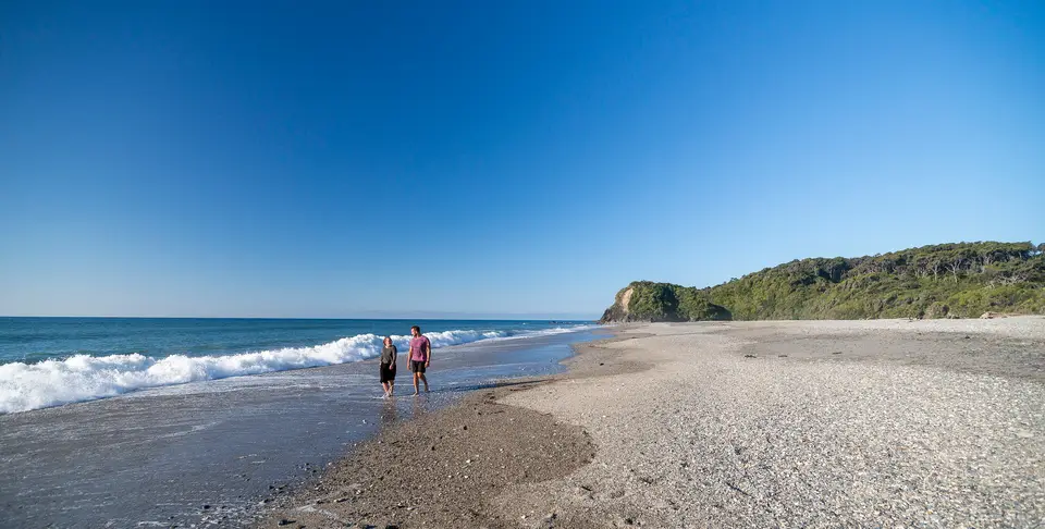
Spanning 2,600,000 hectares (26,000 square kilometres or 10,000 square miles), equal to 10% of the landmass of New Zealand, Te Wahipounamu stretches 450 kilometres (280 miles) along the southwestern coastline of the South Island and extends between 40 and 90 kilometres (56 miles) inland from the Tasman Sea. For New Zealand, the UNESCO World Heritage List in 1990 by uniting the previously listed Westland and Mount Cook National Park and Fiordland National Park with Mount Aspiring, the World Heritage Area incorporates 4 contiguous national parks: Aoraki / Mount Cook National Park, Fiordland National Park, Mount Aspiring National Park, and Westland Tai Poutini National Park. Geologically, the region straddles the great Alpine Fault, one of only three land segments on the globe where a major continental plate boundary is exposed directly on land. Over the last five million years, tectonic collision between the Indo-Australian Plate and the Pacific Plate has uplifted the Southern Alps (known in Māori as Kä Tiritiri o te Moana), raising Aoraki / Mount Cook to 3,724 metres (12,218 feet) within a mere 30 kilometres of the Tasman coast.
Across this seismically active mountain barrier, successive Pleistocene glaciations and ongoing post-glacial processes have carved a dramatic sequence of rocky coasts, towering sea cliffs, marine fiords, serrated ridges, gullying, landslides, alpine lakes, and waterfalls. Hundreds of active glaciers descend from the alpine divide, led by the Haupapa / Tasman Glacier on the east and the steep Franz Josef Glacier and Fox Glacier in Westland, which descend into temperate rainforest. For Māori communities, and especially for the Ngāi Tahu iwi whose traditional rohe encompasses most of the South Island, the entire region is Te Wāhipounamu, meaning "the place of greenstone", prized as the source of pounamu greenstone or jade used for Māori tools, weapons, and jewellery. In Māori legend, the South Island formed when the 4 sons of Rakinui, the Sky Father, voyaged around Papatūānuku, the Earth Mother, until their canoe struck a reef and an icy Tasman Sea wind froze their hull into stone and turned the tallest brother into Aoraki Mt. Cook alongside his brothers as the Southern Alps. A companion legend tells how the mountain climber Hinehukatere persuaded her lover Tawe (Tauwe) to climb with her; when an avalanche killed Tawe in Fox Glacier (named Te Moeke o Tauwe, the bed of Tauwe), Hinehukatere's frozen tears formed Franz Josef Glacier (Ka Roimata o Hinehukatere).
Under the Treaty of Waitangi and its settlement around the 1990 World Heritage inscription, Mount Cook was renamed Aoraki / Mount Cook alongside 88 other topographic features given dual Māori and English names, legal title to Aoraki passed back to the Ngāi Tahu Tribe before being gifted to the nation of New Zealand, and the tribe secured rights of access and temporary occupancy for gathering traditional foods and materials. Crown land is administered by the Department of Conservation under four planning pillars: national legislation (the Reserves Act 1977, the National Parks Act 1980, and the Conservation Act 1987), the Visitor Strategy, regional conservation management strategies, and individual park management plans. Ongoing management issues include controlling invasive red deer, wapiti, fallow deer, and goats through commercial hunting and Department of Conservation programmes, addressing tourist aircraft noise, resisting proposals floated since the 1870s for a Haast-Hollyford road, strengthening coastal marine protection, and responding to a 2026 controversy in which Minister for Resources Shane Jones granted a 157-square-kilometre mineral prospecting permit after former prime minister John Key had ruled out mining in 2012, drawing sharp criticism from Green Party spokesperson Steve Abel.
Temperate Beech-Podocarp Rainforests, Endemic Birds, and Four Wilderness Zones
Because Te Wahipounamu remains the largest and least modified natural ecosystem in New Zealand, its vegetation and wildlife preserve the world's finest living representation of the ancient Gondwana (Gondwanaland) biota. Two-thirds of the park is cloaked in temperate southern beech and podocarp rainforests, where ancient podocarps exceed 800 years of age. Intact ecological sequences unfold along three sharp gradients: altitudinal transitions from sea level to permanent alpine snowlines of shrubs, tussocks, and herbs; latitudinal transitions from the wet western Westland coastal plain (characterised by high-fertility swamps, low-fertility peat bogs, and New Zealand's most extensive unmodified freshwater wetlands) to the drier eastern slopes where licensed sheep and cattle grazing occurs; and chronological plant succession ranging from newly exposed post-glacial surfaces to ancient Pleistocene moraine terraces.
Isolated for tens of millions of years, these habitats support the largest concentration of native forest birds in New Zealand. The kea, the world's sole alpine parrot species, inhabits the high mountain passes, while the rare flightless takahē survives in a wild population of only about 170 birds within remote mountain valleys of Fiordland. Although the critically endangered kākāpō, the heaviest and rarest parrot in the world, vanished from the mainland area in the early 1980s, the forests and waterways shelter the Southern Brown Kiwi, the Great Spotted Kiwi, the Yellow-crowned parakeet, the Fiordland Penguin, the New Zealand Falcon, and the Brown teal, while most of New Zealand's Fur Seals inhabit the south-west coast.
Within Te Wahipounamu lie 4 designated wilderness areas: Hooker-Landsborough (41,000 hectares), Olivine (80,000 hectares), Pembroke (18,000 hectares), and Glaisnock (125,000 hectares). Combined, these 4 wilderness reserves represent 10% of the entire Te Wahipounamu area and are managed under the New Zealand Wilderness Policy, which mirrors the wilderness philosophy of American conservationists John Muir and Aldo Leopold. Inside these 4 zones there are no visitor facilities, no roads, huts, bridges, or tracks, and aircraft landings are prohibited for both recreational and commercial purposes, ensuring that visitors enter strictly on nature's terms. By keeping these four vast wilderness reserves of alpine ridges, glacier basins, and forest valleys completely free of tracks, huts, and aircraft landings, the Department of Conservation safeguards the natural quiet and solitude of the South Island backcountry against rising visitor numbers on the main tramping corridors.
Planning Routes Along the Heritage Highways, Great Walks, and Fiords
Travellers exploring Te Wahipounamu through the UNESCO World Heritage Atlas rely on the region's only 2 main roads, the Haast Highway and the Milford Highway, which together form the Heritage Highway corridors served by a network of 10 visitor centres and numerous nature walks. Most southern itineraries begin in Queenstown or beside Lake Te Anau, giving road access to Milford Sound / Piopiotahi, the Fiordland Sounds, and Mount Aspiring / Tititea, while western and eastern approaches reach Franz Josef and Fox Glaciers, Aoraki / Mount Cook, and the Haupapa / Tasman Glacier. Very few permanent residents inhabit this remote southwestern region of New Zealand.
Under the Department of Conservation Visitor Strategy, which divides visitors into seven groups based on stay length and activity type, experiences combine nature walks, coastal whale-watching, and scenic boat excursions across the Fiordland Sounds with adventure tramping, glacier walks, rafting, and climbing across celebrated routes such as the Milford Track, the Kepler Track, and the Routeburn Track. As researcher Charnley noted, while local communities depend heavily on tourism employment and small-scale coastal fishing or grazing, conservation across the 4 national parks rests primarily on statutory World Heritage protection and Ngāi Tahu partnership frameworks.
- Booking huts on major tramping tracks: Reserve Department of Conservation hut passes well ahead of travel if walking the Milford Track, Kepler Track, or Routeburn Track during the summer tramping season.
- Preparing for rapid Tasman weather shifts: Pack waterproof outer shells, thermal layers, and sturdy boots for Westland and Fiordland, where heavy rain feeds cliff waterfalls and can trigger rockfalls or swollen river crossings.
- Using the ten visitor centres: Stop at the 10 Heritage Highway visitor centres along the Haast Highway and Milford Highway to check daily track, avalanche, and weather advisories before entering alpine valleys.
