Quick Field Data
- UNESCO Inscription: Cultural site inscribed in 1995 (Ref. 479) under criteria (ii), (iv), and (v).
- Scale & Footprint: 820 hectares covering 33 of Luang Prabang's 58 traditional villages on the peninsula where the Mekong and Nam Khan rivers meet, enclosed inside a 12,500-hectare protective buffer zone approved in February 2012.
- Access & Ticketing: The open pedestrian historic district is regulated under Laos's Safeguarding and Enhancement Plan. Individual monuments including Haw Kham Royal Palace Museum, Wat Xieng Thong, Wat Mai, and Mount Phou Si staircases charge modest entry tickets. Visitors should check official heritage notices and observe dawn alms etiquette.
- Arrival Logistics: Luang Phabang International Airport (LPQ, 4 kilometres from the centre) links directly with regional hubs. Air access is backed by Luang Prabang Railway Station (15 kilometres out) on the Vientiane-Kunming line and northern and southern bus terminals. Our closest cross-border destination guide in Thailand is Chiang Mai, 352 kilometres southwest.
Mekong-Nam Khan Peninsula Origins and the Lan Xang Royal Capital
Framed by the steep green ridges of PhouThao and PhouNang mountains in north-central Laos, Luang Prabang occupies a narrow river peninsula sculpted by the confluence of the Mekong and the Nam Khan River. At the centre of that peninsula rises sacred Mount Phousi, anchoring riverine spirit beliefs tied to mythical nagas and early Buddhist legend recounting how the Buddha rested here and smiled in prophecy of a future royal city. Between the sixth and eighth centuries, Mon Dvaravati networks pushed northward to link Haripunjaya, Fa Daet, middle-Mekong trading power Sri Gotapura, Chantaburi (Vientiane), and Muang Sua (Luang Prabang). Those connections introduced Theravada Buddhism via Sri Lankan missionaries. Following brief Khmer suzerainty under Jayavarman VII from 1185 to 1191 and the 1238 Sukhothai uprising against Khmer rule, the settlement grew in stature. Known then as Xieng Dong Xieng Thong, it became capital of the powerful Lan Xang (Kingdom of a Million Elephants) in 1353 under King Fa Ngum (1353 to 1373).
In 1359, Angkor's monarch presented Fa Ngum with the revered Prabang Buddha statue to legitimise Buddhist kingship across Lan Xang, prompting the capital's renaming to Luang Prabang (Royal Buddha Image). Positioned strategically along overland Silk Route branches, the city flourished as a regional monastic seat despite Vietnamese occupation during Emperor Le Thanh Tong's 1478 to 1480 expedition against Lan Xang and Lanna. When dynastic struggle split Lan Xang in 1707, Luang Prabang persisted as capital of the Kingdom of Luang Phrabang, retaining royal primacy when France annexed Laos in 1893 during the reign of King Sisavang Vong.
Through turbulent twentieth-century conflicts, the town stayed a resilient royal and religious heart until Vientiane became administrative capital in 1946. During World War II, it passed under Vichy French, Thai forces (after the 1940 to 1941 Franco-Thai War), and two Imperial Japanese battalions arriving on 7 April 1945 after a 9 March nationalist declaration. On 8 April, King Sisavang Vong declared Laos's protectorate ended while secretly sending Prince Kindavong to the Allies and Sisavang Vatthana to Japan. Free French forces arrived on 25 August 1945, followed by Chinese Nationalist forces in September. Subsequent French paratroop operations in April and May 1946 against the Lao Issara and Viet Minh and Pathet Lao offensives in 1953 and 1954 left Luang Prabang outside major heavy urban clearance, preserving its traditional peninsula village layout.
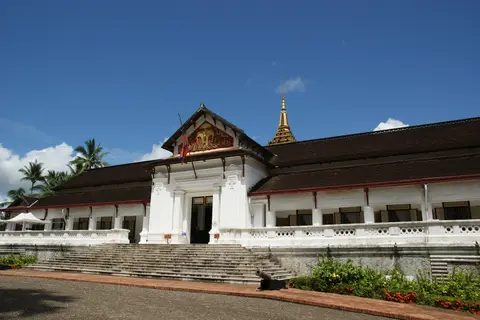
Gilded Wats, Bamboo-Plaster Houses, and French Colonial Streets
Luang Prabang's visual distinction rests on how late-19th- and 20th-century French colonial urban geometry folded gently onto the older mosaic of 33 traditional Lao peninsula villages, each anchored by its own monastic wat. Rather than clearing earlier quarters, colonial brick avenues ran cleanly along the main central spine and Mekong embankment, leaving narrow interior village lanes, royal and noble residential plots, and former defensive perimeter traces intact. Every traditional neighbourhood preserved its communal village monastery as both spiritual focal point and neighbourhood courtyard, creating an unusually porous urban grain where temple gates open directly onto domestic lanes.
Material contrast signals architectural function across the streetscape. While monastic complexes and royal halls used stone, brick, sculpted stucco, engravings, paintings, gilding, and deep sweeping tiled roofs, traditional Lao houses relied on timber framing paired with vernacular wall assemblies introduced in the colonial era using plaited bamboo panels coated in wattle-and-daub plaster. Lining the main commercial avenue and Mekong riverfront, one- and two-storey French brick residences soften formal colonial proportions with deep shaded timber balconies, louvred shutters, and ornamental woodwork suited to tropical river breezes.
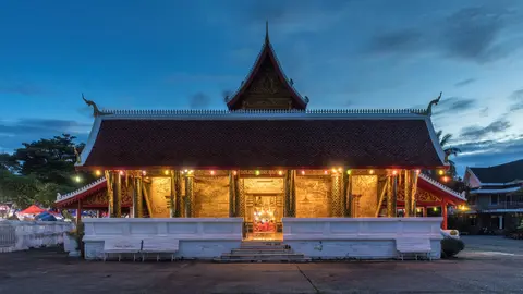
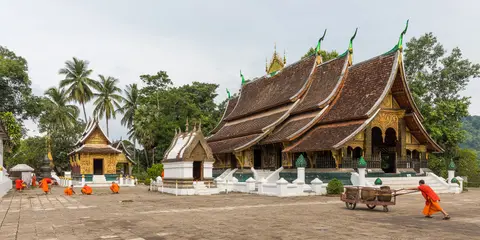
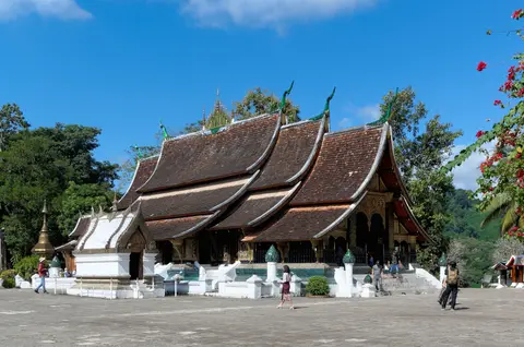
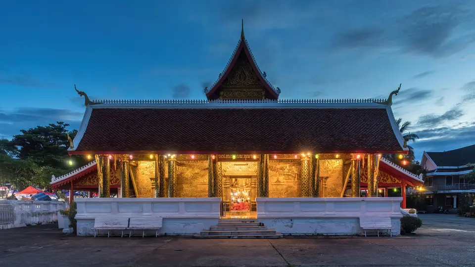
At the spiritual tip of the peninsula where the Nam Khan joins the Mekong stands sixteenth-century Wat Xieng Thong. Its complex monastic ensemble of low-sweeping gilded sanctuary roofs, carved wood doors, mosaic facades, and secondary chapels is valued across both archaeology and Lao iconography. Closer to the base of Mount Phousi along the central avenue stand eighteenth-century Wat Mai Suwannaphumaham and neighbouring smaller wats such as Wat Hosian Voravihane. Together they belong to more than 30 protected Buddhist temples alongside Haw Kham, the former royal residence now operating as the national palace museum.
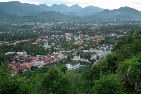
Wetlands, Morning Alms Processions, and Heritage Safeguarding
Urban conservation in Luang Prabang protects living geography and ritual practice as rigorously as roof tiles and timber beams. Behind main streets and along river slopes sits a preserved network of natural ponds and wetlands still managed for local fish farming and vegetable cultivation. These basins cool crowded quarters, support urban food production, and absorb seasonal Mekong and Nam Khan floodwater. Ceremonies honouring river nagas and sacred Mount Phousi persist right beside daily Buddhist observance. Every morning at sunrise, silent processions of saffron-robed monks walk through town streets to accept alms offered by local residents, matched regionally by seasonal Prabang processions and sister-city cultural ties with Bagan in Myanmar established in 2009.
At the same time, rapid tourism growth after the 1995 UNESCO listing placed steep pressure on traditional building materials and local residency. As UNESCO evaluations documented, modern concrete frames and non-traditional mortar often replaced decaying bamboo-and-timber dwellings inside private house plots while rising property demand pushed local residents out of historic neighbourhoods into commercial premises or triggered unauthorised building work.
Lao heritage governance rests on the 1978 Decree No. 1375 under the Lao Buddhist Federation, the 1990 Decree No. 139, and the 2005 National Heritage Law No. 08/NA. Articles 7 and 16 of the 1999 Environmental Protection Law No. 09/NA also require socio-environmental impact assessments. In 2009, authorities restructured the Heritage House into a dedicated Luang Prabang Heritage Department working with National and Local Heritage Committees and decentralised technical cooperation with Chinon in France. Together they enforce the Safeguarding and Enhancement Plan (SEP) and its 12,500-hectare buffer zone, approved in February 2012. Combining binding rules with flexible renovation guidance under national Ministry of Information and Culture supervision alongside provincial and district heritage offices, the SEP curbs concrete replacement of traditional wood, brick, local tile, and wattle-and-daub homes. Every peninsula construction or infrastructure proposal undergoes formal socio-environmental assessment, while Heritage Department specialists advise homeowners and temple committees on carved colonial timber balconies, traditional roof tiles, masonry facades, and riverfront drainage ponds. Under SEP controls, oversized hotel projects and new-town schemes remain deferred pending heritage impact studies, while public cultural buildings such as the primary school and Fine Arts School stay in public custody rather than private concession. Traditional wood, brick, tile, and local ceramic techniques are strengthened while senior monks teach younger novices temple restoration so active Buddhism protects authenticity from within. Outside the peninsula, mountain cycling routes, the evening night market at the end of the main avenue, and local excursions link heritage conservation with rural livelihoods. Trips to Kuang Si Falls, Tat Sae Waterfalls, Pak Ou Caves, and the downstream Mekong pottery village sustain craft incomes and anchor local families in the 33 protected village quarters rather than displacing them.
Luang Prabang Peninsula Zones, Palaces, and Temple Access
Walking the flat historic peninsula takes visitors smoothly from the royal museum quarter out to the tip at Wat Xieng Thong, with elevated steps rising up Mount Phou Si in between.
| Complex Zone | Key Highlights | Access & Ticket Rule |
|---|---|---|
| Wat Xieng Thong & Peninsula Tip | 16th-century main sanctuary, ornate mosaic facades, and Mekong-Nam Khan confluence | Modest daytime entry ticket; shoulders and knees must be covered inside active temple |
| Central Spine, Haw Kham & Wat Mai | Royal Palace Museum, 18th-century Wat Mai tiered verandas, and evening night market avenue | Separate admission tickets at Haw Kham and Wat Mai; evening street market free on foot |
| Mount Phousi Sacred Hill | Central forested ridge, summit sanctuary, and panoramic Mekong valley viewpoint | Paid staircase ascent from either riverfront or palace street; steep stone steps |
| Wetlands, Mekong Banks & Outlying Valleys | Urban fish-farming ponds, dawn alms streets, plus Kuang Si Falls, Tat Sae, and Pak Ou Caves | Urban lanes open freely (silent respect during dawn alms); waterfalls and caves require boat or road transfers |
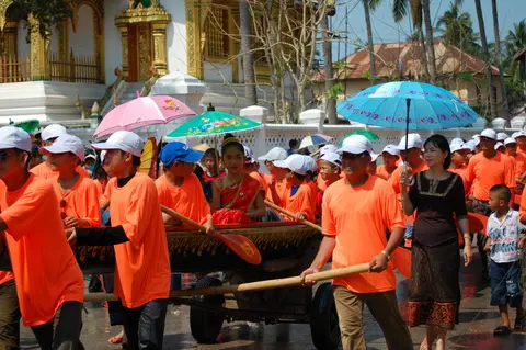
Three Architectural and Timber Craft Details in Luang Prabang
Slow daytime walks down quiet peninsula side lanes expose subtle structural hybrids uniting Lao carpentry with colonial masonry.
- Wattle-and-Daub Bamboo Panels Between Timber Posts: Along narrow residential lanes behind the main road, look beneath weathered plaster coats on vernacular houses to spot woven plaited bamboo panels coated with mud-and-lime wattle-and-daub infill framed inside dark timber beams.
- Colonial Brick Verandas with Timber Fretwork: Along the central avenue and Mekong embankment, inspect one- and two-storey brick shophouses where European arched openings meet carved wooden balcony railings, deep overhanging eaves, and vented shutters tailored for monsoon ventilation.
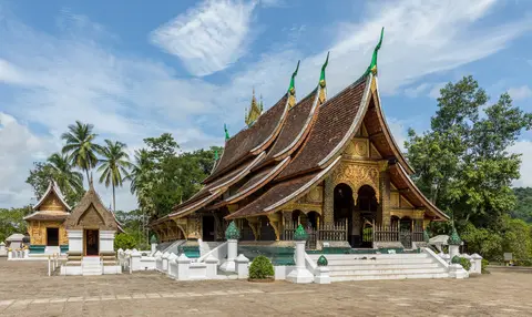
- Gilded Sanctuary Roof Tiers at Wat Xieng Thong and Wat Mai: Compare the sweeping downward-curving multi-tiered roofs descending close to the ground in classic Luang Prabang style, supported by carved gilded timber columns along open side verandas.
Dry-Season Logistics, Rail Connections, and Pairing with Chiang Mai
Dry, cool winter months from November through February clear mountain mists off PhouThao and PhouNang ridges, offering comfortable daytime walks across the peninsula and calm river conditions for 15-minute boat rides downstream to the Mekong pottery village or excursions to Kuang Si Falls. Wet monsoon months bring lush foliage across Mount Phousi and heavier river flows feeding Tat Sae Waterfalls while raising Mekong currents. Visitors sampling regional gastronomy around the night market and riverbank cafes can look for local specialities including or lam stew, Luang Prabang sausage, mokpa steamed fish, and crisp fried kaipen Mekong river moss served with jeow bong.
Luang Phabang International Airport (LPQ) lies just 4 kilometres from the town centre, linking Vientiane domestically and regional hubs including Bangkok, Chiang Mai, and Hanoi. A station 15 kilometres outside town handles high-speed and conventional railway trains connecting Vientiane, Vang Vieng, Muang Xay, Boten, and Kunming. Separate southern buses run toward Vang Vieng and Vientiane, while northern buses serve Muang Xay, Luang Namtha Province, and Houayxay. Luang Prabang pairs naturally with northern Mekong overland circuits into our Chiang Mai city guide 352 kilometres southwest. Travellers assembling wider heritage routes across mainland Southeast Asia can discover neighbouring temples and historic ports inside the UNESCO World Heritage Atlas.