Quick Field Data
- UNESCO Inscription: Natural World Heritage Site (Ref. 1604), inscribed on 5 July 2019 under Criterion (viii).
- Scale & Footprint: 1,482,000 hectares (spanning 14,967 square kilometres across 14 percent of Iceland in park figures, over 1,400,000 hectares or 12 percent in UNESCO boundaries), 85 percent wilderness.
- Access & Ticketing: Entry into the reserve requires no admission ticket, while campgrounds, glacier guides, and Jökulsárlón boat tours charge operator fees. Check official Vatnajökulsþjóðgarður advisories for highland road conditions.
- Arrival Logistics: Keflavik International Airport (KEF) lies 284 km west as the main hub, while Hornafjörður Airport (HFN) sits 85 km east with limited regional flights. Reykjavik sits 248 km west along Route 1.
Mid-Atlantic Rift Volcanism Beneath Europe's Largest Ice Cap
Established on 7 June 2008 by uniting earlier parks at Skaftafell and Jökulsárgljúfur before expanding across Lakagígar, Langisjór, Krepputunga, and Jökulsárlón, Vatnajökull National Park Iceland ranks as Europe's second-largest national park after Russia's Yugyd Va. Known in Icelandic as Vatnajökulsþjóðgarður, this vast protected area shields 14 percent of Iceland's landmass and over 25 percent of its central highlands. At its core gleams the Vatnajökull ice cap, Europe's largest glacier outside the Arctic at 7,700 to 8,100 square kilometres (roughly 780,000 hectares), averaging 400 to 600 metres thick and reaching 950 metres deep. So much frozen water sits locked here that Iceland's highest-volume river, the Ölfusá, would need more than 200 years to carry it all to sea.
Few places illustrate Fire and Ice more starkly, as 200 km of the active Mid-Atlantic Ridge cut straight through the reserve, pulling crustal plates apart by roughly 19 millimetres each year. Beneath intersecting Eastern and Northern Volcanic Zones sits a deep mantle plume feeding ten central volcanoes, eight trapped under glacial ice. While the ice dome climbs over 2,000 metres high, subglacial bedrock plunges 300 metres below sea level, hiding giants such as Bárðarbunga and Iceland's most active volcano, Grímsvötn, joined by Öræfajökull, Askja, Kverkfjöll, Snæfell, and volcanic table mountain Herðubreið.
Exposed volcanic bedrock spans from 10-million-year-old basalts to fresh 2015 lavas, rising into steep-sided tuyas and brown hyaloclastite ridges called tindar built during eruptions under ancient ice sheets. Historic fissure blasts west of the glacier unleashed Eldgjá in 934 and Lakagígar in 1783 to 1784, while Vonarskarð forms a colourful high-temperature watershed between North and South Iceland. Documented across at least 281 peer-reviewed scientific papers over a decade, these exposed shield volcanoes serve researchers as Earth analogues for Mars, while subglacial groundwater preserves ice-age endemic fauna and hardy microbes comparable to icy moons of Jupiter and Saturn.
Jökulhlaups, Skaftafell, and Jökulsárlón Glacial Lagoon
Subglacial eruptions and geothermal reservoirs unleash sudden glacial outburst floods called jökulhlaups, sweeping black volcanic ash across flat outwash sandur plains. Protected first on 15 September 1967 across 4,807 square kilometres before joining the enlarged park, green Skaftafell includes Morsárdalur valley, Kristínartindar peak, and outlet glaciers such as Skaftafellsjökull and Skeiðarárjökull under Iceland's tallest summit, Hvannadalshnjúkur. Overlooking Skeiðarársandur, the oasis preserves evidence of frequent Grímsvötn floods (most recently in 1996) and Öræfajökull blasts in 1362 and 1727.
The 1362 eruption wiped out medieval farms and gave the Öræfi district its bleak name meaning wasteland, yet settlers rebuilt homesteads and held district þing assemblies on Skaftafell land. Earlier farmers supplemented sheep raising by hunting coastal seals, gathering seabird eggs, and crafting fine tools from wrecked ships before cooling climate and ash floods eroded hayfields. Traditional farming ended in 1988, leaving old turf ruins at Gömlutún and restored Sel farmstead (abandoned in 1946) overlooking a Skeiðará bridge bypassed in 2009 when river flow shifted west into Gígjukvísl.
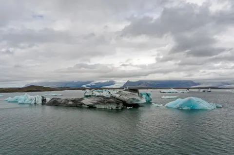
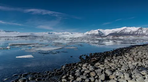
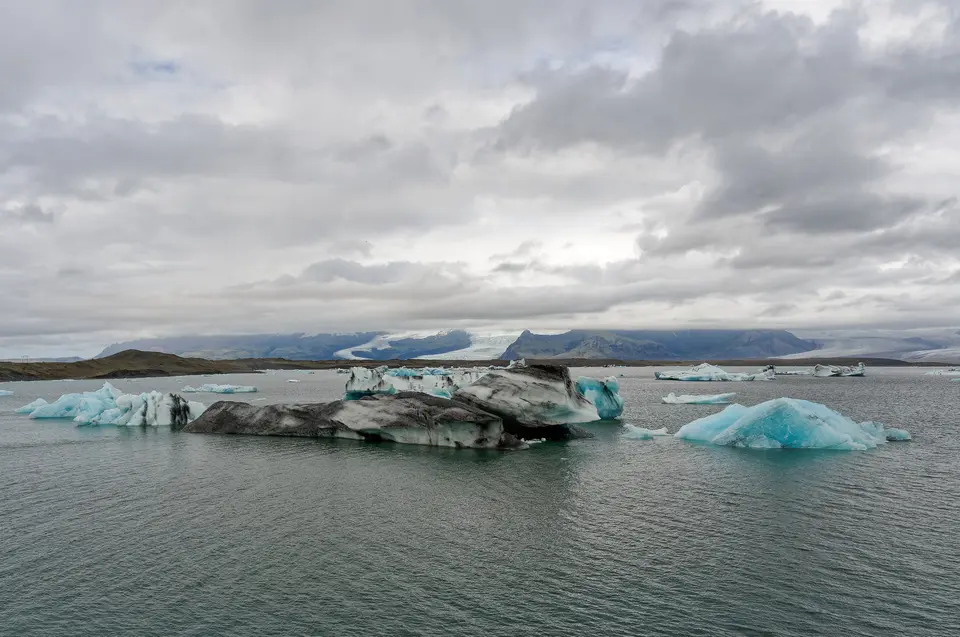
Sixty kilometres east of Skaftafell and 75 km west of Höfn right beside Highway Route 1 shines Jökulsárlón, Iceland's deepest lake at over 284 metres and a prime spot for vatnajökull national park photos. Forming around 1934 after Breiðamerkurjökull began retreating roughly 200 metres yearly from its 1890 Little Ice Age peak, the lagoon quadrupled since 1975 from 8 to 25 square kilometres and now lies 8 km inland from the sea. Thirty-metre-tall milky-white and intense blue icebergs streaked with ancient volcanic ash gather at a narrow outlet reinforced around Route 1's bridge by stone coffer walls before stranding on black volcanic sand at Eystri-Fellsfjara, nicknamed Diamond Beach.
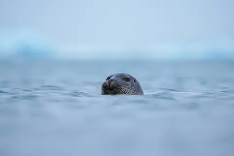
Commercial boat tours began here in 1985 after James Bond's A View to a Kill filmed on the water, growing under local operators Guðbrandur Jóhannesson and Einar Björn Einarsson from 5,000 passengers in 1987 using amphibious LARC-V craft. Today the lagoon operator carries 60,000 to 70,000 annual guests (900,000 cumulative riders), echoing features on a 1991 Icelandic postage stamp and films including Die Another Day, Lara Croft: Tomb Raider, and Batman Begins. Tidal shoals of herring and capelin attract harbour seals to the lagoon mouth each winter, while Arctic terns and aggressive Arctic skuas nest across 25-kilometre-wide Breiðamerkursandur, where ice loss lets coastal bedrock rise 2 to 4 centimetres every year.
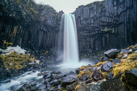
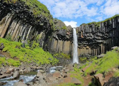
On Skaftafell footpaths, hikers reach Svartifoss waterfall plunging 20 metres over dark hexagonal basalt columns before walking through Bæjarstaðarskógur, home to Iceland's tallest native birches and rowans. Once sheep grazing ended, native plants rebounded quickly across moraines and Morsárdalur, bringing harebells, yellow and pyramidal saxifrages, wild and garden angelica, sea peas, and arctic river beauty back beside willow scrub. Birdwatchers spot redwings, redpolls, wrens, snipe, ptarmigans, golden plovers, meadow pipits, ravens, merlins, wheatears, and snow buntings, together with Arctic foxes, mink, field mice, and rich insect life. Since 2018, four large and several smaller guiding firms have shifted most Vatnajökull National Park glacier hike outings from Svínafellsjökull onto nearby Falljökull.
Northern Canyons, Four Park Territories, and Weather Shifts
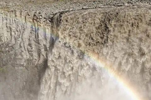
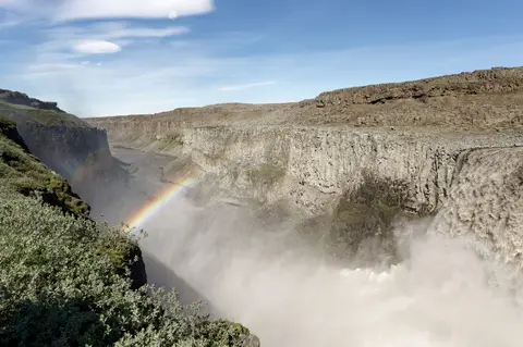
North of the ice cap, ancient glacial mega-floods carved Jökulsárgljúfur canyon along the Jökulsá á Fjöllum river, leaving Dettifoss roaring over fractured basalt steps above twisted columns at Hljóðaklettar and the curved horseshoe cliffs of Ásbyrgi. Across northeastern highlands around Snæfell, damp wetlands shelter wild reindeer herds and summer pink-footed geese far removed from coastal Ring Road traffic. Detailed bedrock maps published in 2007 reveal rocks dating back 5 million years around Skaftafell, while 4-million-year-old tillite strata record dozens of alternating ice ages across an ice cap active for 2.8 million years before entering rapid retreat after the end of the eighteenth century.
Historical sagas and settlement records trace those dramatic ice-margin shifts across southern Vatnajökull in concrete detail. When Norse settlers arrived around 870 CE, the tongue of Breiðamerkurjökull stopped roughly 20 km farther north than its modern snout, leaving broad vegetated pastures below the mountain rim. During the Little Ice Age from 1600 to 1900, colder centuries pushed the glacier forward until it halted within roughly 1 km of the Atlantic coast along the Jökulsá River by 1890. Warming temperatures between 1920 and 1965 reversed that advance rapidly, carving out the deep basin now filled by Jökulsárlón while leaving moraine ridges exposed along both shores. UNESCO boundaries also preserve all subsidiary outlet tongues mapped in 1998 and integrate northern park expansions added since 2013 under coordinated national management plans. Landowners around route corridors and park rangers work together to focus vehicle access on hardened viewing platforms while keeping delicate volcanic moss and highland river terraces free of off-track tyre scars.
Governed under Iceland's Act No. 60/2007, Regulation No. 608/2008, and Conservation Act No. 47/1971 covering Herðubreiðarlindir and Lónsöræfi reserves, Vatnajökulsþjóðgarður operates through four local territories backed by central budgets, own revenue (up to 30 percent), the Tourist Site Protection Fund, and Friends of Vatnajökull. Nearly 1 million annual visitors already approached park thresholds by 2017, managed via satellite and ground seismic monitoring across volcanic hazard zones. In the Southern Territory, Skaftafell Visitor Centre welcomes guests year-round with partner info points at Höfn, Hoffell, Hólmur, and Skálafell, joined in 2017 by state-purchased Fell farm around Jökulsárlón. Seasonal visitor bases operate at Ásbyrgi and Vesturdalur in the North, Skriðuklaustur in the East, and community-shared Kirkjubæjarklaustur in the West near Lakagígar and Langisjór.
Access Zones Across the Reserve's Four Territories
Planning vatnajökull national park things to do requires matching each park quadrant with seasonal road access, visitor hubs, and guided glacier logistics.
| Complex Zone | Key Highlights | Access & Ticket Rule |
|---|---|---|
| Skaftafell and Southern Outlet Glaciers | Svartifoss 20-metre waterfall, Bæjarstaðarskógur birch forest, restored Sel farm, and Falljökull ice tongues. | Year-round Skaftafell centre access with free trails; paid camping May to September and guided glacier tours. |
| Jökulsárlón and Breiðamerkursandur | 284-metre-deep glacial lagoon, Diamond Beach icebergs, harbour seals, and Arctic skua habitats. | Free shoreline viewing off Route 1; commercial lagoon boats and winter ice-cave tours need paid tickets. |
| Jökulsárgljúfur and Northern Plateau | Dettifoss waterfall, Hljóðaklettar basalt pillars, horseshoe Ásbyrgi cliffs, and Askja caldera. | Ásbyrgi centre stays open May to September, winter by request; highland tracks need summer four-wheel vehicles. |
| Eastern Skriðuklaustur and Western Lakagígar | Kverkfjöll peaks, Snæfell reindeer plains, Kirkjubæjarklaustur hub, and 1783 Lakagígar craters. | Eastern centre opens May to September; highland ranger stations patrol from mid-June until late September. |
Basalt Columns, Striated Icebergs, and Post-Glacial Uplift
Exploring southern trails and northern canyons reveals three unmistakable earth-system details inside the Icelandic reserve.
- Hexagonal basalt columns framing Svartifoss: Look straight behind the 20-metre cascade in Skaftafell to see sharp dark polygonal columns fractured during slow lava cooling, echoing across Icelandic architecture.
- Ash-banded blue icebergs drifting in Jökulsárlón: Examine floating blocks from Breiðamerkurjökull to distinguish dense air-free blue glacier ice striped with black layers from ancient subglacial eruptions.
- Canyon scars carved across Jökulsárgljúfur: Stand on basalt rims overlooking Dettifoss to trace dry river terraces stripped raw by repeated prehistoric jökulhlaup surges rushing north toward the ocean.
Best Time to Visit Vatnajökull and Travelling from Reykjavik
Deciding the best time to visit the park balances Iceland's sharp regional weather differences caused by elevation and foehn winds. Southern lowlands see mild winters rarely dipping below minus 10 degrees Celsius and 10 to 20 degree Celsius summers, even though annual rainfall reaches 1,000 to 3,000 millimetres. Up on Öræfajökull, 4,000 to 5,000 millimetres of precipitation piles 10 to 15 metres of winter snow before summit gales plummet temperatures to minus 20 or minus 30 degrees Celsius. Northeastern plains average just 350 to 450 millimetres, and cross-island foehn winds shift weather rapidly: southerly airflows warm the north by 10 degrees Celsius or more, northerly winds bring chill north while brightening the south, and westerly winds favour eastern valleys. Highland routes and ranger stations operate from mid-June until late September, with daily ranger walks running mid-June to mid-August and Skaftafell camping from 1 May to 30 September, leaving winter focused on coastal Route 1 stops. Even during mild coastal periods, severe wind-chill across southern glacier slopes can drop outdoor comfort steeply whenever storms sweep off the ice cap, making layered windproof gear essential for any seasonal walk.
Travellers learning how to get to the national park from Reykjavik typically drive east along paved Ring Road Route 1 (completed across Skeiðarársandur only in 1974) or catch seasonal buses between coastal villages. International flights land at Keflavik International Airport (KEF) 284 km west, while Hornafjörður Airport (HFN) sits 85 km east with limited regional domestic flights. Basing an overland route out of Reykjavik, 248 km west, ties Iceland's capital cleanly to dynamic volcanic icefields, pairing well with other geological sites across the UNESCO World Heritage Atlas.