


























Quick Field Data
- UNESCO Inscription: 1988 (Natural Criteria vii, viii, ix, x)
- Scale & Footprint: 894,420 hectares (893,453 hectares / 8,940 square kilometres / 3,450 square miles) stretching 450 kilometres along the northeast coast of Queensland
- Access & Ticketing: Coordinated by the Wet Tropics Management Authority and Queensland national park authorities; check the official site for permits and biosecurity closures
- Arrival Logistics: Extends from Townsville to Cooktown along the Great Dividing Range and Coral Sea coast, accessed via Cairns, Townsville, Daintree, and Tully
Relict Gondwanan Forests Along the Northeastern Australian Escarpment
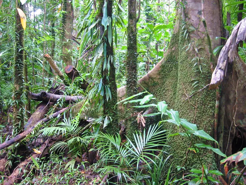
Stretching for approximately 450 kilometres between Townsville and Cooktown along the northeastern coast of Queensland, Australia, the Wet Tropics of Queensland encompasses 894,420 hectares (also measured at 893,453 hectares or roughly 8,940 square kilometres / 3,450 square miles) of rugged coastal ranges, tablelands, escarpments, and lowland tropical rainforests stretching parallel to the offshore Great Barrier Reef. Declared a World Heritage site in the UNESCO World Heritage Atlas in 1988 as one of the rare reserves meeting all four natural selection criteria (vii, viii, ix, and x), added to the Australian National Heritage List on 21 May 2007, and acknowledged on 9 November 2012 for its nationally significant Indigenous heritage, the region is mapped on the Atlas across 14 principal geographic components: the Main block, the Malbon Thompson and Graham Range, the Hugh Nelson Range, the Moresby Range, and the Paluma Range, together with Curtain Fig, the crater waters of Lake Barrine and Lake Eacham, the Russell River corridor, Malaan, Girramay, Cowley, Kurrimine Beach, and Mission Beach. Although the protected area covers just 0.1 percent of the Australian landmass, it shelters 50 percent of all plant and animal species native to the nation. Ancient ferns carpet the wet gullies.
Scientifically, the Wet Tropics preserves the oldest continuously surviving tropical rainforest ecosystems on the planet, containing living relicts of the ancient Gondwanan forests that once blanketed Australia and parts of Antarctica between 50 and 100 million years ago. Whereas the progressive aridification of the Australian continent over tens of millions of years transformed most inland ecosystems into dry sclerophyll woodlands, the steep topographic escarpment of the Great Dividing Range and adjacent small coastal ranges, highlands, tablelands, and foothills trapped moisture from the Coral Sea, allowing ancient Gondwanan lineages to survive and diversify across isolated mountain-top habitat islands. Consequently, these humid forests provide an essential evolutionary record for interpreting fossil plants and animals found across the rest of Australia, demonstrating how Australia's characteristic sclerophyll eucalyptus flora and marsupial fauna evolved from ancestral rainforest stock. At the same time, Indigenous communities known as the Aboriginal Rainforest People have lived continuously within this humid canopy environment for at least 5,000 years, making this the only region in Australia where Aboriginal people permanently inhabited a tropical rainforest ecosystem.
Unlike equatorial evergreen rainforests that experience uniform year-round humidity, the Wet Tropics stands at the latitudinal and climatic limits of tropical rainforest and is shaped by a pronounced dry season alongside frequent tropical cyclones between November and April. Orographic lift along the steep eastern slopes between Cairns and Tully produces extreme precipitation gradients, with annual rainfall ranging from 1,200 millimetres on drier margins to more than 8,000 millimetres on the highest coastal peaks around Mount Bellenden Ker, the wettest meteorological recording station in the region. Feeding off these drenched highlands, 13 major river basins (the northern Annan, Bloomfield, and Daintree rivers; the central Barron, Mulgrave, Russell, Johnstone, and Tully rivers; and the Herbert, Burdekin, Mitchell, Normanby, and Palmer rivers, alongside water storage reservoirs at Copperlode Falls Dam, Koombooloomba Dam, and the southern Paluma Dam) plunge over sheer escarpments that include Wallaman Falls, Australia's highest single-drop waterfall, before meeting coastal floodplains. Between the Daintree River and Cedar Bay, lowland rainforest descends directly onto white sandy beaches and fringing offshore coral reefs, while to the south the winding Hinchinbrook Channel protects the most extensive mangrove forests in the region, forming an unbroken terrestrial and marine continuum with the Great Barrier Reef.
Primitive Flowering Plants, Gondwanan Trees, and Marsupial Evolution
Across its 16 identified structural types of rainforest (including 13 distinct rainforest classes and 29 species of mangroves, more than anywhere else in Australia), the Wet Tropics harbours the world's densest concentration of near-basal primitive flowering plant families, matched in humid tropical endemism only by the historically isolated islands of Madagascar and New Caledonia:
- Sixteen primitive flowering plant families and Vic Stockwell's Puzzle: Among the 28 near-basal flowering plant families recognised globally, 16 occur in the Wet Tropics, including 2 families found nowhere else on earth and at least 50 endemic primitive species. Botanical surveys record more than 390 rare plant species (including 74 threatened species and at least 85 regional endemics), 90 orchid species, and 65 percent of all Australian fern species, including all 7 ancient fern species. In restricted pockets of well-developed upland rainforest grows Stockwellia quadrifida (known as Vic Stockwell's Puzzle in the family Myrtaceae), a rare large living fossil tree closely resembling the ancient Gondwanan ancestors from which modern eucalypts diversified into so many different species across Australia today.
- The musky rat-kangaroo and 107 mammal species: Because Australia's marsupials and most of its native vertebrate lineages originated inside ancient rainforest habitats, their closest surviving evolutionary relatives inhabit the Wet Tropics today among 107 recorded mammal species. Foremost among the 50 animal species unique to the Wet Tropics is the musky rat-kangaroo, a small marsupial that retains primitive anatomical traits representing an ancestral stage in kangaroo evolution. Other rare mammals include the threatened spotted-tailed quoll, yellow-bellied gliders, the brush-tailed bettong, one-quarter of all Australian rodent species, and the insectivorous bat Murina florium (the Flores tube-nosed bat), considered the rarest mammal in Australia.
- The southern cassowary and 370 bird species: Ornithologists have recorded 370 bird species across the forest canopy, singing bird habitats, and coastal wetlands, including 11 species found nowhere else in the world. The flagship avian resident is the threatened southern cassowary, a large flightless rainforest frugivore essential for dispersing the large seeds of canopy trees across the forest floor.
- Endemic reptiles, amphibians, and 225 butterfly species: Diverse geomorphology has created isolated mountain habitat islands where distinct subspecies have evolved on specific mountains or groups of mountains, driving speciation across 113 reptile species (24 endemic) and 51 amphibian species (22 endemic), alongside roughly 225 butterfly species (constituting approximately 57 percent of Australia's entire butterfly fauna), including 6 endemic species and 14 endemic subspecies.
Ten National Parks, Biosecurity Protection, and Visitor Access
Established in 1983 (and employing 20 staff in 2012 as a specialised agency inside Queensland's Department of Environment and Heritage Protection under a board of directors reporting to the joint Queensland and Federal Wet Tropics Ministerial Council), the Wet Tropics Management Authority coordinates conservation across more than 700 protected parcels, including privately owned land, of which 15 percent is designated as national park: Barron Gorge, Kalkajaka, Cedar Bay, Daintree, Girramay, Girringun, Kirrama, Kuranda, Macalister Range, and Wooroonooran National Parks. As documented by researchers Steve Goosen and Nigel I. J. Tucker in their 1995 rainforest restoration study for the Wet Tropics Management Authority, managers actively combat lowland habitat fragmentation and degradation from sugarcane industry expansion, internal fragmentation by road and powerline corridors, motor vehicle strikes on southern cassowaries, feral cats preying on native wildlife and competing directly for prey and denning territory with the rare spotted-tailed quoll, hard-to-detect invasive insects and mites, and the root-rot pathogen Phytophthora, which requires keeping sensitive upland zones off-limits to the general public.
- Entry and route: Cairns and Townsville act as the primary gateways along the coastal highway. From Cairns, travellers can ascend into Barron Gorge and Kuranda National Parks, visit the volcanic crater lakes of Lake Barrine and Lake Eacham and the Curtain Fig on the tablelands, or drive north across the Daintree River into the Daintree Rainforest and Cedar Bay National Park, while southern routes access Girringun National Park (Wallaman Falls), Hinchinbrook Channel, and Paluma Range.
- Tickets and viewpoints: Walking tracks, boardwalks, and scenic lookouts at Wallaman Falls, Wooroonooran (Mount Bellenden Ker), Daintree, and Mission Beach are managed by state park authorities; check the official site for camping bookings, seasonal cyclone track closures, and mandatory boot-cleaning stations that prevent the spread of Phytophthora into restricted upland rainforest pockets.
- Timing and onward connections: The drier, cooler months from May to October provide the clearest hiking conditions and fewest road closures across the 13 river basins, whereas the wet season from November to April brings maximum flow to Wallaman Falls and the Barron Gorge cascades alongside intense rainfall and the risk of tropical cyclones.
