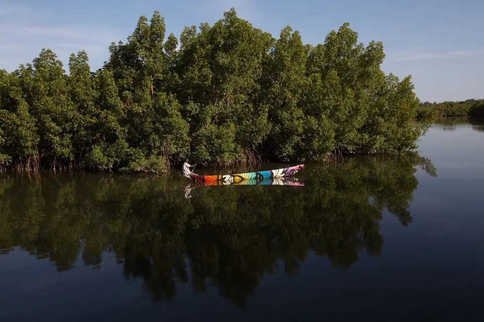
Banjul Island: Arch 22, National Museum, Albert Market and Kunta Kinteh Island
Walking historic Banjul Island from the panoramic gallery of Arch 22 and the National Museum through Albert Market to the Barra and Kunta Kinteh ferries.
Driving east from the Atlantic beach resorts along the Banjul-Serekunda highway and crossing multi-span Denton Bridge over the tidal mangrove channels of Oyster Creek brings you onto St Mary's Island (Banjul Island), a low-lying sandbank poised precisely where the broad estuary of the Gambia River meets the Atlantic Ocean. For generations before colonial settlement, local Mandinka villagers came to this marshy island to gather fibrous bamboo and hibiscus bark for weaving ropes, calling the place Bangjulo ('rope mat island'), from which the modern name Banjul derives. In 1816, British captain Alexander Grant leased the sandbank from the King of Kombo to establish a military and naval garrison named Bathurst (after the British Colonial Secretary, Lord Bathurst), tasked with intercepting illegal slave ships along the West African coast following the Abolition of the Slave Trade Act. Renamed Banjul in 1973 after Gambian independence, the historic island core occupies only the eastern tip of the sandbank, allowing you to walk comfortably from its ceremonial entrance arch through nineteenth-century streets to the riverfront market and ferry terminal in twenty minutes.
Arch 22 and Tree-Lined Independence Drive
Every vehicle entering the capital across Denton Bridge passes directly beneath the three cream-and-peach neoclassical arches of Arch 22, rising 35 metres (115 feet) above the central roundabout at the top of tree-lined Independence Drive (known during the colonial era as Marina Parade). Designed by Senegalese architect Pierre Goudiaby Atepa and inaugurated on 22 July 1996, the monumental gateway stands on eight columns and serves as the vertical orientation point for the entire Greater Banjul region.
Before walking into the town grid, buy a modest entry ticket at the ground-floor kiosk (check current local rates on site and bring small local banknotes as advised in our practical Banjul briefing) and climb the spiral staircases, or ride the internal lift when operating, to the upper gallery levels:
- The 360-Degree Open-Air Cupola Balcony: stepping out onto the breezy top balcony reveals the remarkable island geography of Banjul at a single glance. Looking east and northeast across the waterfront roofs and corrugated iron warehouses, the brown-and-silver mouth of the Gambia River stretches five kilometres wide toward the north-bank town of Barra. Looking north, Atlantic rollers break along the sandy spit leading toward Cape Point and Bakau, while looking west and south behind you, the emerald labyrinth of Tanbi Wetland Complex and Oyster Creek winds around the island, explaining why Banjul can never expand beyond its original sandbank footprint.
- Independence Drive and MacCarthy Square: descending from Arch 22, stroll east down the shaded boulevard of Independence Drive, flanked by government ministries, the white colonnades of State House (viewed from outside; do not photograph military guards or the presidential compound) and the green expanse of MacCarthy Square (July 22nd Square), laid out in the 1820s as the colonial parade ground and cricket pitch of early Bathurst.
The National Museum of The Gambia and Colonial Bathurst
Five minutes' walk down Independence Drive opposite MacCarthy Square stands the white colonial building of the National Museum of The Gambia, opened in 1985 inside the former Bathurst Club Building. Spending forty-five minutes inside its three air-conditioned and fan-cooled floors gives essential historical and cultural context for the rest of your trip across the country:
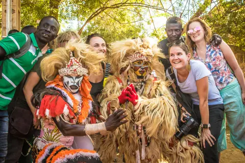
- Ground Floor (Musical Instruments, Masquerades and Material Culture): showcases the living traditions of The Gambia's Mandinka, Wolof, Fula, Jola, Serer and Aku communities. Examine intricately carved gourd resonators of the twenty-one-string kora harp-lute played by hereditary jali (griot) historians, rosewood balafon xylophones, ceremonial Kankurang bark masks and regional basketry.
- First Floor (Archaeology and the River Trade): traces over a thousand years of Senegambian history, from scale models and photographs of the mysterious prehistoric Wassu and Kerbatch Stone Circles upriver to early Portuguese, Courlander (Latvian), French and British trading forts along the Gambia River, plus exhibits on the transatlantic slave trade and the 1816 founding of Bathurst.
- Top Floor and Surrounding Streets (19th-Century Bathurst Photography): displays black-and-white archival photographs of Victorian and Edwardian Bathurst, showing how the streets around nearby Buckle Street, Leman Street and Wellington Street were built by liberated African Aku merchants and timber traders in two-storey brick-and-timber Krio architecture with wraparound wooden verandas.
Navigating the Fabric, Spice and Woodcarving Lanes of 1855 Albert Market
From the National Museum, turn toward the riverfront onto Liberation Avenue (formerly Wellington Street) to enter Albert Market (Banjul Market), established in 1855 and named after Prince Albert, the royal consort of Queen Victoria. Unlike sprawling, high-pressure big-city bazaars, Albert Market occupies a compact grid of covered passages and open courtyards where a friendly greeting in Mandinka ("Kayiraba") or Wolof ("Nanga def") opens warm conversations:
- The Produce, Spice and Fabric Alleys: the northern and central lanes burst with pyramids of red chili powder, dried baobab fruit, hibiscus flowers (for brewing ruby-red wonjo juice), smoked river bonga fish and roasted groundnut paste, leading into lively corridors draped ceiling-to-floor in hand-dyed indigo fabric, wax-resist batik textiles and colourful West African prints where tailors stitch custom garments on treadle sewing machines in a couple of hours.
- The Upstairs Woodcarvers' and Artisans' Gallery: near the middle of the market, climb the wooden stairs to the quieter upper balcony and craft courtyard, where woodcarvers shape mahogany and ebony carvings, leatherworkers stitch sandals and pouffes, and silversmiths craft fine Tuareg and Wolof filigree jewellery.
The Banjul-Barra Ferry and the River Voyage to UNESCO Kunta Kinteh Island
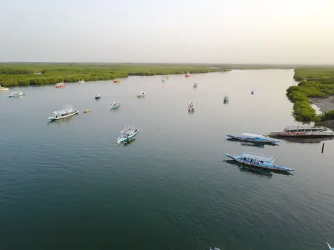
Ten minutes south of Albert Market along the harbourfront sits the busy Banjul Ferry Terminal, the maritime lifeline of the country. Here, wide steel roll-on/roll-off passenger and vehicle ferries cross the five-kilometre mouth of the Gambia River throughout the day to Barra on the North Bank (check our Banjul transport guide for ferry tips and why foot passengers should board with light daypacks rather than rental cars). Watching fishermen haul brightly painted wooden pirogues onto the beach beside the pier while pelicans and terns dive into the tidal current is a classic Banjul scene.
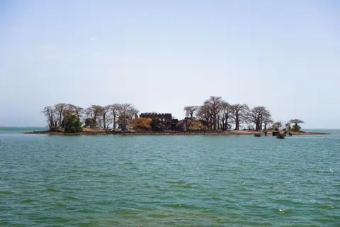
From Barra, where you can inspect the seaside cannon batteries of Fort Bullen, built by the British in 1826 as the northern partner to Bathurst's Six-Gun Battery, travellers continue thirty kilometres east by road to the historic riverbank villages of Albreda and Juffureh, or join a full-day wooden boat cruise directly from Banjul harbour upriver to UNESCO World Heritage-listed Kunta Kinteh Island (known until 2011 as James Island). Sitting mid-stream in the Gambia River and shaded by ancient baobab trees rising from the ruined seventeenth-century stone walls of Fort James, the island and the slavery museum at Albreda preserve the history of the river trade immortalised in Alex Haley's Roots. As mapped out in our three-day Banjul itinerary, you can either dedicate a full day to the Kunta Kinteh Island boat excursion or pair a morning walk through Arch 22, the National Museum and Albert Market with an afternoon return across Denton Bridge to Bakau's Kachikally Crocodile Pool and Cape Point.
Traveller tips
Real advice from people who have been to Banjul Island: Arch 22, National Museum, Albert Market and Kunta Kinteh Island. Every tip is read by our team before it goes live.
No tips yet. Been here? Yours could be the first.
Thank you! Your tip will appear here after a quick review.
More in Banjul
Continue exploring Banjul with related neighbourhood, food, and planning guides