Sedona
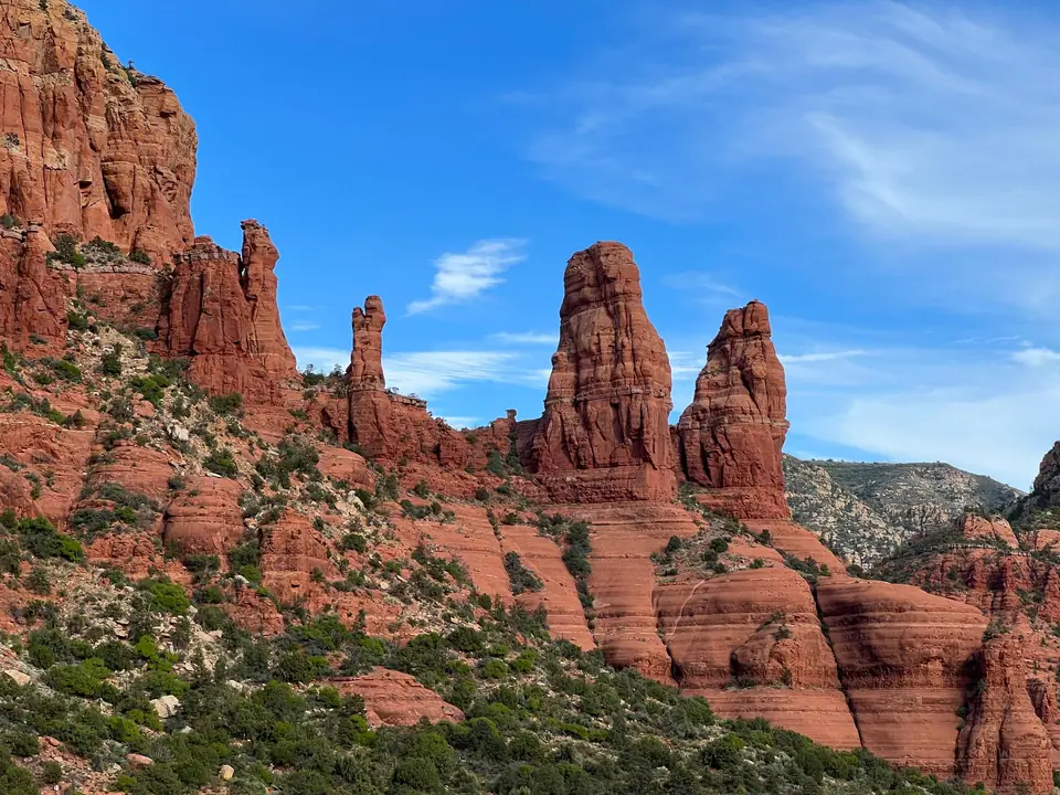
Arizona's crimson red-rock wonderland at the mouth of lush Oak Creek Canyon, where the soaring sandstone spires of Cathedral Rock, Bell Rock and Devil's Bridge meet the cliff-wedged Chapel of the Holy Cross, 800-year-old Sinagua cliff dwellings, natural rock waterslides and sycamore-shaded Tlaquepaque Village.
Quick decisions
How many days?
3 days: Chapel of the Holy Cross, Bell Rock, Tlaquepaque Village and Cathedral Rock (or Red Rock Crossing) at sunset on day one, riding the free Sedona Shuttle to hike Devil's Bridge and Boynton Canyon (Subway Cave) plus Airport Mesa on day two, and driving scenic Oak Creek Canyon (Slide Rock and West Fork Trail) or visiting Jerome and the Verde Canyon Railroad on day three. Follow our three-day route.
Where should I stay?
Uptown Sedona: walkable restaurants, shops and sweeping east-facing views of Snoopy Rock and Munds Mountain. West Sedona (Highway 89A): quieter hotels, organic supermarkets and closest access to Devil's Bridge and Boynton Canyon. Village of Oak Creek (South on Hwy 179): relaxed resort golf base right beneath Bell Rock and Cathedral Rock. Compare bases in our lodging guide.
Do I need a car?
Yes to reach Sedona and explore Oak Creek Canyon; use the free Sedona Shuttle for the top 5 trailheads. From Thursday to Sunday (and daily during peak spring and holiday weeks), car parks at Cathedral Rock, Devil's Bridge, Soldier Pass and Boynton Canyon close to private cars, so you park free at a Park & Ride and hop the complimentary shuttle.
Best for
Acclaimed red-rock day hikes: over 300 kilometres of trails across glowing Schnebly Hill sandstone. Off-road 4x4 Jeep tours & vortexes: Broken Arrow slickrock and four famous energy centres. Creek canyons & wine country: Oak Creek waterfalls and Verde Valley tasting rooms.
Before you go
Understand the Daily Red Rock Pass vs the Free Sedona Shuttle: when riding the free trailhead shuttle you need no pass; when parking your own car at US Forest Service trailheads on non-shuttle days, display a Daily Red Rock Pass or an America the Beautiful National Parks Pass. Read our practical briefing.
Getting around
From Phoenix Sky Harbor Airport (PHX, 190 km / 2 hours north on I-17) or Flagstaff (45 mins south on Scenic 89A): an easy halfway stop between Phoenix and the Grand Canyon. Details in arrival and transport.
Continue your trip
Drive 45 minutes north up the hairpins of Oak Creek Canyon to Flagstaff and the Grand Canyon South Rim (2 hours total), or head 30 minutes west to hilltop Jerome.
Overview
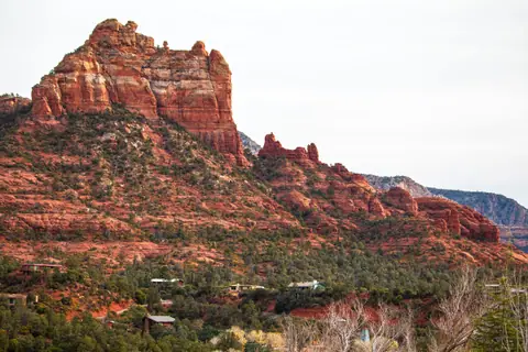
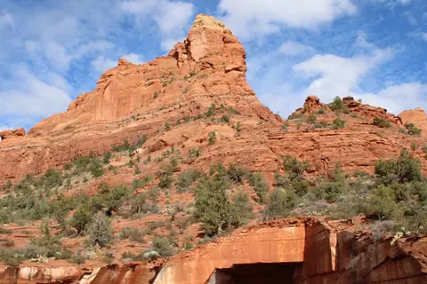
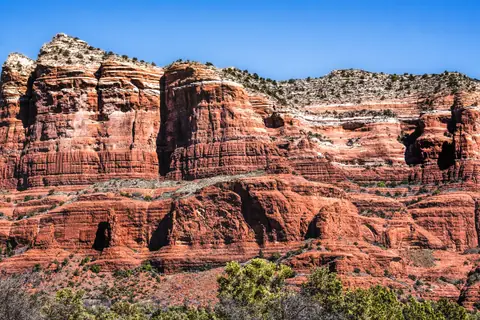
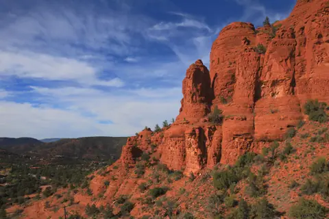
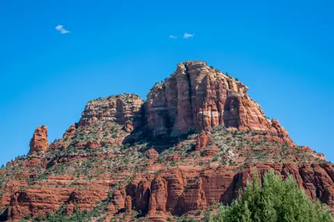
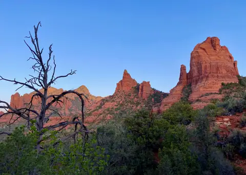
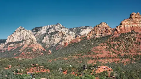
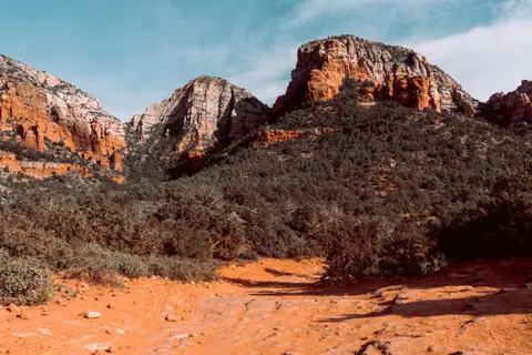
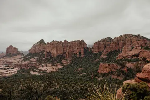
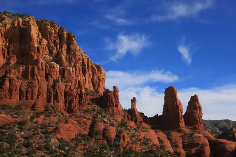
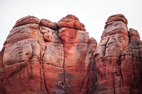
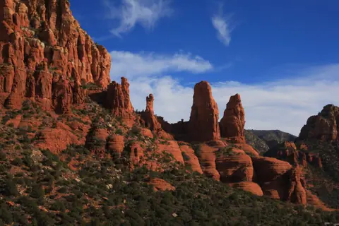
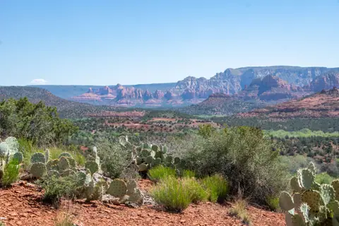
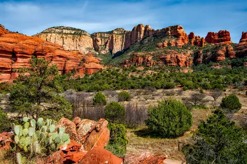
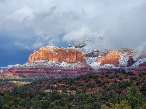
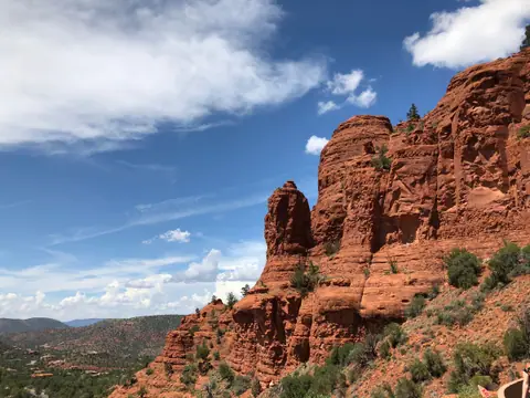
Sitting at a comfortable 1,326 metres (4,350 feet) elevation right where the high ponderosa-pine rim of the Colorado Plateau drops 600 vertical metres into the Verde Valley of central Arizona, Sedona is surrounded on all four sides by 1.8 million acres of protected Coconino National Forest. Unlike national parks where you drive inside a gate to view cliffs from afar, Sedona is a town built directly among dozens of 300-metre-tall crimson, orange and cream sandstone buttes, spires and mesas, coloured by iron-oxide (hematite) coatings on 275-million-year-old Permian Schnebly Hill and Coconino sandstones that glow like hot coals at sunrise and sunset on the ancestral homeland of the Yavapai and Apache Peoples.
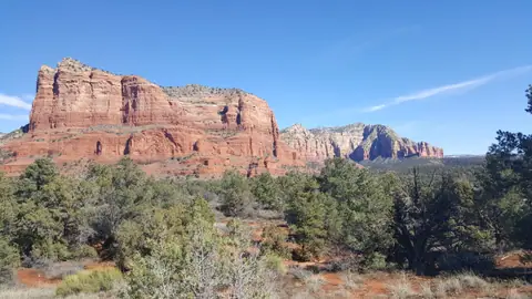
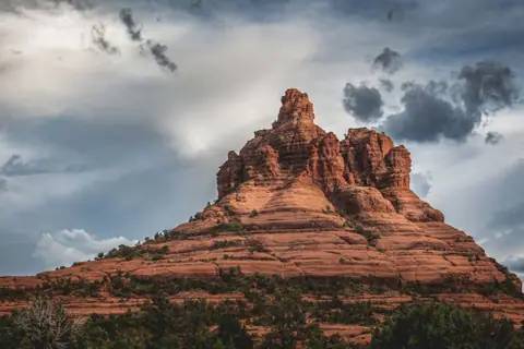
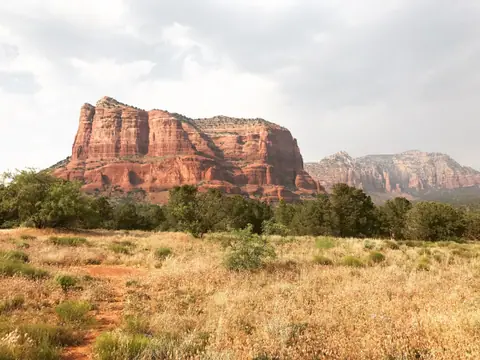
Along scenic Red Rock Byway (Highway 179) rise the twin icons of Bell Rock, Courthouse Butte and the modernist concrete Chapel of the Holy Cross wedged directly into the cliffs, across from the spired fortress of Cathedral Rock. In Dry Creek basin to the northwest, trails lead to the natural sandstone arch of Devil's Bridge, the hidden Subway Cave in Boynton Canyon, and the sinkhole of Soldier Pass and the Seven Sacred Pools. North of town, Oak Creek Canyon (Highway 89A) winds past the natural rock chutes of Slide Rock State Park, while sycamore trees shade the Mexican-style courtyards of Tlaquepaque Arts Village. Start with our before-you-go briefing and top things to do in Sedona.
Getting there
Sedona sits almost exactly halfway between Phoenix Sky Harbor International Airport (PHX, 190 km / 2 hours south down Interstate 17) and the Grand Canyon South Rim (175 km / 2 hours north via Highway 89A through Oak Creek Canyon and Flagstaff). While Groome Transportation runs daily shuttle vans from Phoenix Airport to Sedona, hiring a car is strongly recommended for exploring Oak Creek Canyon, Red Rock Crossing, Montezuma Castle and Jerome. For the five most popular hiking trailheads (Cathedral Rock, Devil's Bridge / Mescal, Soldier Pass, Little Horse and Boynton Canyon), park your car for free at one of the municipal Park & Ride car parks and ride the complimentary 'Sedona Shuttle'. See getting to Sedona and how the free Sedona Shuttle and Red Rock Pass work.
Where to stay
Sedona's hotels are spread across a Y-shaped intersection formed by Highway 89A and Highway 179: stay in Uptown Sedona if you want to walk to over 30 restaurants, jeep-tour depots and Tlaquepaque Village with panoramic eastern rock views; stay in West Sedona (2 to 4 miles west on 89A) for better hotel value, organic supermarkets (Whole Foods and Natural Grocers), top local restaurants and instant access to the Posse Grounds Shuttle Hub for Devil's Bridge and Soldier Pass; stay 6 miles south in the Village of Oak Creek for quieter suites directly facing Bell Rock and Cathedral Rock; or splurge on a canyon resort inside Boynton Canyon or along Oak Creek. Compare all four zones in where to stay in Sedona.
Things to do
Scramble up the red sandstone saddle of Cathedral Rock and photograph its reflection in Oak Creek at Red Rock Crossing, walk across the 16-metre natural sandstone arch of Devil's Bridge, step inside the cliff-wedged 1956 Chapel of the Holy Cross and hike around Bell Rock, find the hidden Subway Cave in Boynton Canyon, see the Devil's Kitchen sinkhole and Seven Sacred Pools on Soldier Pass, ride a Pink Jeep 4x4 over Broken Arrow slickrock and watch sunset at Airport Mesa, drive through Oak Creek Canyon (Slide Rock & West Fork Trail), stroll Tlaquepaque Village, and visit 800-year-old Palatki and Montezuma Castle cliff dwellings. Full list in things to do in Sedona.
Food and drink
Sedona is the culinary jewel of Northern Arizona, pairing modern Southwestern cuisine with panoramic cliff-view terraces and local Verde Valley wines: fire-roasted corn with spicy mayo and cotija cheese at Elote Cafe, Latin-inspired steaks on a bluff facing Snoopy Rock at Mariposa, tables under the sycamore trees right beside rushing Oak Creek at Cress on Oak Creek and Hideaway House, prickly-pear cactus margaritas, and crisp Arizona Syrah and Malvasia Bianca along the Page Springs Wine Trail. Read more in our Sedona dining and wine guide.
Culture
Inhabited from 650 to 1400 AD by the ancestral Sinagua people (who left multi-storey masonry cliff dwellings and thousands of rock pictographs) and still home to the Yavapai-Apache Nation, Sedona evolved from 1902 homesteader Sedona Arabella Miller Schnebly's apple orchards into a 1940s Hollywood Western movie set, a fine-arts colony and an International Dark Sky City.
Weather by month
Sedona is warmest in July, with average highs around 36°C, and coldest in December, when nights drop to about 1°C. January is the wettest month, with rain on about 5 days. For mild weather with fewer rainy days, aim for April, October and November.
| Month | Low | Range | High | Rain | Rainy days |
|---|---|---|---|---|---|
| Jan | 1°C | 14°C | 48 mm | 5 d | |
| Feb | 2°C | 15°C | 46 mm | 5 d | |
| Mar | 5°C | 19°C | 42 mm | 4 d | |
| Apr | 8°C | 24°C | 20 mm | 2 d | |
| May | 12°C | 28°C | 14 mm | 2 d | |
| Jun | 18°C | 35°C | 6 mm | 1 d | |
| Jul | 21°C | 36°C | 42 mm | 6 d | |
| Aug | 20°C | 35°C | 48 mm | 6 d | |
| Sep | 16°C | 32°C | 32 mm | 4 d | |
| Oct | 11°C | 25°C | 28 mm | 3 d | |
| Nov | 4°C | 18°C | 30 mm | 3 d | |
| Dec | 1°C | 13°C | 44 mm | 5 d |
Averages of daily values from 2015 to 2024. Rainy days are days with at least 1 mm of rain. Source: Open-Meteo · Compare destinations by month.
Sedona on the map
Every place we cover in Sedona. Tap a category or pin to explore.
In-depth Sedona guides
Browse the guides grouped by topic: sights, neighbourhoods, food, transport, day trips and trip planning.
Sights, Landmarks & Parks
Key monuments, viewpoints, museums and nature trails.
- Best Things to Do in SedonaCrimson sandstone arches, cliff-wedged modernist chapels, natural rock waterslides, 4x4 slickrock Jeep tours and ancient ruins.
- Cathedral Rock Hike ('The Saddle') & Red Rock Crossing (Crescent Moon Picnic Site)Scrambling up the short, thrilling 1.9-kilometre slickrock trail into the saddle of Cathedral Rock, and seeing its reflection in Oak Creek.
- Hiking to Devil's Bridge: Why the Scenic Mescal Trailhead (Free Shuttle) Beats the 4x4 Dirt RoadWalking across Sedona's largest natural sandstone arch, and why the scenic Mescal Trailhead route beats walking the dusty Jeep road.
- Chapel of the Holy Cross (Free Entry), Bell Rock Vortex & Courthouse Butte LoopVisiting Sedona's architectural icon, the 1956 Chapel of the Holy Cross, and walking the red-rock base of Bell Rock.
- Sedona's 4 Vortex Sites Explained, Boynton Canyon & How to Find the Secret Subway CaveExploring Sedona's four famous energy vortexes and finding the unmarked turnoff to the wave-carved Subway Cave in Boynton Canyon.
- Oak Creek Canyon Scenic Drive (Highway 89A): Slide Rock State Park & the West Fork TrailDriving 10 minutes north of hot red rocks into a shady, spring-fed river gorge, home to Slide Rock and the 13 stream crossings of the West Fork Trail.
- Airport Mesa Sunset Viewpoint, the Airport Loop Trail & 4x4 Pink Jeep Tours (Broken Arrow)Watching the red-rock skyline ignite in crimson alpenglow from Airport Mesa, and crawling over 45-degree slickrock in a 4x4 Jeep.
- Hiking Soldier Pass Trail: Devil's Kitchen Sinkhole, Seven Sacred Pools & Soldier Pass CaveSeeing a 50-metre collapsed sinkhole and seven tiered sandstone pools in the first 30 minutes of a single trail.
- 800-Year-Old Sinagua Cliff Dwellings: Palatki, Honanki, Tuzigoot & Montezuma CastleStanding beneath 800-year-old five-storey stone masonry cliff dwellings and 5,000 years of rock pictographs.
- Stargazing in an International Dark Sky City & Sunrise Hot-Air Balloon FlightsGazing at the Milky Way in one of the world's few certified Dark Sky Cities, and floating silently over 300-metre red spires at dawn.
Neighbourhoods & Where to Stay
Districts, historic quarters and the best bases for your stay.
- Tlaquepaque Arts & Shopping Village, Uptown Sedona & Hillside GalleriesWandering under giant sycamore trees through the stucco arches, fountains and bronze sculpture courtyards of Tlaquepaque Village.
- Where to Stay in Sedona: Uptown vs West Sedona, Village of Oak Creek & Boynton Canyon ResortsChoosing between walkable Uptown Sedona, practical West Sedona, golf-and-view resorts in the Village of Oak Creek, or Boynton Canyon luxury.
Food & Drink
Local dishes, markets, cafés and dining districts.
Getting Around & Arrival
Airport transfers, public transit, passes and driving rules.
- Getting to Sedona from Phoenix (PHX, 2 Hours), Flagstaff & the Grand Canyon (Scenic 89A)Driving two hours north from Phoenix into the red rocks, or descending the dramatic switchbacks of Oak Creek Canyon from Flagstaff and the Grand Canyon.
- Getting Around Sedona: The Free Sedona Shuttle to Trailheads, Red Rock Pass & RoundaboutsHow the free Sedona Shuttle works for the five most popular hikes, and when your National Parks Pass covers trailhead parking.
Day Trips & Excursions
Easy half-day and full-day trips from the city.
Trip Planning & Itineraries
When to visit, what to pack and day-by-day routes.
- Sedona: What to Know Before You GoMastering Sedona's Y-shaped town layout, the free trailhead shuttle rules, and why your National Parks Pass covers parking.
- Best Time to Visit Sedona: Spring Wildflowers, October Canyon Foliage, Summer Creek & Mild WintersWhy Sedona is a true four-season high-desert paradise, from 22°C April and October hiking weather to November maple foliage in Oak Creek Canyon.
- What to Wear in Sedona: Sticky-Rubber Trail Shoes for Slickrock, Slide Rock Denim & LayersWhy sticky-rubber trail shoes are mandatory on sloping Cathedral Rock slickrock, plus the local secret for sliding down Slide Rock.
- 3 Days in Sedona: Cathedral Rock, Devil's Bridge, Subway Cave, Oak Creek Canyon & JeromeA logical 3-day route grouping Highway 179 & Cathedral Rock on Day 1, Dry Creek Basin (Devil's Bridge & Boynton) on Day 2, and Oak Creek Canyon + Jerome on Day 3.
Need your embassy or consulate in United States? See embassies and consulates in United States.
Reviews
Log in to write a review.
No reviews yet.