Quick Field Data
- UNESCO Inscription: 2023 (Ref. 1687), cultural archaeological mound and spring in the Jordan Valley, State of Palestine; Criteria (iii) and (iv).
- Scale & Footprint: 5.93 hectares enclosing the oval-shaped Tell es-Sultan archaeological mound and the adjacent perennial Ain es-Sultan oasis spring, 2 kilometres north of central Jericho.
- Access & Ticketing: Managed as a National Archaeological Park by the Palestinian Ministry of Tourism and Antiquities (MoTA-DACH) under the 2018 Tangible Cultural Heritage Law; verify visitor entry arrangements locally before travelling.
- Arrival Logistics: Across the Jordan River basin, Queen Alia International Airport (AMM) sits 54 kilometres southeast and Ben Gurion International Airport (TLV) lies 55 kilometres west, while regional travel links south toward Petra (172 kilometres).
Ain es-Sultan Spring and the Neolithic Settlement Sequence
Positioned 2 kilometres north of modern Jericho in the Jordan Valley (population 20,907 in 2017), Ancient Jericho/Tell es-Sultan stands among the oldest continually settled cities on Earth. Its Arabic name Ariha and Biblical Hebrew name Yeriho both link to the Canaanite word for fragrant (reh), though some scholars derive the name from the moon or lunar deity Yarikh, while biblical sources call it the city of palm trees. In Arabic and Hebrew, tell means artificial mound formed over millennia as successive sun-dried mudbrick towns rose over earlier layers. Across twenty-nine documented occupation phases extending past 10,500 BC, the oval 5.93-hectare mound reveals over 20 settlement strata tied directly to the ancient Jericho location beside Ain es-Sultan spring.
Understanding how a compact oasis mound grew across eleven millennia explains every trench cut into the earth today. Whenever sun-dried clay houses weathered or collapsed after rains or earthquakes, builders levelled the earthen rubble cleanly to lay fresh living floors right above earlier walls. Repeating that practical rebuilding cycle for thousands of years elevated the mound organically above the flat desert floor, sealing domestic hearths, beneath-floor burials and stone toolkits in crisp chronological stacks.
During cold, arid Younger Dryas droughts before 9600 BC, reliable spring discharge drew mobile Natufian hunter-gatherers who left crescent-shaped flint microliths across seasonal camps. Once Holocene warming ended the Younger Dryas around 9600 BC, Natufian groups erected permanent stone-footed shelters between 10,000 and 9000 BC before organised farming began. Archaeologists treat Tell es-Sultan as the defining type site for both Pre-Pottery Neolithic A (PPNA) and Pre-Pottery Neolithic B (PPNB) cultures across the Levant. Because reliable perennial spring water guaranteed year-round moisture in an arid valley below sea level, early residents pioneered cultivated grains and stable courtyard architecture centuries ahead of dry upland villages.
Between roughly 8500 and 7500 BC (known locally as Sultanian, with calibrated Pre-Sultan dates spanning around 8350 to 7370 BC), the oasis developed into an early walled proto-city covering 4 hectares (40,000 square metres). Without planned streets, builders grouped round dwellings measuring 5 metres across made from sun-dried clay-and-straw bricks set in mud mortar beneath mud-plastered brush roofs, cooking over indoor and courtyard hearths while burying dead kin beneath room floors. Estimates of ancient Jericho population during this PPNA peak vary sharply between 200 to 300 inhabitants and 2,000 to 3,000 farmers cultivating emmer wheat, barley and pulses while hunting wild game.
The 8300 BC Stone Tower, Plastered Skulls and Early Religion
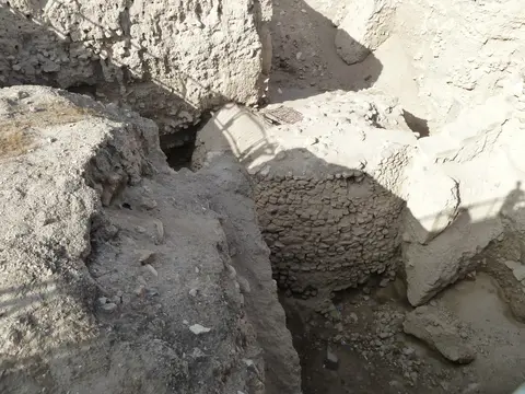
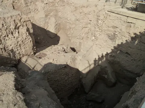
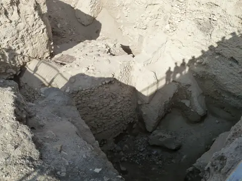
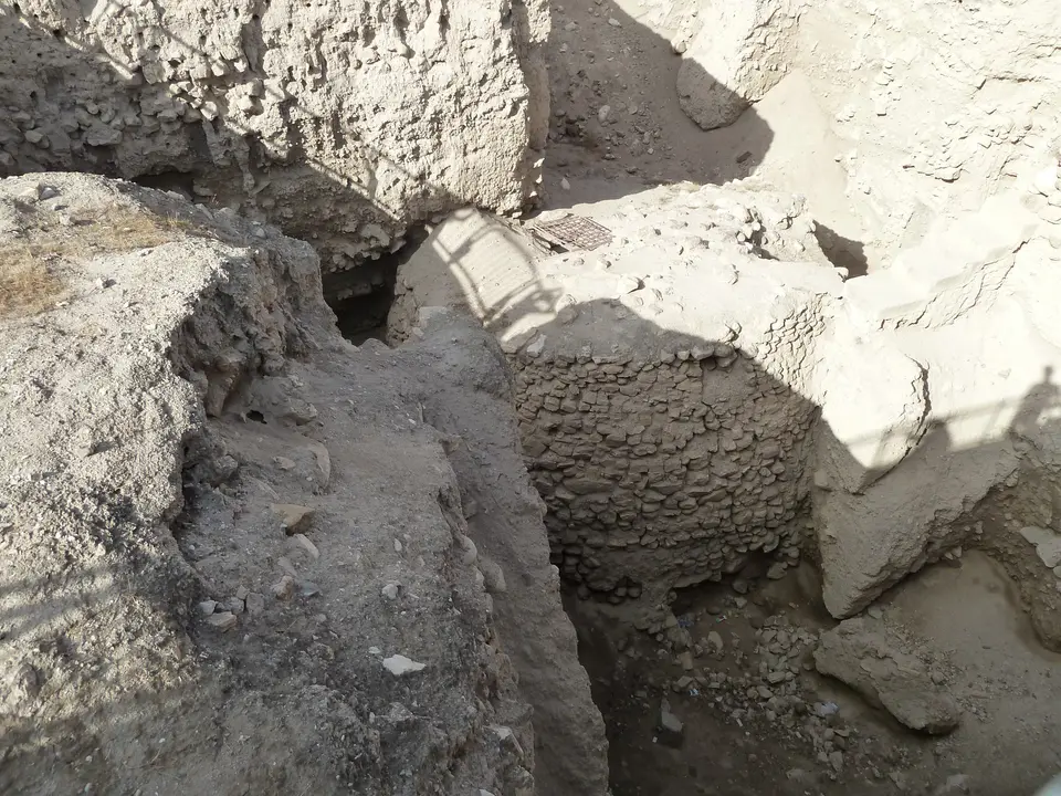
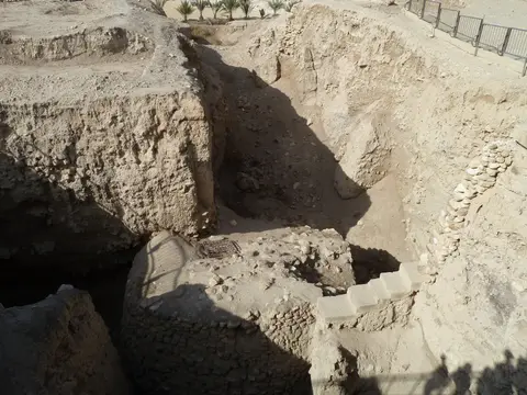
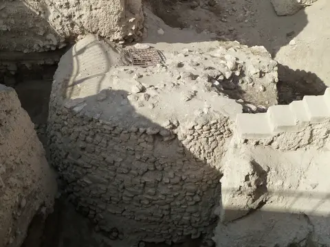
Rising inside the western archaeological trench stands Tell es-Sultan's defining prehistoric monument: a circular stone tower enclosed by a perimeter defensive wall. Surrounding the 4-hectare PPNA settlement rose a stone wall over 3.6 metres high and 1.8 metres wide at its base, cut outside by a rock ditch and backed internally on the mound's west flank by a solid stone tower rising over 8.5 metres tall. Inside that tower ascends an intact stair passage containing 22 stone steps. It remained the tallest human-built monument known on Earth until Egypt's Pyramid of Djoser and ranks behind only Syrian towers at Tell Qaramel in age. Quarried, hauled and stacked solely with stone tools before pottery kilns or bronze chisels existed, both works prove organised communal labour far earlier than urban kingdoms emerged.
Radiocarbon testing published in 1981 and 1983 places tower construction around 8300 BC, remaining active until roughly 7800 BC. Researchers estimate raising the ancient Jericho walls and tower demanded a hundred workers labouring more than a hundred days, proving early social coordination. While the perimeter wall and ditch likely shielded fields from mudslides and seasonal floodwater, many archaeologists assign the towering stair chamber a ceremonial or ritual purpose.
After a settlement break lasting roughly five centuries, Pre-Pottery Neolithic B communities founded a new settlement atop eroded mound levels around 6800 BC (within a 7220 to 5850 BC span). Rectangular courtyard houses replaced round huts, assembled on stone foundations from hand-formed loaf-shaped mudbricks bearing deep thumbprints to lock mortar. Main rooms (6.5 by 4 metres and 7 by 3 metres) carried burnished red or pink lime terrazzo floors beside clay courtyards and reed-mat impressions, surrounded by small storage rooms. Burials beneath floors and rubble yielded rare clues to ancient Jericho religion: ten detached human skulls had jaws removed and faces modelled in painted plaster with cowrie-shell eyes. Seven skulls lay in one ritual cache near a room Kathleen Kenyon identified as a shrine featuring a wall niche and chipped volcanic stone pillar.
Rich PPNB craft assemblages deepen this portrait of early Neolithic village exchange. Excavations uncovered tanged and side-notched flint arrowheads, finely denticulated sickle-blades, burins, scrapers, tranchet axes and green obsidian traded from unknown distant sources. Domestic deposits also yielded stone querns, hammerstones, ground greenstone axes, carved soft limestone bowls and dishes, stone spindle whorls, possible loom weights, drills and spatulae. Ritual and decorative finds include nearly life-size stylised anthropomorphic plaster figures, animal and human clay figurines, shell beads and malachite beads, connecting Tell es-Sultan with Tell Ramad, Beisamoun, West Syria and Middle Euphrates Neolithic towns.
Canaanite Bronze Age Ramparts and Stratigraphic Excavations
Following Chalcolithic occupation from 4500 BC, Early Bronze Age builders expanded the ancient Jericho city through sequential Sultan IIIA1 villages (3500 to 3200 BC) and Sultan IIIA2 proto-urban towns (3200 to 3000 BC). Fortified Sultan IIIB towns added outer towers and bastions between 3000 and 2700 BC, reaching their largest Early Bronze III extent around 2600 BC. On Spring Hill overlooking Ain es-Sultan, excavators uncovered Early Bronze IIIB Palace G within Sultan IIIC2 levels (2500 to 2350 BC) before Sultan IIID phases (2300 to 2000 BC) closed the era. Rebuilt after destruction around 2000 to 1950 BC, Middle Bronze Age Canaanite Jericho reached its Bronze Age height from 1700 to 1550 BC. Heavy stone revetments, sloping earthen ramparts, rectangular towers including Lower Town Tower A1 and deep vertical shaft tombs with royal offerings point to Maryannu chariot aristocrats tied to northern states.
Calibrated radiocarbon testing dates City-IV destruction layers to 1617 to 1530 BC, matching New Kingdom Egyptian scarabs of Ahmose the First and Tuthmose the Third found in nearby cemeteries. In the Late Bronze Age (1550 to 1200 BC), builders added a mudbrick wall atop surviving Middle Bronze rampart crests. Later Iron Age levelling documented by Lorenzo Nigro cut away most thirteenth-century layers. Resettled in the eleventh and tenth centuries BC with an eastern four-room house, the town grew again by the seventh century until Babylonian troops destroyed Jericho in 587 to 586 BC during Judah's revolts. Only scant Persian remains followed before urban settlement shifted away from the mound.
Modern research opened after Edward Robinson identified Ain es-Sultan as Elisha's spring in 1838. Charles Warren dug nine mounds in 1868 for the Palestine Exploration Fund, cutting unwittingly through ancient mudbrick walls. Ernst Sellin and Carl Watzinger excavated Tell es-Sultan and Tulul Abu el-'Alayiq from 1907 to 1909 and in 1911, revising initial biblical claims down to the Middle Bronze Age. John Garstang worked from 1930 to 1936 before Kathleen Kenyon established modern stratigraphic trenching between 1952 and 1958. Following Jordanian rule from 1950, Israeli occupation from 1967 and Palestinian Authority administration in 1994, joint MoTA-DACH and Sapienza University of Rome teams led by Lorenzo Nigro, Nicolò Marchetti, Hamdan Taha and Jehad Yasine completed 13 seasons over 20 years since 1997. Protected under Palestine's 2018 Tangible Cultural Heritage Law (Law 11), Jordanian Building Law 79 in the buffer zone and the Jericho City Spatial Urban Plan, surrounding works require Ministry approval and formal impact assessments.
Access Zones Inside the Tell es-Sultan Archaeological Park
Elevated walkways and deep stratigraphic pits let visitors read eleven millennia of mudbrick and fieldstone construction inside the compact 5.93-hectare park. Careful conservation shields fragile Middle Bronze Age earthen ramparts while preserving undisturbed ancient deposits beneath wooden viewing decks. Starting along Kathleen Kenyon's deep western excavation trench introduces the deepest Pre-Pottery Neolithic sequence first, before circling southward and eastward past Spring Hill's Bronze Age palace rooms and perimeter revetments.
| Complex Zone | Key Highlights | Access & Ticket Rule |
|---|---|---|
| Western Trench & Neolithic Tower | Deep Kenyon pit exposing the 8300 BC 8.5-metre stone tower and ancient Jericho walls. | Viewed from sheltered observation decks and walkways inside the fenced archaeological park. |
| Spring Hill & Palace G Sector | Eastern mound slopes holding Early Bronze IIIB Palace G walls above Ain es-Sultan. | Included in main park paths; stay strictly off fragile exposed earthen baulks. |
| Middle Bronze Ramparts & Lower Town | Sloping Canaanite defensive earthworks, stone revetment traces and Tower A1 trenches. | Explored along marked perimeter footpaths tracing the 5.93-hectare oval mound boundary. |
| Ain es-Sultan Oasis Spring | Perennial freshwater discharge sustaining Natufian, Neolithic and Bronze Age life. | Situated directly across the street east of the mound under joint municipal management. |
Three Stratigraphic and Masonry Details at Tell es-Sultan
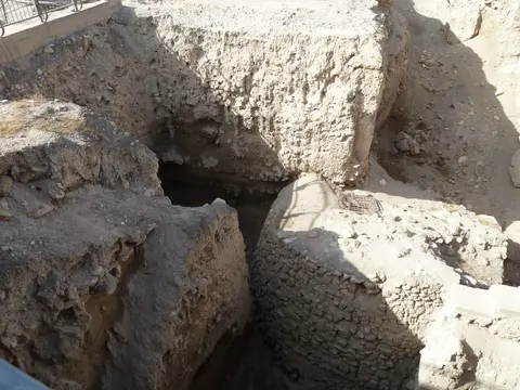
- Twenty-Two Internal Stone Steps Inside the 8300 BC Tower: Look down into Kathleen Kenyon's deep western excavation trench to see the circular stone tower and stair portal. Masons raised the monument entirely from rough fieldstone without metal tools or fired brick.
- Thumb-Impressed Loaf Mudbricks and Lime Plaster Floors: Along PPNB trench sections, spot rectangular sun-dried mudbricks pressed with deep thumbprints designed to grip mortar. Directly beneath them survive fragments of burnished pink-red lime terrazzo flooring.
- Vertical Stratigraphic Cut Faces Across Twenty-Nine Layers: Trace the stepped vertical earthen faces sliced through the mound. Alternating ash bands, stone footings and melted clay courses compress over twenty settlements into legible geological history.
Planning Jordan Valley Heritage Travel Toward Petra
Lying deep in the Jordan Valley, late autumn through spring (November to April) gives comfortable outdoor conditions for inspecting exposed earthen trenches at Tell es-Sultan without fierce summer heat. Morning visits offer angled sunlight inside the deep western excavation shaft and calmer shade across exposed earthen paths before midday glare builds. Bring sun protection, supportive walking shoes for gravel trails and bottled drinking water, pausing across the street afterward beside the leafy Ain es-Sultan oasis. Seeing modern gardens flourishing around the perennial spring clarifies immediately why generations rebuilt sun-dried mudbrick towns atop this compact desert rise.
Combine slow walking beside the Neolithic tower with a close look at Spring Hill to see why this single freshwater spring anchored unbroken town life for over eleven millennia. Positioned 54 kilometres northwest of Queen Alia International Airport (AMM) and 55 kilometres east of Ben Gurion International Airport (TLV), Jericho connects with regional routes. Southern Jordan Valley itineraries continue toward Petra (172 kilometres) and wider Near Eastern sites in the UNESCO World Heritage Atlas.