


























Quick Field Data
- UNESCO Inscription: Inscribed in 1987 as a transnational cultural property spanning the United Kingdom and Germany along the second-century Roman Limes.
- Scale & Footprint: Encompasses the 118-kilometre Hadrian's Wall (begun c. 122 AD), the 60-kilometre Antonine Wall in Scotland (started 142 AD), and 550 kilometres of German Limes.
- Access & Ticketing: Open rural trail corridors interspersed with excavated forts, bathhouses, and site museums; check the official site of each fort before setting out.
- Arrival Logistics: Accessible via regional rail and road corridors across northern Britain and Germany, with continental gateways reachable from Amsterdam.
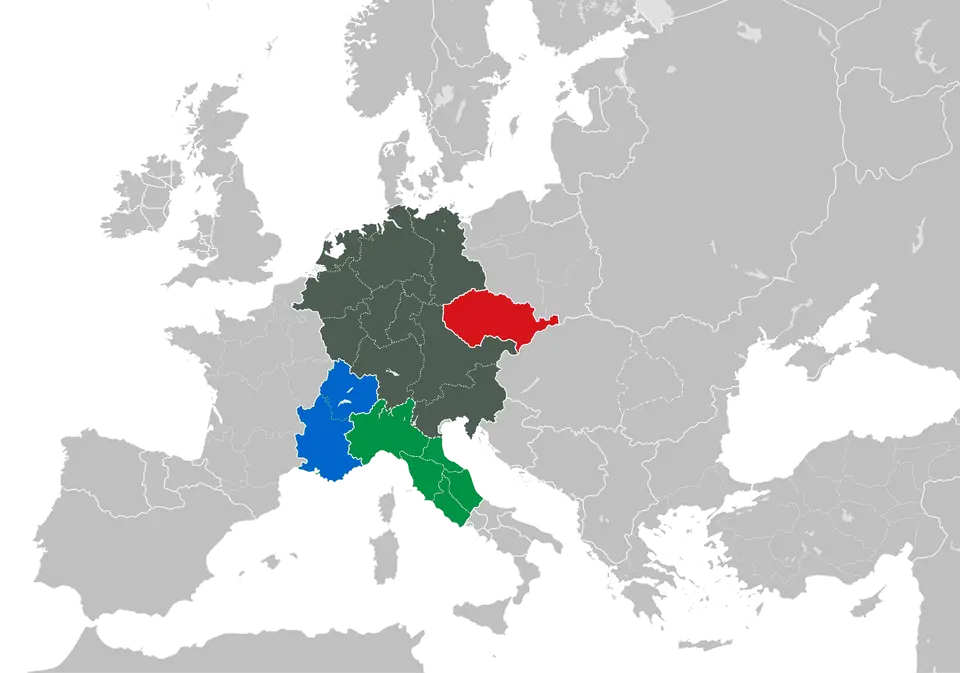
Spanning over 5,000 kilometres at its second-century AD zenith from the Atlantic coast of northern Britain across continental Europe to the Black Sea, and onward down to the Red Sea coast and westward across North Africa to the fringes of the Sahara Desert, the Roman Limes formed one of the most ambitious border systems in human history. Throughout United Kingdom, the UNESCO World Heritage Atlas, the Frontiers of the Roman Empire inscription brings together the monumental stone and turf barriers of Roman Britannia and the timber, earth, and stone fortifications of Germany. In the United Kingdom, the 118-kilometre Hadrian's Wall was constructed on the orders of Emperor Hadrian around 122 AD across the northern neck of Britannia, followed two decades later in 142 AD by the 60-kilometre Antonine Wall built under Emperor Antonius Pius across central Scotland. On the European mainland, two long sections of the Upper German Limes cover 550 kilometres from the Rhine in the northwest to the Danube in the southeast, while the Lower German frontier extends toward the North Sea coast within easy reach of Amsterdam.
Far from serving as an impenetrable iron curtain, the Roman Limes functioned as a regulated military, customs, and diplomatic zone where soldiers, merchants, and frontier communities interacted daily. Along the 118 kilometres of Hadrian's Wall and the 60 kilometres of the Antonine Wall, ditches, turf ramparts, stone curtain walls, milecastles, watchtowers, legionary fortresses, and civilian settlements (vici) allowed Roman garrisons to monitor movement, levy tariffs, and project imperial engineering power against northern tribes. At the same time, Rome's frontier strategy on its southeastern Red Sea flank relied on maritime trade and diplomatic alliances rather than continuous stone walls. As documented in the mid-first-century AD Periplus of the Erythraean Sea and by Pliny the Elder, Roman merchants sailing from Egypt traded down the Red Sea through the port of Adulis, situated three days from the ivory market at Coloe and five days from the highland capital of Axum on a 2,000-metre plateau in northern Ethiopia and Eritrea.
From Hadrian's Curtain Wall to Rome's Distant Horizons
Comparing the British and German sectors of the Limes reveals how Roman military engineers adapted frontier construction to local topography and geology. Across the crags and river valleys of northern Britain, Hadrian's legions erected a continuous stone and turf barrier supported by regular forts and a deep southern earthwork ditch, creating a textbook military zone in 122 AD. When Antonius Pius pushed the frontier north into Scotland in 142 AD, his troops built a 60-kilometre turf rampart on a stone foundation fronted by a wide ditch to control the central lowlands. Across the 550 kilometres of the German Limes between the Rhine and the Danube, where dense forests and river valleys lacked natural cliff lines, engineers laid out dead-straight survey lines marked by timber palisades, earthen banks, stone watchtowers, and auxiliary cohort forts that anchored Roman provincial life throughout the second century AD.
While soldiers patrolled the turf and stone ramparts of Britain and Germany, the economic vitality that funded the Limes depended on transcontinental commerce linking the Mediterranean world to the Indian Ocean. By the third century AD, the prophet Mani wrote in the Kephalaia that Rome shared world power with three other great realms: Persia, China, and the Kingdom of Aksum, which had emerged between 150 BCE and 150 CE from the earlier earlier polity and pre-Aksumite settlements such as Mezber, Ona Adi, Gobedra (two kilometres west of Axum), and Giyorgis (seventh to fourth centuries BCE). Under rulers from Zoskales and Gedara (GDRT, c. 200 to 230 AD, ally of Sabaean king Alhan Nahfan and later rival of his successor across Tihama, Najran, Zafar, al-Ma'afir, and Hamir) to Endybis (270 to 310 AD), Aksum struck gold, silver, and copper coins that circulated as far as Roman Caesarea and southern India. Drawn into the Greco-Roman cultural sphere through Red Sea trade in ivory, tortoiseshell, and rhinoceros horn, King Ezana (320s to c. 360 AD) adopted Christianity around 325 or 328, conquered Kush and Kush in 330, and ended the carving of pagan steles across a domain spanning 1,250,000 square kilometres in 350 AD. Later, at the request of Byzantine emperor Justin I, King Kaleb (514 to 542) invaded Himyar between 518 and 525 to overthrow Dhu Nuwas, expanding Aksum to 2,500,000 square kilometres before Abraha deposed Sumyafa Ashwa, the Persian wars of 570 to 578, the seventh-century cessation of coinage, soil erosion between 650 and 760, and the shift to Kubar around 800 under final ruler Dil Na'od (917 or 940 to 960) closed that Red Sea chapter of late antique frontier history.
Walking the British Walls and German Watchtower Lines
For modern travellers, exploring the Frontiers of the Roman Empire means following linear trails where excavated bathhouses, granaries, headquarters buildings, and reconstructed timber or stone watchtowers sit directly in the open landscape. In northern Britain, the central crags of Hadrian's Wall offer dramatic views of stone curtain walls hugging basalt ridges between preserved forts, whereas the Scottish Antonine Wall presents grassy ditches, rampart mounds, and museum collections displaying distance slabs carved by Roman legions. In Germany, cycling or walking routes trace the 550-kilometre Limes line through forests and farmland from the Rhine toward the Danube.
- Focus on the central crags of Hadrian's Wall: Base your British walk along the central upland sector where the AD 122 stone wall, milecastles, cavalry forts, and civilian vici remain most clearly visible above the surrounding valleys.
- Combine Antonine earthworks with museum collections: Along the 60-kilometre Scottish frontier begun in 142 AD, pair field walks beside the surviving turf rampart and deep ditch with regional museums that house the carved legionary distance slabs.
- Trace the German Limes watchtowers and reconstructed forts: Use regional rail links from continental hubs such as Amsterdam to visit excavated cohort forts and reconstructed watchtowers along the 550-kilometre German corridor, and check the official site for seasonal museum entry.
Across the northern provinces of Britannia and Germany, every fort along the Limes operated as a self-contained military community connected by paved supply roads and river transport. Stone walls marked the edge. Along the 118 kilometres of Hadrian's Wall begun around 122 AD and the 60 kilometres of the Antonine Wall started in 142 AD across central Scotland, auxiliary regiments from across the Roman Empire manned gates, patrolled wall-walks, and monitored movement between the northern highlands and the provincial lowlands. Along the 550 kilometres of the German frontier running from the northwest of Germany to the Danube in the southeast, watchtowers stood within sight of one another so garrisons could relay torch, smoke, or horn signals whenever raiding bands approached the palisade or stone wall.
Beyond those northern ramparts, Rome's broader imperial network interacted continuously with distant kingdoms along the Red Sea and Indian Ocean routes. As recorded by Cosmas Indicopleustes in the Greek inscription known as the Monumentum Adulitanum, third-century rulers expanded their reach across the Ethiopian Highlands toward Lake Tana and the borders of Egypt while maintaining busy commerce through Adulis with Roman merchants. Archaeological research by scholars such as Stuart Munro-Hay, David W. Phillipson, Carlo Conti Rossini, and Paul A. Yule has shown how that trade network flourished when first-century climatic shifts extended the highland rainy season to six or seven months on the 2,000-metre plateau, allowing two annual crops without irrigation before seventh- and eighth-century trade isolation and rainfall shifts between 730 and 760 reshaped the region. Understanding both the fortified walls of Britain and Germany and the maritime commercial frontiers of the Red Sea reveals how the Roman Empire sustained its 5,000-kilometre border system.
Managing a 5,000-Kilometre Transnational Archaeological Landscape
Conserving a frontier system that cuts across modern farms, towns, forests, and upland moors in the United Kingdom and Germany requires close coordination between national heritage agencies, local landowners, and municipal planners. While certain forts and watchtowers have been excavated or selectively reconstructed to help visitors read the military layout, large stretches of the 118-kilometre Hadrian's Wall, the 60-kilometre Antonine Wall, and the 550-kilometre German Limes survive as fragile subterranean archaeological deposits beneath pasture and woodland. Turf capping, controlled grazing, and footpath maintenance prevent hikers' boots and winter frost from eroding Roman masonry cores and earthwork profiles.
Standing beside a windswept milecastle in northern Britannia or a forest watchtower foundation on the German Limes brings the geopolitical scale of the second-century empire into sharp focus. Every ditch, fort gate, and civilian settlement along the border belonged to an integrated security and trade network that connected the North Sea and the Danube to the Mediterranean and the Red Sea. Walking these frontier lines lets you trace how ancient Rome organised, defended, and defined the edges of its world.
