


























Quick Field Data
- UNESCO Inscription: 1978 · Criteria (vii), (viii), (ix), (x) as the very first site inscribed on the World Heritage List
- Scale & Footprint: Roughly 8,000 square kilometres of land across 19 main islands and 127 islets spread over 45,000 square kilometres of sea, encircled by the 133,000-square-kilometre Galápagos Marine Reserve
- Access & Ticketing: Protected within the Galápagos National Park and surrounding Marine Reserve of Ecuador; visitors arrive via controlled island airports and must follow marked trails or licensed expedition vessels
- Arrival Logistics: Situated in the eastern Pacific Ocean along the Equator about 1,000 kilometres (898 kilometres or 485 nautical miles at closest point) west of mainland Ecuador, served by the renewable-energy airport on Baltra alongside San Cristóbal and Santa Cruz plus Isabela
Hotspot Volcanism and Three Converging Ocean Currents
Straddling the Equator in the eastern Pacific Ocean roughly 1,000 kilometres (898 kilometres, or 485 nautical miles) west of mainland Ecuador, the Galápagos Islands (officially Archipiélago de Colón) comprise 127 islands and islets alongside volcanic rocks, with 19 islands exceeding 1 square kilometre in area. Together they total about 8,000 square kilometres of volcanic land scattered across 45,000 square kilometres of ocean along a 220-kilometre axis from Española Island in the south to Darwin Island in the north, surrounded within 40 nautical miles by the 133,000-square-kilometre Galápagos Marine Reserve. Administratively divided across the three cantons of Isabela and Santa Cruz plus San Cristóbal (where the 2020 provincial census recorded just above 33,450 inhabitants), the chain is dominated in size by Isabela at 4,588 square kilometres (nearly three-fifths of the total landmass, rising to 1,700 metres at Volcán Wolf directly on the Equator), followed by Santa Cruz (986 square kilometres) and Fernandina (642 square kilometres).
The archipelago sits atop the Galápagos hotspot near the Galápagos triple junction where the Nazca and Cocos plates meet the Pacific plate. As the oceanic crust of the Nazca plate drifts east-southeast toward South America at about 6.4 centimetres (2.5 inches) per year (51 kilometres per million years) over the mantle plume and 200 kilometres south of the Galápagos spreading centre (bounded by the Cocos Ridge and Carnegie Ridge), magma melts through structural weaknesses to build a 3-kilometre-thick submarine platform. Consequently, the islands show a clear west-to-east age progression: western Fernandina (0.05 million years old) and Isabela (0.65 million years) are young, tall shield volcanoes composed of tholeiitic basalt with steep rounded flanks fed by radial and circumferential fissures, whereas Santiago (1.10 million years), Santa Cruz (1.7 million years), Santa Fe (2.90 million years), and eastern San Cristóbal (3.2 million years, with oldest formations reaching three to five million years) are lower and heavily eroded. Nine active volcanoes erupted 24 times between 1961 and 2011; Isabela alone joins six major volcanoes (Cerro Azul, Sierra Negra, Alcedo, Darwin, and Wolf plus Ecuador, erupting between 1813 and 2018), Fernandina suffered history's largest basaltic caldera collapse during a 1968 phreatomagmatic eruption before erupting again in 1991 and 1995 as well as 2005 and 2009, and Sierra Negra uplifted 240 centimetres between 1992 and 1998 prior to its 2005 and June 2018 lava flows.
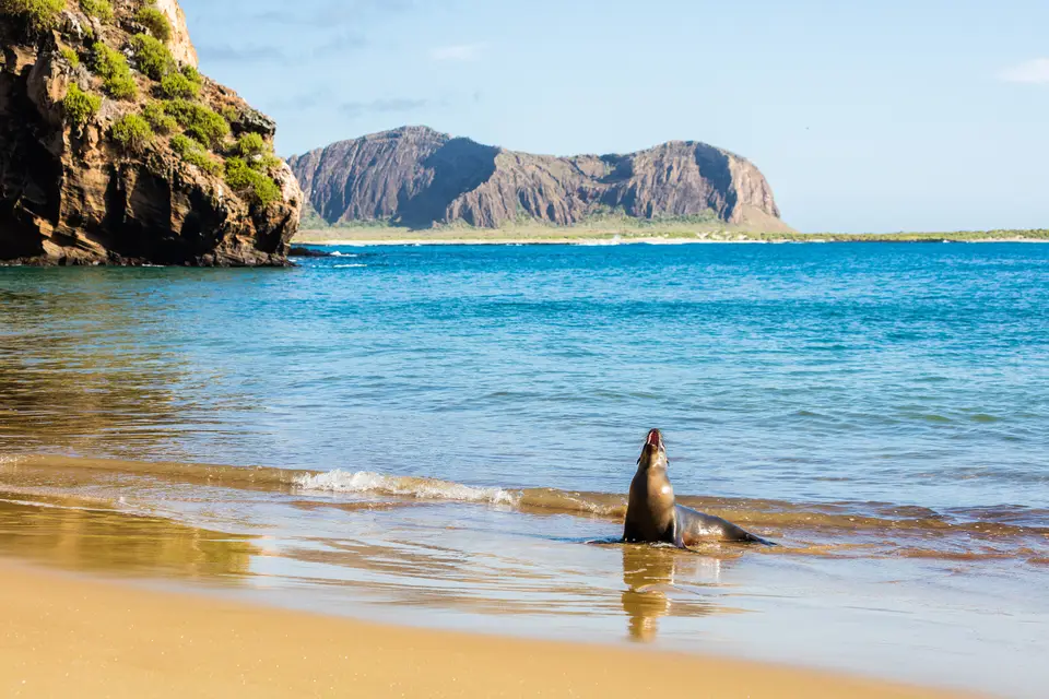
Marine and terrestrial life across this barren basaltic landscape is governed by the convergence of three major ocean currents: the warm Panama Current descending from the north, the cold Humboldt Current arriving from the south, and the Cromwell Current bringing deep, nutrient-rich waters from the west. During the cool garúa season from June to November, southerly winds and 22-degree waters cloak the high slopes in mist and drizzle while leaving low islands like Baltra in the dry rain shadow of Santa Cruz; from December to May, calm seas warm to 25 degrees, interrupted every 3 to 7 years by El Niño warming events (such as at Charles Darwin Station, where March rainfall plunged from 249.0 millimetres in 1969 to 1.2 millimetres in 1970). This vertical and oceanic gradient supports 500 native vascular plant species (including 90 ferns and 180 endemics across arid Opuntia cactus and Sesuvium lowlands up to humid highland woodlands and pampas) and an unmatched endemic fauna of giant tortoises alongside marine and land iguanas (plus hybrids on South Plaza Island), flightless cormorants, Galápagos lava lizards, penguins, sharks, sea lions on Mosquera Island, and the Floreana mockingbird restricted to tiny Champion Island (Isla Campéon, 1.64 kilometres long) and Enderby Island.
Buccaneer Charts, Whaling Depletion, and Charles Darwin
Although Spanish chronicler Pedro Sarmiento de Gamboa claimed in 1572 that Inca ruler Topa Inca Yupanqui sailed to the islands and a 1952 expedition by Thor Heyerdahl and Arne Skjølsvold recovered more than 130 ceramic shards (reanalysed in 2016 as post-Spanish deposits alongside a 2008 Australian National University botanical study), firm historical contact began on 10 March 1535 when Bishop Tomás de Berlanga drifted off course in the Doldrums while sailing from Panama to Peru to mediate between Francisco Pizarro and Diego de Almagro. Finding the rocks so waterless that two men and ten horses died, Berlanga reported the giant tortoises and iguanas to Emperor Charles V, while cartographers Abraham Ortelius and Gerardus Mercator mapped them around 1570 as Insulae de los Galopegos. After English captain Richard Hawkins visited in 1593, buccaneers raiding Spanish silver fleets used the bays as hideouts; in 1684 Ambrose Cowley aboard Batchelor's Delight (with John Cook and John Eaton's Nicholas) published the first chart naming 16 islands after British royalty and nobles, improved in 1793 by Royal Navy officer Captain James Colnett.
Colnett's report triggered a destructive whaling and fur-seal rush, accelerated in 1818 when Captain George Washington Gardner of the Nantucket whaleship Globe discovered the Offshore Grounds and returned in 1820 with 2,000 barrels of sperm whale oil. Whalers stacked thousands of live tortoises in ship holds for months of fresh meat, marooned Irish sailor Patrick Watkins on Floreana from 1807 to 1809 (who escaped to Guayaquil in a stolen longboat), and in October 1820 English boatsteerer Thomas Chappel aboard the Nantucket whaleship Essex set a wildfire that scorched Charles Island (Floreana). After winning independence from Spain in 1822 and leaving Gran Colombia in 1830, Ecuador annexed the islands on 12 February 1832 under Ignacio Hernández and General José de Villamil, who founded the Haven of Peace (Asilo de Paz) colony on Floreana with 120 settlers and lieutenant governor Nicholas Oliver Lawson before penal-colony uprisings in 1841 and failed settlements on Indefatigable (Santa Cruz) and Chatham (San Cristóbal, under mayor William Gurney in 1844) collapsed Villamil's venture by 1848.
Amid this early republic era, the British survey brig HMS Beagle under Captain Robert FitzRoy anchored in the archipelago from 15 September to 20 October 1835. During five weeks ashore on San Cristóbal, Floreana, Isabela, and Santiago, young geologist and naturalist Charles Darwin explained the phreatomagmatic formation of volcanic tuff cones and heard from acting governor Nicholas Lawson that tortoise shells differed island by island. When ornithological analysis in England proved that his diverse island bird specimens were closely related finches, Darwin formulated his theory of evolution by natural selection, published in 1859 in On the Origin of Species (a scientific tradition continued for decades by Peter and Rosemary Grant's finch studies on the inaccessible tuff cone of Daphne Major). Following research visits by USS Albatross in April 1888 and a United States military airbase built on Baltra in the 1930s to guard the Panama Canal, Ecuador established the Galápagos National Park and modernized the Baltra airport in the 2010s to run entirely on renewable energy for roughly 300,000 annual visitors.
Island-Hopping and Cruising the Volcanic Calderas and Tuff Cones
Exploring the Galápagos today divides between land-based day boats out of Santa Cruz, San Cristóbal, and Isabela and regulated multi-day liveaboard itineraries that reach the western shield volcanoes and outer seabird islets. The lava is black.
- Entry and Route on Santa Cruz and Baltra: Arrive through the solar- and wind-powered terminal on Baltra Island, cross the narrow channel into Santa Cruz, and visit the Charles Darwin Station on the southern coast to understand how the island's rain-shadow highlands capture moisture from the southerly garúa winds. From Santa Cruz, take a licensed day boat to the 23-metre lava cliffs of South Plaza Island to observe land and marine iguanas alongside their hybrids among red Sesuvium carpets and Opuntia cacti, or snorkel the coral reefs among sea lions at Mosquera Island between Baltra and North Seymour.
- Tickets, Interiors and Viewpoints on Isabela and San Cristóbal: Travel west to Puerto Villamil on Isabela to hike the active fault rim of the Sierra Negra caldera (which erupted in 2005 and June 2018) and explore the seven volcanic islets of Las Tintoreras. On eastern San Cristóbal and Floreana, boat out to the 140-metre split tuff towers of León Dormido (Sleeping Lion) and the submerged volcanic crater ring of Corona del Diablo (Devil's Crown), or cruise past the sloping volcanic cone of Isla Sombrero Chino off Santiago and the crescent seabird cliffs of Tortuga Island.
- Timing and Onward Connections across the Pacific: Choose the warm, calm-water months from December to May for clear snorkelling and diving with sharks and marine iguanas, or visit between June and November when the cold Humboldt and Cromwell currents drive peak nutrient upwelling across the 133,000-square-kilometre Galápagos Marine Reserve. Connect your equatorial voyage with other marine and volcanic reserves in our UNESCO World Heritage Atlas.
