


























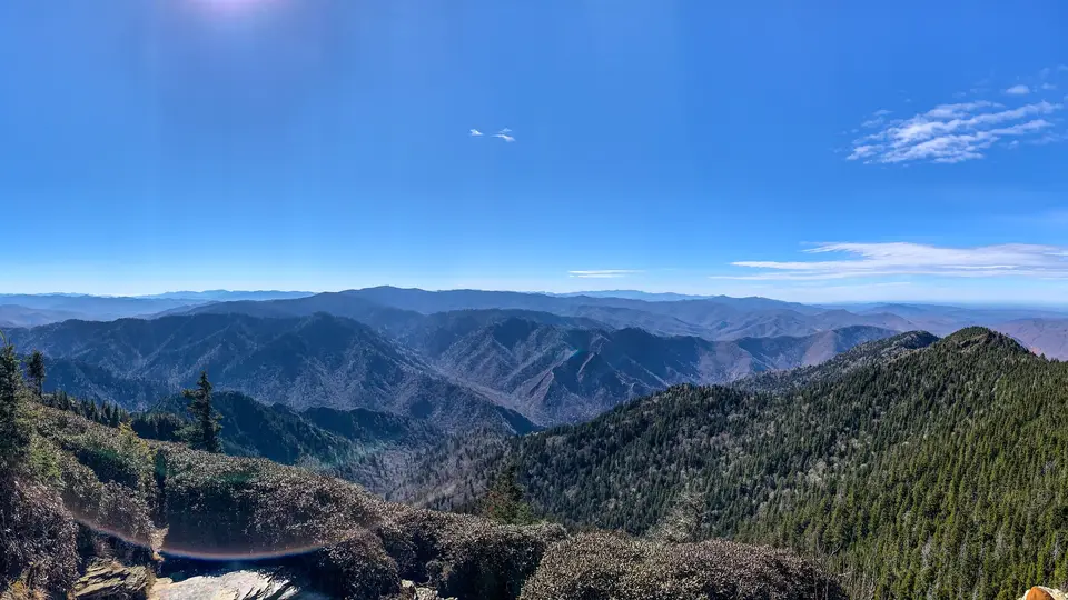
Quick Field Data
- UNESCO Inscription: 1983 (designated an International Biosphere Reserve in 1976 and incorporated into the wider Southern Appalachian Biosphere Reserve during 1988) · Criteria (vii), (viii), (ix), (x).
- Scale & Footprint: 522,419 acres (816.28 square miles, or 211,415.47 hectares) across the ridge of the Great Smoky Mountains in the Blue Ridge Province of the Appalachian Mountains.
- Access & Ticketing: Administered by the National Park Service with visitor centres at Sugarlands and Oconaluftee as well as Kuwohi and Cades Cove; check the official site for parking tags as well as backcountry camping permits and seasonal road closures.
- Arrival Logistics: Straddling Swain and Haywood counties in North Carolina and Sevier and Blount alongside Cocke counties in Tennessee, crossed by U.S. Route 441 between Gatlinburg and Cherokee.
Pleistocene Glacial Refugium and Ocoee Supergroup Geology
Straddling the border between North Carolina and Tennessee within the Blue Ridge physiographic province of the southern Appalachian Mountains, Great Smoky Mountains National Park encompasses 522,419 acres (816.28 square miles, or 211,415.47 hectares), making this mountain sanctuary among the largest protected reserves across the eastern United States and the most visited national park in North America, with more than 12 million recreational visitors (and over 14.1 million in 2021) each year. Certified on the UNESCO World Heritage Atlas in 1983 and designated an International Biosphere Reserve in 1976, the park owes its exceptional biological richness to its role as a Pleistocene glacial refuge. During the Quaternary ice ages, the northeast-to-southwest alignment of the ridges allowed temperate species to migrate southward along the slopes without being trapped by transverse mountain barriers, enabling southern remnants to survive alongside northern species.
Elevations inside the park rise from 875 feet (267 metres) along Abrams Creek to 6,643 feet (2,025 metres) at the summit of Kuwohi, while sixteen peaks exceed 6,000 feet (1,800 metres), including Mount Guyot (6,621 feet, or 2,018 metres) and Mount Le Conte (6,593 feet, or 2,010 metres, which rises 5,301 feet or 1,616 metres from its base near Gatlinburg). Geologically, the majority of the range consists of Late Precambrian rocks of the Ocoee Supergroup formed over a billion years ago alongside metamorphosed sandstones and phyllites as well as schists and slate. During the Ordovician period, as the North American alongside the African plates collided to initiate the Alleghenian orogeny, these older Precambrian rocks were thrust northwestward over younger Palaeozoic limestones and shales formed from marine sediments. Subsequent stream erosion cut through the Precambrian caprock in valleys such as Cades Cove, exposing the underlying Palaeozoic limestone in fertile valley "windows" framed by older sandstone ridges and freeze-thaw boulder blockfields.
Because climbing from the lowland valleys to the high peaks matches the climatic shift of travelling from Tennessee to Canada (with high temperatures dropping at a moist adiabatic lapse rate of 1.8 °C per 300 metres of elevation gain between the 488-metre valleys and 1,539-metre Newfound Gap), annual precipitation increases from 50 inches (1,300 millimetres) in the basins to 80 inches (2,000 millimetres) on the high crests. Virtually the entire park drains into the Tennessee River system via the Little Tennessee River (fed by the Oconaluftee River and Raven Fork, the Tuckasegee River, Hazel Creek, and Eagle Creek and Abrams Creek) and the French Broad River watershed (fed by the Little Pigeon River and Roaring Fork alongside the Little River and the Pigeon River).
Old-Growth Temperate Forests and the Salamander Capital
Roughly 95 percent of the park is forested, protecting over 200,000 hectares (exceeding 209,000 hectares in total, with over 90 percent managed for wilderness values) that harbour an immense tract of deciduous temperate old-growth woodland alongside the largest block of virgin red spruce on earth that escaped early 20th-century industrial logging, the largest old-growth stand in the eastern United States. Botanical inventories document more than 3,500 plant species, including over 1,300 native vascular plant species (with 105 to 130 native tree species) and nearly 500 species of non-vascular plants. These plants organise into five major forest types: cove hardwood forests in sheltered moist valleys below 4,500 feet (1,400 metres) led by tuliptree and yellow buckeye together with basswood, sugar maple, silverbell, and Eastern hemlock; northern hardwood forests of American beech and yellow birch between 3,500 and 5,000 feet; pine-oak forests on dry ridges; hemlock forests along cool stream corridors; and spruce-fir forests above 5,500 feet (1,700 metres), where 10,600 acres of red spruce and endangered Fraser fir cling to the highest crests alongside open heath balds of rhododendron and grassy balds such as Gregory Bald.
Entomological and biological surveys have documented more than 9,000 species of insects in the park (including the synchronous firefly Photinus carolinus near Elkmont, one of at least 19 firefly species in the Smokies). Known worldwide as the "Salamander Capital of the World," the Smokies shelter 31 salamander species, including 24 species of lungless salamanders that breathe directly through capillaries in their skin. Complementing these amphibians are 14 frog and toad species, 8 turtle species, 9 lizard species, 23 snake species (among them the timber rattlesnake and northern copperhead), 67 fish species (including native brook trout and the federally protected duskytail darter, yellowfin madtom, and the smoky madtom and spotfin chub), over 240 bird species (with 120 breeding species and reintroduced peregrine falcons), and 65 mammal species. Prominent mammals include an estimated 1,500 American black bears (roughly two per square mile), white-tailed deer, bobcats, coyotes and river otters alongside red and grey foxes, 11 bat species (including the endangered Indiana bat), the endangered Carolina northern flying squirrel, and elk reintroduced to the Cataloochee Valley in 2001.
Cherokee Homeland and Settler Coves Before Park Establishment
Human presence in the Smokies began with prehistoric hunter-gatherers around 14,000 years ago across Archaic (8,000 to 1,000 BCE), Woodland (1,000 BCE to 900 CE), and Mississippian (900 to 1,500 CE) phases, before the historic Cherokee established Middle towns along the Oconaluftee and Tuckasegee (including the sacred mother town of Kittuwa near Bryson City) and Overhill towns along the Little Tennessee River, encountered by Hernando de Soto in 1540 and Juan Pardo in 1567. After the 1830 Indian Removal Act signed by President Andrew Jackson forced most Cherokee west on the Trail of Tears in 1838, bands along the Oconaluftee River and those aided by William Holland Thomas remained on the Qualla Boundary south of the park, forming the Eastern Band of Cherokee Indians.
From the 1790s through the 1830s, European-American settlers established subsistence farms of roughly 50 acres across the valleys: John Mingus and Ralph Hughes settled along the Oconaluftee valley in 1795; William and John Whaley settled Greenbrier in 1801; William Ogle and Martha Jane Huskey settled Gatlinburg in 1802; John and Lucretia Oliver reached Cades Cove in 1818; and the Caldwell family settled Cataloochee in 1834. Divided during the American Civil War beginning in 1861 (when 74 percent of Cocke County, 80 percent of Blount County, and 96 percent of Sevier County voters in Tennessee backed the Union while Thomas's Legion occupied Gatlinburg in 1862 and bushwhackers killed Russell Gregory in Cades Cove in 1864), the mountains were transformed between 1901 and 1939 by railroad logging companies led by Colonel Wilson B. Townsend's Little River Lumber Company (which built company towns at Townsend alongside Elkmont and Tremont) and the Ritter Lumber Company on Hazel Creek, clear-cutting up to 80 percent of the range.
Alarmed by the destruction of the forests, Knoxville resident Anne May Davis and her husband W. P. Davis worked with Colonel David C. Chapman, Knoxville Mayor Ben Morton, photographers George Masa and Jim Thompson, explorer Paul M. Fink, and travel writer Horace Kephart in 1923 and 1924 to establish the Great Smoky Mountains Conservation Association. Authorized by President Calvin Coolidge on 22 May 1926 and funded by appropriations from North Carolina and Tennessee alongside private donations and a 1928 contribution from John D. Rockefeller Jr., land agent Ben W. Hooper purchased thousands of farms and timber tracts before Congress established the park on 15 June 1934 and President Franklin D. Roosevelt dedicated it at Newfound Gap on 2 September 1940 before 10,000 people. Advocacy by William J. Trent Jr. ended campground segregation by the early 1950s, and in 2015 Cassius Cash became the park's 16th and first African American superintendent.
Scenic Drives and Historic Districts Along the Appalachian Trail
Today, the park protects over 90 historic structures comprising log cabins and barns alongside churches and gristmills such as Mingus Mill, across four historic districts (Cades Cove and Oconaluftee and Cataloochee and Roaring Fork) and the Elkmont Historic District, in which historic resort cabins alongside the Appalachian Club recall early mountain tourism. Blue mist hangs over the ridges.
- Entry and Route Across Newfound Gap and Cades Cove: Drive U.S. Route 441 across the mountain crest between Gatlinburg and Cherokee via Newfound Gap (5,048 feet, or 1,539 metres), detouring along the spur road to the observation tower atop Kuwohi (6,643 feet), or tour the historic log cabins and barns as well as mills along the Cades Cove loop, the Roaring Fork Historic District, and the Oconaluftee Mountain Farm Museum.
- Tickets and Viewpoints: Prior to setting out on the trails, check the official site of the National Park Service for mandatory parking tag rules and seasonal closures before hiking any of the 850 miles (1,370 kilometres) of trails, which include 71.6 miles (115.2 kilometres) of the Appalachian Trail along the high state-line crest and five trails climbing to LeConte Lodge atop Mount Le Conte.
- Timing and Onward Connections: Spring wildflower hikes in April and May and autumn foliage weeks in October draw heavy traffic, so start at dawn and store all food properly in backcountry campsites. Explore other North American natural reserves in our UNESCO World Heritage Atlas.
