


























Quick Field Data
- UNESCO Inscription: 1981 · Criteria (vii), (viii), (x)
- Scale & Footprint: 52,007 acres (21,046 hectares) of forested karst terrain across Edmonson alongside Hart and Barren counties in south-central Kentucky, protecting more than 686 kilometres (426 miles) of surveyed underground passages
- Access & Ticketing: Surface trails along the Green River and Nolin River alongside karst sinkholes like Cedar Sink are open to visitors, whereas all underground entry requires booking a guided National Park Service cave tour in advance
- Arrival Logistics: Accessed directly at Exit 48 via Mammoth Cave Parkway, linking northward to Kentucky Route 70 alongside Kentucky Route 255 from the south near Cave City, Park City, and Brownsville
Mississippian Limestone Stratigraphy and the Sandstone Caprock
Spanning 52,007 acres (21,046 hectares) primarily in Edmonson County with eastern extensions into Hart and Barren counties in south-central Kentucky, Mammoth Cave National Park preserves the longest surveyed cave system in the world. Dedicated as a national park on 1 July 1941 and inscribed on the World Heritage List on 27 October 1981 (followed by UNESCO Biosphere Reserve status on 26 September 1990 and International Dark Sky Park designation on 28 October 2021), the park records 747,042 annual visitors as of 2024. While the UNESCO inscription initially cited between 500 and 560 kilometres of mapped passages, ongoing systematic exploration has expanded the surveyed total to more than 686 kilometres (426 miles) by 2025, making the labyrinth more than 1.5 times the length of the second-longest cave system, the underwater Ox bel ha network in Mexico. Darkness rules this subterranean world.
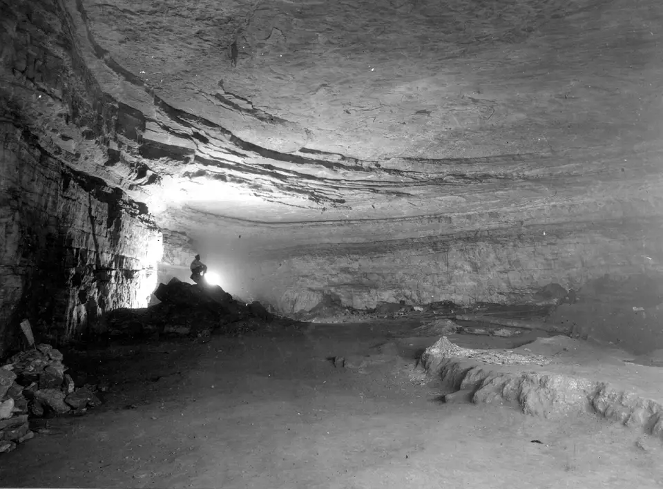
What explains the extraordinary horizontal reach and structural preservation of the Mammoth and Flint Ridge Cave System is a specific geological cause-and-effect relationship between soluble carbonate strata below and an impermeable protective caprock above. Roughly 330 million years ago during the Mississippian period, when Kentucky lay beneath an ancient warm sea, thick marine sediments accumulated to form three primary limestone layers arranged in descending stratigraphic order beneath the ridges: the Girkin Formation at the top, the Ste. Genevieve Limestone in the middle, and the St. Louis Limestone at the base, interspersed with beds of dolomite alongside siltstone and shale. Resting directly atop these massive limestones is a hard, erosion-resistant upper unit known as the Big Clifty Sandstone.
Groundwater began dissolving the upper Girkin stone roughly 10 million years ago, excavating the large upper trunk passages around 3.2 million years ago as the Green River and its tributary, the Nolin River, cut deeper into the surface plateau. Above the massive limestones, thin carbonate bands within the Big Clifty Sandstone form an epikarstic zone where acidic rainwater dissolves tiny conduits, emerging briefly as high-elevation ridge springs before sinking underground at the contact line between sandstone and limestone. Because the overlying Big Clifty Sandstone caprock prevents rainwater from percolating downward through the roof, the older upper-level galleries, such as the Main Cave passage at the boundary of the Girkin Formation and Ste. Genevieve Limestone, remain bone-dry. Instead of dissolving away or filling with water-fed stalactites, these dry upper passages foster delicate evaporative sulfate minerals found in unsurpassed variety here, including curving gypsum flowers alongside fine gypsum needles and rare mirabilite flowers. Only where surface erosion has breached the sandstone caprock at valley edges, such as in the Frozen Niagara chamber, does dripping groundwater form classic travertine stalactites and stalagmites, while on the surface the karst drainage network creates fissures, underground rivers, and massive valley-floor collapses like Cedar Sink.
Five Millennia of Subterranean History and the 1972 Flint Ridge Link
Human exploration of Mammoth Cave began at least five thousand years ago during the late Archaic and early Woodland periods. Beginning in the late 1950s, Washington University in St. Louis archaeologist Patty Jo Watson analysed carbon-dated dietary evidence alongside woven grass moccasin slippers, gourd fragments, and cane torches left in Mammoth Cave and the Salts Cave section of Flint Ridge, demonstrating a prehistoric transition from hunter-gatherer foraging to plant domestication. Early Native American miners ventured far into the dark passages to harvest gypsum and sulfate minerals; in 1935, guides found the crushed prehistoric body of an ancient miner known as Lost John pinned beneath a shifted boulder, whose remains were displayed until the 1970s before being reinterred in a secret underground location.
Written historical records began in 1797 and 1798, when the Houchin family, linked in local lore to brothers John Houchin alongside Francis Houchin and Charles Houchin, hunted near the Turnhole bend of the Green River and Valentine Simon registered the land around the Historic Entrance to mine calcium nitrate (saltpeter). When the Jefferson Embargo Act of 1807 and the War of 1812 cut off foreign gunpowder supplies, owners Charles Wilkins and Philadelphia investor Hyman Gratz expanded saltpeter extraction on an industrial scale, forcing a labour force of 70 enslaved workers to haul cave dirt and operate wooden leaching vats inside the passages. After Hyman Gratz sold the estate in 1838 to Franklin Gorin, who turned the caverns into a show attraction, Gorin brought in the enslaved African-American guide Stephen Bishop. Across the 1840s and 1850s, Stephen Bishop crossed the frightening chasm of the Bottomless Pit, descended to the floor of Gorin's Dome, drafted comprehensive maps of the previously unknown passages beyond the Old Cave, and guided visitors under subsequent owner Dr. John Croghan of Louisville, who also operated an ill-fated underground tuberculosis hospital in 1842. Nineteen-century celebrity visitors included naturalist John Muir alongside photographer Charles Waldack (who captured the first subterranean images using magnesium flash in 1866), actor Edwin Booth, singer Jenny Lind, and violinist Ole Bull, inspiring chamber names including Ole Bull's Concert Hall alongside Booth's Amphitheatre.
In 1908, German mining engineer Max Kämper, assisted by guide Ed Bishop, completed a secret instrumental survey of the passages, while French hydrologist Martel predicted that Mammoth Cave connected hydrologically to Salts Cave and Colossal Cave. During the early twentieth-century Kentucky Cave Wars, rival landowners competed fiercely for automobile tourists; George Morrison blasted new entrances into Mammoth Cave on unowned land in the 1920s, and explorer Floyd Collins discovered Floyd Collins' Crystal Cave under Flint Ridge before dying trapped in nearby Sand Cave in 1925. Following the 1924 creation of the Mammoth Cave National Park Association and May 1926 congressional authorisation, four CCC camps operated between 1933 and 1942 as over 600 farmstead parcels were assembled through purchase and contentious eminent domain to establish the park in 1941 under first Superintendent R. Taylor Hoskins.
The modern era of speleology accelerated in February 1954 when William Austin hosted the National Speleological Society's C-3 expedition in Crystal Cave, documented by Robert Halmi alongside Joe Lawrence Jr. and Roger Brucker, leading in 1957 to the incorporation of the Cave Research Foundation (CRF) under Austin alongside E. Robert Pohl plus Jim Dyer and John J. Lehrberger. After the National Park Service purchased the Crystal Cave and Great Onyx Cave properties in March 1961, CRF cartographer John Wilcox led teams to bridge the 240-metre gap beneath Houchins Valley. After caver Patricia Crowther squeezed through the Tight Spot canyon in July 1972 and explorers spotted Warner P. Hanson's 1930s inscription along Hanson's Lost River on 30 August 1972, a six-person team including John Wilcox, Patricia Crowther, Richard Zopf, Gary Eller, Stephen Wells, and ranger Cleveland Pinnix linked Flint Ridge to Echo River in Cascade Hall on 9 September 1972, creating a 232.4-kilometre system with fourteen entrances. Subsequent connections to Proctor and Morrison caves under Joppa Ridge in 1979, Roppel Cave on 10 September 1983 with the Central Kentucky Karst Coalition (CKKC), and the Hoover Entrance under Eudora Ridge (found by Alan Canon and James Wells in 2003 and connected in 2005) pushed the mapped system past 686 kilometres, sheltering over 130 troglobitic and cave-dwelling species.
Navigating Cave Tours and Surface Karst Trails Today
Visiting Mammoth Cave National Park involves two distinct vertical levels: the forested ridges alongside sinkholes and river valleys of the 21,046-hectare surface reserve, and the gated underground labyrinth beneath the Big Clifty Sandstone caprock. Whereas the historic Echo River boat tour was discontinued in the early 1990s to protect the subterranean aquatic environment, the National Park Service operates a diverse schedule of electric-lit walking routes, paraffin-lamp heritage walks, and muddy wild caving crawls departing from the main visitor centre on Mammoth Cave Parkway.
Plan your field itinerary by pairing specific stratigraphic cave tours with surface karst walks.
- Reserve guided underground tours across the upper and lower strata: Because self-guided entry into the cave system is prohibited, book National Park Service tours well before arriving at Exit 48 on Mammoth Cave Parkway. Choose the Historic Tour through the Historic Entrance to see the 1812 saltpeter leaching vats alongside the Rotunda Room, Bottomless Pit, and Fat Man's Misery in the Girkin and Ste. Genevieve limestones, or book routes entering via the New Entrance (reopened in December 1951) to examine Grand Avenue and the water-sculpted flowstone draperies of the Frozen Niagara chamber.
- Experience paraffin-lamp routes and wild caving crawls: To understand how Stephen Bishop alongside Max Kämper and nineteenth-century visitors navigated the dark trunk passages before electric wiring, reserve one of the two popular tours illuminated solely by hand-carried paraffin lamps. Experienced visitors seeking physical adventure can book guided wild cave tours that leave the groomed trails behind to crawl through dusty tunnels and muddy canyons similar to the Flint Ridge passages explored by the Cave Research Foundation.
- Hike the surface karst contact line to Cedar Sink and the Green River: Complement your underground tour by walking the surface trails linking the valley bottoms to the ridge crests, where exposed rock outcrops visibly transition from massive Mississippian limestone to the overlying Big Clifty Sandstone caprock at a sharp elevation boundary. Hike down into Cedar Sink in the southern sector of the park to watch an underground river emerge at the base of a collapsed sinkhole before vanishing back into the limestone bedrock, and explore further geological landmarks in our UNESCO World Heritage Atlas.
