Quick Field Data
- UNESCO Inscription: Cultural site inscribed in 1991 (Ref. 576) under criterion (iii).
- Scale & Footprint: 289 hectares forming the core royal precinct inside Phra Nakhon Si Ayutthaya District on Ayutthaya Island, surrounded by outlying temples across the wider Ayutthaya Historical Park buffer zone.
- Access & Ticketing: Ayutthaya is protected by Thailand's Fine Arts Department. Major fenced temple complexes including Wat Mahathat, Wat Phra Si Sanphet, Wat Ratchaburana, and outlying Wat Chaiwatthanaram charge separate modest entry fees or combined park passes. Open park lawns stay accessible, though visitors should check official notices for restoration zones.
- Arrival Logistics: Don Mueang International Airport (DMK, 49 kilometres south) and Suvarnabhumi Airport (BKK, 77 kilometres southeast) handle regional and international air arrivals, linked by rail and road through Bangkok 66 kilometres south.
River Island Hydraulics and the Four-Polity Rise of Ayutthaya
Founded in 1351 (recorded around 1350 in UNESCO summaries) by King Ramathibodi I, Ayutthaya rose on an engineered river island encircled by three converging waterways in the lower Chao Phraya basin. Long before becoming the second Siamese capital after Sukhothai, the confluence supported Mon Dvaravati populations and an 850 AD Khmer stronghold named Ayodhya after the sacred Indian city of the Ramakien. Excavations close to the southwestern tip of Wat Yai Chai Mongkhon even revealed traces of an ancient Khmer baray water reservoir. Thai chronicle traditions trace pre-1351 settlement to Mueang Nong-sano around Nong-sano Lake in the 930s to 940s under Phuttha Sakhon, succeeded by his son in 974 before Phraya Kreak brought both Nong-sano and Lavo under his authority. Around 1082, King Narai of Lavo relocated his court to Nong-sano, followed in 1205 by dynastic ties linking Uthong and Phetchaburi lineages. Early port polities at Suphannabhum similarly passed through rulers from Phanthumburi to Uthong in the early eleventh century before moving back to Phanthumburi (Songphanuri). Modern historians identify a late thirteenth- and fourteenth-century mandala confederation uniting four lower-basin port states: Lopburi (Lavo), Suphanburi (Suphannabhum), Phetchaburi, and Ayodhya itself. Neighbouring Chen Li Fu at Phraek administered over sixty settlements, appeared in Chinese merchant records around 1103 to 1115, and sent embassies to Song China in 1200, 1202, and 1205 before folding into Suphannabhum. Across the western basin and Mae Klong valley, earlier Angkorian ties operated as a mandala of circulating titles, cultural motifs, and religious gifts rather than direct rule. Jayavarman VII's Preah Khan inscription lists Suphanburi as Suvarnapura, Phetchaburi as Srijayavajrapuri, Mueang Kosi Narai as Samphukapatthana, and Ratchaburi as Srijayarajapura. By contrast, the 1167 Dong Mae Nang Mueang and 1213 Phra Phuttharup Nak Prok inscriptions preserve local Thai lexical elements distinct from classical Angkor. By the mid-thirteenth century, each port polity conducted foreign missions independently, including Suphanburi missions to the Song in 1180 and Phetchaburi missions to the Yuan in 1294, before the four ports merged into Ayutthaya.
Placing the capital inland at the three-river junction solved twin strategic threats simultaneously. Standing above the reach of the Gulf of Siam's tidal bore kept deep-draft foreign warships from sailing straight up to the city walls. Meanwhile, an advanced hydraulic network of engineered moats, straight canals, and embankments absorbed annual river floods and turned seasonal inundation into an agricultural and defensive asset. Contemporary maps drafted by foreign emissaries assigned to the Siamese court reveal a systematic planning grid dividing royal palaces, monastic compounds, and civic districts cleanly across the island.
Through its early maritime centuries, Ayutthaya drew tribute across post-Srivijaya Southeast Asia before shifting toward hinterland centralization under northern administrative traditions. Though Toungoo Burmese forces captured the city in 1569, carrying off artistic treasures and holding Siam as a vassal until 1584, the kingdom regained independence and consolidated its urban fabric.
Cosmopolitan Diplomacy, Eclectic Monasteries, and the 1767 Siege
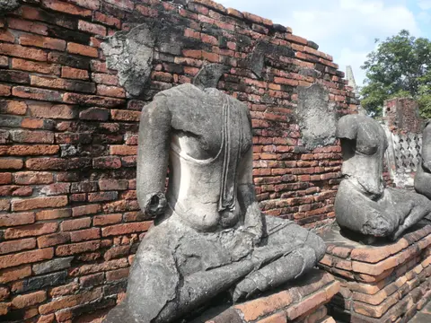
By the early sixteenth century, European travellers ranked Ayutthaya with Ming China and Vijayanagara among Asia's three great powers. Locals identified as Tai and called their kingdom Krung Tai, while foreign charts captured its global stature under shifting names. Fra Mauro's c. 1450 world map records Scierno (from a Persian phrase meaning New City), and early Iberian and Italian sources use variants such as Cernouem, Cernome, Xarnauz, and Sarnau. Later works list Zerena on Vesconte de Maggiolo's 1508 nautical chart, Iudea on Dutch East India Company artist Johannes Vingboons's 1662 to 1663 bird's-eye painting, and Iudia in Alain Mallet's 1683 engraving. Equidistant between India and China yet safely upstream from European and Arab warships, the island city operated through strictly zoned quarters. Surviving diplomatic maps show foreign merchants, advisers, and missionaries constructing distinct residential compounds downstream from the Royal Palace.
Under King Narai (reigned 1657 to 1688), royal diplomacy reached its widest global sweep. Persian and European court officials advised the throne, culminating in the celebrated 1686 Siamese embassy dispatched to King Louis XIV at Versailles alongside exchanges with Mughal Delhi, China, and Japan. Following French and English departures and expanding Chinese maritime commerce, late Ayutthaya ushered in a golden age of Siamese literature, painting, and temple ornament. That Ayutthaya school fused Sukhothai sculptural grace and Angkorian brick prangs with motifs adapted from Japan, China, India, Persia, and Europe. Official royal titles (Krung Thep Dvaravati Si Ayutthaya) are attested across preambles of the Three Seals Law, a 1620 letter from the governor of Tenasserim to the Danish court, and the 1664 Dutch East India Company treaty. They also survive in a 1757 Pali letter to Kandy, chronicles compiled by Somdet Phra Phonarat at Wat Pho, an 1842 Cambodian inscription by Chaophraya Bodindecha, and a Burmese inscription on a bronze gun captured in 1767.
Unresolved succession disputes and shifting labour controls weakened court administration during the mid-18th century, leaving the capital exposed to Konbaung Burmese invasions in 1759 to 1760 and 1765 to 1767. In April 1767, after a 14-month siege, Burmese troops breached the island, burned timber palaces and shrines, and forced residents to abandon the 417-year-old capital. Rather than rebuilding atop the burned ruins, Siam recovered swiftly and shifted downstream within fifteen years to Thonburi and Bangkok, where surviving Ayutthayan architects consciously recreated the old city's canal plan and preserved Ayutthaya within Bangkok's official ceremonial Thai name, Krung Thep Dvaravati Si Ayutthaya.
From Wat Phra Si Sanphet to Wat Chaiwatthanaram Across the Island
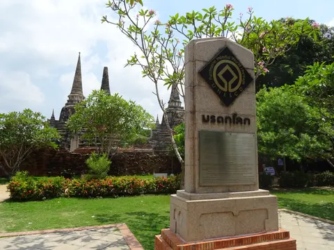
Thailand's Fine Arts Department began structural renovations in 1969 and formally declared Ayutthaya Historical Park in 1976. Statutory protection draws on the Act on Ancient Monuments (1961, amended 1992), Ratchaphatsadu Land Act (1975), City Planning Act (1975), Building Control Act (1979, amended 1992), and Environmental Quality Act (1992). Following UNESCO's 1991 inscription of the 289-hectare core zone, a Cabinet-approved Master Plan and joint national-local heritage committees steer future urban growth away from the historic city. Proposed World Heritage boundary extensions aim to encompass the complete eighteenth-century island footprint, guided by palm-leaf manuscripts, surviving court archives, sculpture, and mural testimony. Inside that central royal polygon stand the signature brick-and-laterite monasteries that anchored court ritual. Occupying the former Royal Palace precinct, Wat Phra Si Sanphet preserves three soaring bell-shaped chedi reliquaries aligned along a commanding east-west axis.
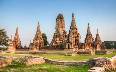
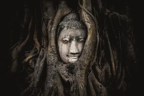
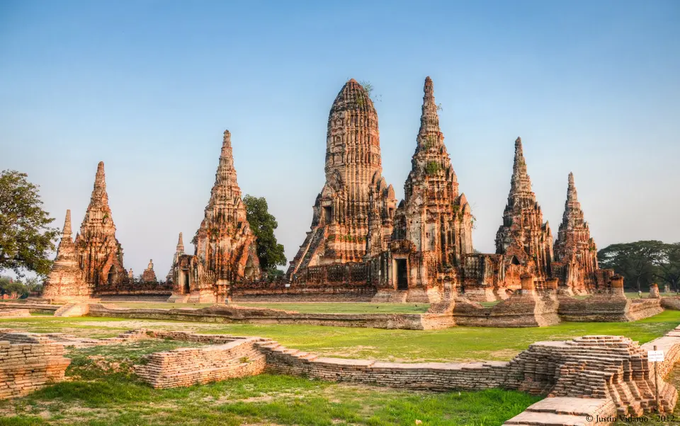
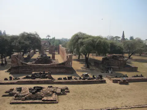
Nearby, Wat Mahathat anchors the central monastery quarter, famous for collapsed brick prang masonry and its sandstone Buddha head encircled by tree roots beside minor chapels. Adjacent Wat Ratchaburana guards rare Ayutthaya-era mural paintings and surviving artefacts inside a subterranean crypt beneath its central Khmer-inspired prang. Extending beyond the 289-hectare core zone across the buffer landscape on the Chao Phraya's western bank sits Wat Chaiwatthanaram. Built in 1630 by King Prasat Thong near his mother's residence, it was also linked by Prince Damrong to victory over Longvek. The monastery later hosted royal ceremonies and cremations, including Prince Chaofa Thammathibet under King Boromakot, before restoration ran from 1987 to 1992.
Conceived explicitly around fourteenth-century Traiphum Phra Ruang Buddhist cosmology, Wat Chaiwatthanaram lifts a 35-metre (115-foot) central brick prang symbolising Mount Meru surrounded by four smaller prangs representing the four continents in the world sea. Around that rectangular terrace stand eight chedi-shaped chapels connected by a once-roofed cross-shaped passage (Phra Rabieng). That gallery originally held 120 seated Buddha statues painted in black and gold, interior murals, 12 clockwise Jataka life-story exterior reliefs, and wooden ceilings patterned with golden stars on black lacquer. East toward the river stood the Phra Ubosot ordination hall flanked by two 12-indented-corner chedis holding the ashes of the king's mother. Looted for bricks and headless statues after 1767 and submerged under 2 metres of floodwater during the 2011 Thai floods, Wat Chaiwatthanaram required extensive Fine Arts Department stabilisation to safeguard its surviving terracotta masonry and stucco ornament.
Ayutthaya Historical Park Core Zone and Outlying Temple Rules
Because major royal compounds occupy broad green parklands dotted across the island and opposite riverbanks, planning by zone prevents unnecessary backtracking under tropical heat.
| Complex Zone | Key Highlights | Access & Ticket Rule |
|---|---|---|
| Royal Palace & Wat Phra Si Sanphet | Three aligned chedi towers and adjacent royal chapel grounds inside the core zone | Fenced historical park monument charging standard daytime entry ticket |
| Central Island Core (Wat Mahathat & Ratchaburana) | Root-wrapped sandstone Buddha head, collapsed central prang, and underground crypt murals | Individual monument tickets sold at each temple gate within the 289-hectare core |
| West Bank Buffer (Wat Chaiwatthanaram) | 1630 Khmer-style 35-metre prang, eight Meru chapels, and riverside flood embankments | Outside the 289-hectare core polygon inside park buffer; separate entry ticket |
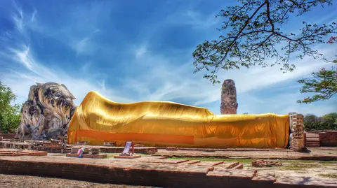
| Island Canal Grid & Park Lawns | Remaining moats, masonry rampart segments, Wat Yai Chai Mongkhon, and park avenues | Open public access along island roads and riverside paths; modest dress advised in temples |
Three Brick, Prang, and Mural Details to Inspect in Ayutthaya
Looking closely at structural masonry reveals how Siamese builders adapted brick, stucco, and hidden passages across four centuries.
- Hidden Mid-Level Stairways on Wat Chaiwatthanaram's Prang: Stand back from the central 35-metre riverfront tower to spot steep narrow staircases ascending roughly halfway up the brick flanks toward concealed upper entrances, showing how massive brick towers framed upper ritual niches.
- Clockwise Jataka Relief Fragments Along Phra Rabieng: Along the surviving outer walls of Wat Chaiwatthanaram's eight chedi chapels, scan fragmented stucco reliefs designed to be read clockwise illustrating episodes from the Buddha's life, paired with traces of interior murals.
- Subterranean Crypt Access at Wat Ratchaburana: Descend the steep narrow shaft inside Wat Ratchaburana's intact prang tower to view rare surviving Ayutthaya-period mural paintings protected underground from the 1767 conflagration that stripped timber roofs across the island.
Floodwater Cycles, Dry-Season Touring, and Pairing with Bangkok
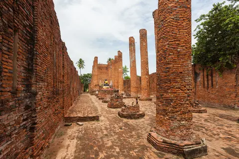
Positioned on a low floodplain where three rivers meet, Ayutthaya's monuments reflect constant interaction with seasonal monsoon water levels. Cool dry months from late autumn through early spring offer crisp morning light over red brick ruins and comfortable cycling between core island temples. By contrast, peak hot-season midday sun and late-monsoon river surges, seen dramatically during the 2011 floods, test outdoor exposure across unshaded brick terraces.
With Don Mueang International Airport (DMK) just 49 kilometres south, direct mainline trains and highways run straight from the old capital downriver into its historical successor. Pairing Ayutthaya with our Bangkok city guide 66 kilometres south traces Thailand's continuous urban evolution from 1351 to the present. Readers mapping Southeast Asian Buddhist capitals can explore further regional entries in the UNESCO World Heritage Atlas.