Quick Field Data
- UNESCO Inscription: Inscribed in 2000 (Ref. 985) and extended in 2013 to Lesotho's Sehlabathebe National Park, following a bilateral Transfrontier Conservation Area memorandum signed on 11 June 2001. This mixed cultural and natural property meets Criteria (i), (iii), (vii) and (x).
- Scale & Footprint: 249,313 hectares joining uKhahlamba Drakensberg Park in South Africa's KwaZulu-Natal Province (242,813 hectares across 12 protected reserves including four Wilderness areas) with Sehlabathebe National Park in Lesotho (6,500 hectares), embedded within the 8,113-square-kilometre Maloti-Drakensberg Transfrontier Conservation Area
- Access & Ticketing: Managed separately across the international frontier by Ezemvelo KwaZulu-Natal Wildlife in South Africa and Lesotho conservation ministries; reserve gate fees, overnight hut bookings and guided access to designated San rock art caves require official park permits
- Arrival Logistics: Primary commercial gateways are King Shaka International Airport in Durban (DUR, 173 kilometres straight-line east) and O.R. Tambo International Airport in Johannesburg (JNB, 405 kilometres northwest toward northern and Royal Natal entries). Closer southern approaches also sit near a small regional alternative (single-runway Pietermaritzburg Airport, PZB, 103 kilometres). Overland mountain roads in Lesotho connect northwest to Maseru (182 kilometres).
Basalt Escarpment Walls and the Continental Watershed Divide
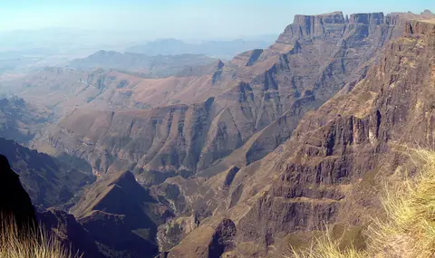
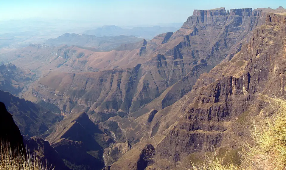
Stretching along Southern Africa's Great Escarpment where Lesotho meets South Africa's KwaZulu-Natal Province, Maloti-Drakensberg Park crowns a mountain wall exceeding 1,000 kilometres. Forged during Gondwana's breakup roughly 150 million years ago, the escarpment starts near the Baziya mountains outside Tsolo in the Eastern Cape. It runs past the Lesotho, Free State and Mpumalanga borders (including Blyde River Canyon, Three Rondavels and God's Window) toward Hoedspruit's Klein Drakensberg, Tzaneen's 2,200-metre Wolkberg and Iron Crown peaks and Mokopane's Strydpoort range. Only a 450-kilometre failed rift gap drained by the Limpopo and Save rivers breaks the line where Antarctica drifted away. After eroding inland, uplift over the past 20 million years raised the plateau over 1,000 metres above sea level. Along KwaZulu-Natal's Lesotho frontier, summits climb past 2,000 and 3,000 metres to reach 3,482 metres at Thabana Ntlenyana.
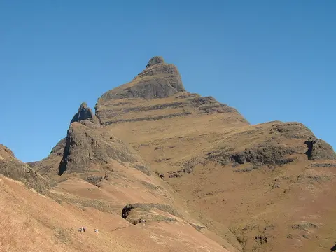
Two contrasting rock layers give these highlands a two-tiered profile celebrated in Zulu as uKhahlamba and in Sotho as Maloti, meaning Barrier of Up-Pointed Spears. Early Dutch settlers likewise named them Drakensbergen, or Dragons' Mountains. Massive flood basalts erupted 180 million years ago cap the upper ramparts in dark buttresses and high plateaux. Prominent peaks include Mafadi (3,450 metres), Makoaneng (3,416 metres), Njesuthi (3,408 metres), Champagne Castle (3,377 metres), Popple Peak (3,331 metres), Giant's Castle (3,315 metres), Ben Macdhui (3,001 metres) and Cathedral Peak. Immediately beneath the basalt lie golden ramparts of Clarens sandstone deposited in desert conditions 200 million years ago. Those cliffs rest atop 250-million-year-old Beaufort and 300-million-year-old Ecca beds of the Karoo Supergroup, contrasting with 2,000-million-year-old Transvaal Supergroup quartzites north toward the Magaliesberg.
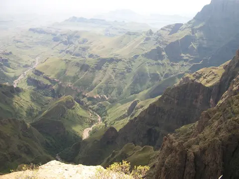
Rivers, diminishing periglacial frost and frequent summit lightning strikes documented by researchers Knight and Grab have sculpted this ridge into Southern Africa's foremost water tower. From below, KwaZulu-Natal and Free State slopes over softer Karoo beds look gently rounded beside Lesotho's steep basalt pinnacles. Atop the escarpment, flat table-top plains soon break westward into rugged Lesotho valleys carved by headwaters of the Senqu (Orange) River flowing to the Atlantic Ocean. On the eastern flank, heavy rainfall feeds steep mountain streams including the Thukela (Tugela). Plunging 947 metres down Tugela Falls in Royal Natal National Park toward the Indian Ocean, these waters supply South Africa's industrial heartlands in Mpumalanga and Gauteng, including Johannesburg.
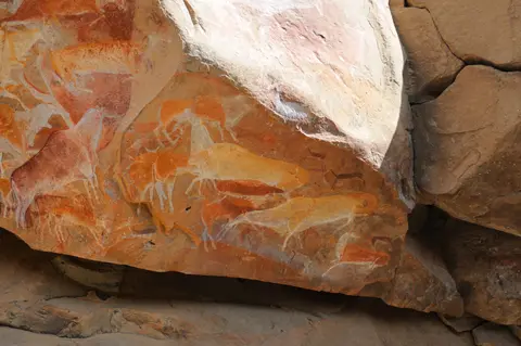
San Spiritual Cosmology Across Highland Rock Art Shelters
While sheer basalt columns command the skyline, softer golden Clarens sandstone overhangs mid-slope offered windproof shelters and luminous stone canvases to San hunter-gatherers for over 4,000 years. Across the 249,313-hectare transboundary park, archaeologists have inventoried roughly 690 rock art caves and overhangs containing more than 35,000 individual paintings. This forms the densest, best-preserved gallery of San art in sub-Saharan Africa, joined later by 19th- and 20th-century paintings by Bantu-speaking and Iron Age communities.
Executed in rich mineral earth pigments across rough sandstone ceilings, these scenes go far beyond literal hunting snapshots. Delicate polychrome eland, rhebok, felines, dancers and elongated human figures encode San spiritual life, shamanic trance rituals and healing practices across harsh mountain seasons, preserving deep cultural continuity from the Late Stone Age through Khoi and Iron Age times. Equally significant to heritage conservators is their untouched physical condition: across vast stretches of uKhahlamba Drakensberg and Sehlabathebe, authorities deliberately withheld systematic conservation sealants or chemical consolidants, leaving original pigments slightly fragile yet completely authentic in material, workmanship and natural setting.
That authenticity requires vigilant protection on the ground. Visitor crowding, dust kicked up along cave floors, woodsmoke from moorland fires and clearing of shade-giving bushes outside shelter mouths all risk flaking sandstone or fading colours. Ongoing ultraviolet light exposure also dims unsealed pigments over time. Management calls for trained conservator monitoring, balanced heritage budgets and strictly guided access at key shelters like Giant's Castle. Coordinated cultural-ecological inventories reaching into Lesotho's western buffer caves help pair rock art care with watershed management across both nations.
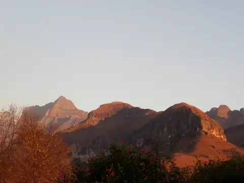
Alpine Endemics, Vulture Cliffs, and Transfrontier Protection
Altitudinal zones climb from 1,800-to-2,500-metre grassy montane foothills (the Drakensberg montane grasslands, woodlands and forests ecoregion across South Africa, Lesotho and Eswatini) to treeless alti-montane plateaux above 2,500 metres and Ramsar wetlands above 2,750 metres. Acting as Africa's southernmost high-mountain botanical island, the range brings cool climates at lower elevations than equatorial peaks farther north. Botanists recognise the Drakensberg Alpine Region as a Global Centre of Plant Diversity holding 2,153 plant species. These include 98 strictly endemic or near-endemic species (over 250 in broader regional syntheses) and 119 Red Data globally endangered plants. Rare African conifers of the genus Podocarpus shelter in lower valleys beneath oat grass, caterpillar grass and native Drakensberg tussock grasses. Higher up, ericas and the geometric Spiral Aloe (Aloe polyphylla) thrive on steep rocky basalt slopes where plant cover varies with rock hardness.
Vertebrate life matches that plant richness across 299 recorded bird species, representing 37 percent of southern Africa's non-marine avifauna inside an Important Bird Area and Lesotho Highlands Endemic Bird Area. High cliff ledges sustain threatened Cape vultures (Gyps coprotheres) and bearded vultures (Gypaetus barbatus) alongside lesser kestrels, mountain pipits, yellow-breasted pipits and Drakensberg rockjumpers. Bush blackcaps, buff-streaked chats, Rudd's larks and Drakensberg siskins also inhabit the escarpment. Cold mountain streams protect the critically endangered Maloti minnow (Pseudobarbus quathlambae), rediscovered in Lesotho's Senqunyane and Sehlabathebe waters. Three river frogs (Drakensberg, Phofung and Maluti) and five forest and grassland amphibians (forest, plaintive and rough rain frogs, long-toed tree frog and Poynton's caco) share these habitats. Lower grasslands support southern white rhinos, black wildebeest (surviving strictly in reserves by 2011), eland, klipspringer, mountain reedbuck, grey rhebok, oribi, Chacma baboons and 24 snake species, two highly venomous.
South Africa's uKhahlamba-Drakensberg Park unites 12 KwaZulu-Natal reserves formed between 1903 and 1973, including four proclaimed Wilderness zones covering almost 50 percent of the South African park. South Africa's park was inscribed by UNESCO in 2000, and both countries signed a bilateral Transfrontier Conservation Area memorandum on 11 June 2001. UNESCO formally extended the World Heritage property in 2013 to include Lesotho's Sehlabathebe National Park (protected since 1970 and gazetted in 2001). Together they anchor an 8,113-square-kilometre Peace Park spanning 64 percent Lesotho (5,170 square kilometres) and 36 percent KwaZulu-Natal (2,943 square kilometres). Proposed extensions reach toward Golden Gate Highlands National Park, Sterkfontein Dam Nature Reserve, Royal Natal National Park, Bokong Nature Reserve and Ts'ehlanyane National Park. South African safeguards rest on the 1999 World Heritage and National Heritage acts, 1999 KwaZulu-Natal Nature Conservation Amendment Act, 2003 Protected Areas Act and 2004 Biodiversity Act. Lesotho enforces the 1951 Game Preservation Proclamation, 1967 Historical Monuments Act, 2008 Environment Act and 2011 National Heritage Act. Across both nations, these statutes ban mining, require combined Environmental and Heritage Impact Assessments and restrict building above the 1,650-metre contour. Joint Project Coordinating Committees oversee invasive weed control, fire plans protecting fire-sensitive frogs, alpine path erosion work and agreements across the amaNgwane and amaZizi Traditional Council boundary gap.
Access Zones Across uKhahlamba Drakensberg and Sehlabathebe
Because towering cliffs divide KwaZulu-Natal's lush eastern valleys from Lesotho's remote highland plateau, visitors typically choose between accessible South African trailhead camps and cross-border mountain entries into Sehlabathebe.
| Complex Zone | Key Highlights | Access & Ticket Rule |
|---|---|---|
| Northern Drakensberg (Royal Natal & Tugela Gorge) | Drakensberg Amphitheatre basalt cliff wall, 947-metre Tugela Falls cascade and lower Podocarpus valley walks | South African Ezemvelo KZN Wildlife park gates; day passes and overnight trail permits required at reserve reception |
| Central Escarpment (Cathedral Peak & Giant's Castle) | 3,315-metre Giant's Castle cliffs, accessible San rock art shelters, bearded vulture hides and steep high-altitude wilderness passes | Paid reserve entry; rock art caves require accredited Ezemvelo guide accompaniment and zero flash or surface contact |
| Southern Wilderness Zones & Foothill Reserves | Four proclaimed wilderness sectors inside South Africa's 12 component reserves covering nearly 50 percent of the park, golden Clarens sandstone arches and yellow-breasted pipit grasslands | Limited visitor permits for wilderness overnight trails; check official KwaZulu-Natal Wildlife rules before multi-day hikes |
| Sehlabathebe National Park (Lesotho) | 6,500-hectare highland plateau protected since 1970, Ramsar wetlands above 2,750 metres, sculptured sandstone arches, rock pillars, clear rock pools and critically endangered Maloti minnow streams | Remote Lesotho entry via rugged 4x4 highland roads and border controls; national park permits arranged through Lesotho authorities |
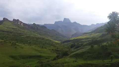
Three Geological, Botanical, and Rock Art Details in Maloti-Drakensberg
- The Basalt-Over-Sandstone Contact Line: Scanning Giant's Castle or the Amphitheatre from mid-valley paths, trace the sharp seam between dark 180-million-year-old volcanic basalt buttresses above and pale golden 200-million-year-old Clarens sandstone below. Differential erosion along that contact hollowed out living overhangs for San artists.
- Lightning-Fractured Summit Talus vs Frost Scree: Climbing high passes near Thabana Ntlenyana or Cathedral Peak above 3,000 metres, notice razor-sharp angular basalt blocks blasted directly off ridge crests by intense summer lightning strikes rather than slow glacial frost shattering alone.
- Untreated Polychrome Eland Paintings and Natural Tree Shade: Inside guided Clarens sandstone shelters, note the delicate feathered pigment edges of eland herds left entirely free of artificial resin coatings, while observing how remaining native shrubs outside cave mouths shield irreplaceable mineral paints from direct sunlight.
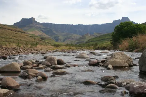
Mountain Weather Patterns and Approaches Via Maseru
Elevations above 2,500 metres, mapped by the World Wide Fund for Nature as the Drakensberg alti-montane grasslands and woodlands ecoregion, turn cool and wet under summer storm clouds. Winter freezes bring regular ridge snowfalls and crisp dry visibility beneath clear Lesotho skies. Hikers on steep basalt passes, Royal Natal's Amphitheatre rim or multi-day traverses carry four-season rain and cold layers in every month. As lodges and trailhead camps expand across lower foothills, visiting through regulated park gates with licensed guides protects alpine paths, fire-sensitive wetlands and unsealed murals. Plan two to four days in KwaZulu-Natal's Drakensberg reserves. Major international gateways are King Shaka International Airport in Durban (DUR, 173 kilometres straight-line east) and O.R. Tambo International Airport in Johannesburg (JNB, 405 kilometres northwest toward northern Royal Natal entries). Southern entries lie closer to a small regional alternative (single-runway Pietermaritzburg Airport, PZB, 103 kilometres). Lesotho's highland approaches connect northwest to Maseru (182 kilometres away), or browse wider landmarks in the UNESCO World Heritage Atlas.