Maseru
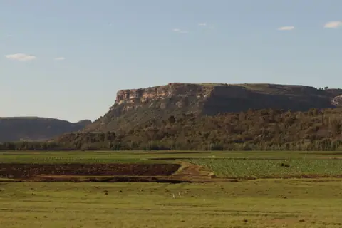
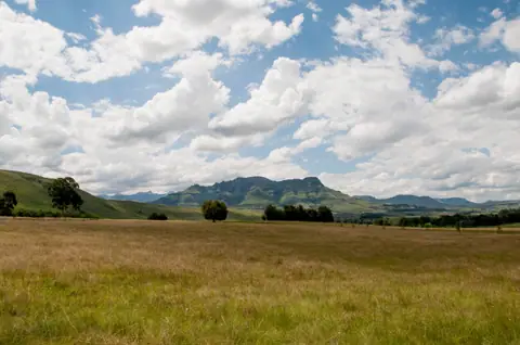
Lesotho's sky-high capital beside the Caledon River, framed by flat-topped sandstone mesas, the royal citadel of Thaba Bosiu and roads climbing into the Maloti highlands.
Quick decisions
How many days?
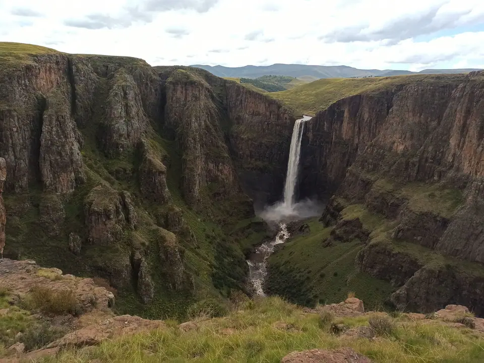
3 days: Kingsway and the Basotho Hat craft centre, the royal plateau of Thaba Bosiu and Kome Cave Dwellings, plus a full day trip to Semonkong for Maletsunyane Falls or the Katse and Mohale highland dams. Follow our three-day route.
Where should I stay?
Maseru West and Central Hills: leafy diplomatic streets and ridge viewpoints overlooking Kingsway. Pioneer Road and Riverside: modern malls, restaurants and quick border access. Lancer's Gap and Berea plateau outskirts: quiet country lodges above the valley. Compare areas in our neighbourhood overview.
Do I need a car?
For highland day trips, yes. Shared 4+1 sedans and minibuses cover Kingsway and nearby Thaba Bosiu, but reaching Semonkong, Kome Caves, Roma and the Mohale Dam over steep mountain passes is far smoother with a high-clearance rental car or local driver.
Best for
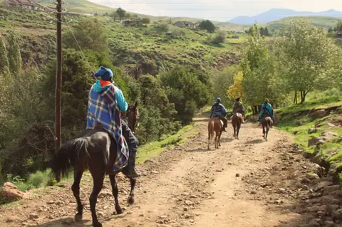
Highland scenery: dramatic sandstone tablelands and sheer basalt gorges right outside the capital. Living heritage: King Moshoeshoe I's mountain stronghold and woven woollen Basotho blankets. Outdoor adventure: pony trekking and waterfall hikes.
Before you go
Border and altitude: Lesotho sits entirely enclosed within South Africa above 1,400 metres, so carry a passport with spare blank pages for Maseru Bridge stamps and pack warm layers for crisp mountain nights. Read our practical briefing.
Getting around
From Moshoeshoe I Airport (MSU) and Maseru Bridge: airport taxis run 20 km north into central Kingsway, while pedestrian and vehicle lanes cross the Caledon River directly from Ladybrand in the Free State. Details in arrival and transport.
Continue your trip
Mountain highways climb east from Maseru past Nazareth and Ha Baroana to Mohale Dam and Katse Dam in the central Maloti range, south to Semonkong and Malealea, or north along the foothills toward Leribe, Clarens and the Golden Gate Highlands.
Overview
Sitting at 1,600 metres along a loop of the Mohokare (Caledon) River on Lesotho's western border, Maseru is the gateway to the only independent nation on earth whose entire territory lies more than a kilometre above sea level. Founded as a modest police camp in 1869 and named after the Sesotho word for red sandstones, the city spreads below steep flat-topped mesas along Kingsway boulevard and the iconic conical roof of the Basotho Hat craft centre.
Twenty-four kilometres east of the centre rises the flat-topped sandstone fortress of Thaba Bosiu, where King Moshoeshoe I forged the Basotho nation in the 1820s, while surfaced mountain roads climb past Roma into the basalt gorges of Semonkong, Maletsunyane Falls and the Mohale highland dam. Start with our first-timer briefing before crossing the border.
Getting there
Moshoeshoe I International Airport (MSU) lies 20 km south of central Maseru near Mazenod with regional flights from Johannesburg OR Tambo. Most overland travellers enter across Maseru Bridge on the Caledon River (18 km east of Ladybrand and about 145 km east of Bloemfontein on the South African N8 corridor). Inside town, shared 4+1 saloon taxis and minibuses ply Kingsway and Main North 1. See how to get to Maseru.
Where to stay
Staying on the ridges above Kingsway in Maseru West or around the Parliament hills gives you quiet gardens and wide views toward the Free State plains, while Pioneer Road and the Caledon riverside keep you within walking distance of restaurants and supermarkets. For a rural highland base, lodges near Lancer's Gap or Roma sit thirty minutes outside the traffic. We compare the main areas in where to stay in Maseru.
Things to do
Browse woven grass baskets and heritage wool blankets inside the Basotho Hat along Kingsway, climb the guided royal trail onto Thaba Bosiu and visit the mud-walled Kome Cave Dwellings, hike up Lancer's Gap for valley panoramas, and take a day trip to Maletsunyane Falls in Semonkong or Mohale Dam. See the complete list in things to do in Maseru.
Food and drink
Highland cooking in Maseru is built for cool mountain air: steamed sour sorghum or maize bread (lejeqe and papa) paired with slow-simmered oxtail, moroho wild spinach greens, spiced mutton sausages (boerewors) grilled over roadside coals, and pan-fried Maloti rainbow trout from the cold mountain streams. Read what to eat in our Kingsway and food overview.
Culture
Everyday life in Maseru reflects a proud mountain kingdom that resisted both nineteenth-century regional upheavals and colonial incorporation. Even along modern commercial streets, residents wear patterned woollen Seanamarena blankets pinned at the shoulder and conical mokorotlo woven grass hats, an emblem that appears on Lesotho's national flag and crowns the parliament chamber on Mpilo Hill.
Weather by month
Maseru is warmest in January, with average highs around 28°C, and coldest in June, when nights drop to about 0°C. January is the wettest month, with rain on about 11 days. For mild weather with fewer rainy days, aim for April, May, August and September.
| Month | Low | Range | High | Rain | Rainy days |
|---|---|---|---|---|---|
| Jan | 14°C | 28°C | 115 mm | 11 d | |
| Feb | 14°C | 27°C | 95 mm | 10 d | |
| Mar | 12°C | 25°C | 85 mm | 9 d | |
| Apr | 8°C | 21°C | 50 mm | 6 d | |
| May | 3°C | 18°C | 22 mm | 3 d | |
| Jun | 0°C | 15°C | 12 mm | 2 d | |
| Jul | 0°C | 16°C | 10 mm | 1 d | |
| Aug | 3°C | 19°C | 15 mm | 2 d | |
| Sep | 7°C | 23°C | 25 mm | 3 d | |
| Oct | 11°C | 25°C | 65 mm | 7 d | |
| Nov | 12°C | 26°C | 85 mm | 9 d | |
| Dec | 14°C | 28°C | 100 mm | 10 d |
Averages of daily values from 2015 to 2024. Rainy days are days with at least 1 mm of rain. Source: Open-Meteo · Compare destinations by month.
Maseru on the map
Every place we cover in Maseru. Tap a category or pin to explore.
In-depth Maseru guides
Browse the guides grouped by topic: sights, neighbourhoods, food, transport, day trips and trip planning.
Sights, Landmarks & Parks
Key monuments, viewpoints, museums and nature trails.
- Kingsway, the Basotho Hat Craft Centre and What to EatExploring Maseru's main artery, woven mokorotlo crafts, heritage blankets and mountain dishes.
- Thaba Bosiu Royal Citadel and the Kome Cave DwellingsThe sacred sandstone mesa where the Basotho nation was born and the cliffside mud homes of Ha Kome.
Neighbourhoods & Where to Stay
Districts, historic quarters and the best bases for your stay.
Getting Around & Arrival
Airport transfers, public transit, passes and driving rules.
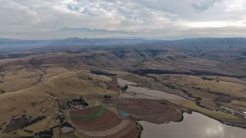
Day Trips & Excursions
Easy half-day and full-day trips from the city.
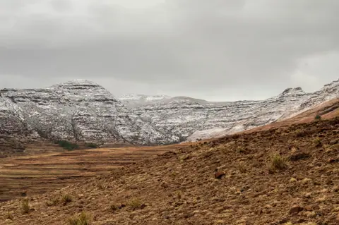
Trip Planning & Itineraries
When to visit, what to pack and day-by-day routes.
- Maseru: What to Know Before You GoBorder procedures, dual currency rules, mountain altitude and everyday etiquette in Lesotho's capital.
- Best Time to Visit MaseruChoosing between clear autumn trekking skies, summer green pastures and crisp winter snows.
- What to Wear in MaseruPacking for fierce high-altitude sunshine at midday and freezing mountain evenings.
- 3 Days in Maseru: Royal Citadels, Cave Villages and Maletsunyane FallsThree days combining Kingsway crafts, Moshoeshoe's royal mesa, Kome Caves and Semonkong.
Need your embassy or consulate in Lesotho? See embassies and consulates in Lesotho.
Reviews
Log in to write a review.
No reviews yet.