Quick Field Data
- UNESCO Inscription: 2007 (Ref. 1221), cultural waterway and defence ensemble in Ontario, Canada; Criteria (i) and (iv).
- Scale & Footprint: 21,454.81 hectares stretching 202 kilometres through the Rideau and Cataraqui rivers with 46 locks climbing 83 metres from Ottawa before dropping 50 metres to Kingston Harbour.
- Access & Ticketing: Protected as a National Historic Site under Historic Canals Regulations; Parks Canada operates boating navigation from May through October, while official notices govern winter skateway openings.
- Arrival Logistics: Major commercial flights land at Ottawa Macdonald-Cartier International Airport (YOW), 120 kilometres northeast of the canal's midpoint near Ottawa (129 kilometres). Watertown International Airport (ART) sits 48 kilometres south in New York with limited regional service.
Post-1812 Military Strategy and Colonel John By's Slackwater Plan
Following the War of 1812, British military intelligence warned that United States forces could sever Upper Canada's lifeline by advancing along the exposed St. Lawrence River between Montreal and Lake Ontario. To safeguard troops and supplies bound for the Kingston naval dockyard, Britain launched fortifications including Halifax's Citadel Hill, Quebec City's La Citadelle and Kingston's Fort Henry. Planners simultaneously sought a sheltered interior water highway running westward up the Ottawa River to the curtain-like Rideau Falls, then southwest through lakes and rivers directly into Kingston Harbour. Shorter bypass canals at Grenville, Chute-à-Blondeau and Carillon cleared rapids along the Ottawa River leg.
Indigenous travellers had long navigated portions of this Rideau corridor before Lieutenant Gershom French first mapped the river in 1783 for Loyalist settlement rather than canal shipping. At that time, dry ground separated the Rideau watershed near Newboro from Kingston until mill dams at White Fish Falls and Round Tail flooded the Cranberry marshes. Royal Engineer Lieutenant Joshua Jebb surveyed both the main Rideau Lakes route and a shorter Irish Creek overland line in 1816. Civilian surveyor Samuel Clowes later dismissed Irish Creek during 1823 to 1824 surveys because it demanded an eight-kilometre overland cut, confirming Rideau Lake as the natural summit water body.
Governor-in-Chief Charles Lennox, fourth Duke of Richmond, championed the defence corridor with Master-General of the Ordnance the Duke of Wellington before dying of rabies near Richmond in 1819 after a fox bite. In 1826, British authorities recalled Lieutenant-Colonel John By of the Royal Engineers from retirement to direct construction as Superintending Engineer. Working around earlier surveys, By adopted an ingenious slackwater engineering plan rather than excavating long parallel artificial channels beside roaring rapids. Instead, masonry dams raised river heights deliberately to flood hazards under navigable deep pools connected by stone locks.
Construction began in autumn 1826 under private contractors including John Redpath, Thomas McKay, Robert Drummond and Thomas Phillips, backed by thousands of Irish, Scottish and French-Canadian labourers. Designed explicitly for steam-powered vessels, the waterway opened in spring 1832 when Robert Drummond's steamer Rideau, carrying Colonel By and his family, departed Kingston on 22 May and arrived in Bytown on 29 May. Final land and engineering expenditures reached £822,804 by January 1834, triggering parliamentary inquiries over cost overruns that forced John By into recall and retirement without official recognition.

Forty-Six Locks, Dams, and Heritage Corridors to Kingston Harbour
Covering 202 kilometres across eastern Ontario, the Rideau Canal forms the oldest continuously operating canal system in North America and the only early 19th-century line still running along its original course. Beginning at the steep multi-lock flight right beside Parliament Hill in downtown Ottawa, its 46 masonry locks raise vessels 83 metres upstream through the Rideau River toward the Rideau Lakes summit. From that watershed divide near Newboro, boats descend 50 metres downstream along the Cataraqui River into Kingston Harbour on Lake Ontario. Most original stone lock chambers, dams, bridges and defensive blockhouses survive intact within the 21,454.81-hectare protected corridor.
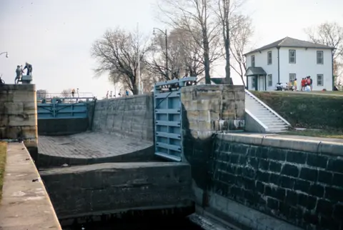
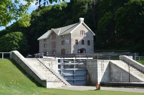
Operational authenticity distinguishes the Rideau Canal from static masonry monuments converted purely into parkland walks. Parks Canada lockmasters still open and close the vast majority of massive timber lock gates and sluice valves manually using historic hand-powered iron winches. From May through October, pleasure boaters trace the exact navigation alignment engineered for military steamships in 1832. Meanwhile, shoreline footpaths and lock station lawns link historic stone lockmaster cottages, blockhouses, Fort Henry and the Kingston fortifications across urban Ottawa and quiet rural Rideau Lakes townships.
Commercial trade quickly surpassed military defence as the canal's main nineteenth-century role once peaceful relations stabilised along the border. Bypassing dangerous St. Lawrence rapids made the Rideau a busy arterial freight route hauling timber, grain and mineral cargoes east to Montreal while carrying tens of thousands of British Isles immigrants west into Upper Canada. In 1841 alone, 19 steamboats, three self-propelled barges and 157 tow barges worked the channel, even while competing for traffic diverted across Lake Ontario toward Oswego and New York's Erie Canal.
Direct St. Lawrence River lock improvements in 1849 and opening of the Prescott and Bytown Railway in December 1854 rapidly drew commercial barges off the winding Rideau route. Eventually, development of the deep-draft Saint Lawrence Seaway in the 1950s shifted ocean shipping entirely southward, sparing the Rideau Canal from concrete widening or industrial destruction. With the arrival of outboard motors, recreational cruising revived the waterway, integrating Ottawa and Kingston directly into North America's celebrated Great Loop boating circuit.
Construction Losses, Steamers, and Parks Canada Asset Inspections
Human costs behind this 1826 to 1832 engineering feat remain solemnly documented at cemeteries and memorials along the waterway. Roughly one thousand labourers, women and children perished during construction, chiefly from endemic Ontario malaria transmitted by Anopheles mosquitoes (Plasmodium vivax) and seasonal sickness rather than blasting mishaps. Official records note only seven accidental deaths in 1827, each formally investigated through legal inquests, while deceased workers received proper funerals marked by wooden markers that eventually decayed. Visitors today can pay respects at three open canal-era burial grounds at Chaffeys Lock, Royal Sappers and Miners Cemetery near Newboro and McGuigan Cemetery near Merrickville, plus Celtic Cross memorials in Ottawa, Kingston and Chaffeys Lock and a 1993 Kingston Mills monument.
Dedicated federal protection preserves every element of the canal, dams, lock stations, associated historic buildings and Kingston forts under the Historic Sites and Monuments Act. Designated a National Historic Site in 1925 and commemorated with federal plaques in 1926, 1962 and 2013, the system operates under enforceable Historic Canals Regulations and a buffer zone. Parks Canada oversees ongoing stone repairs, mortar conservation and bank stabilisation directly using matching traditional techniques. Engineers inspect one third of all waterway assets thoroughly every year, maintaining a rolling condition inventory across all 202 kilometres.
Modern climate swings and urban growth around Ottawa test century-old masonry spillways, timber gates and earthen embankments each spring. Meltwater surges demand careful dam regulation across the Rideau and Cataraqui basins, while growing urban development near Bytown and Kingston requires strict buffer-zone adherence to preserve shoreline sightlines. Keeping hand-operated lock stations manned throughout summer navigation ensures mechanical skills pass between generations of Parks Canada staff. At the same time, balancing recreational wake control, wetland shorelines and historic lock-station lawns protects both wildlife habitats and 19th-century stonework.
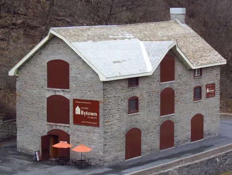
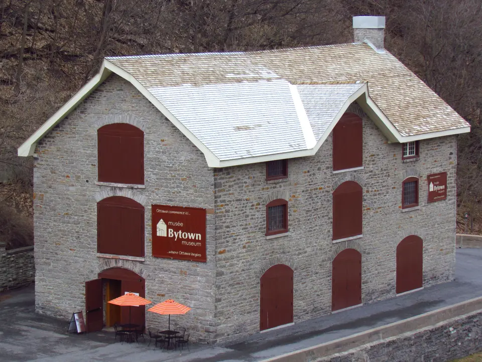
Public heritage outreach links federal management with local Ontario towns and museum curators all along the route. Near the Ottawa Locks sits the Commissariat Building, home to the Bytown Museum documenting Colonel John By's engineering works and early city growth, while Fort Henry guards the southern Lake Ontario approach at Kingston. Canada Post commemorated both summer boating at Jones Falls and winter skating by Parliament on stamps in 1998 and again in 2014. Today, visitors experience an unbroken 1832 living monument where manual winches still lift boats cleanly across eastern Ontario.
Access Zones Along the Rideau Canal in Ottawa and Ontario
Understanding how the 202-kilometre corridor divides between urban Ottawa, rural Rideau Lakes lock stations and Kingston fortifications helps focus single-day or multi-day trips. Check official Parks Canada seasonal notices before planning boat lockage, pathway closures or winter ice access.
| Complex Zone | Key Highlights | Access & Ticket Rule |
|---|---|---|
| Ottawa Locks and Bytown | Steep downtown lock flight climbing from the Ottawa River beside Parliament Hill, Commissariat Bytown Museum and urban paths. | Pedestrian canal towpaths remain open year-round; Parks Canada charges vessel lockage fees during May-to-October boating. |
| Central Lock Stations and Dams | Historic stone lock flights, timber lockmaster cottages, defensive blockhouses and slackwater stone arch dams such as Jones Falls. | Public pedestrian grounds at lock stations; verify Parks Canada boat moorage permits and seasonal museum building openings. |
| Rideau Lakes Summit Basin | Natural lakes around Newboro and Chaffeys Lock linking the 83-metre northern ascent to the 50-metre southern drop. | Navigable summer waterways and lakeside village roads; check local marine charts for rock shoals and channel markers. |
| Kingston Mills and Fort Henry | Southern Cataraqui lock flight descending to Kingston Harbour near Fort Henry and coastal masonry Martello defences. | Parks Canada manages Kingston Mills grounds and Fort Henry passes separately; confirm seasonal site entry schedules online. |

Three Slackwater Engineering Details Along the Canal Locks
- Hand-Operated Iron Sluice and Gate Winches: Watch Parks Canada staff crank traditional geared iron chains beside lock walls to swing timber gates and raise submerged paddles entirely by human leverage without electric motors.
- Curved Masonry Arch Dam at Jones Falls: Inspect one of the finest early 19th-century stone arch dams in North America, built without mortar courses on the downstream face to resist immense slackwater lake pressure across deep granite ravines.
- Ottawa Eight-Lock Flight by Parliament Hill: Walk along the terraced stone promenade between the Ottawa River and Wellington Street to see eight consecutive masonry lock chambers stepping boats cleanly up the sheer limestone escarpment.

Summer Pleasure Boating and Rideau Canal Winter Skating Logistics
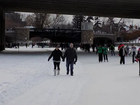
Seasonal planning shapes every rideau canal ottawa itinerary because water conditions transform dramatically between warm navigation months and sub-zero eastern Ontario winters. Travellers checking rideau canal ottawa open status should note that Parks Canada operates lock stations for pleasure craft from May through October, whereas winter freezes the central Ottawa channel into the National Capital Commission's Rideau Canal Skateway. Exact skating opening dates fluctuate annually with ice thickness and weather, so visitors must verify official National Capital Commission ice reports before packing skates.
Addressing practical rideau canal ottawa directions and depth questions starts with clarifying how the urban section links toward Lake Ontario. Running straight from the Ottawa Locks below Parliament Hill southward past Dow's Lake, visitors searching where is the rideau canal in ottawa can step directly onto paved multi-use pathways on both banks. Rather than relying on unverified soundings for how deep is the rideau canal in ottawa, recreational skippers consult official Parks Canada marine navigation charts for draft clearances across each pool. Meanwhile, road and bike travellers tracing the full rideau canal ottawa to kingston route follow scenic eastern Ontario highways linking Merrickville, Smiths Falls, Rideau Ferry, Chaffeys Lock and Jones Falls.
International visitors flying in for things to do in ottawa rideau canal commonly use Ottawa Macdonald-Cartier International Airport (YOW), lying close to the northern Ottawa corridor and 120 kilometres northeast of the full serial site's Rideau Lakes midpoint near Ottawa (129 kilometres). Watertown International Airport (ART) sits 48 kilometres south of the midpoint across the United States border, offering far fewer commercial routes. Explore additional historic engineering monuments and canals worldwide inside our UNESCO World Heritage Atlas.