Quick Field Data
- UNESCO Inscription: 1996 (Ref. 757), officially inscribed as Sceilg Mhichíl; Criteria (iii) and (iv)
- Scale & Footprint: 21.58 hectares (cited between 18 and 22 hectares across surveys) covering the steep rock crag 11.6 to 12 kilometres west of County Kerry's Iveragh Peninsula, buffered naturally by the Atlantic Ocean
- Access & Ticketing: Landing is restricted exclusively to summer boats operating under annual Office of Public Works (OPW) permits when swell allows; private craft are discouraged, the South Peak hermitage remains largely closed on safety grounds, and access outside the official season is prohibited
- Arrival Logistics: Cork International Airport (ORK) stands 141 kilometres east as the primary major commercial airport, whereas closer Kerry Airport (KIR) at 83 kilometres operates a smaller regional schedule with fewer international flights
Devonian Sandstone Pinnacles and Atlantic Faulting
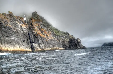
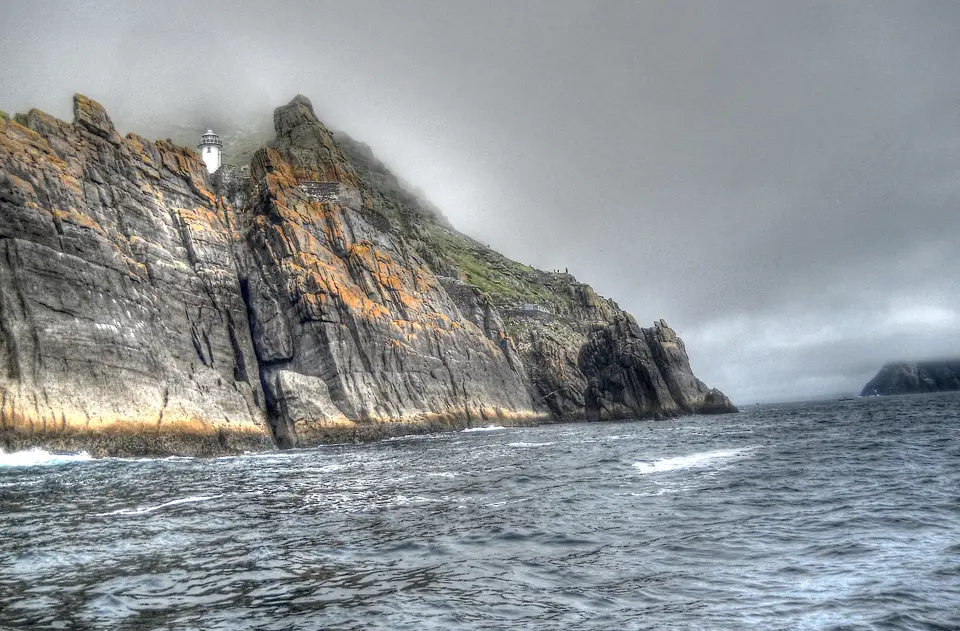
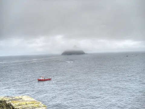
Skellig Michael (Sceilg Mhichíl, or Great Skellig) rises abruptly from the open Atlantic 11.7 kilometres west-northwest of Bolus Head at the mouth of Saint Finian's Bay. It marks one of the most westerly outposts of Ireland and non-Icelandic Europe. Its Irish name derives from sceilig (or sceillec), meaning a sharp splinter of stone, a rare place-name element shared only with Bunskellig in County Cork and Temple-na-Skellig at Glendalough. Old Norse speakers called the crags skellingar, the resounding ones, and early Irish verses also termed the island Glascarraig, the green rock. Cliff-ringed Little Skellig (Sceilig Bheag) sits one mile closer to land, paired with Lemon Rock 3.6 kilometres inland and nearby Puffin Island. Both Skellig crags formed between 360 and 374 million years ago during the Devonian period, when Ireland formed part of a continental landmass south of the equator. Sediment then compressed into Old Red Sandstone and slate during the uplift of the MacGillycuddy's Reeks and Caha Mountains, folded further during Hercynian mountain building around 300 million years ago.
Post-glacial sea-level rise flooded deep coastal inlets such as Bantry Bay and severed the compressed sandstone ridge from County Kerry. Exposed to relentless Atlantic storms, rock fractured along a major north-south fault where brittle bedrock eroded away to carve a U-shaped central valley known as Christ's Saddle at 129 to 130 metres above sea level. Flanking that saddle stand two dramatic summits: the north-eastern peak reaching 185 metres, where monks perched their monastery at 170 to 180 metres, and the jagged south-western summit (called the Spit) rising to 218 metres. Despite ferocious salt spray and steep cliffs, the surrounding ocean keeps the crag almost frost-free year round.
Reaching the heights required cutting stone flights upward from three exposed landing coves. Blind Man's Cove on the sheltered eastern recess receives modern permitted boats at a pier built in 1826 beneath soaring seabird cliffs. Beside the 37-metre Flagstaff platform, the approach splits into two staircases, leaving the older medieval flight climbing directly up toward the monastery largely abandoned. Cross Cove opens to the south, while exposed Blue Cove on the northern side permits boat landings on an average of barely 20 days per year. Writer Des Lavelle suggested medieval weather must have been calmer when monks hewed such a perilous landing stair. Above the Flagstaff platform, the climb toward Christ's Saddle passes the flat 1.2-hectare grass shelf known as Wailing Woman rock at 120 metres, the sole level fertile ground on the island where medieval crop cultivation traces survive.
Gaelic Monks, Viking Raids and Nineteenth-Century Lighthouses
Pre-Christian annals weave Skellig into mythic shipwreck stories dated around 1400 BC involving the Tuatha Dé Danann and Irr, son of Míl Espáine, buried on the rock after sailing from Iberia. Early prose such as Lebor Gabála Érenn, Cath Finntrágha and the Martyrology of Tallaght recalls these tales. It also links the rock to third-century ruler Daire Domhain (around 200 AD before attacking Fionn mac Cumhaill at Ventry) and fifth-century King Duagh fleeing rivals from Cashel. Historical certainty starts with Gaelic monks who built a stone retreat here between the sixth and eighth centuries, part of an Atlantic archipelago of ascetic islands off the Iveragh and Dingle peninsulas. Across the fifth and sixth centuries, those communities carried Christian monasticism and early literacy from Egypt through Italy, Gaul and Britain past Rome's vanished frontier. Although local tradition credited Saint Fionán in the early sixth century, historians view the first reliable monastic date as the eighth-century death notice of Suibhini of Skelig.
Between the ninth and eleventh centuries, the Annals of the Four Masters chronicle repeated ordeal and devotion on the rock. Viking raiders struck in 823, plundering Skellig and carrying off abbot Eitgal, who died of starvation in captivity, before attacking churches across Skellig, Kenmare and Innisfallen Island again in 838.
Between about 950 (when Blathmhac of Sceilic died and Augustinian foundations took root on the mainland at Ballinskelligs) and the 1040 or 1044 record of Aedh of Scelic-Mhichíl, the island community dedicated its site to Archangel Michael. Monks added St Michael's Church between 950 and 1050, reflecting medieval traditions linking Saint Patrick's final battle against venomous serpents with Saint Michael. Probably numbering no more than twelve monks and an abbot at any period, the brothers supplemented small walled vegetable plots with fish, seabird meat and nesting eggs. Growing storms, Viking pressure and twelfth-century Irish church restructuring eventually drove the monks to abandon permanent residence for Ballinskelligs in the late twelfth or early thirteenth century. Pilgrims nonetheless continued sailing across until at least the early sixteenth century.
After Queen Elizabeth I dissolved Ballinskelligs Abbey in 1578, ownership passed to the Butler family until the 1820s. In the 1820s, the Corporation for Preserving and Improving the Port of Dublin (forerunner of the Commissioners of Irish Lights) compulsorily purchased the island from John Butler of Waterville. The board constructed two Atlantic lighthouses and keeper quarters, completed in 1826. That nineteenth-century building camp modified parts of the island approach before Lord Dunraven recorded the monuments in his 1871 Notes on Irish Architecture survey. Placed under State guardianship in the 1880s, including repairs to enclosures and the upper retaining wall along St Michael's Church, Skellig Michael underwent further targeted work in the 1930s. Starting in 1978 and accelerating across terrace retaining walls in 1986, the Office of Public Works (OPW) carried out systematic dry-stone stabilisation, conservation engineering and archaeological photography. This programme operates under a Service Level Agreement with the National Monuments Service and Department of Arts, Heritage, Regional, Rural and Gaeltacht Affairs. Designated a Special Protection Area since 1986, the island shelters peregrine falcons, fulmars, Manx shearwaters, storm petrels, gannets, kittiwakes, guillemots, razorbills, Atlantic puffins and roughly fifty grey seals. Meanwhile, rabbits and house mice introduced in the nineteenth century persist after a former goat herd vanished.
Terraced Beehive Masonry and the South Peak Hermitage
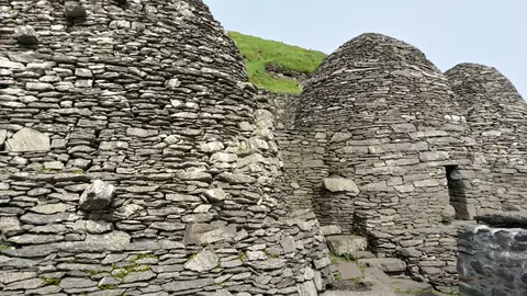
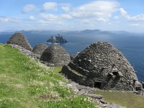
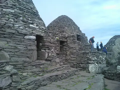
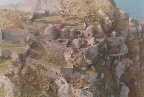
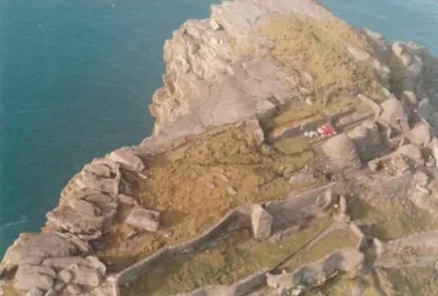
Because Skellig Michael escaped urban stone robbing and modern rebuilding, its monastic summit preserves a chronological textbook of early Irish dry-stone engineering. Built across a sloping shelf along the north-eastern ridge at 170 to 180 metres, dry-stone retaining walls buttress paved terraces. Those platforms hold dry-stone corbelled cells (beehive huts), oratories, burial enclosures, rainwater cisterns, stone paths and St Michael's Church, whose upper retaining wall was partially rebuilt after collapse in the 1880s. Walking from cell to cell reveals how builders shifted from early rectangular stone courses toward tightly fitted overlapping corbels angled slightly downward on the outer face so rainwater dripped away without mortar. During conservation and survey campaigns begun in 1978 and expanded across terrace walls in 1986, every original structural trace was retained and stabilised in situ. Skilled OPW craftspeople, conservation architects and engineers carry out this work with funding from the State Exchequer.
Far more extreme than the main monastery is the isolated hermitage clinging just below the 218-metre South Peak across the island. Leaving Christ's Saddle along the treacherous ascent known as the Way of the Christ, climbers pass the Needle's Eye stone chimney at 150 metres. Along the ridge stand fourteen simple stone crosses bearing sombre names such as the Rock of the Women's piercing caoine. Beyond the Stone of Pain, narrow 60-centimetre-wide rock-cut steps hug vertical sandstone faces. Tiny cantilevered prayer and sleeping terraces cut directly into sheer ledges demonstrate the austere extreme reached by early medieval Gaelic ascetics seeking uninterrupted solitude between Atlantic spray and open sky.
Access Zones Across Skellig Michael's Cliffs and Terraces
| Complex Zone | Key Highlights | Access & Ticket Rule |
|---|---|---|
| Blind Man's Cove & Stairways | 1826 Flagstaff pier, split lighthouse road and steep rock-cut monastic steps | Accessible only via licensed summer OPW-permit passenger boats; no winter landings and private boats discouraged |
| Main Monastery (North-East Ridge) | Corbelled beehive huts, oratories, St Michael's Church, stone crosses and retaining terraces | Open during the official summer guide season; steep uneven stone steps require steady footing and warm waterproof gear |
| Christ's Saddle & Wailing Woman | Central 129-metre sandstone fault pass and 1.2-hectare grassy ridge with medieval garden marks | Transit path along the main ascent; nesting seabird burrows and thin turf must stay undisturbed |
| South Peak Hermitage (The Spit) | Needle's Eye chimney, Way of the Christ crosses and 60-centimetre steps rising to 218 metres | Largely closed to public visitors owing to extreme fall hazards and fragile cliffside masonry |
Since 1987 an official OPW guide service has regulated visitor numbers on site during peak periods, expanded since 2007 into an annual seasonal window defining when permitted boatmen and boatwomen may land passengers safely. Protected in full State ownership as a national monument, the island is governed under the National Monuments Acts (1930 to 2004), Planning and Development Acts, European directives and Wildlife Acts (1976 and 2000). All guiding stops roughly between October and May whenever Atlantic swells batter the landing steps. During the operating summer season, OPW staff maintain a continuous full-time presence on the rock, even though the nineteenth-century lighthouse now runs automatically without keepers.
Three Monastic and Geological Features to Spot on the Ascent
- The Staircase Fork Above Flagstaff Pier: Soon after climbing off the 1826 pier at Blind Man's Cove, observe where the gentler lighthouse supply path diverges from the steeper original stone stair leading straight toward the medieval abbey shelf.
- Unmortared Corbelled Stone Domes at the Monastery: Inspect the overlapping horizontal sandstone slabs curving inward to cap the beehive cells without mortar, engineered to stay dry and structurally stable in hurricane-force sea gales.
- Seabird Ledges and Fault Geology Across Christ's Saddle: Pause on the 130-metre pass to trace the eroded Devonian fault dividing the twin peaks. Below sits the 1.2-hectare grassy shelf of Wailing Woman rock at 120 metres where monks once grew crops. Above, look toward the Needle's Eye stone chimney while Atlantic puffins, razorbills and fulmars wheel past the steep sandstone ledges.
Planning a Summer Crossing From Kerry and Pairing With Dublin
Reserve an official OPW-licensed boat place months ahead for summer dates, keeping flexible multi-day weather margins in County Kerry. Choppy Atlantic swells around Blind Man's Cove, let alone northern Blue Cove approachable on an average of just 20 days annually, frequently force last-minute landing cancellations even in peak July or August. Carry food, water, windproof outer layers and grippy hiking boots for the 170-metre climb, since zero visitor shelters, cafés or public toilets operate on the crag. Travellers touring south-western Ireland often link the Iveragh Peninsula coastline by road or rail back eastward to Dublin, 338 kilometres northeast, before browsing further island and early medieval monastic heritage in the UNESCO World Heritage Atlas.