Quick Field Data
- UNESCO Inscription: Inscribed on 28 June 2007 (Ref. 1258) as a Natural site under Criteria (vii) and (viii).
- Scale & Footprint: Protects 18,990 hectares inside La Orotava municipality on central Tenerife, centred on the 3,715-to-3,718-metre Teide-Pico Viejo volcanic complex inside Las Cañadas caldera.
- Access & Ticketing: National park road viewpoints, visitor centres, and lower caldera hiking trails open free year-round. Ascending Mount Teide's summit cone requires an advance free permit checked on official park channels, while morning and afternoon coach excursions depart southern Tenerife resorts.
- Arrival Logistics: Direct commercial air connections land at Tenerife Sur Airport (TFS, 26 kilometres south) and Tenerife Norte-Ciudad de La Laguna Airport (TFN, 38 kilometres northeast), with Gran Canaria Airport (LPA) 129 kilometres southeast. Mainland Spain air links connect toward Seville (1,419 kilometres).
Shield Volcano Roots, Las Cañadas Collapse, and Teide Stratovolcano Growth
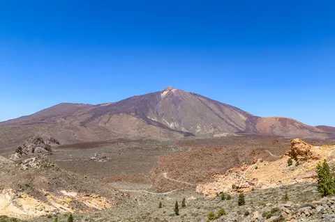
Rising from the Atlantic Ocean floor 290 kilometres northwest of the Western Sahara coast, mount teide tenerife forms both Spain's highest peak and the highest mountain on any Atlantic island. When measured from its base on the deep oceanic seabed, the volcano reaches 7,500 metres, ranking behind only Mauna Loa and Mauna Kea in Hawaii as Earth's third-tallest volcanic structure. Above sea level, mount teide height registers between 3,715 and 3,718 metres across surveys, crowning Tenerife as the world's tenth-highest island. Beside it on the western slope rises secondary cone Pico Viejo, whose summit measures 3,135 to 3,414 metres around an 800-metre-wide crater 140 metres deep, making Teide and Pico Viejo the only Canary Islands summits exceeding 3,000 metres.
Deep geological roots beneath mount teide span nearly twelve million years of oceanic volcanism across the Canary Islands chain. Older eastern islands such as Fuerteventura and Lanzarote date back 20.2 million years, whereas western El Hierro formed roughly 1.1 million years ago and nearby submerged Lars seamount dates to 68 million years. Unlike Hawaii's rapidly sinking hotspot chain, Tenerife shows minimal subsidence, and volcanic eruptions persist across multiple islands rather than migrating strictly to one youngest cone. Scientists debate whether deep mantle convection cells feeding magma eastward explain active volcanism across older Canary islands. On Tenerife itself, central basaltic shield growth between 12 and 8.9 million years ago preceded Teno (6 to 5 million years ago) and Anaga (4.9 to 3.9 million years ago) shields forming 90 percent of the island.
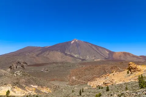
After a 5.5-million-year lull, activity resumed roughly 3.5 million years ago and sculpted the vast asymmetric Las Cañadas caldera. Measuring 15 kilometres across and opening northward toward the sea, the caldera floor stands at 2,000 to 2,200 metres beneath southern walls reaching 2,717 metres at Mount Guajara. Around 170,000 years ago, a catastrophic landslide triggered the growth of Teide-Pico Viejo, building an eight-kilometre-wide stratovolcano cone spanning 150 to 200 cubic kilometres with steep 20-to-40-degree flanks. Today El Pitón forms the 150-metre summit cone with a 100-metre-wide crater 30 metres deep, flanked by Roques Blancos, Pico Cabras, Montaña Blanca, and dark Lavas Negras burying southern ravines such as Corredor Mario, Corredor La Corbata, and Corredor La Bola.
Although long quiescent compared with Sicilian cones, mount teide eruption risk keeps the massif designated a United Nations Decade Volcano due to nearby towns including Garachico, Icod de los Vinos, and Puerto de la Cruz. Its most recent volcanic outbreak occurred in late 1909 from the El Chinyero vent along the northwestern Santiago rift. Centuries earlier, in 1492, Christopher Columbus's crew reported flames rising from Tenerife's highest mountain while passing seaward. Together with Pico Viejo and Montaña Blanca, Teide preserves an exceptional living record of evolved, differentiated oceanic island magmas contrasting directly with simpler basaltic shields in Hawaii.
Inversion Clouds, Endemic High-Altitude Flora, and Sacred Guanche Ground
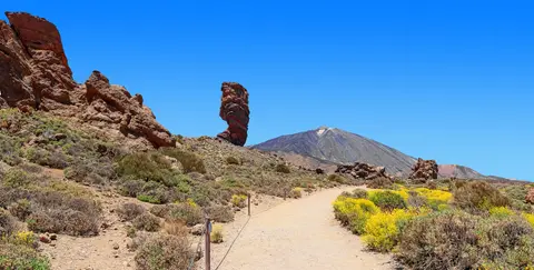
Climate inside mount teide national park differs sharply from Tenerife's humid northern coast because an atmospheric temperature inversion traps trade-wind moisture around 1,000 metres above sea level. Moist Atlantic air driven by the Azores high piles dense cloud banks between 240 and 490 metres altitude along northern slopes, generating a persistent sea of clouds beneath dry caldera summits. Above that cloud barrier, high-altitude continental swings drop winter night temperatures down to minus 15 degrees Celsius while summer afternoons reach 30 degrees Celsius, accompanied by daily 15-degree shifts and annual rainfall under 500 millimetres (one third falling as snow). Extreme midsummer UV indexes exceed 11, wave clouds form the mountain's hat (Toca del Teide), and Izaña observatory at 2,371 metres logs a mild 10.2 degrees Celsius annual mean and nearly 3,500 sunshine hours.
Weathering lava beds yield thin mineral-rich volcanic soils supporting 168 vascular plant species, including 33 found nowhere else beyond Tenerife. Between 1,000 and 2,100 metres, Canary Island pine woodlands form an alpine treeline 1,000 metres lower than continental ranges at equivalent latitude, while Las Cañadas shelters fragile Canary Island cedar. Above the pines grow semi-spherical, waxy, or downy mountain shrubs flowering mostly across May and June. Prominent species include white-and-pink Teide white broom (Cytisus supranubius), violet Canary Island wallflower (Erysimum scoparium), and towering red spikes of Teide bugloss (Echium wildpretii) up to three metres tall. Higher still, the white Teide daisy thrives high up the flanks while the delicate Teide violet reaches the summit cone as Spain's highest flowering plant.
Animal life mirrors this extreme volcanic elevation. Over 40 percent of park invertebrates are endemic, with 70 insect and arachnid species restricted exclusively to park habitats. Ten bird species nest inside the caldera, including the Tenerife blue chaffinch, Berthelot's pipit, Atlantic canary, and local kestrel subspecies, sharing rocky outcrops with three endemic reptiles: the Canary Island lizard, wall gecko, and skink. Leisler's bat represents the sole native mammal, contrasting with introduced rabbits, hedgehogs, feral cats, and mouflon managed carefully by rangers. Long before Spanish colonisation in 1496, native Guanche people revered sacred Echeyde as the pillar holding up the sky and home of the volcano deity Guayota, lighting protective bonfires during eruptions and hiding stone tools and pottery offerings in mountain caches.
Volcanological Pioneers, Mars Instrument Trials, and Visitor Pressure
Declared a national park on 22 January 1954, Teide earned international distinction early. The Council of Europe awarded the European Diploma of Protected Areas in 1989 (renewed in 1994, 1999, and 2004) before UNESCO inscription in 2007 and popular selection as one of the 12 Treasures of Spain. Pioneer geologists Alexander von Humboldt, Leopold von Buch, and Charles Lyell established Teide as a cornerstone of European volcanology and geomorphology. On an eastern ridge stands the international Teide Observatory, while Mars-like caldera soils and UV levels turned Las Cañadas and Las Minas de San José into testing grounds for the ESA-NASA ExoMars Raman spectrometer in 2010 and European planetary rovers in 2017. Even Spain's highest Christian chapel, dedicated to Virgen de las Nieves, sits inside the park.
Dramatic scenery also drew filmmakers and endurance athletes to the volcano. Productions from One Million Years B.C. (1966) and Clash of the Titans (2010) to Fast & Furious used the caldera slopes, while elite road-cycling squads train at stable high altitude with sea-level descents nearby. Visitor volume has surged steadily as Teide became Spain and Europe's most visited national park, climbing from roughly three million annual guests to 4,079,823 in 2016, 4,463,281 in 2023, and 5,242,653 in 2024. Managing heavy footfall, climate drying, and coordination between national and regional authorities remains central under Teide's six-year management plans and technical exchanges with sister parks like Rapa Nui and Morocco's Souss-Massa National Park.
Access Zones Inside Teide National Park on Tenerife
Planning things to do mount teide depends on distinguishing free caldera sightseeing along paved drives from regulated summit climbs. Paved caldera roads carry drivers, cyclists, and coach tours straight into 2,000-metre viewpoints, whereas El Pitón's crater rim operates under strict permit controls.
| Complex Zone | Key Highlights | Access & Ticket Rule |
|---|---|---|
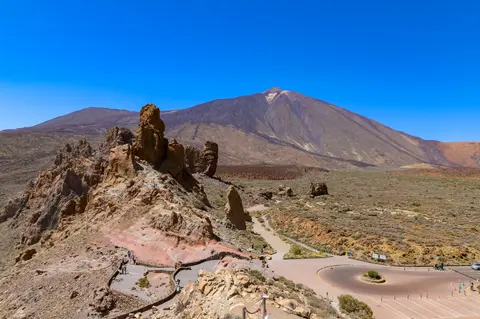
| Las Cañadas Caldera & Roques de García. | 15-kilometre asymmetric caldera floor, eroded Roques de García and Roque Cinchado spires, Mirador de La Ruleta, and Guajara walls. | Public caldera roads and paved overlooks open free year-round. Stay strictly on marked paths to protect fragile volcanic soils. |
| Lower Trails & Las Minas de San José. | Pumice plains tested for Mars rovers, Teide bugloss spring blooms, Lavas Negras flows, and Canary pine perimeter forests. | Marked national park walking trails open free. Pack warm layers, high-factor sun protection, and ample drinking water. |
| Pico del Teide Summit Cone (El Pitón). | Highest summit point in Spain at 3,718 metres, 100-metre summit crater, fumarole vents, and Spain's highest Teide violet habitat. | Ascending the final peak trail requires a free advance permit booked via official national park reservation channels. |
| Izaña Ridge & Teide Observatory. | Solar and astronomical domes at 2,371 metres altitude enjoying roughly 3,500 sunshine hours above the coastal cloud inversion. | Restricted scientific complex outside casual public roaming. Guided observatory visits require advance booking through authorised educational tours. |
Three Volcanic and Botanical Details Around Mount Teide
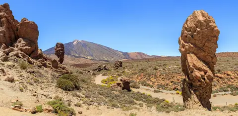
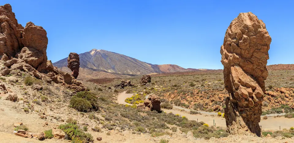
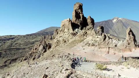
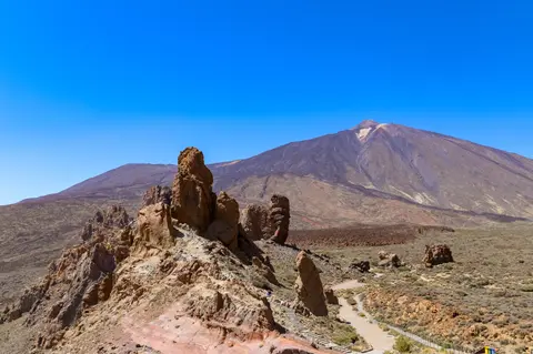
- Basalt Spires and Differential Erosion at Roques de García: Walk the trail around Roque Cinchado opposite Mirador de La Ruleta in Las Cañadas caldera. Harder volcanic dyke cores resisted centuries of wind and rain erosion far better than surrounding softer pyroclastic ash beds, leaving balanced top-heavy rock pillars framing the volcano cone.
- Towering Red Spikes of Teide Bugloss in May and June: Look across sunlit caldera gravel slopes in late spring for Echium wildpretii blooming up to three metres tall. Its narrow cylindrical flower spire shelters blooms from freezing nocturnal winds while concentrating nectar and warmth for endemic high-altitude pollinators.
- Cloud Inversion Boundary Above Canary Pine Forests: Watch the sharp horizontal cloud bank hovering roughly 1,000 metres below the caldera rim when driving uphill from Tenerife's coast. Above that thermal inversion lid, humid Atlantic mist ends abruptly, giving way to dry desert-like basalt gravel and crystal-clear ultraviolet skies.
How to Visit Mount Teide Across Tenerife's Seasons
Working out how to visit mount teide starts with Tenerife's sharp altitude contrast between sunny beaches and high mountain air. Spring months of May and June represent the best time to visit mount teide for botany, when Teide white broom, wallflowers, and towering red Teide bugloss burst into bloom across clear caldera slopes. Summer guarantees nearly unbroken clear skies above 3,450 sunshine hours per year, though midday UV exceeds 11 and daytime highs touch 30 degrees Celsius before plunging dramatically after sunset. Winter brings crisp snowfields and occasional ice closures down to 2,000 metres when roughly a third of annual caldera rainfall arrives as snow, requiring cold-weather clothing and road checks.
Travellers asking can you drive up mount teide can travel smoothly by hire car across paved island highways into Las Cañadas caldera car parks or join morning and afternoon coach trips departing southern Tenerife tourist towns. Anyone planning a mount teide hike all the way to the 3,718-metre summit crater must secure the free advance national park permit before starting uphill from lower caldera trails. Both Tenerife Sur Airport (TFS, 26 kilometres south) and Tenerife Norte Airport (TFN, 38 kilometres northeast) put visitors within easy half-day reach of the caldera, while Gran Canaria Airport (LPA) connects nearby islands 129 kilometres away. Pair your volcanic Canary Islands journey with mainland Spain via our guide to Seville (1,419 kilometres) or browse more natural sites across our UNESCO World Heritage Atlas.