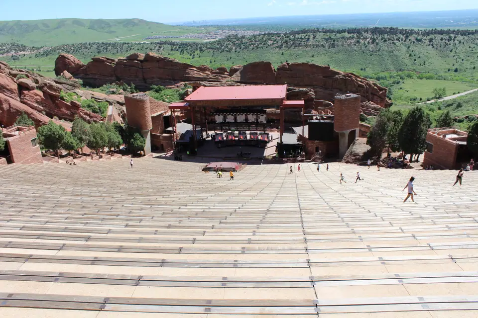
Photo: Sarbjit Bahga · CC BY-SA 4.0
Red Rocks and Mountain Parks Guide
A practical guide to visiting Red Rocks Amphitheatre and Denver Mountain Parks with altitude safety tips and driving itineraries.
Denver Mountain Parks and Red Rocks Park offer immediate access to preserved wilderness, dramatic rock formations, and subalpine summits directly west of the city.
Red Rocks Amphitheatre and Foothills Geology
Red Rocks Park and Amphitheatre is owned and operated by the City and County of Denver. Carved out of massive 300-foot-high red sandstone monuments, it is the only completely natural amphitheatre in the world. Natural acoustic clarity develops because of a bounce rock situated behind the performance stage. The open venue houses a 9,000-seat arena. It holds official LEED Gold certification for environmental sustainability and celebrated the 85th anniversary of its grand opening on June 15, 1941.
Geological processes sculpted these dramatic 300-foot-high red sandstone monoliths over millions of years. Today, the municipal venue welcomes live musical performances across its seasonal concert calendar. The park itself is free and open to the public except when there is a scheduled performance. When shows take place, access rules change, so check the official site before driving up. Outside show hours, visitors use the steep amphitheatre seating for morning fitness routines or hike the surrounding red stone landscape.
Right beside Red Rocks lies Morrison, a historic entry town featuring 70 historic sites plus local shops and restaurants. The immediate area around Morrison also features Dinosaur Ridge, an outdoor museum where palaeontologists first discovered famous dinosaurs like Stegosaurus, Diplodocus, and Allosaurus in 1877. Visiting both locations on the same excursion offers insight into local earth history. To plan your visit around seasonal performance dates and weather patterns, consult our Best Time to Visit Denver guide.
The region benefits from 300 days of sunshine each year, which creates dependable conditions for touring outdoor foothills sites. Pack sun protection and supportive walking shoes before setting out. Morning journeys provide quiet paths, unobstructed views of the sandstone slabs, and reliable parking across all upper and lower vehicle lots.
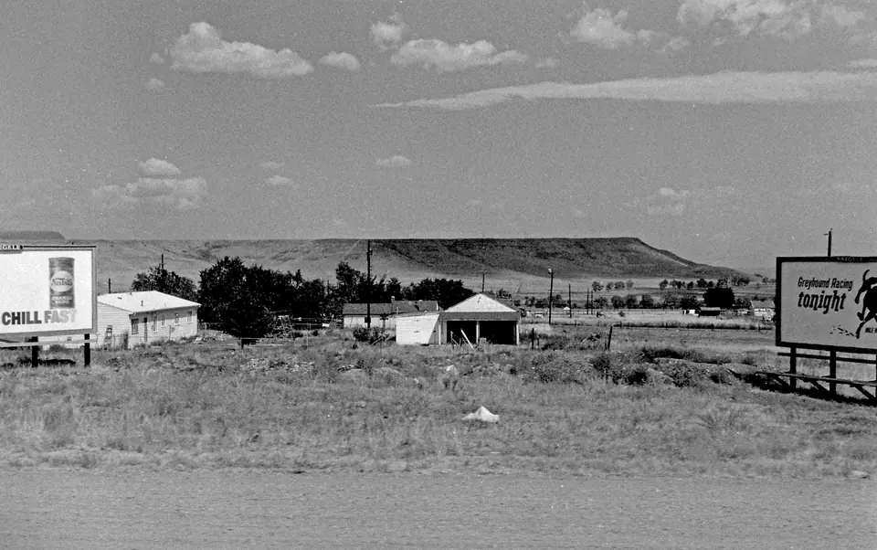
Denver Mountain Parks Across the Foothills
Denver maintains an immense mountain park system that covers 14,000 acres in the nearby foothills of the Rocky Mountains. This system forms an expansive city backyard that covers an area almost the size of Manhattan. For more than 100 years, these lands have provided outdoor recreation in scenic landscapes. The municipal network encompasses 22 accessible parks and 24 conservation areas spanning across three separate Colorado counties.
These properties extend from foothills elevations to altitudes of over 13,000 feet. Visitors can pursue hiking, fishing, golfing, and picnicking in different climate settings without leaving municipal public territory. Park Rangers patrol mountain and urban parks daily by foot, bicycle, and vehicle. They assist local law enforcement and fire services whenever hazardous conditions occur.
Genesee Park was Denver's first mountain park and remains its largest, protecting 2,413 acres of foothills terrain. The park hosts Chief Hosa campground, which spans 58 acres and opened in 1918 as America's first motor-camping area. It continues to provide accessible camping within native pine forests. Genesee also preserves open mountain pastures framed by distant snowy peaks.
Just 12 miles west of downtown Denver sits Lookout Mountain Park. The site contains the Buffalo Bill Museum and Grave, which welcomes over 80,000 visitors each year and provides sweeping views across Denver and Golden. Next to the museum grounds sits the Lookout Mountain Nature Center and Preserve. This 110-acre open space provides 1.5 miles of trails winding through forest and meadow.
The Boettcher Mansion also sits on Lookout Mountain at an elevation of 7,500 feet. It was built in 1917 as a summer home and hunting lodge for Charles Boettcher. The mansion stands on 110 acres of pine forest and showcases classic Arts and Crafts architecture. Exploring these contiguous parks demonstrates how early civic planners successfully safeguarded mountain corridors for community recreation.
Mount Blue Sky Scenic Byway and Alpine Lakes
Mount Blue Sky is home to the highest paved road in North America and offers a journey through multiple climate zones. The 14-mile Mount Blue Sky Scenic Byway climbs directly to the 14,264-foot summit. This alpine road is 154 feet higher than Pikes Peak. Due to winter snow, vehicle access is restricted to summer and early autumn. The road is typically open from the Friday of Memorial Day weekend through the first weekend in October.
Driving this corridor leads through changing alpine life zones, climbing in elevation with new vistas in every direction. At 47 miles from Denver, drivers arrive at Echo Lake Park at an elevation of 10,600 feet. The subalpine park surrounds a 24-acre lake formed by a glacial moraine. Visitors can stop at Echo Lake Lodge, an authentic log building constructed in 1926 that features a charming four-sided stone fireplace.
Continuing higher along the Mount Blue Sky Scenic Byway brings motorists to Summit Lake Park. Located at 12,836 feet above sea level, Summit Lake is the highest city park in the nation. It perches far above the alpine timberline, where fragile tundra vegetation survives extreme subalpine conditions. For wider driving options across the state, browse our detailed Best Day Trips From Denver guide.
Because road access depends heavily on late-spring thaws and early-autumn blizzards, always check highway conditions prior to leaving the city. The route passes straight drop-offs and narrow switchbacks without guard rails. Drivers must maintain safe speeds, downshift gears when descending steep inclines, and respect changing conditions across every mile of mountain road.

Altitude Safety, Sun Exposure, and Mountain Weather
Ascending into the Rocky Mountain foothills requires physical preparation. Temperatures drop 3.5 degrees Fahrenheit for every 1,000 feet of elevation gained. A pleasant morning in Denver can turn chilly by the time you reach Echo Lake or high summits. Dressing in breathable layers allows you to adjust quickly to rapid atmospheric changes.
Atmospheric density decreases significantly as you drive up from Denver into the high parks. At 14,000 feet, the atmosphere has 43 percent less oxygen than at sea level. This thin air makes any physical activity strenuous, including simple strolls on paved overlooks. Drink plenty of water before and during your mountain excursion to help your body manage high elevations.
Solar radiation increases rapidly with elevation. Visitors at 14,000 feet face 50 percent less protection from the sun than people at sea level. Applying broad-spectrum sunscreen and wearing sunglasses is essential across open ridges. Even on mild or cloudy afternoons, ultraviolet exposure remains exceptionally intense along exposed terrain.
Severe afternoon thunderstorms represent a major environmental hazard across the Rocky Mountains. Lightning storms are common on summer afternoons, bringing rapid temperature drops and intense electrical strikes across bare ridges. As a general rule, it is best to be off high mountain summits by noon. Plan early morning starts to ensure you descend safely before cloud formations gather.
Driving Routes and Wildlife Across the Foothills
The Lariat Loop is an established 40-mile stretch of road in the foothills west of Denver. This scenic drive connects the historic communities of Golden, Morrison, Lookout Mountain, and Evergreen. Motorists can experience geological landmarks, cultural museums, and native forests along one convenient driving circuit without venturing far from urban services.
Rail history enthusiasts can extend their foothills journey in Golden near the base of North Table Mountain. The Colorado Railroad Museum exhibits over 60 historic narrow and standard gauge locomotives and cars on 12 acres of grounds. Pairing this collection with foothill scenic roads creates a comprehensive historical tour.
Wildlife viewing provides another compelling reason to explore the regional park network. Denver Parks and Recreation maintains two conservation bison herds in the mountain parks system, located at Genesee Park and Daniels Park. At Genesee Park, a herd of 40 buffalo grazes in an open meadow with snowcapped peaks as a backdrop.
Travellers can spot these animals safely from roadside pull-offs and designated viewing pastures along the highway corridor. Keep an appropriate distance from fences and never approach wildlife on foot. Combining animal viewing at Genesee with a stop at Red Rocks provides a thorough experience of Denver's outdoor preservation work.
Where it is
- 1Denver
- Denver International Airport (DEN) · about 30 km from Denver in a straight line
- Directions in Google Maps
Stations and taxi ranks: OpenStreetMap. Airports: OurAirports. Distances are in a straight line.
Traveller tips
Real advice from people who have been to Denver. Every tip is read by our team before it goes live.
No tips yet. Been here? Yours could be the first.
Thank you! Your tip will appear here after a quick review.
More in Denver
Continue exploring Denver with related neighbourhood, food, and planning guides