A detailed canyon and mountain trail guide through the rose-red Nabataean capital of Petra, tracing water channels down the Siq to the Treasury, High Place of Sacrifice, and Ad-Deir.
Frankincense Caravans and Desert Water Engineering in Nabataean Raqmu
Known to its builders as Raqmu, Petra was established by the nomadic Arab Nabataeans as early as the fourth century BC in a natural fortress basin surrounded by multicoloured Palaeozoic sandstone cliffs between the Dead Sea and the Red Sea. Controlling the lucrative caravan trade in Arabian frankincense, myrrh, and Indian spices, Nabataean engineers mastered desert hydrology, carving ceramic pipelines, cisterns, and flood-diversion dams that sustained a lush garden city of thirty thousand people.
Under Kings Aretas IV and Rabbel II in the first centuries BC and AD, sculptors chiselled monumental Hellenistic-Nabataean tomb facades directly from the living cliff top-down, before Roman annexation in AD 106 added the Colonnaded Street and Byzantine bishops built mosaic churches.
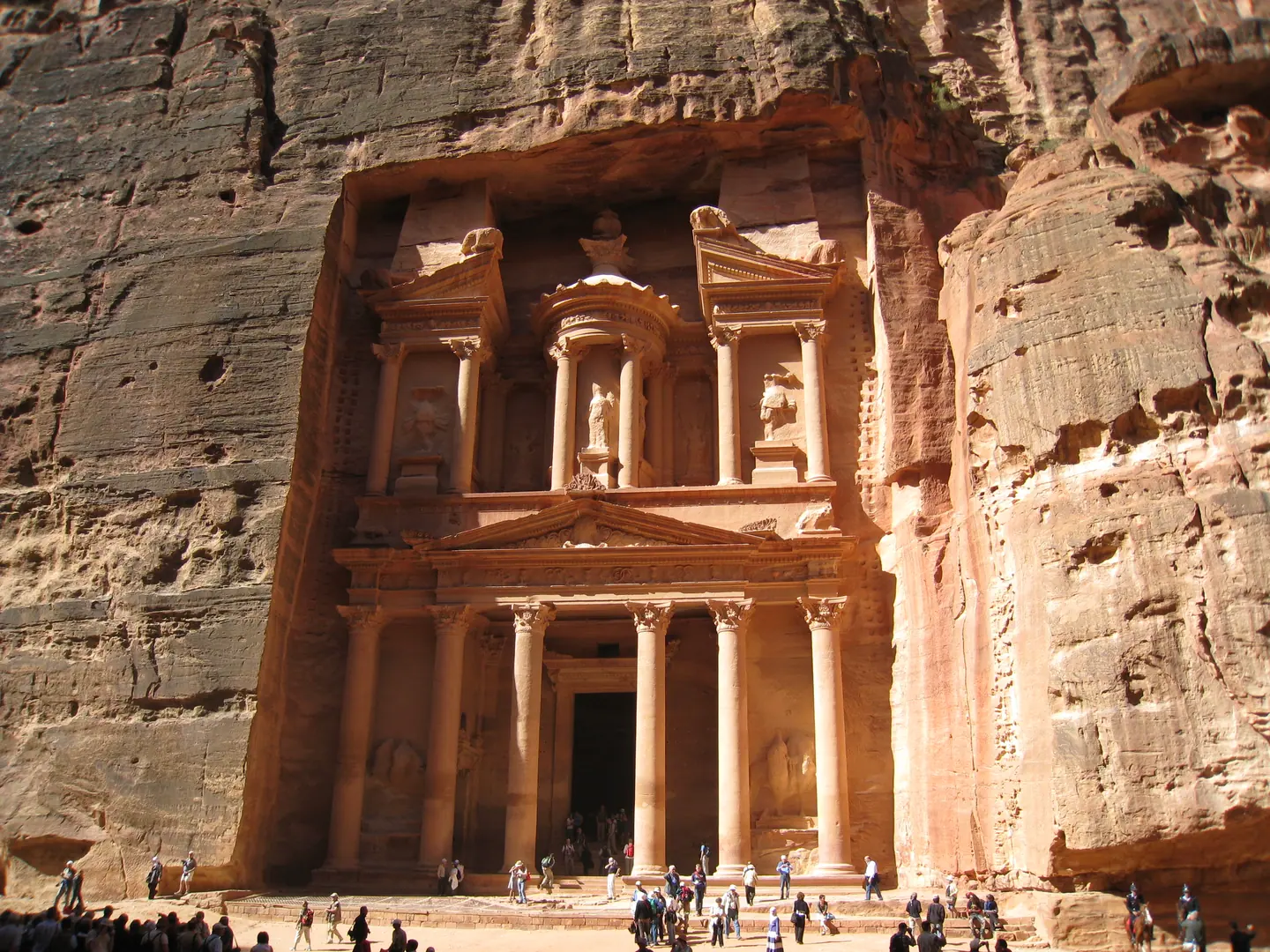
Bab as-Siq, Djinn Blocks, The Siq & Al-Khazneh Treasury
Petra Visitor Museum, Djinn Blocks, Obelisk Tomb and Bab as-Siq Triclinium, Nabataean Flood Dam, The Siq Canyon, Camel Caravan Relief, Betyl Niches, and Al-Khazneh The Treasury
Petra Museum
Situated adjacent to the visitor centre, this modern complex houses hundreds of artefacts excavated across the archaeological park. The galleries explain Nabataean engineering, trade networks, and funerary rituals through well-preserved stone carvings, pottery, and interactive displays. It provides vital historical context before visitors enter the ancient canyon.
Djinn Blocks
These three massive, monolithic stone cubes stand prominently along the gravel road of Bab as-Siq. Carved directly from the sandstone bedrock during the first century AD, they functioned as Nabataean funerary monuments or symbolic tomb towers. Their austere, undecorated facades contrast sharply with the elaborate classical colonnades found further into the city.
Obelisk Tomb
Carved into the sandstone cliffside, this prominent monument displays distinct Egyptian architectural influences alongside classical motifs. Four slender stone pyramids, known as nephesh, crown the upper facade to commemorate the five individuals buried within. Beneath them lies a recessed burial chamber framed by simple Nabataean pilasters and architraves.
Bab as-Siq Triclinium
Positioned directly beneath the Obelisk Tomb, this rock-cut chamber served as a ceremonial banqueting hall for funerary feasts. Its facade features classical pediments and doric pilasters carved into the rock face. Inside, stone benches flank three sides of the central room, where families gathered annually to honour deceased relatives.
Snake Monument
Located south of the main approach track, this weathered block of bedrock was carved into a coiled serpent resting atop a rectangular base. The sculpture likely held symbolic or protective religious significance for Nabataean travellers approaching the city. Heavy wind erosion has softened its contours, yet the undulating serpentine form remains clearly visible.
Nabataean Flood Dam
Constructed across the mouth of the Siq, this masonry barrage was designed by Nabataean engineers to protect the gorge from flash floods. It diverted seasonal floodwaters through an adjacent tunnel into Wadi al-Mudhlim. Modern restorations follow the original ancient footprint, demonstrating the sophisticated hydrological mastery of the Nabataeans.
Muthlim Tunnel
This eighty-metre conduit was carved entirely through solid sandstone in the first century BC. Built in conjunction with the adjacent dam, it channelled dangerous floodwaters away from the Siq into northern gullies. Travellers can examine the pick-axe marks on the vaulted ceiling and the paved floor that sustained intense hydraulic pressure.
The Siq Arch Springers
At the threshold of the Siq, visitors can spot the carved stone springers and masonry footings that once supported a massive ceremonial archway. Erected during the first century AD, the arch spanned the canyon chasm until an earthquake destroyed it in 1896. Detailed nineteenth-century lithographs by David Roberts confirm its grand original appearance.
The Siq
This twisting gorge stretches for over a kilometre between sheer sandstone walls rising up to ninety metres. Created by tectonic forces rather than mere water erosion, it served as the sacred ceremonial entry to the Nabataean capital. Its shaded path curves continuously, keeping sunlight low and building anticipation along the journey.
Nabataean Water Terracotta Channels
Hewn into both walls of the Siq, these parallel conduits brought freshwater from Ain Musa directly into the urban centre. The northern wall preserves an open channel carved into bedrock, while the southern wall features interlocking terracotta pipe sections set in waterproof lime mortar. Inspection niches enabled engineers to clear sediment blockages.
Camel Caravan Relief
Carved at eye level on the southern cliff face, this weathered sculpture depicts life-sized dromedaries led by a merchant figure. Although water and wind have worn away the upper bodies, the lower legs, feet, and guide lead remain recognisable. It represents the lucrative incense and spice trade that sustained the desert kingdom.
Votive Niches of the Siq
Scattered along the vertical cliffs of the gorge are dozens of recessed niches carved to house betyls, or sacred aniconic stones. These representations of gods, such as Dushara and al-Uzza, provided protection to merchant caravans entering the gorge. Some recesses retain pedimented frames influenced by Hellenistic temple designs.
Sabinos Betyl
One of the most notable shrines in the gorge features a detailed Greek inscription by a Roman officer named Sabinos. The text dedicates the carving to the supreme deity Dushara, represented here as an unhewn rectangular stone relief within a framed recess. It offers valuable evidence of religious continuity after Roman annexation.
Siq Roman Pavement
Excavations throughout the Siq have revealed long stretches of ancient paving stones dating from the first century AD. The limestone slabs were laid diagonally across the natural floor to withstand the rushing water of mountain torrents. Heavy carriage wheel ruts can still be seen grooved into several stone sections.
Al-Khazneh (The Treasury)
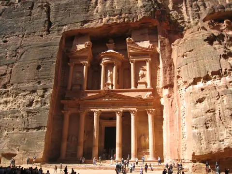
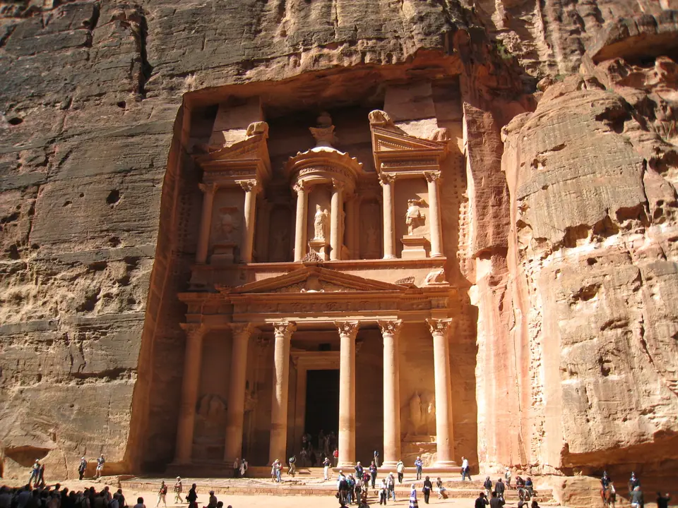
Carved directly into the sheer rose-red cliff, this forty-metre facade served as a royal mausoleum, likely for King Aretas IV. It displays Corinthian columns, floral acroteria, and a central circular tholos topped by a funerary urn. The interior comprises an austere square chamber flanked by three small secondary rooms.
Treasury Crypts
Excavated beneath the plaza fronting the Treasury, these deep chambers yielded ancient skeleton fragments, ceramics, and incense burners dating to the first century AD. Protected by iron grilles, the sunken crypts confirmed the monument was primarily an elite royal tomb rather than a functional bank or temple.
Outer Siq
Past the Treasury, the gorge widens dramatically into the Outer Siq, where the landscape opens toward the city centre. Dozens of weathered facades line the cliffs, featuring stepped crowstep patterns that reflect early Nabataean architecture. Merchants and pilgrims passed this funerary corridor when arriving from the desert.
Street of Facades
This sheer sandstone cliff contains more than forty tombs and domestic chambers arranged in tiers above the wadi bed. The monuments exhibit distinctive Assyrian crowstep crenellations above simplified doorways. Many interiors contain burial loculi cut into the walls, while flash flooding has eroded several lower levels.
Tomb 67
Situated on the southern flank of the Street of Facades, this tomb features a symmetrical pediment and an unusually well-preserved facade. Inside, multiple graves were carved into the sandstone floor, illustrating standard Nabataean burial customs. Its position just above the wadi floor demonstrates the dense spatial planning of the ancient city.
High Place of Sacrifice Trail Head
Marked by broad sandstone steps cut into the rock face, this path leads out of the Outer Siq up Jabal Madhbah. The Nabataeans engineered stone flights, retaining walls, and water gullies along the route to aid pilgrims climbing to the peak. It provides the initial access point toward the open-air summit altar.
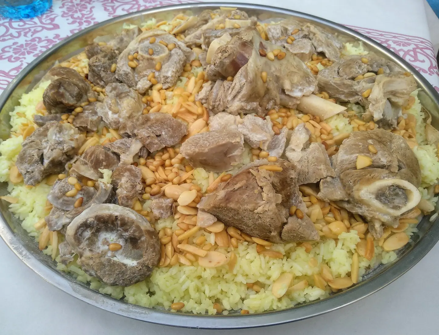
Outer Siq, Street of Facades, Theatre & High Place of Sacrifice
Street of Facades, Tomb of Unayshu, Nabataean Theatre, High Place of Sacrifice Trail, Twin Obelisks, Sacrificial Altar, Wadi Farasa Lion Fountain, Garden Temple, and Roman Soldier’s Tomb & Coloured Triclinium
Street of Facades
Carved into the towering sandstone cliffs beyond the Outer Siq, this row of tombs features rows of crowstepped pediments. We examine these multi-level burial chambers, which housed prominent Nabataean officials during the first century AD. Erosion has softened their geometric reliefs, revealing the vivid natural banding of the sandstone bedrock.
Tomb of Unayshu
Positioned high above the canyon floor on the eastern cliff face, this tomb features a wide courtyard, portico columns, and loculi burial niches. An excavated inscription links the structure to Unayshu, chief minister to Queen Shaqilath II during the first century AD. The elevation provides a clear perspective across the southern facade line.
Tomb 67
Standing along the Street of Facades, Tomb 67 demonstrates early Nabataean mortuary craftsmanship through its pilasters and double attic frieze. The lower chamber opens into rock-cut graves carved directly into the floor. Scholars observe here the gradual synthesis of indigenous desert architectural traditions with Hellenistic stylistic influences.
Tomb 70
This weathered tomb facade displays traditional Nabataean crowstep patterns along its upper cornice, flanked by half-columns carved in high relief. The interior space contains a spacious rectangular hall surrounded by recessed burial slots. Flash flood deposits historically gathered here, leaving visible silt marks across the rock walls.
Petra Roman Theatre
Hewn directly into the base of the en-Nejr mountain, this massive theatre was originally engineered by the Nabataeans before Roman renovations enlarged its capacity. The auditorium sliced through older street tombs, exposing ancient burial shafts behind the seating tiers. The orchestra pit and proscenium wall still reveal clear hydraulic drainage channels.
High Place of Sacrifice Trail
This historic processional route climbs the steep southern cliffs via flights of rock-cut steps. Built to accommodate sacred pilgrimages, the trail traverses exposed sandstone ledges that showcase hydraulic catchment channels along the stone walls. Hikers gain commanding vantage points over the central theatre and the Outer Siq.
Twin Obelisks of Petra
Standing over six metres high, these two free-standing obelisks were shaped by quarrying away the entire surrounding rock platform. Dedicated to the supreme Nabataean gods Dushara and al-Uzza, they marked the boundary of the holy summit. Their solitary profiles stand out starkly against the barren mountaintop terrain.
High Place of Sacrifice
Perched on the summit of Jabal al-Madhbah, this open-air sanctuary features a courtyard, libation basins, and a raised sacrificial platform. Priest attendants directed water and animal blood through incised rock channels toward ritual cisterns below. The panorama covers Mount Hor and the distant Aaron's Tomb across the rift valley.
Wadi Farasa Lion Fountain
Deep along the western descent from the High Place, this weathered lion relief originally poured fresh water into a stone basin. Fed by a terracotta aqueduct system running from mountain springs, it served parched travellers and livestock. Although heavily eroded, the lion's arched back and feline contours remain visible.
Garden Temple
This monument consists of two engaged columns supporting a pediment, set in front of a wide artificial terrace. Archaeological excavations identify the complex as a monumental water-storage depot rather than an exclusive place of worship. The neighbouring grove of mature wild pistachio trees preserves the memory of its garden setting.
Tomb of the Roman Soldier
Positioned at the floor of Wadi Farasa, this monument displays three stone niches containing military statues carved in high relief. The central figure wears a Roman cuirass and greaves, leading historians to date the construction to the late first or early second century. The entrance leads into an unadorned central funerary chamber.
Coloured Triclinium
Facing directly opposite the Tomb of the Roman Soldier across a paved courtyard, this is the only carved triclinium in Petra with fluted wall pilasters. The interior walls showcase swirling veins of yellow, purple, and red sandstone. Nabataean mourners gathered on the stone benches here to conduct memorial banquets for departed ancestors.
Renaissance Tomb
Named by early European explorers for its balanced proportions, this facade features an arched pediment resting on delicate pilasters. Three urn finials crown the upper roofline, exhibiting clean lines preserved from severe wind damage. Inside, the cavernous tomb chamber includes multiple graves cut into the sandstone floor.
Broken Pediment Tomb
Carved into the upper cliff of Wadi Farasa, this monument demonstrates the Nabataean mastery of classical Greek ornamentation through its broken triangular pediment. A centrally mounted urn stands within the roof breach, flanked by stylized acroteria. The interior contains deep grave troughs oriented toward the canyon approach.
Tomb of the 17 Graves
This rectangular rock-cut chamber contains seventeen distinct burial shafts carved in neat parallel alignments across its interior floor. Modest external carvings contrast sharply with the internal engineering, which maximized burial density for a single kin group. Traces of ancient plaster indicate the chamber was once painted.
Wadi Farasa Cistern
Engineered to capture flash floods from the southern ridges, this vast water tank demonstrates advanced Nabataean desert hydro-engineering. Massive stone arches supported stone slabs that formed an evaporation-resistant roof. Remnants of impermeable waterproof hydraulic plaster still line the lower floor and the surrounding stone intake conduits.
Jabal al-Madhbah Southern Fortress
Perched on the rugged southern spur of the sacrificial mountain, these drystone foundations incorporate both Nabataean stonework and later Crusader period mortar. The garrison maintained continuous line-of-sight communication with the fortress at al-Wu'ayra and controlled southern caravan approaches. The vantage looks straight into the deep fissures of Wadi Sabra.
Outer Siq Southern Caves
Before the gorge widens toward the Theatre, the western cliff face opens into interconnected artificial caverns. Originally excavated as modest burial chambers, many were converted into dwelling units and animal shelters by later Byzantine and Bedouin occupants. Soot deposits from historical hearths coat the carved sandstone ceilings.
Farasa Aqueduct and Rock Chutes
Carved continuously along the vertical cliff faces of the Farasa ravine, this sophisticated channel system diverted winter torrents away from footpaths and into storage tanks. Stone settling pools trapped heavy sediment before the water reached downstream cisterns. We observe chisel marks tracing the natural fall lines across the bedrock.
Al-Zantur Ridge
Rising above the path linking Wadi Farasa to the Colonnaded Street, this ridge contains extensive residential mansions from the late Nabataean and Roman periods. Swiss excavations uncovered multi-room private houses with internal courtyards, painted stucco walls, and private underfloor heating systems. The site provides views down onto the Theatre.
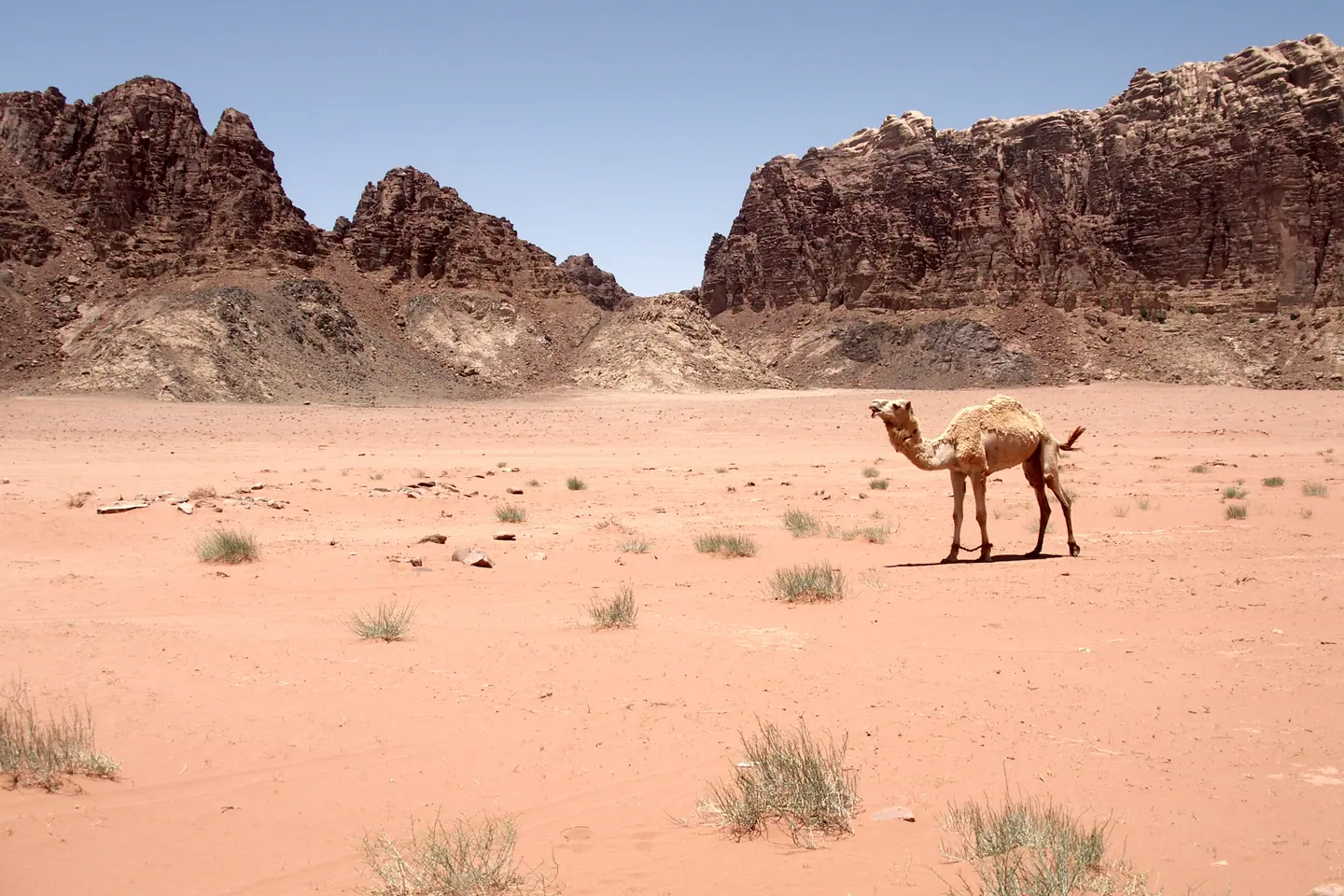
Royal Tombs of Jabal al-Khubtha & Al-Khubtha Treasury Viewpoint
Urn Tomb Byzantine Cathedral, Silk Tomb Swirled Sandstone, Corinthian Tomb, Palace Tomb Four-Storey Facade, Sextius Florentinus Tomb, and Al-Khubtha Cliff Trail Viewpoint over the Treasury
Urn Tomb
Perched high on the western face of Jabal al-Khubtha, the Urn Tomb features an expansive courtyard supported by vaulted stone substructures. Originally carved in the first century AD for a Nabataean king, it was consecrated as a Christian church in AD 446. Inside, visitors can observe Greek inscriptions recording the conversion alongside burial recesses cut into the rear rock walls.
Silk Tomb
Standing directly north of the Urn Tomb, this facade is famous for its swirl of red, yellow, and grey geological mineral strata. Natural weathering has stripped away the sharp exterior mouldings, accentuating the vivid rock veining across the classical pilasters. We recommend observing the facade in the morning light when the mineral bands appear most distinct.
Corinthian Tomb
Severely eroded by centuries of flash floods and wind, the Corinthian Tomb exhibits an architectural design clearly modelled on the Treasury. Floral capital carvings and classical pediments adorn the upper storey, while eight distinct burial chambers puncture the lower interior. Careful examination reveals structural similarities to the grandest royal facades of the ancient capital.
Palace Tomb
The Palace Tomb represents the broadest rock-cut facade in the Royal Tombs group, spanning over forty-nine metres across the cliff face. Due to the natural height limit of the sandstone ridge, builders erected dressed masonry blocks along the upper tier to complete the imperial elevation. Four separate doorways lead into plain funeral rooms, suggesting multiple collective elite interments.
Tomb of Sextius Florentinus
Positioned north of the central Royal Tombs ridge, this monument commemorates Sextius Florentinus, who governed the Roman province of Arabia during the reign of Hadrian. A weathered Latin inscription above the entrance details his military commands and political titles before his burial around AD 129. The facade incorporates classical pediments topped by a central Nabataean funerary urn.
Carmine Tomb
Situated just north of the Palace Tomb, this smaller classical monument takes its name from the deep red hues of its bedrock. The entrance doorway displays standard Nabataean cavetto mouldings crowned by a crowstep attic. Inside, rock-hewn shaft graves indicate that the chamber served as a family mausoleum during the late first century.
Al-Khubtha Cliff Trail
This arduous stone path climbs behind the Palace Tomb and winds along the eastern spine of Jabal al-Khubtha. The route follows ancient processional steps cut directly into the mountain bedrock, passing eroded cisterns and rock platforms. Hikers encounter dramatic vistas overlooking the City Centre before the trail turns towards the precipices above the Outer Siq.
Al-Khubtha Treasury Viewpoint
Located at the southern terminus of the Jabal al-Khubtha mountain path, this viewpoint looks directly down onto the pediments of Al-Khazneh. Visitors stand over one hundred metres above the canyon floor, looking down upon travellers emerging from the narrow Siq gorge. The ledge offers clear perspective on the Nabataean masonry work carved into the opposite cliff face.
Jabal al-Khubtha High Place
Carved into the exposed summit rock of Jabal al-Khubtha, this open-air sanctuary served Nabataean religious ceremonies dedicated to Dushara and Al-Uzza. A raised sacrificial platform, complete with drainage channels for libations, sits beside a large rock-cut water basin. The isolated location provided priest processions with panoramic views across the Petra valley and surrounding sandstone canyons.
Jabal al-Khubtha Water Cisterns
This complex series of covered subterranean reservoirs demonstrates Nabataean hydraulic engineering at high altitude. Channels cut into the plateau surface collected rain run-off and directed water into deep chambers lined with waterproof hydraulic mortar. The preserved system ensured a reliable water supply for mountain guards, stonemasons, and priests inhabiting the upper crags.
Amorces Tomb
Located in the northern sector of the Khubtha mountain base, this monument remains partially carved from the cliff. The unfinished status provides archaeologists with clear evidence of how Nabataean stonemasons worked downwards from the cliff top, chiselling classical capitals before carving the lower portals. Tool marks across the facade show the diagonal strokes of iron picks.
Tomb of the 17 Graves
Tucked near the Silk Tomb, this funerary monument features a simple facade framing an expansive burial hall. The floor of the interior chamber contains seventeen rock-cut loculi arranged in neat rows, each designed to receive multiple family burials. Ancient plaster fragments adhering to the inner walls suggest the interior was once painted in decorative geometric motifs.
Dorotheos House
Excavations along the Khubtha trail uncovered this sprawling domestic complex dating to the fifth and sixth centuries AD. Named from Greek inscriptions discovered on pottery sherds, the compound contains multiple paved rooms, storage bins, and private cisterns. The domestic architecture reveals how monastic or elite Byzantine citizens adapted earlier Nabataean summit installations.
North-East City Wall of Jabal al-Khubtha
Constructed from dressed sandstone blocks, this defensive wall joined natural cliff faces to protect the ancient city against incursions from the eastern desert. Built during the late Nabataean kingdom and reinforced under Roman administration, remnants of watchtower foundations remain visible along the line. The barrier controlled access along the narrow ravine paths entering Petra.
Wadi Mataha Aqueduct
This gravity-fed stone conduit transported potable water from the springs of Ain Musa around the flank of Jabal al-Khubtha into the urban centre. Visible along the cliff path, the channel retain stone covers designed to protect the water from evaporation and desert sand contamination. The gradient remains steady despite the uneven terrain of the ravine.
Al-Khubtha Eastern Ravine Sanctuary
Located along the eastern descent of the Khubtha mountain, this narrow sandstone gully contains multiple sacred niches cut into vertical rocks. Within the recesses, pilgrims carved non-figural baetyls representing Nabataean deities alongside ancient Dedanite and Nabataean graffiti. The shrine complex provided a ritual resting spot along ancient goat trails connecting Petra to the desert plateau.
Tomb with the Classical Pediment
Situated between the Palace Tomb and the northern quarries, this smaller facade displays a sharp triangular pediment supported by two engaged columns. Unlike its grander neighbours, the stonework has resisted severe weathering, leaving the dentils and architrave mouldings clearly discernible. The single doorway leads to an elevated arcosolium niche designed for a high-status burial.
Urn Tomb Vaulted Arcades
These substantial stone substructures extend the natural cliff terrace to create the monumental forecourt fronting the Urn Tomb. Built in two distinct tiers of semi-circular arches, the galleries served as substructures and cellars during both the Nabataean and Byzantine eras. Visitors can walk beneath the barrel vaults to inspect the precise ashlar masonry supporting the platform.
Jabal al-Khubtha Watchtower
Perched on a rocky promontory, this dry-stone defensive structure commanded visual control over the exit of the Siq and the theatre below. Nabataean guards used the station to signal the urban core regarding incoming trade caravans or potential military threats. Today, the rectangular stone footings provide a clear overview of ancient Petra's outer street layout.
Wadi al-Khubtha Dam
Constructed across the mouth of a side canyon below the Royal Tombs, this robust ashlar dam prevented winter torrents from flooding the lower city monuments. The hydraulic barrier diverted water into stone channels leading towards urban cisterns and irrigation terraces. The surviving lower masonry tiers demonstrate the vital importance of flood management in Petra's sandstone canyons.
Colonnaded Street, Great Temple, Qasr al-Bint & Byzantine Churches
Nymphaeum, Colonnaded Street, Great Temple Propylaeum & Theatrenon, Paradeisos Pool Complex, Temenos Gate, Qasr al-Bint Main Sanctuary, Winged Lions Temple, and Petra Church Mosaics & Ridge Church
Nymphaeum of Petra
Dedicated to water nymphs, this semi-circular public fountain once received fresh mountain water through ceramic pipes. An ancient wild pistachio tree still shades the stone basin near the junction of Wadi Musa and Wadi al-Mataha. Travellers can observe traces of sculpted niches that once displayed statues overlooking the public square.
Colonnaded Street
Refurbished following the Roman annexation in the second century, this monumental thoroughfare served as the primary commercial spine of the ancient city. Sandstone slabs still show grooves worn by ancient carriage wheels and pedestrian traffic. Flanked by porticoes, the avenue connected the eastern entrance with the sacred precinct to the west.
Great Temple Propylaeum
This grand entrance staircase rises directly from the Colonnaded Street to provide ceremonial access to the sacred upper terraces. Excavations revealed symmetrical flights of stone steps framed by limestone pedestals and drainage channels. We can view the lower landings where public crowds gathered before ascending towards the civic assembly rooms.
Lower Temenos of the Great Temple
Paved with hexagonal limestone flags, this broad courtyard formed an assembly ground bordered by triple colonnades on its east and west sides. Elaborate capitals carved with Asian elephant heads originally crowned the flanking pillars. Traces of monumental exedrae and subterranean canal systems demonstrate sophisticated civic water management beneath the plaza.
Upper Temenos of the Great Temple
The elevated platform hosts the main stone structure, surrounded by walkways paved in decorative stone tiles. Architectural fragments here display a blend of Nabataean masonry traditions and classical Roman decorative motifs. Visitors can trace wall foundations and surviving column bases that outlined this upper tier of religious administration.
Theatron of the Great Temple
Constructed inside the temple interior, this semi-circular auditorium seated around six hundred people on curved tiers of limestone benches. Archaeologists interpret the space as a civic council hall, or bouleuterion, rather than an exclusively sacred shrine. The remaining stone rows offer clear evidence of civic debate and civic governance in late antiquity.
Great Temple Garden-Pool Complex
Situated adjacent to the Great Temple, this engineered terrace featured a vast open-air pool complete with a central island pavilion. Fed by hillside aqueducts, the luxurious pleasure garden represented an ostentatious display of civic wealth in an arid landscape. Terraced soil beds once accommodated imported botanical specimens and decorative fruit trees.
Temenos Gate
Standing at the western terminus of the Colonnaded Street, this monumental triple gate controlled access to the precinct of Qasr al-Bint. The stone structure featured carved relief panels portraying Nabataean deities and Roman imperial motifs. Substantial door sockets and decorative pilasters remain visible, marking the formal boundary between secular and sacred grounds.
Qasr al-Bint
Rising twenty-three metres above the valley floor, this freestanding temple survived major regional earthquakes due to flexible wooden stringcourses embedded in its ashlar masonry. Dedicated to the chief deity Dushara, the building preserves an elevated interior adyton flanked by stairwells. Marble veneer fragments and stucco mouldings indicate its lavish original decoration.
Great Altar of Qasr al-Bint
Located directly facing the monumental flight of temple steps, this vast rectangular stone base supported open-air religious sacrifices. The platform was once revetted in fine marble slabs and accessible via dedicated ramps. Today, surviving stone footings reveal drainage channels designed to carry away fluids during ceremonial animal offerings.
Temple of the Winged Lions
Perched on the northern slope of the wadi, this sanctuary was dedicated to the supreme Nabataean goddess al-Uzza. The temple derived its modern name from twelve columns crowned with distinctive winged lion capitals, one of which is displayed in regional collections. Excavations revealed painters workshops, oil presses, and an elevated central altar platform.
Petra Church
Constructed in the fifth century over earlier Nabataean foundations, this three-aisled basilica served as the metropolitan cathedral of Palaestina Tertia. The northern and southern aisles retain exceptionally historic mosaic pavements displaying personifications of the seasons, animals, and mythological beasts. A modern protective canopy shields the delicate stone tesserae from weathering.
Baptistery of the Petra Church
Adjoining the western flank of the basilica, this circular baptistery houses a distinctive cruciform immersion font cut directly into stone. Four monolithic pillars supported a vaulted roof over the ceremonial chamber where converts received Christian baptism. Travellers can observe carved niches that once held sacred chrism oils and liturgical vessels.
Petra Church Scroll Archive Room
In 1993, archaeologists uncovered one hundred and fifty-two carbonised papyrus rolls within this northeastern storage chamber of the church complex. The documents detailed private family legal disputes, marriage contracts, and agricultural tax registries from sixth-century Petra. The surviving stone room illustrates how ecclesiastical buildings served as community administrative archives.
Ridge Church
Resting along the northern ridge above the civic valley, this two-aisled structure represents one of the earliest Christian church conversions in Petra. The builders incorporated ancient masonry blocks and subterranean cisterns directly into the modest sanctuary plan. The elevated location provides clear sightlines over the Colonnaded Street and the temples opposite.
Blue Chapel
Named after the re-erected blue sandstone and Egyptian granite columns framing its nave, this sixth-century chapel was integrated into an earlier residential quarter. Architectural elements include a two-tiered bishop seat and marble chancel screen fragments. Its compact design illustrates the private devotional spaces established by high-ranking ecclesiastical officials.
Upper Market
Perched on the rock slope southeast of the Colonnaded Street, this expansive open platform served as an elevated commercial terrace. Initial explorers identified the site as a market, though recent work suggests connections to palatial gardens. Surviving retaining walls demonstrate the ambitious terracing projects undertaken during the zenith of the Nabataean kingdom.
Middle Market
Positioned between the Colonnaded Street and the upper civic terraces, this paved intermediate terrace accommodated merchants, financial exchanges, and administrative offices. Excavations revealed extensive hydraulic conduits cut into the sandstone bedrock to drain runoff during seasonal flash floods. Surviving flagstones still delineate ancient public pedestrian walkways.
West Shops of the Colonnaded Street
A sequence of barrel-vaulted stone chambers lines the southern edge of the main street near the Temenos Gate. These retail booths served caravan traders selling frankincense, myrrh, textiles, and spices arriving from southern Arabia. Travellers can examine preserved threshold stones featuring iron door mountings and drainage gullies.
Monumental Basin of Wadi Musa
Engineered by Nabataean hydraulic specialists, this revetted stone channel directed the perennial waters of Wadi Musa parallel to the Colonnaded Street. Massive ashlar retaining walls prevented torrential flash floods from washing away municipal markets and temples. Stone bridges once spanned the masonry channel, linking the civic street with the residential slopes to the north.
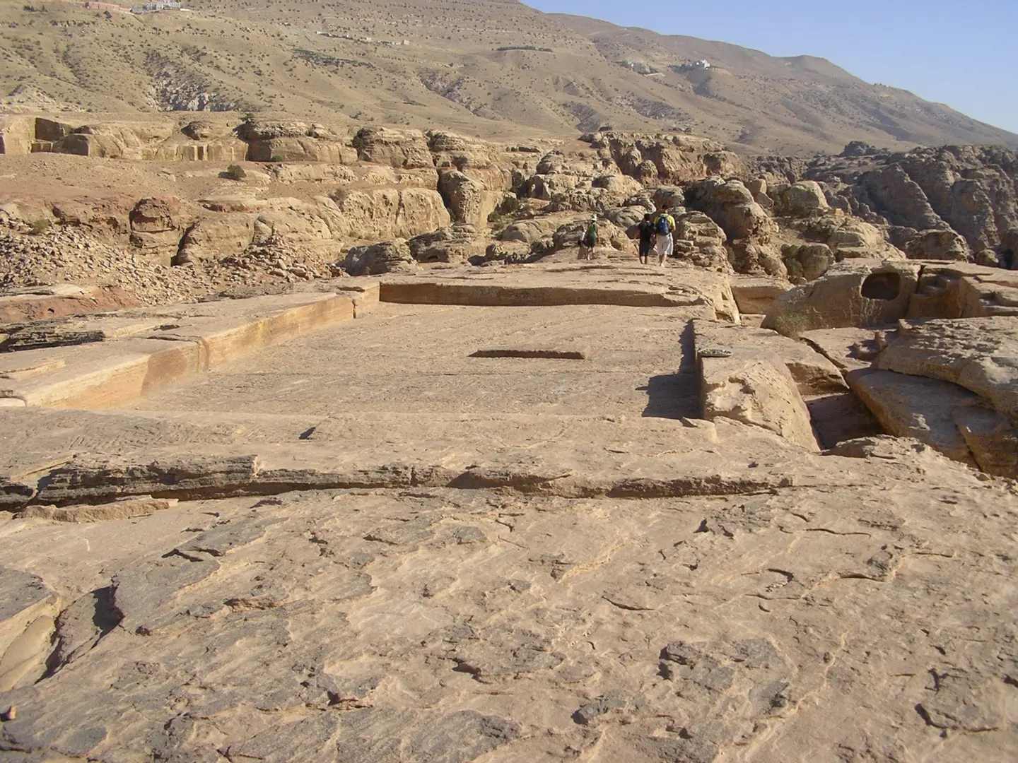
Ad-Deir Monastery Trail, Umm al-Biyara & Little Petra Siq al-Barid
Lion Triclinium, 850 Rock-Cut Steps, Ad-Deir The Monastery, End of the World Viewpoint Wadi Araba, Umm al-Biyara Summit, Snake Monument, and Little Petra Siq al-Barid Painted Biclinium
Lion Triclinium
Tucked inside a side ravine along the ascent toward the Monastery, this ancient banquet chamber features relief sculptures of confronting lions flanking its doorway. Nabataean mourners gathered here for commemorative funerary meals. Notice the classical pediment above the entrance and the Medusa medallion set into the frieze.
Ad-Deir Processional Stairway
This rugged rock-cut staircase ascends over two hundred vertical metres through sandstone ravines to link the city basin with the high plateau. Built by Nabataean masons, the trail incorporates retaining walls, drainage channels, and votive niches carved directly into the bedrock. Travellers pass ancient cisterns and sheer cliff overlooks during the climb.
Qattar ad-Deir Spring
Located near the upper reaches of the Monastery path, this dripping seep provided vital freshwater to pilgrims climbing to the mountain sanctuary. Nabataean stonecutters carved small niches and religious inscriptions into the damp rock face to honour the water deity. The small grotto offers cool shade beneath weeping sandstone overhangs.
Hermitage of Ad-Deir
These rock-cut chambers served as ascetic retreats for Christian monks during the fifth and sixth centuries. Located opposite the main facade, the simple caves contain incised crosses, plaster fragments, and carved stone benches. The presence of these hermitages explains why early Arab travellers later named the entire plateau Ad-Deir, meaning the Monastery.
Ad-Deir (The Monastery)
Carved during the reign of King Rabel II, this colossal sandstone facade spans nearly fifty metres in width and forty-five metres in height. Originally consecrated to the deified king Obodas I, the complex features massive semi-engaged columns, broken pediments, and a crowning stone urn. Byzantine crosses incised inside the single cavernous interior indicate its later Christian use.
Courtyard of Ad-Deir
This expansive level terrace was carved out of solid mountain bedrock to accommodate thousands of religious worshippers during major Nabataean festivals. Surrounding rock platforms supported colonnades, banqueting tents, and ceremonial seating. The open space provides the clearest vantage point to examine the intricate classical proportions and colossal capital details of the facade.
Ad-Deir Summit Viewpoint
A steep stone trail climbs above the Monastery plaza to reach this dizzying ridge line. Bedouin markers and flagpoles guide travellers past weathered sandstone formations shaped by centuries of desert winds. From the summit, visitors look directly across at the monumental stone urn atop the pediment and down into the surrounding canyons.
End of the World Viewpoint
Perched on the extreme western rim of the Petra massif, this cliff-edge lookout plummets hundreds of metres down to the Jordan Rift Valley. The panorama extends across the expanse of Wadi Araba towards the Negev desert hills. Weathered sedimentary strata display historic ribbons of yellow, pink, and grey stone across the cliff drop.
Mount Hor Viewpoint from Ad-Deir
This south-facing promontory on the Ad-Deir plateau offers unobstructed lines of sight across the southern canyons toward Jabal Haroun. The gleaming white dome of Aaron's tomb is visible on the far mountain summit, marking a holy destination for regional pilgrims. The route here passes several Nabataean rainwater cisterns hollowed into the rock.
Umm al-Biyara Trail
This demanding route ascends the sheer eastern cliff of Petra's most prominent plateau via rock-cut steps and narrow ledges. Nabataeans fortified the trail with stone parapets to transform the towering mountain into an impregnable citadel during wartime. Climbing the path reveals defensive wall segments, rock inscriptions, and sweeping vistas across the city centre.
Umm al-Biyara Summit
Rising three hundred metres above the ancient city, this mountain tableland served as the primary Edomite stronghold between the eighth and sixth centuries BC. British excavations uncovered modest stone houses, domestic seals, and iron tools across the summit. The high elevation provides complete oversight of the ancient caravan routes converging below.
Edomite Cisterns of Umm al-Biyara
The Arabic name Umm al-Biyara translates as Mother of Cisterns, named after the numerous subterranean reservoirs dotting the mountain top. Edomite builders hollowed out these bottle-shaped chambers to collect seasonal rainfall, ensuring that defenders could endure prolonged desert sieges. Several plaster-lined tanks remain preserved beneath stone caps and access shafts.
Snake Monument
Standing along the ancient caravan trail heading south toward Sabra, this unusual megalithic sculpture depicts a coiled serpent resting atop a rocky plinth. The serpent's head, though eroded, once guarded nearby shaft tombs and water collection systems. Scholars believe the monument possessed protective apotropaic significance for travelers entering the sacred city precinct.
Thughra Necropolis
Positioned south of Umm al-Biyara, this valley basin contains a dense collection of early Nabataean tombs cut into low sandstone outcrops. The facades display simple crowstep and horn decorations characteristic of archaic Nabataean design before heavy Hellenistic influence took hold. Ancient caravan routes linked this burial ground directly to water storage dams.
Wadi Siyyagh
This dramatic canyon serves as the sole western exit for waters draining out of the central Petra basin. The wadi bed drops precipitously through towering walls of multi-coloured sandstone into crystalline granite bedrocks. Remnants of rock-cut aqueducts, ancient check-dams, and Nabataean water-collecting channels trace the steep cliff contours.
Siq al-Barid Entrance
Serving as the northern commercial outpost of Petra, this canyon corridor measures only a few metres wide, shielding the interior from harsh desert winds. The entrance displays rock-cut niches, stone steps, and decorative carvings where caravan guards monitored trade goods. Camels and traders rested here before completing the final leg into the main city.
Little Petra Painted Biclinium
Carved deep into the northern cliff of Siq al-Barid, this rock-cut dining chamber contains rare surviving Nabataean figurative wall paintings. Restored frescoes on the vaulted ceiling depict intricate grapevines, flowers, fluting putti, and birds associated with the cult of Dionysus. The delicate Hellenistic details highlight the cultural sophistication of wealthy Nabataean merchants.
Little Petra Triclinia
A sequence of monumental rock chambers along the main gorge provided luxurious communal dining and resting quarters for visiting trade caravans. Broad doorways and classical porticos allowed air to circulate into the cool stone interiors, which feature carved perimeter benches. Masons smoothed the interior walls to support fine lime plaster and painted decorative murals.
Little Petra Water Cisterns
At the western terminus of the gorge, a steep flight of steps leads to high mountain gullies engineered with sophisticated water harvesting systems. Channels carved along cliff edges directed winter torrents into large covered subterranean chambers hollowed out of the sandstone. This infrastructure sustained large camel caravans and residents through dry desert summers.
Beidha Neolithic Village
Situated just north of Little Petra, this open-air archaeological site preserves one of humanity's earliest transitions from hunting to sedentary farming. Excavated structures illustrate the evolution from circular semi-subterranean pit dwellings to sophisticated rectangular stone houses with timber roofs. Visitors can examine grinding stones, animal bone deposits, and reconstructed Neolithic homes.
High-Place Clifftop Routes and Wadi Musa Notes
You can combine these stops with the district-by-district where-to-stay notes and seasonal planning tables on our Petra destination page, or explore further regional and neighbourhood guides.