


























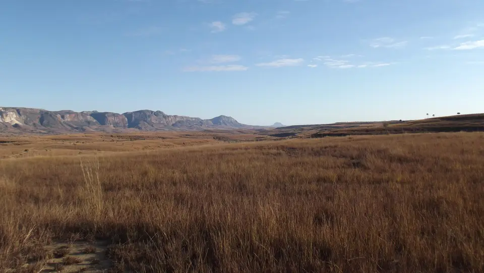
Quick Field Data
- UNESCO Inscription: 1990
- Scale & Footprint: Six protected component areas spanning western Madagascar from northern karst reserves to southwestern arid spiny thickets
- Access & Ticketing: Administered as four national parks and two special reserves with mandatory park permits, accredited local guides, and seasonal dry-weather opening windows; check the official site
- Arrival Logistics: Reached via domestic flights and overland four-wheel-drive routes radiating west and north from the national capital of Antananarivo
Six Isolated Refuges Across Madagascar's Western Biogeographic Corridor
Stretching along the western flank of Madagascar from the northern limestone massifs to the arid southwestern coast, the Andrefana Dry Forests serial designation unites six distinct conservation units into a single north-to-south ecological continuum. Madagascar ratified the 1972 UNESCO World Heritage Convention on 19 July 1983 and held a seat on the World Heritage Committee between 2005 and 2009. Its first natural World Heritage Site, the Tsingy of Bemaraha Strict Nature Reserve, entered the list in 1990 during the 14th Committee Session in Banff, Canada. That initial inscription was later joined by the cultural Royal Hill of Ambohimanga in 2001 (after the 19th-century Merina royal compound at the Rova of Antananarivo burned in 1995 shortly before planned inscription) and the 13-site Rainforests of the Atsinanana in 2007, making three inscribed World Heritage Sites in Madagascar as of 2025 alongside seven properties on the national tentative list as of 2024. Expanded into the six-component Andrefana Dry Forests serial site, the protected network now encompasses four national parks (Tsingy de Bemaraha, Ankarafantsika, Mikea, and Tsimanampesotse) together with two special reserves in the far north (Analamerana and Ankarana).
Separated from all other continental landmasses for tens of millions of years, Madagascar evolved as an isolated island laboratory where ancient floral and faunal lineages survived long after disappearing elsewhere in the world. Within the western half of the island, major west-flowing river systems such as the Manambolo River and dramatic paleoclimatic oscillations over millions of years repeatedly expanded and contracted the forest canopy, dividing the western lowlands and plateaus into discrete regional centres of endemism. By linking the northern sub-humid dry forests of Analamerana and Ankarana with the central deciduous woodlands of Ankarafantsika, the karstic labyrinth of Tsingy de Bemaraha, and the southwestern dry thorny forests and thickets of Mikea and Tsimanampesotse, the six parks and reserves safeguard the full evolutionary gradient from dry tropical forest to arid spiny scrub.
Across these six protected areas, the terrain shifts from rolling hills, undisturbed lakes, and coastal mangrove swamps to deep river canyons and towering limestone uplands. Together they shelter an extraordinary concentration of threatened and locally endemic flora and fauna that stand in sharp ecological contrast to the humid eastern Rainforests of the Atsinanana, which UNESCO placed on the World Heritage in Danger list on 30 July 2010 following illegal logging inside the parks after the 2009 to 2013 political crisis in Madagascar. Every reserve protects irreplaceable island habitats.
Karst Limestone Needles, Flame Trees, and Ancient Endemic Lineages
The geological centrepiece of the six-part reserve network is the Tsingy de Bemaraha limestone plateau, complemented by the northern karst massifs of Ankarana and Analamerana, where millennia of tropical rainfall and groundwater dissolution have carved limestone uplands into a dense forest of razor-sharp stone peaks and needles known in Malagasy as tsingy. Viewed from canyon lookouts or along suspended walkways, the metallic reflections of the grey karst bristles contrast vividly with the shades of forest green rising from deep shaded fissures below, while the dramatic canyon of the Manambolo River cuts through the southern margin of the Bemaraha plateau. In the far southwest, Tsimanampesotse National Park protects a shallow mineralized lake, coastal dunes, and limestone caves, whereas Ankarafantsika and Mikea preserve rolling sandy hills, dry forest canopies, and undisturbed lakes.
Botanically, the six component reserves trace a complete north-to-south transition in drought adaptation across western Madagascar. The northern and central reserves support western dry deciduous forests dominated by towering baobabs and vivid flame trees of the genus Delonix, whose canopies shed their foliage during the long dry season to conserve moisture. Moving south into Mikea and Tsimanampesotse, annual rainfall drops sharply and the woodland gives way to southwestern spiny forest-thicket, an arid biome of water-storing succulents and thorny thickets adapted to intense solar radiation and porous limestone soils.
This mosaic of karst canyons, undisturbed dry forests, lakes, and coastal mangrove swamps shelters endangered lemurs and rare bird species restricted to single inter-river centres of endemism. Most notable among the ancient avian lineages preserved within the Andrefana Dry Forests is the endemic order Mesitornithiformes, the ground-dwelling mesites, an evolutionary lineage approximately 54 million years old that has disappeared everywhere else on the planet. While Tsingy de Bemaraha displays the famous grey limestone needles, the other five component parks and reserves contribute equally to the natural beauty and evolutionary completeness of the western Madagascar corridor.
Each of the six component areas illustrates how geographic isolation between major western river valleys and long-term shifts in rainfall drove speciation across western Madagascar. In the northern special reserves of Ankarana and Analamerana, dry deciduous forests grow atop karstic plateaus riddled with sunken forest canyons and subterranean waterways. Further south, Ankarafantsika National Park protects dense deciduous woodland, sandy plateaus, and permanent lakes that sustain waterbirds and forest lemurs. Along the central western edge, Tsingy de Bemaraha combines towering limestone needles with the deep gorge of the Manambolo River and undisturbed mangrove swamps. Finally, in the arid southwest, Mikea National Park and Tsimanampesotse National Park conserve the southwestern spiny forest-thicket biome, where baobabs, flame trees (Delonix), and drought-adapted shrubs shelter ancient bird orders such as the 54-million-year-old Mesitornithiformes and localised reptile and lemur populations.
Navigating Seasonal Roads and Karst Trails Across the Six Reserves
Planning an expedition through the Andrefana Dry Forests with the UNESCO World Heritage Atlas requires choosing specific component parks rather than attempting to link all six sites in a single overland trip, as they are distributed from the northern tip of the island to the southwestern coast. Most international travellers begin in the highland capital of Antananarivo, which acts as the primary aviation and overland gateway for reaching the western reserves. Ankarafantsika National Park is the most accessible component by paved highway northwest of the capital, while the northern special reserves of Ankarana and Analamerana are reached via regional flights and road transfers, and Mikea and Tsimanampesotse lie along the arid southwestern coastal route.
Reaching Tsingy de Bemaraha National Park involves a multi-stage overland journey combining river ferry crossings and unpaved four-wheel-drive tracks, or a multi-day canoe descent along the Manambolo River gorge. Because heavy summer rains flood the western river systems and turn unpaved clay tracks into mud, Tsingy de Bemaraha and several seasonal trails open only during the dry months. Inside the karst reserves, hikers wear climbing harnesses clipped to fixed steel cables while crossing suspension bridges and narrow limestone ledges among the razor-sharp tsingy peaks, always accompanied by an accredited local park guide. Guided walks protect both visitors and fragile habitats. Across all six component reserves (spanning the northern karst canyons of Ankarana and Analamerana, the lake woodlands of Ankarafantsika, the limestone needles of Tsingy de Bemaraha, and the southwestern thorny thickets of Mikea and Tsimanampesotse), visitors witness how long-term continental isolation, river barriers, and paleoclimatic shifts created one of the highest concentrations of endemic dry-forest flora and fauna on the globe, where baobabs, Delonix flame trees, lemurs, and 54-million-year-old Mesitornithiformes birds survive in undisturbed island refuges. By uniting the four national parks of Tsingy de Bemaraha, Ankarafantsika, Mikea, and Tsimanampesotse with the two northern special reserves of Analamerana and Ankarana, the Andrefana Dry Forests protect the full north-to-south ecological gradient of western Madagascar for future generations.
- Dry-season travel window: Schedule visits to Tsingy de Bemaraha and the western dirt tracks during the dry season when river ferries operate and seasonal roads are passable for four-wheel-drive vehicles.
- Footwear and karst safety: Wear rigid-soled hiking boots, long trousers, and protective gloves when traversing the limestone tsingy needles, as the eroded karst edges are extremely sharp.
- Selecting complementary reserves: Pair a karst park such as Tsingy de Bemaraha or Ankarana with either the deciduous lakes of Ankarafantsika or the southwestern spiny thickets of Mikea and Tsimanampesotse to experience both geological and botanical extremes.
