


























Quick Field Data
- UNESCO Inscription: 1979 · Criteria (viii), (ix), (x)
- Scale & Footprint: 1,508,976 acres (6,106.6 km2) across Miami-Dade alongside Monroe and Collier counties, with 86% designated within the Marjory Stoneman Douglas Wilderness
- Access & Ticketing: Entry passes are required at the main road gates near Homestead or Miami as well as Everglades City, while backcountry camping along the Wilderness Waterway requires separate permits
- Arrival Logistics: Reached via State Road 9336 from Homestead and Florida City in the east, U.S. Route 41 (Tamiami Trail) west of Miami in the north, or State Road 29 at Everglades City in the northwest
Limestone Geology and Sheet Flow Hydraulics Across Nine Ecosystems
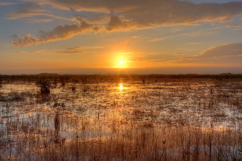
At the southern extremity of the Atlantic coastal plain, Everglades National Park encompasses 1,508,976 acres (6,106.6 km2) where temperate North America meets the subtropics of the Caribbean. Unlike mountain reserves established for vertical relief, this park was dedicated in 1947 specifically to safeguard a horizontal biological and hydrological system. Water defines every horizon here. Elevation across Dade and Monroe together with Collier counties rarely exceeds 8 feet (2.4 m) above the ocean surface, while a Calusa shell mound on the Gulf Coast rises to 20 feet (6.1 m). Beneath this flat horizon lies a porous marine limestone bed formed after the Florida peninsula separated from Gondwana and accumulated calcium carbonate from sand and shells alongside bryozoans compressed into permeable ooids. Following the Wisconsin ice age, rising ocean levels pushed the water table near the surface around 5,000 years ago, while seasonal overflow from Lake Okeechobee created a slow-moving sheet of water 64 to 113 km (40 to 70 miles) wide creeping southward at roughly 100 feet (30 m) per day.
Water residence time across this gently tilted limestone shelf dictates soil chemistry and divides the landscape into two primary substrates: dark organic peat where water stands for more than nine months each year, alongside calcitic grey marl formed by dried periphyton where flooding lasts six months or less. Slight dissolution depressions and small limestone pinnacles etched by acidic marsh water create micro-elevations measured in inches, yet those few inches separate nine interdependent ecosystems. Two vast freshwater drainage channels, Shark River Slough in the centre-west and Taylor Slough in the southeast, carry surface water toward the estuaries while building parallel peat ridges and dense sawgrass prairies where blades rise 6 feet (1.8 m) above the water.
Scattered across the open sloughs are thousands of teardrop-shaped tropical hardwood hammocks sculpted by the slow current around them. Because these tree islands sit slightly above the surrounding water, they support southern live oaks and gumbo-limbo alongside wild tamarind and strangler figs rising up to 50 feet (15 m) above an understorey of wild coffee and saw palmetto with poisonwood. Slightly higher limestone ridges near Long Pine Key support 20,000 acres (80.9 km2) of South Florida slash pine rocklands rooted directly in solution holes. These pines depend on prescribed fire cycles every three to seven years to clear competing hardwoods and open heat-activated cones, triggering wildflower blooms roughly 16 weeks after a burn.
Where freshwater meets the tide along the Gulf of Mexico and Florida Bay, bald cypress domes give way to coastal wet prairies of saltwort and glasswort alongside the largest contiguous mangrove system in the Western Hemisphere. Red and black together with white mangroves line the tidal channels, stabilising coastal mud against hurricane surges and sheltering nurseries for 220 fish species alongside crustaceans and molluscs. Beyond the southern shoreline, Florida Bay covers over 800 square miles (or 2,100 km2) across shallow marine basins and seagrass meadows with sandbanks extending toward the Florida Keys, recharging the Biscayne Aquifer while sustaining roseate spoonbills and great white herons as well as American crocodiles and West Indian manatees alongside 350 bird species.
Indigenous Shellworks and Canal Engineering to Hydrological Restoration
Human adaptation to this amphibious terrain began 10,000 to 20,000 years ago when early nomadic hunters settled the southern peninsula, eventually giving rise to the Tequesta along the Miami River and the Calusa along the southwestern coast. Lacking hard quarry stone, the Calusa engineered cutting tools from shark teeth and bone together with shells while digging canoe canals and piling vast shell middens across the Ten Thousand Islands and Chokoloskee Island to raise dry living platforms above tidal surges. By the time Spanish expeditions arrived in the late 16th century, an estimated 20,000 indigenous inhabitants lived in and around the wetlands before European diseases and 18th-century raids shattered both nations. During the 19th-century Seminole Wars that ended in 1842, Seminole and Miccosukee hunters retreated deep into Big Cypress and the sawgrass interior to live on tree islands and trade along the coast while pioneer outposts took root at Flamingo on Cape Sable and at Everglades City in the 1890s.
Systematic drainage transformed South Florida after 1882 and accelerated between 1905 and 1910 under Governor Napoleon Bonaparte Broward, who promoted land reclamation for sugarcane fields and new towns. After the 1926 Miami Hurricane and the 1928 Okeechobee Hurricane breached early levees and killed 2,500 people, the U.S. Army Corps of Engineers encircled Lake Okeechobee with the Herbert Hoover Dike and completed the Tamiami Trail across the northern marshes in 1928. Following severe storms in 1947, federal legislation authorised the Central and Southern Florida project for flood control, which dug 1,400 miles (about 2,300 km) of drainage canals and earth levees alongside 150 spillways and 16 pumping stations. While 350,000 hectares north of the park were placed into three state Water Conservation Areas, the canal network diverted vital freshwater into the Atlantic Ocean and robbed Shark River Slough and Taylor Slough of their natural sheet flow.
Conservation resistance coalesced around landscape architect Ernest F. Coe, who led the Tropical Everglades National Park Commission in 1928 with backing from Senator Spessard Holland and editor John Pennekamp as well as writer Marjory Stoneman Douglas, whose 1947 book reframed the wetlands as a living river of grass rather than a swamp. Authorized by Congress in 1934 and dedicated by President Harry Truman in December 1947 around the core of the 1916 Royal Palm State Park, the reserve gained UNESCO Biosphere status in 1976 alongside federal wilderness protection across 1,296,500 acres (5,246.7 km2) in 1978 before World Heritage listing in 1979. In 1968, Douglas founded Friends of the Everglades to halt a proposed Big Cypress jetport, while in 1989 the federal Protection and Expansion Act for Everglades National Park added 109,506 acres (443.2 km2) to the eastern boundary and banned commercial airboats inside the park.
Despite legal boundaries, upstream water diversion and agricultural nutrient runoff together with mercury contamination and invasive species such as the melaleuca tree or Brazilian pepper alongside Australian pine and Burmese python severely strained native food webs. Wading bird populations dropped 90 percent between the 1940s and 2000s, while hurricane damage and eutrophication in Florida Bay placed the site on the UNESCO Danger List from 1993 to 2007 and again from 2010 onward. To reverse saltwater intrusion and restore sheet flow, Congress approved the Comprehensive Everglades Restoration Plan in 2000, a 30-year programme combining 50 engineering projects to remove 240 miles (390 km) of canals and build 35,600 acres (144.1 km2) of treatment wetlands while capturing 1.7 billion US gallons (equal to 6,400,000 m3) of fresh water daily.
Navigating the Park Districts and Wilderness Waterways
Visiting on the ground requires understanding that the park has no single road connecting all its sectors. Instead, five visitor centres anchor three separate terrestrial and marine gateways around the perimeter, while 86% of the interior remains roadless wilderness accessible only by foot or bicycle as well as canoe or low-powered boat. The dry winter months from December to March bring lower humidity and minimal mosquito activity alongside receding water levels that concentrate alligators and snail kites together with wood storks and wading birds around freshwater sloughs and alligator holes.
- Main Park Road from Homestead to Flamingo: Enter via State Road 9336 west of Homestead and stop first at the Ernest F. Coe Visitor Center before turning onto the Royal Palm road to walk the half-mile Anhinga Trail boardwalk over Taylor Slough and the half-mile Gumbo Limbo Trail through a shaded hardwood hammock. Continue along the 38-mile (61 km) road past the 28 miles (45 km) of pine rockland cycling tracks at Long Pine Key, stopping at the two-storey Pa-Hay-O-Kee overlook and the Mahogany Hammock boardwalk before reaching the Guy Bradley Visitor Center and marina alongside coastal trails such as Snake Bight and Rowdy Bend at Flamingo on Florida Bay.
- Shark Valley loop and Gulf Coast paddling routes: Approach the northern sector along U.S. Route 41 (Tamiami Trail) west of Miami to reach the Shark Valley Visitor Center, where a 15-mile (24 km) paved loop leads by bicycle or tram as well as foot into Shark River Slough to a two-storey concrete observation tower overlooking alligator holes and sawgrass ridges. On the northwestern coast along State Road 29 at Everglades City, the Marjory Stoneman Douglas Visitor Center acts as the northern launch point for boat tours into the Ten Thousand Islands and for the 99-mile (160 km) Wilderness Waterway canoe route down to Flamingo, where elevated wood chickees and coastal beaches require advance backcountry permits.
- Seasonal pacing and regional connections: Plan boardwalk walks and cycling loops for early morning during the December to March dry season while carrying sun protection and insect repellent if hiking coastal trails near Flamingo or paddling mangrove creeks. After dark, Flamingo and the Ten Thousand Islands offer some of the clearest night skies in South Florida, looking south across Florida Bay with minimal light pollution. Pair your field route with our UNESCO World Heritage Atlas and our Miami city guide northeast of the park gates.
