


























Quick Field Data
- UNESCO Inscription: 1987 · Criteria (vii), (x).
- Scale & Footprint: 528,148 ha (5,280 to 5,281 square kilometres, or 2,040 square miles) in Quintana Roo, Mexico, including over 400,000 ha of land and 120,000 ha of marine waters.
- Access & Ticketing: Administered by Mexico's National Commission of Natural Protected Areas; check the official site for biosphere entry permits and boat regulations.
- Arrival Logistics: Stretches across 120 kilometres of Caribbean coastline in Tulum Municipality and eastern Felipe Carrillo Puerto in the state of Quintana Roo.
Limestone Hydrology and the Mesoamerican Barrier Reef
Within Mexico, the UNESCO World Heritage Atlas in 1987 under Criteria (vii) and (x) during the eleventh session, Sian Ka'a Biosphere Reserve protects 528,148 hectares (roughly 5,280 to 5,281 square kilometres, or 2,040 square miles) of linked marine alongside coastal and terrestrial ecosystems along the eastern shoreline of the Yucatán Peninsula in the Mexican state of Quintana Roo. Water links every habitat here. Established in 1986, administered by the National Commission of Natural Protected Areas, and designated a Ramsar wetland (Site 1329) on 27 November 2003, the reserve takes its name from the Yucatec Mayan language of the peoples who once inhabited the region, where the phrase translates as "Origin of the Sky," "gate of heaven," or "where heaven begins."
Situated across Tulum Municipality and the eastern sector of Felipe Carrillo Puerto (which contains the bulk of the biosphere reserve), the protected area stretches along roughly 120 kilometres of Caribbean Sea coastline. Its terrestrial portion covers more than 400,000 hectares of low-lying limestone terrain ranging from sea level to an altitude of only 10 metres above sea level. Because the porous limestone shelf of the eastern Yucatán relies on a complex hydrological system of subterranean channels alongside freshwater marshes and brackish estuaries, this flat coastal plain supports diverse medium and low tropical forests, flooded palm savannah, pristine wetlands, inland lagoons, and extensive mangrove stands alongside sandy beaches and coastal dunes.
Offshore, the 120,000-hectare marine section intersects the Caribbean Sea to protect a vital segment of the Mesoamerican Barrier Reef alongside shallow bays carpeted with seagrass beds. Where the lush green of the tropical forests and mangrove fringes meets the varied blue shades of the coastal lagoons and Caribbean waters beneath a wide sky, the barrier reef together with seagrass meadows and coastal marshes functions as a single biological system that nurtures marine life and shields the low-lying Yucatán coast.
Because elevations across the 400,000-hectare terrestrial sector never exceed 10 metres above sea level, seasonal rains do not form fast surface rivers; instead, water sheets slowly across the palm savannahs alongside peat marshes and mangrove swamps before filtering through the coastal lagoons into the bays behind the coral reef. This slow, clear freshwater flow prevents heavy sediment from smothering the offshore corals of the Mesoamerican Barrier Reef while creating a mosaic of fresh alongside brackish and marine water habitats along the entire 120-kilometre shoreline.
Yucatán Forest Mammals and Over 300 Bird Species
The convergence of tropical forests alongside palm savannahs, mangrove marshes, and coral reefs provides a habitat for a rich flora and fauna comprising over 300 resident and migratory bird species alongside numerous terrestrial vertebrates characteristic of the Yucatán region. Within the tropical forests roam five species of wild cats alongside large forest mammals: the jaguar (Panthera onca), the puma (Puma concolor), the ocelot (Leopardus pardalis), the margay (Leopardus wiedii), the jaguarundi (Puma yagouaroundi), and the endangered Baird's or Central American tapir (Tapirus bairdii). High in the forest canopy live Yucatán black howler monkeys (Alouatta pigra) together with Geoffroy's spider monkeys (Ateles geoffroyi) and nocturnal kinkajous (Potos flavus), while the forest floor shelters white-lipped peccaries (Tayassu pecari), collared peccaries (Dicotyles tajacu), white-tailed deer (Odocoileus virginianus), spotted pacas (Cuniculus paca), Central American agoutis (Dasyprocta punctata), white-nosed coatis (Nasua narica), tayras (Eira barbara), greater grisons (Galictis vittata), and Mexican tamanduas (Tamandua mexicana).
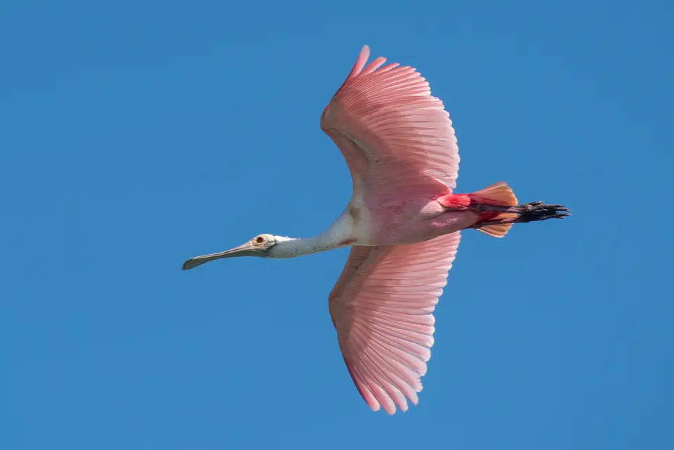
Avian diversity across the reserve's lagoons alongside marshes and forests exceeds 300 recorded species. Coastal wetlands and mangrove keys support wading and marine birds such as the jabiru (Jabiru mycteria), the roseate spoonbill (Platalea ajaja), the American flamingo (Phoenicopterus ruber), the wood stork (Mycteria americana), the great blue heron (Ardea herodias), the magnificent frigatebird (Fregata magnificens), the brown pelican (Pelecanus occidentalis), and the neotropic cormorant (Nannopterum brasilianum). Inside the tropical forest interior live the keel-billed toucan (Ramphastos sulfuratus), the yellow-lored amazon parrot (Amazona xantholora), the ocellated turkey (Meleagris ocellata), the great curassow (Crax rubra), the king vulture (Sarcoramphus papa), and the crested caracara (Caracara plancus).
Both the American crocodile (Crocodylus acutus) and Morelet's crocodile (Crocodylus moreletii) inhabit the reserve's marshes and lagoons, while the black iguana (Ctenosaura similis) is common along rocky outcrops and beaches. In the marine waters alongside seagrass beds and coral reef channels live the endangered West Indian manatee together with four nesting marine turtle species that come ashore on the sandy beaches and hundreds of reef and estuarine fish species.
This extraordinary juxtaposition of terrestrial and marine food webs allows predators and migratory species to move directly between ecosystems. Mangroves lining the shallow bays shelter juvenile reef fish and crustaceans before they migrate outward to the Mesoamerican Barrier Reef, while coastal lagoons provide undisturbed feeding grounds for wading birds and crocodiles year-round.
Maya Sites and Regional Conservation
Millennia ago, the early Maya inhabitants recognized the natural beauty of this coastline, giving it the name Sian Ka'an and building settlements across its forest ridges and lagoon margins. Within the reserve boundaries lie some 23 known archaeological sites of the Maya civilisation, including the forest-ringed ruins of Muyil. Early twentieth-century transport history also survives in several places along the trace of the narrow-gauge Decauville railway between Vigía Chico and Santa Cruz, which was operated through the reserve from 1905 to 1932.
Working together with scientists alongside technicians, students, fishermen, farmers, and rural promoters as well as international partners, conservationists have carried out more than 200 conservation projects across Quintana Roo. Coordinated in part through the bilingual conservation organisation Amigos de Sian Ka'an alongside the Centro Ecologico Sian Ka'an, these regional programmes cover eight protected natural areas across Quintana Roo (encompassing the southern reefs of Banco Chinchorro and Xcalak, Sian Ka'an itself, Cancún, Cozumel opposite Xcaret, and northern Isla Contoy) spanning 320,000 hectares (780,000 acres) across all seven Caribbean coastal municipalities of the state. Key goals of the Amigos de Sian Ka'a programme include identifying and managing high-biodiversity habitats essential to the life cycles of endangered and migratory species in the Riviera Maya, publishing environmental education books alongside journals and pamphlets, and providing technical guidance and training to Mayan communities engaged in ecotourism.
Through this cooperative management framework, local fishing communities, and Mayan guides help monitor the shallow bays, mangrove channels, and coral heads while introducing visitors to the 528,148-hectare biosphere reserve without disturbing its nesting bird colonies, marine turtle beaches, or forest wildlife corridors.
Whether visitors approach the reserve through the forest trails and lagoon boardwalks near Muyil on its inland edge or follow the coastal strip between the Caribbean surf and the turquoise bays, Sian Ka'an demonstrates how ancient Maya cultural landscapes and modern biosphere protection can coexist across half a million hectares of tropical forest alongside wetland marsh and coral reef. Every channel linking the freshwater petenes to the Mesoamerican Barrier Reef sustains the ecological continuity of Quintana Roo's eastern littoral.
- Muyil & 23 Maya Sites: Explore the ancient Maya archaeological site of Muyil and the historic 1905 to 1932 Vigía Chico to Santa Cruz Decauville railway remains preserved within the reserve.
- 120-Kilometre Coastal & Reef System: Experience the transition from tropical forests alongside palm savannahs and mangrove lagoons to shallow seagrass bays and the Mesoamerican Barrier Reef.
- 300+ Bird Species & Mesoamerican Mammals: Spot jabirus, roseate spoonbills, American flamingos, West Indian manatees, crocodiles, spider monkeys, tapirs, and wild cats across 528,148 hectares.
