Quick Field Data
- UNESCO Inscription: 2000 (Ref. 956), historic island urban town in Saint-Louis Region, Senegal; Criteria (ii) and (iv).
- Scale & Footprint: Narrow river island slightly over two kilometres long by roughly 400 metres wide inside the Senegal River, encompassing the entire island, surrounding quays and the Faidherbe Bridge.
- Access & Ticketing: Protected under Senegal's Law 71-12 (1971) and the 2008 Safeguarding and Valorisation Plan (Decree 2008-694); public streets, river quays and the Faidherbe Bridge remain open without admission gates.
- Arrival Logistics: Blaise Diagne International Airport (DSS) lies 163 kilometres southwest near Dakar (179 kilometres southwest in direct distance, or roughly 320 kilometres along coastal roads).
From Ndar Sandbar to the Capital of French West Africa
Anchored inside the mouth of the Senegal River 25 kilometres north of its ocean bar, the Island of Saint-Louis unites 19th-century colonial planning with West African river life. Known locally in Wolof as Ndar (or N'dar, meaning island), this narrow strip measures slightly over two kilometres long and about 400 metres wide, shielded from Atlantic swells to the west by the 25-kilometre-long, 300-metre-wide Langue de Barbarie sand spit. To the east sits the older mainland suburb of Sor, surrounded by tidal marshes. Three natural landscapes shape its setting: Sahel acacias between Sahara dunes and savannah baobabs, rainy-season flood basins lined with mangroves, and the Filao-planted Langue de Barbarie (named after Barbary coast references) bearing seaside Ndar Toute (Little Saint-Louis) and Guet Ndar (pasture).
Long before European traders charted the estuary, a Wolof settlement flourished at Guet Ndar around 1450 as a gathering point for Muslim pilgrims embarking toward Mecca. After Portuguese, Dutch and English ships visited the coast, French traders erected a first nearby fort in 1638 on Bocos Island, 25 kilometres away, before floods forced relocation onto uninhabited Ndar in 1659. Local ruler Diagne of Sor leased the spirit-feared island for annual tribute of three pieces of blue cloth, a scarlet cloth measure, seven long iron bars and ten pints of eau-de-vie. Originally called Saint-Louis-du-Fort after canonised King Louis IX and reigning Louis XIV, Saint-Louis became France's first chartered West African coastal post trading in enslaved people, gold, hides, beeswax, ambergris and gum arabic across nine successive chartered companies (1659 to 1779).
Imperial conflicts and shifting trade shaped urban growth across two centuries. British forces captured Senegal in 1758 until France recovered Saint-Louis in February 1779, occupying it again during the Napoleonic Wars until 1817. Once Atlantic slave exports faded after 1790 and Waalo plantation schemes failed from 1819 to 1830, gum arabic trade centred on lower-river desert escales rather than distant Gajaaga fueled rapid commercial growth. Wars with Trarza emirs and Berber zwaya boycotts ended after French marines won the 1855 Battle of Leybar Bridge and secured river trade terms in 1858. Population grew from roughly 5,000 in the late 18th century to 10,000 (1826), 23,000 (1914) and 39,000 (1955), reaching 254,171 across the municipality in 2023 while serving as capital of Senegal (1673 to 1902), French West Africa (1895 to 1902) and Mauritania (1920 to 1957).
Faidherbe's Orthogonal Grid, Signare Mansions, and Iron Bridge
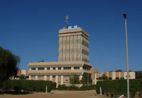
Studying a Saint Louis Senegal map highlights how decisively Governor Louis Faidherbe reshaped Ndar after assuming office in 1854. Building bridges, fresh drinking water lines and an overland telegraph link south to Dakar, Faidherbe laid down an orthogonal street grid anchored squarely to continuous perimeter stone river quays aligning every east-west cross street. Every riverside promenade forms an architectural anchor connecting North and South residential quarters directly to the central administrative square. Three clear quarters structure the island: central Place Faidherbe featuring the military-barrack-style Government Palace built atop the old fort core, flanked northward by the North quarter and southward by the South quarter. Colonial institutions established during the 19th century, including the Muslim Tribunal and the School for Chiefs' Sons, shaped civic governance far beyond Senegal's borders, establishing Saint-Louis as a crucible of education, craftsmanship and urban administration across French West Africa.
Walking those straight riverfront streets exposes distinctive Franco-African Creole architecture forged by wealthy Métis merchant women called signares. Emerging during the 17th and 18th centuries, Métis traders dominated up-country river commerce, financed principal Catholic institutions and shaped public urban culture with refined social gatherings and civic celebrations. They supplied Saint-Louis's first Métis mayor in 1778 before municipal status arrived as a French commune in 1872. Later, large Bordeaux commercial firms and completion of the Dakar-Saint-Louis railroad in 1885 diverted inland freight away from Saint-Louis's shallow port and sidelined Métis traders as steamships struggled across the river bar. Even so, Saint-Louis remained capital of Senegal until 1902 and of Mauritania until 1957, preserving two-storey balconied townhouses, shaded gallery houses and rare low Portuguese maisons basses together with active political parties and independent newspapers throughout the 19th and early 20th centuries.
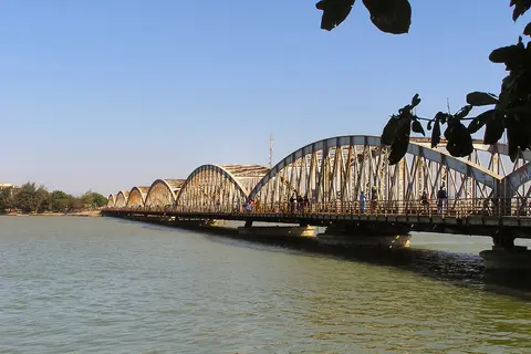
Connecting mainland Sor directly into Place Faidherbe stands Saint-Louis's defining monument, the Faidherbe Bridge. Imported from France in separate iron sections and inaugurated on 19 October 1897 by French minister André Lebon, the multi-span truss bridge preserved Faidherbe's geometric grid completely unchanged. After Dakar became sole national capital upon independence, French residents and military units departed, closing many offices and shops. Economic quiet deepened after French-educated lawyer Lamine Guèye died in 1968, leaving the historic island largely undisturbed. Since 1993, the annual Saint Louis Jazz Festival has revived cultural tourism near regional historic landmarks including the colonial waterworks at Makhana, the palace of Baron Roger at Richard-Toll and the Diama Dam.
Relay Canals, Rising Seas, and Living Heritage Safeguarding
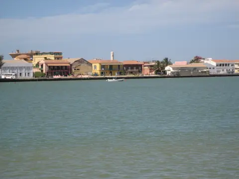
Sitting scarcely above ocean and river levels along the Sahel edge makes hydrology a pressing conservation priority for modern Saint-Louis. Classified under hot desert climate conditions (BWh), the coast alternates between a humid, stormy June-to-October rainy season and a breezy November-to-May dry season dusted by Harmattan winds. A 2011 documentary identified Saint-Louis as the African city most exposed to sea-level rise, and a Senegalese government study warns up to 80 percent of the city could face flood risks by 2080. Upriver dam development paired with seasonal flooding prompted engineers to construct a protective relay canal, while Filao trees anchor sandy soils against erosion along the Langue de Barbarie. Sharp 2016 to 2017 fish catch declines have also strained local coastal fishing communities and national food supplies, adding urgency to sustainable estuarine stewardship.
Strong legislation and civic coalitions protect Saint-Louis's built fabric against flooding and urban pressures beyond the buffer boundary. Extending urban planning rules begun in 1928, conservation enforces Law 71-12 (25 January 1971), Decree 73.746 (1973), Ministerial Order 012 771 (1975) and Decree No. 2008-694 implementing the 2006 UNESCO-supported Safeguarding and Valorisation Plan, plus a 2007 buffer zone extension. Active local partners unite ARCAS (Association for the Restoration and Conservation of Saint-Louis Architecture), neighbourhood quarter associations, the Tourism Office and the Saint-Louis ICOMOS committee to organise theatre, carnivals and heritage education posters. Training workshops have also instructed more than 200 local craftsmen across restoration trades, strengthening traditional masonry know-how, lime plastering and timber balcony conservation.
Access Zones Across the Island of Saint-Louis and Langue de Barbarie
Exploring Saint-Louis easily unfolds on foot across the flat two-kilometre island grid before crossing narrow channels onto the active Atlantic fishing spit or mainland Sor. Respect active coastal fishing landings in Guet Ndar and seek permission before photographing residents or inside religious mosques and churches.
| Complex Zone | Key Highlights | Access & Ticket Rule |
|---|---|---|
| Place Faidherbe and Government Palace | Orthogonal central plaza, former colonial palace built on the 1659 fort core and Faidherbe Bridge landing. | Open public civic square and pedestrian bridge walkways; administrative buildings maintain regulated public access. |
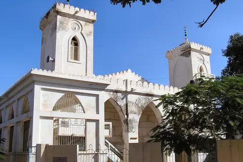
| North and South Island Quarters | Two-storey signare balconied townhouses, gallery houses, Great Mosque and Portuguese maisons basses along river quays. | Free pedestrian street access across the entire two-kilometre island grid; quiet etiquette applies near mosques and homes. |
| Langue de Barbarie (Guet Ndar & Ndar Toute) | Atlantic oceanfront sand spit, painted wooden pirogue fleet, Filao windbreaks and seaside neighbourhood lanes. | Cross west from the island via river bridges; stay clear of hauling crews and active fishing beach operations. |
| Surrounding Delta Reserves | Langue de Barbarie National Park, Djoudj National Bird Sanctuary (60 km north) and Gueumbeul Fauna Reserve. | Managed protected parks reached by boat or regional road; arrange licensed reserve guides and entry permits at gates. |
Three Urban and Riverfront Details Across Old Saint-Louis
- Modular Iron Trusses of the Faidherbe Bridge: Walk across the 1897 crossing linking Sor and Place Faidherbe to inspect riveted French prefabricated iron spans bridging the Senegal River.
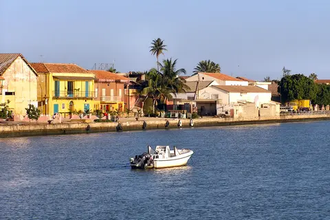
- Signare Balconied Houses and Shaded Galleries: Look along east-west cross streets joining both island quays for overhanging timber-and-iron balconies built by Métis merchant families for Sahel breezes.
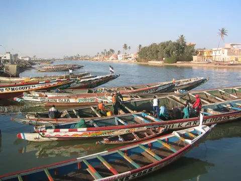
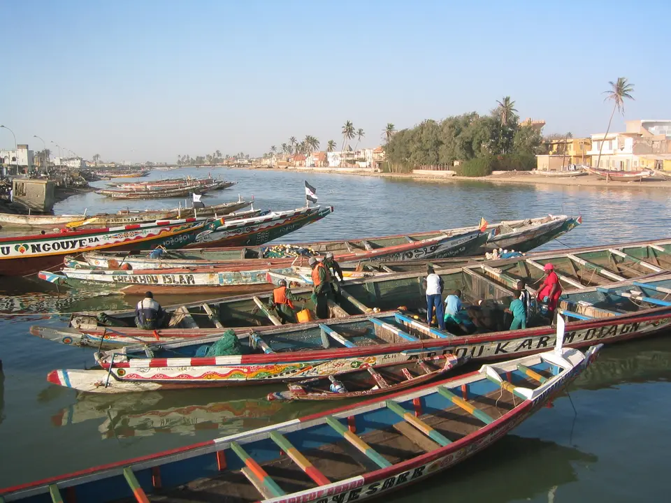
- Painted Pirogue Fleet Along Guet Ndar: Stand on the western island quay facing the Langue de Barbarie sand spit to watch brightly painted wooden fishing canoes line the narrow oceanfront channel.
Routes Between Dakar, Saint-Louis, and Northern Bird Reserves
Travellers consulting a Saint Louis Senegal travel guide frequently pair coastal Dakar with northern Saint-Louis because the island joins walkable colonial heritage with major Sahel wetland reserves nearby. Timing cultural walks for the cooler dry season from November to May avoids June-to-October rainstorms and matches May jazz festival nights, while wet-season months flood delta basins into bird-filled lagoons. Spending two or three days lets guests explore North and South quarters calmly by morning before crossing over to watch returning Guet Ndar fishing boats late in the day.
Understanding transport links between Saint Louis Senegal and Dakar or Mauritania anchors regional itineraries cleanly. Overland coastal highways connect Saint-Louis southwest to Dakar (179 kilometres in direct distance, or roughly 320 kilometres along coastal roads), passing Blaise Diagne International Airport (DSS) 163 kilometres southwest as the primary international commercial gateway. Heading north toward Mauritania's capital Nouakchott follows the Senegal River valley upstream for 100 kilometres to the Rosso frontier crossing, while regional road connections link northern Senegal toward inland hunting lodges and historic colonial waterworks.
Surrounding nature sanctuaries round out any northern itinerary within easy reach of the island. Twenty-square-kilometre Langue de Barbarie National Park occupies the southern estuary tip, sheltering pink flamingos, pelicans, cormorants, herons and ducks each year, while 7-square-kilometre Gueumbeul Fauna Reserve 12 kilometres south protects endangered dama gazelles, patas monkeys and African spurred tortoises. Sixty kilometres north, Djoudj National Bird Sanctuary spans over 120 square kilometres as the world's third-largest ornithological park, hosting roughly three million migratory birds across 400 species annually across lakes, basins and marshes.
Linking those wetland excursions back to Saint-Louis's orthogonal island streets explains why both cultural architecture and coastal ecology depend on the same river mouth. Historic stone quays, iron bridge piers, painted pirogues in Guet Ndar and shaded gallery townhouses endure only through careful water governance balancing upstream dams, ocean erosion and urban upkeep. Giving Saint-Louis unhurried days lets visitors walk both North and South quarters quietly, inspect colonial stonework across Place Faidherbe, visit lively riverfront markets and talk with local heritage artisans before crossing west onto the coastal spit. Observing daily life along both riverfronts reveals how resilient island traditions remain across northern Senegal despite environmental pressures. Explore additional coastal heritage towns across Africa inside our UNESCO World Heritage Atlas.