Quick Field Data
- UNESCO Inscription: 1999 (Ref. 934), natural subtropical forest reserve inside Madeira Natural Park, Portugal; Criteria (ix) and (x).
- Scale & Footprint: 15,000 hectares (150 square kilometres) of laurel forest inside the 27,000-hectare Parque Natural da Madeira.
- Access & Ticketing: Managed by the Autonomous Regional Government of Madeira under strict and partial reserve zoning; check regional forestry notices for marked levada walking routes and permit rules.
- Arrival Logistics: Direct commercial flights reach Cristiano Ronaldo International Airport (FNC), 22 kilometres southeast on Madeira, roughly 978 kilometres southwest across the Atlantic from Lisbon and mainland Sintra (959 kilometres).
Tertiary Cloud Forests and Endemic Flora of Madeira's North Slopes
Rising out of the Atlantic Ocean 978 kilometres southwest of Lisbon and 560 kilometres west of Morocco, Madeira forms an autonomous Portuguese archipelago with Porto Santo, Desertas and Selvagens. Formed primarily of fertile volcanic basalt and ash with pockets of uplifted marine limestone, Madeira spans 741 square kilometres, measuring 57 kilometres east to west and 22 kilometres across while peaking at 1,861 metres on Pico Ruivo. Neighboring Porto Santo covers 42.2 square kilometres 43 kilometres northeast, while the uninhabited Desertas islands (14.2 square kilometres) and distant Selvagens islands (2.73 square kilometres, 165 kilometres north of the Canaries) guard offshore marine reserves across an archipelago of roughly 289,000 residents centred in Funchal.
Inside Madeira Natural Park, the 15,000-hectare Laurisilva preserves evergreen laurel woodland confirmed by paleobotanical evidence to have existed on Madeira for at least 1.8 million years. This forest forms the largest surviving remnant of subtropical laurel woodlands that once spanned Southern Europe 15 to 40 million years ago before ice-age cooling restricted them to the Azores, Madeira and the Canary Islands. Today, laurel cover occupies 16 percent of Madeira, roughly 90 percent primary growth with ancient trees over 800 years old predating human settlement, joined by 10 percent secondary forest last felled during the mid-twentieth century.
Prevailing northeast trade winds push moist ocean air against Madeira's central volcanic spine, wrapping northern valleys in persistent orographic clouds and fog. At sea level, subtropical maritime averages stay between 15 and 20 degrees Celsius with 250 to 750 millimetres of annual rainfall, turning cool and occasionally snowy atop high mountain ridges in winter. Wet north-facing canyons nurture moist laurel forest between 300 and 1,300 metres elevation, contrasting with drier south-facing laurel zones between 700 and 1,600 metres.
Botanical diversity across the archipelago counts roughly 1,226 native vascular plants, including 66 island endemics (with 76 Madeiran endemic vascular plants inside UNESCO reserve boundaries) and 54 Macaronesian endemics, plus strong botanical links to the Mediterranean Basin. Three primary climax associations structure the canopy: Til Laurisilva (Ocotea foetens), Barbusano Laurisilva (Apollonias barbujana subspecies barbujana) and Vinhático Laurisilva (Persea indica). Other canopy trees include Laurus novocanariensis, Clethra arborea, Heberdenia excelsa, Laurus nobilis, Pittosporum coriaceum, Rhamnus glandulosa, Ilex perado, Ilex canariensis, Picconia excelsa and Visnea mocanera.
Beneath mossy boughs grow giant cranesbill (Geranium maderense), Madeiran squill (Scilla madeirensis), Pride of Madeira (Echium candicans) and Honey Spurge (Euphorbia mellifera). Other shaded understory species include Madeira Foxglove (Isoplexis spectrum), Musschia wollastonii, dense ferns and endemic orchids (Dactylorhiza foliosa and Goodyera macrophylla). Below the laurel belt, coastal ravines up to 200 metres shelter wild olive (Olea europaea subspecies cerasiformis) and dragon trees (Dracaena draco), while secondary coastal scrub includes Euphorbia piscatoria and Echium nervosum. Northern cliff pockets from 200 to 300 metres carry marmolano (Sideroxylon mirmulano), and high mountain ridges above the forest support Erica arborea, Erica platycodon subspecies maderincola and Madeira juniper heath. Abundant lichens plus 13 threatened liverwort and 20 threatened moss species confirm pollution-free mountain air.
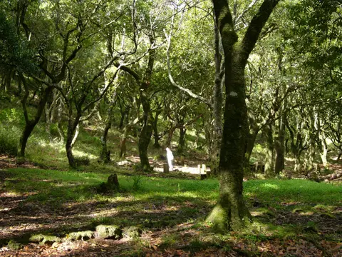
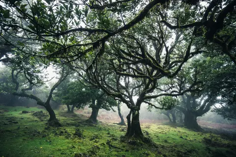
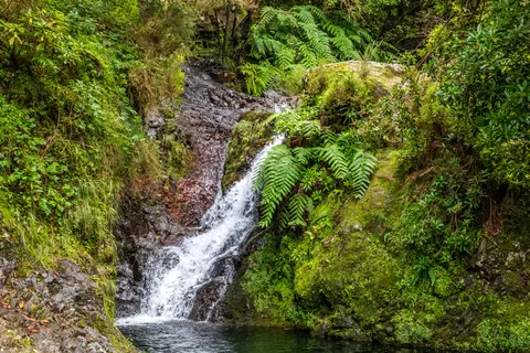
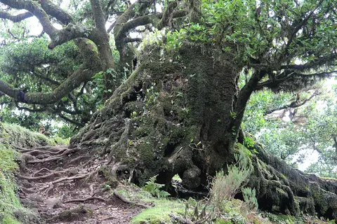
Across steep valley floors, fallen trunks and mossy boulders foster complex soil food webs and micro-habitats where endemic plants and invertebrates co-evolved in Atlantic isolation. Ancient broad-crowned trees standing in damp river bottoms create cool shaded corridors below waterfalls and basalt cliffs, anchoring an ecosystem largely untouched by modern timber felling. Deep shade beneath evergreen laurel canopies holds consistent moisture across root zones, permitting delicate tree ferns, liverworts and bryophytes to carpet wet banks and vertical rock ledges throughout the year.
Botanical comparisons also explain why Madeiran woodlands differ sharply from mainland Europe's dry forests. When Quaternary cooling and drying wiped out continental laurel forests across southern Europe, oceanic warmth around Madeira insulated this Tertiary plant community across steep volcanic valleys.
Stone Levada Channels, Trocaz Pigeons, and Primary Canopy Zones
Intercepting horizontal cloud drip and heavy mountain rains, the dense evergreen canopy regulates Madeira's hydrological balance and keeps streams flowing year-round. When Portuguese settlers arrived after 1420, logging targeted prized Persea indica timber before sixteenth- and seventeenth-century landowners converted drier southern slopes to sugarcane plantations and cut upland wood for sugar-mill charcoal. To carry abundant mountain water from northern canyons toward dry southern fields, towns and hydropower stations, islanders carved stone and later concrete water channels called levadas measuring 80 to 150 centimetres wide.
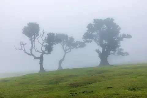
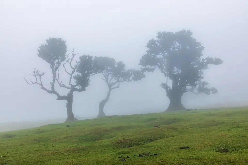
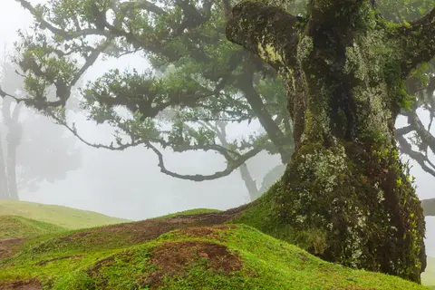
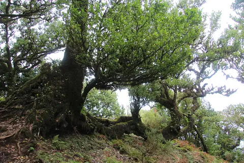
No new levadas have been dug inside the UNESCO forest for roughly 70 years, yet careful upkeep of existing channels preserves narrow 1-to-2-metre inspection paths curving gently along steep cliff contours. Because steep V-shaped canyons are covered with impenetrable evergreen undergrowth, levada walkways serve a double conservation benefit by keeping human foot traffic confined to tiny level strips. Apart from tiny stone huts housing maintenance workers and two minor mountain roads (with plans to replace one by tunnel), zero settlements, houses or cultivated farms intrude across the 15,000-hectare core. Accessible landmarks include the high plateau groves of Fanal between Paul da Serra and the northwest coast, famous for ancient sprawling Ocotea foetens trees, and damp northern canyons around Ribeiro Frio near São Roque do Faial.
Designated an Important Bird Area by BirdLife International, Madeira records 295 bird species and subspecies, including 42 breeding species. Its emblematic woodland inhabitant is the endemic Madeiran Laurel Pigeon, or Trocaz Pigeon (Columba trocaz), which feeds heavily on evergreen laurel fruits and disperses seeds across deep gorges. Forest birds share the archipelago with the Madeira Firecrest (Regulus maderensis), Madeiran Chaffinch (Fringilla madeirensis), Zino's Petrel (Pterodroma madeira), Desertas Petrel, Berthelot's pipit, Atlantic canary and plain swift (replacing the extinct Madeira and Porto Santo rails). Mammal and reptile endemics include the Madeira Pipistrelle bat, an endemic lesser noctule subspecies and the Madeiran wall lizard (Teira dugesii), accompanied by over 500 endemic terrestrial insects, spiders and molluscs.
Eradicating Grazing Livestock and Controlling Invasive South-Slope Trees
Establishing Madeira Natural Park in 1982 across 444 square kilometres (with 27,000 hectares directly framing the 15,000-hectare UNESCO forest, complemented by Selvagens reserve in 1971 and Desertas reserve in 1990) transformed upland land care. During the 1980s, conservation rangers removed introduced goats, sheep and cows that once grazed down forest understories, allowing native ferns, shrubs and young laurel trees to recover beneath ancient canopies.
Today, roughly half of the Laurisilva holds Strict Reserve status (Reserva Integral) and half operates as Partial Reserve (Reserva Parcial) under regional Madeiran law. Strong layered safeguards also derive from European Union Habitats and Birds Directives protecting 39 priority species, Council of Europe Biogenetic Reserve recognition and the statutory Plano de Ordenamento e Gestão da Floresta Laurisilva executed by the Autonomous Regional Government of Madeira. Park managers monitor invasive exotic trees like maritime pine (Pinus pinaster) and eucalyptus (Eucalyptus globulus) spreading uphill from south-slope plantations, phase down limited local tree-heather cutting permits and guide rising walker numbers safely along exposed cliffside levadas without building intrusive tourist facilities. Expanded visitor education and buffer-zone management help ensure surrounding rural plots introduce zero harmful alien weeds into primary woodland.
Preserving the misty northern canyon watershed also guards Madeira's long-term water supply against warmer, drier Atlantic conditions. Because ancient laurel trees capture substantial fog moisture even without heavy downpours, protecting intact canopy height and understory ferns keeps island springs, irrigation channels and mountain waterfalls flowing reliably throughout dry summer months.
Access Zones Across the Laurisilva of Madeira
Because steep V-shaped canyons divide Madeira's north slope, most visitors experience the Laurisilva along marked levada walks and high-plateau viewpoints linked by mountain roads from Funchal. Check regional trail alerts before setting out, as heavy fog or rockfalls can close narrow cliff paths temporarily.
| Complex Zone | Key Highlights | Access & Ticket Rule |
|---|---|---|
| Fanal & Paul da Serra Edge | Ancient wind-sculpted Ocotea foetens laurel groves shrouded in Atlantic fog in northwestern Madeira. | Open upland walking pastures; stay on signed paths around old root zones and follow parking rules. |
| Ribeiro Frio Valleys | Humid eastern laurel ravines, waterfalls near the Ribeiro Frio trout farm and scenic levada viewpoints. | Marked forest footpaths remain open year-round; verify trail maintenance notices and parking at trailheads. |
| Primary Levada Corridors | Stone and concrete 80-to-150-centimetre water channels lined with narrow paths through dense cloud forest. | Foot access follows posted regional route regulations; carry rain layers and lights for tunnel sections. |
| Strict Reserve Core | Oldest 800-year-old primary laurel forest pockets and steep interior ridges shielding sensitive habitats. | Half of the 15,000-hectare reserve prohibits off-trail entry and public infrastructure to preserve primary growth. |
Three Ecological and Hydrological Details in the Laurel Forest
- Horizontal Fog-Comb Foliage in Fanal: Stand beneath gnarled Ocotea foetens crowns on the Fanal plateau during mist to watch broad, glossy evergreen leaves trap passing cloud droplets that drip straight into the forest soil.
- Contours of Stone and Concrete Levadas: Observe how 80-to-150-centimetre water channels cling precisely to cliff gradients, carrying cold northern mountain runoff through steep basalt walls without motorized pumping.
- Epiphytic Lichens and Moss Carpets: Examine damp shaded tree trunks in Ribeiro Frio and lower canyons, where thick curtains of liverworts, ferns and hanging lichens flourish in unpolluted subtropical air.
Walking Levada Trails, Direct Flights, and Weather Across Madeira
Planning a Laurisilva of Madeira walk requires packing for swift mountain weather changes even when coastal Funchal feels warm. Sea-level averages hover between 15 and 20 degrees Celsius year-round, yet upper slopes around Paul da Serra, Fanal and Pico Ruivo regularly catch damp Atlantic clouds, brisk winds and chilly fog, with frost or snow on high summits in winter. Walking damp, narrow levada paths beside sheer canyon drops calls for sturdy non-slip boots, waterproof outer shells and a torch for short rock tunnels, after checking official trail status updates.
Choosing trailheads carefully lets hikers match fitness levels and daily weather conditions across the island's northern slopes. Easy, nearly level strolls wind past ancient wind-twisted laurel trees across the high Fanal pastureland or out to forest viewpoints above Ribeiro Frio. Longer canyon circuits link damp stream valleys, waterfalls and stone irrigation tunnels deep inside Madeira Natural Park, rewarding early morning starts before afternoon clouds thicken around central mountain peaks.
Travellers asking how to get to Madeira or whether you can fly direct to Madeira benefit from strong European air links. Direct commercial flights reach Cristiano Ronaldo International Airport (FNC), 22 kilometres southeast of the forest reserve, bypassing Atlantic crossings from mainland Portuguese hubs such as Sintra (959 kilometres northeast). From Funchal, Madeira's largest city and main harbour on the south shore, paved mountain roads climb steadily toward trailheads at Fanal, Paul da Serra and Ribeiro Frio. Allowing two to three days for northern valley hikes lets visitors adjust itineraries around shifting mountain fog without missing clear plateau views. Explore additional European and Atlantic natural reserves inside our UNESCO World Heritage Atlas.