


























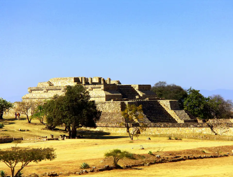
Quick Field Data
- UNESCO Inscription: 1987
- Scale & Footprint: Two linked cultural zones in the central valleys of Oaxaca, Mexico, combining the 1,940-metre ridge of Monte Albán with 1,200 inventoried monuments in the historic centre of Oaxaca de Juarez
- Access & Ticketing: The colonial city streets and plazas are open year-round, while the hilltop archaeological zone and on-site museum operate under INAH daytime entry rules; check the official site
- Arrival Logistics: Monte Albán rises 9 kilometres west of Oaxaca City across the Santa Cruz Xoxocotlán ridge and is reached by short road transfers from the city centre
Two Linked Urban Centres in the Central Valleys of Oaxaca
Positioned in the highland valley basin framed by the Sierra Madre Oriental on one side and the Sierra Madre del Sur on the other in southern Mexico, this dual World Heritage site unites two distinct urban achievements separated by more than two millennia: the pre-Columbian hilltop metropolis of Monte Albán and the Spanish colonial city of Oaxaca de Juarez, situated 9 kilometres to the east. Monte Albán crowns an artificially levelled mountain ridge in the municipality of Santa Cruz Xoxocotlán at an elevation of 1,940 metres above mean sea level, rising 400 metres above the valley floor where the three valley arms of Etla in the north, Tlacolula in the east, and Zimatlán and Ocotlán (also called Valle Grande) in the south meet. Below in the valley, the Spanish settlement originally named Villa de Antequera was founded in 1529 on a flat alluvial plain inhabited by Zapotec communities midway between the Jalatlaco and Atoyac rivers and the slopes of Cerro del Fortin.
Archaeological research directed by Kent Flannery and Joyce Marcus of the University of Michigan demonstrated that during the Archaic period (8000 to 2000 BCE) and the Rosario ceramic phase (700 to 500 BCE), the valley floor was dominated by the northern Etla chiefdom at San José Mogote alongside rival centres such as Tilcajete in the Valle Grande and Yegüih in Tlacolula. Around 500 BCE, at the close of the Middle Formative period, elites from San José Mogote and neighbouring communities established a new capital in the previously uninhabited hilltop buffer zone at Monte Albán. Known to scholars as the Monte Alban Synoikism, this rapid shift brought an estimated 5,200 inhabitants to the ridge by the end of the Monte Albán Ia phase around 300 BCE, while studies by Charles Spencer and Elsa Redmond from New York's American Museum of Natural History showed that Tilcajete initially resisted incorporation. By the Terminal Formative period during phase Monte Albán II (100 BCE to 200 CE), the city reached roughly 17,200 residents and expanded through colonization and conquest into the northern Cañada de Cuicatlán canyon as well as the southern valleys of Ejutla and Sola de Vega.
During the Early Classic Monte Albán IIIA phase (200 to 500 CE), the Zapotec capital dominated the Oaxacan highlands and maintained diplomatic contacts with Teotihuacan in central Mexico, where an ethnic Zapotec enclave resided. In the Late Classic IIIB and IV phases (500 to 1000 CE), regional centres such as Cuilapan, Zaachila, Lambityeco, Mitla, and El Palmillo asserted autonomy, and by 900 to 1000 CE the hilltop capital was largely abandoned. Later Mixtec elites opportunistically reused earlier Zapotec tombs during the Postclassic period up to the Spanish arrival in 1521. Centuries later, after early accounts by Guillermo Dupaix, J. M. García in 1859, A. F. Bandelier in the 1890s, and Leopoldo Batres in 1902 under Porfirio Diaz, Mexican archaeologist Alfonso Caso, assisted by Eulalia Guzmán, Ignacio Bernal, and Jorge Acosta, launched eighteen years of scientific excavations in 1931, uncovering Tomb 7 in 1932 and 1933, before Richard Blanton, Gary Feinman, Steve Kowalewski, and Linda Nicholas mapped the full terraced ridgeline in the 1970s.
Carved Mountain Platforms, Conquest Slabs, and Earthquake-Resistant Grids
The ceremonial core of Monte Albán centres on the Main Plaza, an artificially flattened expanse measuring approximately 300 metres by 150 metres and originally surfaced in white plaster. Bounded by monumental north and south platforms accessed via wide staircases and flanked on the east and west by smaller temple mounds and 1 of the 2 known ballcourts, the plaza also carries a central north-south spine of ceremonial platforms. Because the central valleys experience frequent seismic activity, Zapotec builders engineered thick masonry walls and sloped talud batters to withstand earthquakes. Although the plaza appears rectangular, its corners depart from strict 90-degree symmetry, and early western mounds rotate slightly south of east while later temples align with the cardinal directions and the solar path, featuring a 2-room layout of an outer communal porch and an inner sanctuary dedicated to royal ancestors and the rain deity Cocijo.
Two groups of carved stone monuments inside the Main Plaza record the military and astronomical priorities of the early state. Near Building L on the southwestern side stand the earliest reliefs from phase Monte Albán I, known as the Danzantes: more than 300 carved slabs depicting naked, contorted male figures that represent captured and sacrificed rival chiefs rather than dancers, accompanied by early Zapotec glyphs and calendrical notation. Within Mexico, the centre of plaza stands the arrow-shaped Building J, rotated out of alignment with neighbouring platforms so its staircase faces perpendicular to the heliacal rising of the star Capella, which occurred within a day of the zenith passage of the Sun. Set into the walls of Building J are more than 40 Monte Albán II conquest slabs carved with place-names and inverted heads representing subordinated territories such as the Cañada de Cuicatlán. Beyond the ceremonial core, walls up to 9 metres tall and twenty metres wide enclosed hundreds of residential terraces across the slopes of Monte Albán, Atzompa, and El Gallo, where Scott Hutson noted that evenly spaced elite mounds with 3-to-4-room patio residences and painted subterranean stone tombs oversaw 1-to-2-room commoner adobe houses.
Nine kilometres east on the valley floor, royal surveyor Alonso García Bravo laid out the colonial Villa de Antequera in 1529 around a central plaza oriented along east-west and north-south axes with a slight tilt to temper the highland sunlight at 17 degrees north latitude. Across a checkerboard grid of square blocks and 4-sided arcaded portals, builders adapted to the same earthquake-prone terrain by raising low, massive-walled churches, convents, and patrician townhouses that gave the city an intact colonial profile. Inventoried across 1,200 listed historic monuments, this urban fabric spans 4 centuries of religious, civic, and residential architecture, including the Baroque Santo Domingo Church and 19th-century neoclassical buildings erected in the hometown of national leader Benito Juarez, after whom the city was officially renamed Oaxaca de Juarez in 1872.
Planning a Dual Itinerary Across Monte Albán and Oaxaca de Juarez
A thorough visit using the UNESCO World Heritage Atlas pairs a morning ascent to the open ridgeline of Monte Albán with an afternoon architectural walk through the gridded streets of Oaxaca de Juarez. Because the Main Plaza sits exposed at 1,940 metres with minimal shade across its 300-by-150-metre expanse, arriving when the archaeological zone opens allows travellers to climb the North and South Platforms, inspect the Danzantes gallery at Building L and the conquest slabs on Building J, and tour the on-site museum before midday heat builds over the valley. The site museum displays original carved stelae sheltered from weathering and outlines the five ceramic phases established by Alfonso Caso. The ridge commands views across all 3 valley arms.
Returning 9 kilometres east into Oaxaca de Juarez, travellers should visit the Museo Regional de Oaxaca housed inside the former monastery of Santo Domingo. Here, the gold, jade, turquoise, and carved bone offerings excavated by Alfonso Caso and Eulalia Guzmán in 1932 from Tomb 7 (a Classic Zapotec chamber reused for Postclassic Mixtec elite burials) are displayed together with pre-Hispanic ceramics and colonial art, while additional monuments reside in Mexico City at the Museo Nacional de Antropologia. Walking south from Santo Domingo to the central arcaded plaza reveals how Alonso García Bravo's 1529 checkerboard layout and thick-walled earthquake construction still organise the civic, market, and cultural life of the state capital across 4 adjacent municipalities.
- Pacing the mountain ridge and valley grid: Ascend to Monte Albán early in the morning for clear visibility across the Etla, Tlacolula, and Valle Grande valleys, reserving the shaded portals and museums of Oaxaca de Juarez for the afternoon.
- Connecting Tomb 7 to its artifacts: Examine the residential terraces and Tomb 7 on the northeastern flank of Monte Albán first, then view its Postclassic Mixtec treasure inside the Museo Regional de Oaxaca at Santo Domingo.
- Observing seismic engineering across eras: Compare the sloped talud platform walls of the Zapotec Main Plaza with the low, buttressed stone facades of the 1,200 listed colonial monuments in the city below.
