Quick Field Data
- UNESCO Inscription: 1999 (Ref. 652, inscribed 4 December 1999; also designated a Ramsar Wetland Site in 2012), natural karst and forest sanctuary in Palawan, Philippines; Criteria (vii) and (x).
- Scale & Footprint: 22,202-hectare national park covering three barangays and the entire underground river watershed, enclosing an 8.2-kilometre subterranean section of the Cabayugan River within a 32-kilometre cave network.
- Access & Ticketing: Owned and managed since 1992 by the City Government of Puerto Princesa under the NIPAS Act of 1992 and Protected Areas Management Board (PAMB); daily entry is enforced at 900 visitors per day under PAMB policy and Puerto Princesa City permits ("No Permit, No Entry"; management reviews have also evaluated peak limits up to 1,200).
- Arrival Logistics: Served by Puerto Princesa International Airport / PAF Antonio Bautista Air Base (PPS), 50 kilometres south, and overland road trips roughly 76 to 80 kilometres northwest from Puerto Princesa city to Sabang village. Domestic flights link northward across the archipelago to Manila (542 kilometres).
Saint Paul Karst Geology and the Brackish Subterranean River
The sanctuary sits inside the Saint Paul Mountain Range on Palawan Island. Standing along Palawan's mid-western coast roughly 76 to 80 kilometres northwest of Puerto Princesa city, the park covers 22,202 hectares across three barangays including Barangay Marufinas. Inscribed by UNESCO on 4 December 1999 and named a Ramsar Wetland Site in 2012, the reserve encloses the complete watershed feeding an 8.2-kilometre subterranean stretch of the Cabayugan River inside a cave system exceeding 32 kilometres. Protecting that full drainage basin from mountaintop ridges straight to Saint Paul Bay preserves both karst cave stability and estuary water clarity.
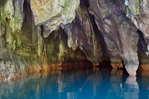
Unlike inland underground streams that emerge into dry valleys, the subterranean Cabayugan River flows directly into the South China Sea. Ocean tides reach up to 6 kilometres inside the limestone cavern, creating a brackish estuarine zone across the lower half of the river. Denser saline seawater slips underneath a thin freshwater upper layer only a few centimetres thick, producing a crisp stratified water column. During heavy monsoon rains, floodwaters temporarily flush seawater out of the passage until calmer tidal cycles rebuild the brackish boundary.
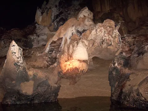
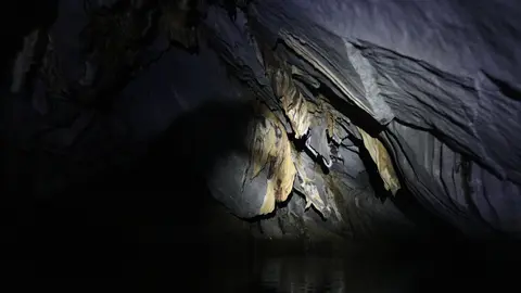
Until the 2007 discovery of a longer subterranean river system in Mexico's Yucatán Peninsula, Puerto Princesa ranked as the world's longest known underground river and still stands second globally. Standard guided paddle-boat tours navigate roughly the first 1.5 kilometres (with deep tidal vaults extending up to 4.3 to 4.5 kilometres for special scientific access) through cathedral-scale limestone halls measuring up to 120 metres wide and 60 metres high. Towering stalactites, stalagmites and flowstone draperies anchor vast subterranean halls led by the 360-metre-long Italian's Chamber, one of the largest natural cave rooms on Earth.
Scientific cave exploration continued revealing hidden geological chambers well after UNESCO inscription. During 2010 field expeditions, geologists and environmentalists discovered an upper second-floor cave horizon perched directly above the main river, complete with interior waterfalls cascading down limestone walls. Researchers also documented a 300-metre rock dome arching above the subterranean stream, deep water holes, additional river branches, large bat colonies and specialised marine and subterranean life. Deeper interior passages beyond the navigable zone remain inaccessible to standard exploration due to severe oxygen deprivation.
Eight Mountain-to-Sea Forest Formations and Palawan Endemics
Above ground, the national park protects a complete mountain-to-sea ecosystem inside the Palawan Biogeographic Province. Extending uninterrupted from Saint Paul karst summits straight to South China Sea reefs and bays, the park safeguards eight intact tropical Asian forest formations. These distinct habitats encompass forest on ultramafic soil, forest on limestone soil, montane forest, freshwater swamp forest, lowland evergreen tropical rainforest, riverine forest, beach forest and coastal mangrove forest. Global conservation assessments by WWF recognise the Palawan Moist Forest as hosting Asia's richest tree flora and largest, most valuable limestone forest.
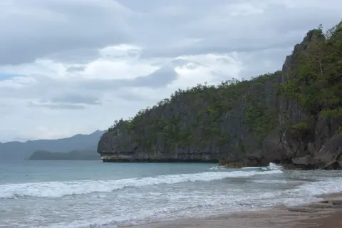
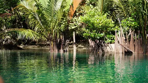
Each forest belt performs a specific ecological role supporting cave hydrology and coastal reef health. Upland montane and ultramafic woods trap Pacific monsoon moisture across rocky crests before releasing steady springs through karst fractures into riverine forests below. Downstream, freshwater swamp forests filter floodwater sediments cleanly ahead of mangrove thickets lining Saint Paul Bay, where roots shelter marine nursery grounds and bind coastal sand behind sandy beach vegetation. From coastal trails, steep forested limestone peaks drop straight toward turquoise coves and karst cliffs.
Botanical surveys record more than 800 plant species spanning 300 genera and 100 families, anchored by at least 295 tree species led by towering dipterocarps. Giant dao (Dracontomelon dao), ipil (Intsia bijuga), dita (Alstonia scholaris), amugis (Koordersiodendron pinnatum) and apitong (Dipterocarpus gracilis) tower over humid lowland valleys. Coastal fringes preserve bitaog (Calophyllum inophyllum), Pongamia pinnata and Erynthia orientalis, while interior slopes harbour almaciga (Agathis philippinensis), kamagong (Diospyros pulganensis), anibong palms, pandan (Pandanus) and climbing rattan (Calamus), binding thin karst topsoil and filtering rainwater entering the cave.
Vertebrates flourish across sunlit tree canopies, tidal bays and pitch-black subterranean limestone vaults. Birds form the largest vertebrate group, numbering 165 of Palawan's 252 recorded bird species (67 percent) and every single one of Palawan's 15 endemic bird species, including the Palawan hornbill, blue-naped parrot, hill myna, Tabon scrub fowl and white-breasted sea eagle. Thirty mammal species include shoreline long-tailed macaques foraging during low tide, Palawan bearded pigs, bearcats (binturongs), Palawan stink badgers and Palawan porcupines.
Reptiles, amphibians and cave invertebrates complete an interconnected food chain stretching from upper karst slopes down into mangrove mudflats. Nineteen reptile species include eight endemics, led by reticulated pythons, Palawan monitor lizards and green crested lizards. Ten amphibian species include dominant Philippine woodland frogs (Rana acanthi) and Palawan-endemic Barbourula busuangensis, while caves shelter nine bat species, two swiftlets and Stygophrynus whip spiders above coastal seagrass pastures frequented by dugongs and hawksbill sea turtles. Protecting every tier together sustains both dark cave food webs dependent on bat guano and healthy coastal reefs beyond the river mouth.
Municipal Stewardship, 900-Visitor Cap, and Watershed Care
Puerto Princesa pioneered local government environmental stewardship as the first Philippine national park devolved directly to municipal control. Placed under the City Government of Puerto Princesa since 1992 and protected nationally under the National Integrated Protected Area System (NIPAS) Act of 1992, park management consults continuously with the Protected Areas Management Board (PAMB) and national government stakeholders. Because municipal ownership anchors long-term local political commitment, steady budgets and dedicated staff maintain conservation continuity even across local administrative changes. Two-tier core and buffer zoning separates strict ecosystem protection inside the 22,202-hectare park from sustainable farming practices across adjacent rural barangays, helping protect natural water resources while improving rural resident livelihoods.
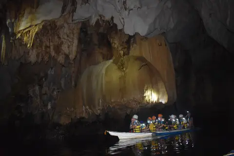
Strict daily visitor caps manage tourism pressure inside dark cave chambers without disturbing roosting bats, swiftlets or fragile speleothems. Authorities enforce a limit of 900 visitors per day along the river stretch, backed by annual wildlife population surveys monitoring tourism effects on birds, mammals and coastal primates. Only quiet paddle-powered outrigger boats enter the dark limestone tunnels, shielding underground acoustics from motor noise and exhaust fumes while trained staff refine visitor planning. These bioecological links between coastal mangroves, cavern fauna and forest slopes keep the full subterranean sanctuary intact.
Long-term conservation hinges equally on protecting upstream catchment basins beyond coastal cliffs. Because rainwater draining across Barangay Marufinas and neighbouring upland agricultural lands feeds directly into the Cabayugan River before vanishing underground, forest clearing and agricultural pollution inputs pose persistent risks to subterranean water quality. Regular barangay awareness campaigns, expanded ranger planning training, water quality monitoring and an integrated watershed land-use plan work continually to preserve both cave water clarity and Palawan's intact mountain-to-sea forests for local communities and visiting naturalists.
Access Zones Across Puerto Princesa Underground River National Park
Permitted visitors move from Sabang's beach pier toward the lagoon mouth by outrigger boat, keeping coastal roads away from sensitive karst watersheds. Secure official city entry permits before travelling north to Sabang.
| Complex Zone | Key Highlights | Access & Ticket Rule |
|---|---|---|
| Sabang Beach Gateway Village | Coastal boat launch area roughly 76 to 80 kilometres northwest of Puerto Princesa city with permit validation desks and wooden outrigger bangkas. | Mandatory permit verification point before boarding licensed coastal bangkas; enforced daily park limit of 900 visitors (official permit required). |
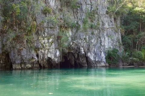
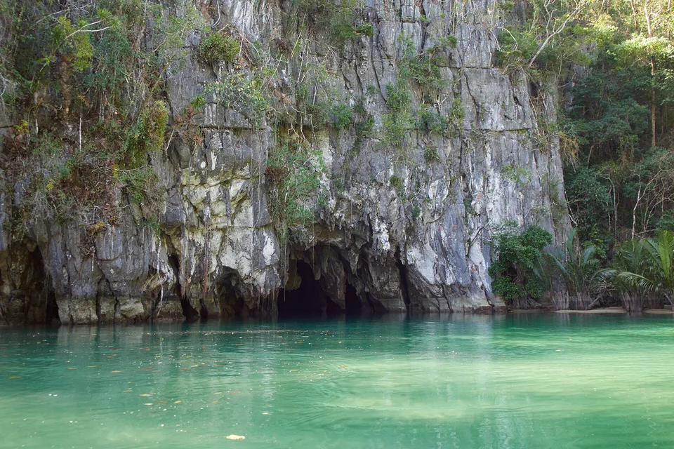
| Coastal Forest Bay and Beach Trail | Beach forest, mangrove fringes, limestone cliff entrance and foraging long-tailed macaques along the river lagoon mouth. | Reached by bangka boat or regulated coastal trails; keep food securely stored away from wild macaques along the landing beach. |
| Subterranean River Cave Channel | 4.3-to-4.5-kilometre navigable boat corridor revealing stalactites, stratified brackish waters and chambers up to 120 metres wide. | Guided paddle-boat tour wearing life jackets and helmets; loud voices and flash photography restricted to protect bats and swiftlets. |
| Upper Karst Watershed and Eight Forest Belts | Saint Paul Mountain Range ridges, ultramafic slopes, limestone forests and deeper 32-kilometre cave passages beyond public boat limits. | Protected conservation zone; deep upper river passages remain closed due to strict ecosystem protection and oxygen hazards. |
Three Karst and Tidal Features Inside the Underground River
- Brackish Tidal Stratification Inside the Lower Cavern: Watch how South China Sea tides reach 6 kilometres underground inside the channel. Dense saltwater glides quietly beneath a thin freshwater stream flowing out from Saint Paul watersheds.
- Monumental Speleothem Vaults in Italian's Chamber: Look upward as tour lights sweep past massive hanging stalactites and limestone ceiling vaults. Expansive halls reach 60 metres high and 120 metres wide along the navigable passage.
- Intact Dipterocarp-to-Mangrove Transition at the Cave Mouth: Contrast lowland rainforest giants like dao and ipil trees clinging to bare coastal cliffs against estuarine mangroves framing the river lagoon entrance.
How to Get to Puerto Princesa Underground River, What to Wear, and Timing
Booking official entry permits well ahead prevents arriving at Sabang after the 900-visitor daily limit fills. Scheduled domestic flights connect northward to Manila (542 kilometres north-east), landing locally at Puerto Princesa International Airport (PPS), 50 kilometres south of the park. From town, overland shuttles cross Palawan's central hills roughly 76 to 80 kilometres north-west to coastal Sabang, where wooden outrigger bangka boats ferry permitted guests to the lagoon beach before paddle boats enter the cave.
Coastal boat transfers and cave openings depend directly on sea swells and monsoon runoff. Drier months generally bring calmer South China Sea crossings from Sabang and clear tidal layers inside the cavern, whereas heavy monsoon rains can roughen landings and flood the Cabayugan River. Pairing the quiet cave cruise with guided coastal forest walks watching hornbills, monitor lizards and wild macaques makes an unhurried full-day excursion.
Simple clothing makes shallow surf landings at Sabang and the cave beach straightforward. Because guests step straight into knee-deep bay water when boarding and disembarking bangkas at Sabang and the cave beach, light quick-drying clothes, secure water sandals and waterproof dry bags for electronics work far better than street trainers. Wear provided helmets and life vests cleanly inside dark chambers and carry reef-friendly sun protection for open boat rides. Discover more karst cave parks across Southeast Asia in our UNESCO World Heritage Atlas.