Quick Field Data
- UNESCO Inscription: 1995 (Ref. 722), the first site ever listed in UNESCO's cultural landscape category, Ifugao Province, Luzon, Philippines; Criteria (iii), (iv) and (v).
- Scale & Footprint: Five distinct mountain terrace clusters spanning four Ifugao municipalities (Batad and Bangaan in Banaue, Mayoyao Central, Hungduan and Nagacadan in Kiangan), awaiting formal boundary delineation.
- Access & Ticketing: Active ancestral private farmlands protected under Presidential Decrees 260 (1973) and 1505 (1978) and Republic Act 10066 (2010); check local municipal registration desks and trail guide rules on arrival.
- Arrival Logistics: Closest major commercial air hub is Clark International Airport (CRK), 194 kilometres south, with alternate gateway Ninoy Aquino International Airport (MNL), 262 kilometres south near Manila (252 kilometres). Cauayan Airport (CYZ) sits 74 kilometres away with limited domestic service.
Banaue Rice Terraces History and the Five Inscribed Ifugao Clusters
Carved across steep mountain spurs on northern Luzon, the Rice Terraces of the Philippine Cordilleras stand among the rare monumental stoneworks in the Philippines showing zero colonial architectural influence. Because rugged mountain passes deterred Spanish armies for centuries, Cordillera communities preserved indigenous tribal traditions across five present-day provinces while surrounding lowlands built colonial masonry towns. Elsewhere across Southeast Asia, Cambodia, Indonesia and Thailand built stone monuments, whereas traditional Philippine domestic houses, granaries and ritual shrines relied almost exclusively on wood. Today, that pre-colonial timber tradition persists directly across these highland village hamlets, framing these terraced stone embankments and the distant Ivatan idjang fortresses of Batanes as rare pre-colonial stone survivals.
Modern archaeological dating adds essential precision to Banaue rice terraces history without diminishing Ifugao engineering achievement. While oral traditions and early heritage accounts traced the terraces back 2,000 years across a thousand farming generations, the Ifugao Archaeological Project under Stephen Acabado applied Bayesian radiocarbon (14C) modelling to buried field profiles. Because tiered paddy soils mix chaotically during centuries of maintenance, simple stratigraphic superposition can mislead laboratory calibration, whereas Bayesian statistical sequencing combines known relative deposition order with calibrated 14C dates. Results indicate intensive stone wet-rice terracing accelerated roughly 400 years ago during the 16th century as upland settlers moved inland during Spanish contact, succeeding earlier taro terraces started less than 1,000 years ago before rice replaced taro around 1600 AD.
Clarifying Banaue rice terraces location prevents a common visitor misconception across northern Luzon. Although the stepped slopes visible from Banaue's main town poblacion overlook carry Philippine National Cultural Treasure protection, modern concrete structures around the township lowered visual integrity enough to exclude them from UNESCO status. Instead, the 1995 World Heritage inscription formally protects five intact clusters inside Ifugao Province across four municipalities: Batad and Bangaan in Banaue, Nagacadan in Kiangan, Hungduan in Hungduan and Mayoyao Central in Mayoyao.
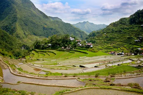
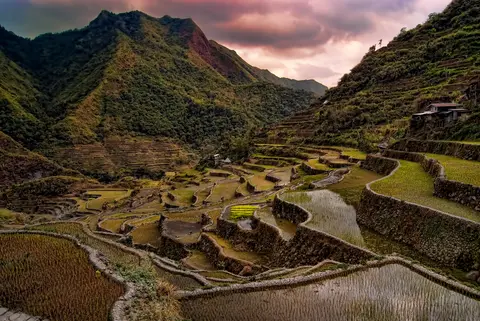
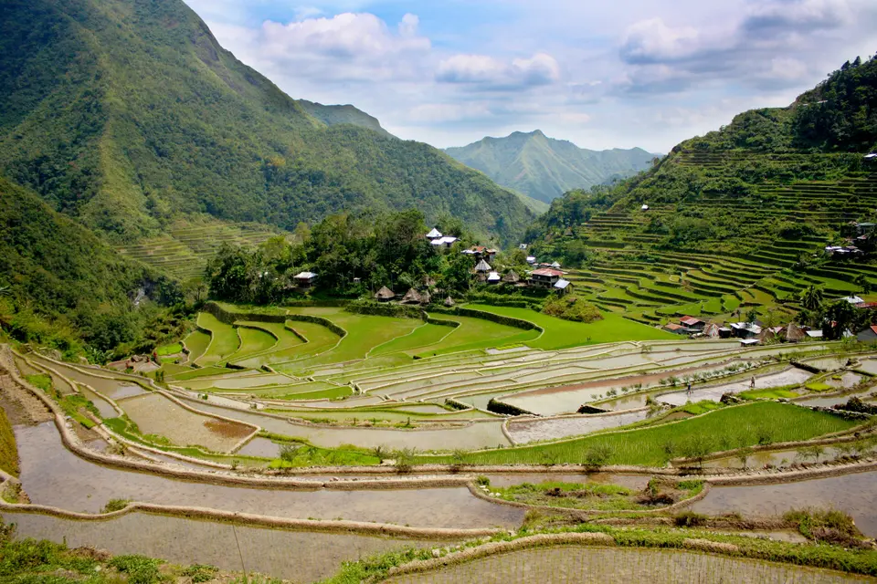
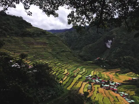
Each of the five clusters displays a distinctive spatial geometry shaped directly by steep valley contours. Nagacadan in Kiangan unfolds in two distinct ascending terrace bands split down the centre by a valley river, whereas Hungduan braids irrigated walls uniquely into a striking spider-web basin. Mayoyao Central intersperses stone pond fields directly with traditional farmers' timber bale dwellings and alang rice granaries, while Bangaan frames a typical traditional Ifugao village and Batad sweeps down in dramatic semi-circular amphitheatre tiers above a village at its base.
Across all four municipalities, private family inheritance and community consensus bind individual rice terraces into coherent valley systems. No outside colonial power or centralised state engineered these steep contour walls; local clans carved, shored and irrigated every hillside field themselves. That unbroken pre-colonial lineage turns Cordillera villages into living repositories of indigenous Cordillera agriculture, timber craft and upland land governance.
Muyong Mountaintop Watersheds, Timber Hamlets, and Hydraulic Engineering
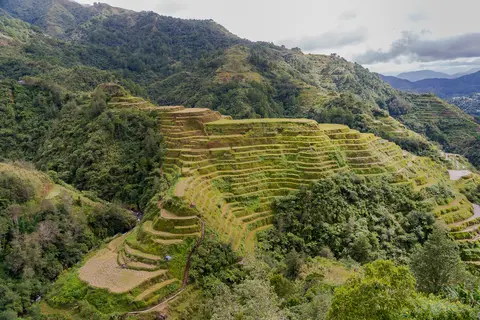
Keeping flooded pond fields saturated above 1,000 metres elevation across extreme mountain slopes requires unified watershed stewardship. Crowning each terrace cluster stands a muyong, a privately owned yet collectively maintained mountaintop forest governed under ancestral tribal rules. Housing approximately 264 mostly endemic indigenous plant species, these dense forest caps form linked micro-watersheds across mountain ecology, trapping rain and filtering monsoon mist through forest humus to supply year-round gravity springs without losing topsoil.
From mountaintop forests downward, Ifugao engineering harmonises water flow, climate biorhythm and cooperative labour purely through oral transmission without written records. Farmers reinforce contoured mud beds with interlocking stone and mud retaining walls built at higher altitudes and steeper gradients than comparable rice terraces elsewhere. Traditional annual calendars respect lunar cycles, village land-use zoning, extensive soil conservation and complex herbal pest remedies prepared from local forest plants rather than industrial chemicals.
Shared ritual and song anchor farming ethics deep within Ifugao identity. Also designated a Globally Important Agricultural Heritage Site (GIAHS), the living system connects directly with the Hudhud Chants of the Ifugao, originally proclaimed in 2001 and inscribed on UNESCO's Intangible Cultural Heritage list in 2008. Sung chiefly by elder Ifugao women during sowing seasons, golden harvest periods and funeral wakes, these oral narrative chants weave ancestral law, ecology and communal solidarity straight into village labour.
Maintaining this living agro-ecosystem depends on balancing all social, religious, agronomic and climatic links simultaneously. If watershed timber vanishes or community ritual cohesion weakens, terrace embankments degrade far faster than stone repairs alone can restore. Conversely, sustaining tribal stewardship together with national heritage funding protects both ancient landscape engineering and living Cordillera culture.
Outmigration, Invasive Earthworms, and World Heritage Danger Recovery
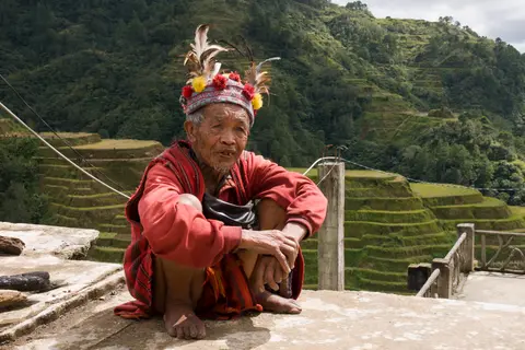
Acute social and environmental pressures placed the terraces on UNESCO's List of World Heritage in Danger in 2001, prompting sustained provincial intervention. Christianisation beginning in the 1950s altered traditional rituals (even where tribal ceremonies now coexist with church practices), while formal education, television and Internet exposure drew younger Ifugaos away from labour-intensive farming. Rural-to-urban outmigration leaves mainly elders and children in mountain hamlets, starving sprawling stone embankments of repair workers even where mechanical cultivators and threshers appear, as youths shun farming as an occupation for the uneducated.
Labour shortages directly erode the traditional unpaid cooperative farming practices that built and maintained the terraces. Historically, neighbouring farmers gathered voluntarily to clear weeds, transplant rice or rebuild fallen stone walls in exchange solely for shared meals and reciprocal help when another neighbour needed assistance later. Today, hired repair workers expect cash wages or payments in kind that families cultivating six-month rice crops struggle to afford. Poverty tempts growers toward fast-income commercial vegetables requiring chemical fertilisers and pesticides that damage downstream ecology and encourage clearing watershed forests, while tourism prompts converting rice paddies into residential lodging shops or cutting forest timber for woodcarvings.
Biological pests and extreme weather multiply masonry damage across Ifugao's valleys. Since the late 1940s, invasive earthworms have burrowed beneath paddy floors, draining water fast until exposed clay dries, cracks and collapses upon re-flooding. Faster-reproducing swamp eels bore even bigger holes in dikes, joined by snails and mole crickets, while typhoon downpours and massive regional earthquakes shift water springs and shatter retaining dams. Legal protection under Presidential Decrees 260 (1973) and 1505 (1978) and Republic Act 10066 (2010) empowers the Ifugao Provincial Government and National Commission for Culture and the Arts (building on the 1994 Ifugao Terraces Commission) to implement expanded 10-year Master Plans. Ongoing boundary delineation, Environmental Impact Assessments and Community-Based Land Use and Zoning Plans (CBLUZP) work continuously to restore collapsed stonework and revive ancestral farming stewardship.
Sustaining these terraced hillsides long term requires matching national policies with active municipal coordination and farmers' associations. Provincial agencies aim to restore physical damage steadily while creating viable agricultural livelihoods so younger generations choose to remain on mountain slopes. Preserving traditional pride of place among indigenous Ifugao landowners secures both the living paddies and surrounding watershed forests. Coordinating local owners' associations with national environmental policies ensures infrastructure repairs follow authentic stone-and-mud craft rather than concrete shortcuts. Every repaired dike and guarded mountaintop woodland helps move these steep Cordillera clusters steadily away from historical threats.
Access Zones Across the Five Ifugao Terrace Clusters
Because the five protected clusters lie separated across steep Cordillera ridges, pairing one Banaue-based valley walk with western Hungduan or southern Kiangan routes keeps mountain road transfers realistic. Register at local barangay and tourism desks before stepping onto narrow stone dikes.
| Complex Zone | Key Highlights | Access & Ticket Rule |
|---|---|---|
| Batad Cluster in Banaue | Semi-circular stone-walled amphitheatre terraces and hillside village beneath forested ridges. | Reached by mountain spur road and steep foot trail from Banaue; register at the Batad checkpoint and hire local trail guides. |
| Bangaan Cluster in Banaue | Compact terraced valley framing a traditional Ifugao village of elevated wooden bale houses. | Viewed from highway overlooks or walked down stone paths; respect private residential yards inside the village centre. |
| Hungduan and Nagacadan | Spider-web terrace basin at Hungduan and twin river-bisected ascending rows in Kiangan. | Reached via winding Cordillera roads west and south of Banaue; local municipal offices advise on guides and trail conditions. |
| Mayoyao Central Cluster | Broad contour terraces interspersed with traditional timber bale dwellings and alang rice granaries. | Eastern mountain road journey from Banaue; active farmlands where visitors must remain strictly on designated terrace walls. |
Three Hydraulic and Village Details in Ifugao's Living Terraces
- Dry-Laid Stone Retaining Walls Without Mortar: Inspect the curved embankments inside Batad's steep bowl to see interlocking river stones and packed subsoil holding heavy flooded paddies while letting excess water weep gently through narrow joints.
- Muyong Watershed Forests Above Every Ridge: Trace the terraced slopes upward until green broadleaf woodland caps every ridge crest, deliberately preserved under tribal ownership solely to sustain year-round gravity irrigation springs below.
- Wooden Bale Houses and Alang Granaries: Inside Mayoyao and Bangaan, examine steep pyramidal thatched roofs resting over peg-joined timber rooms elevated on cylindrical pest-guarded posts, preserving pre-colonial Philippine wood architecture.
Best Time to Visit Banaue Rice Terraces and Overland Access From Manila
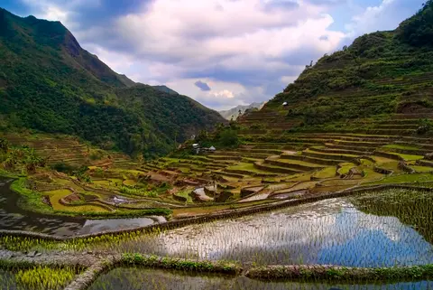
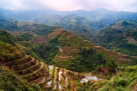
Choosing the best time to visit Banaue rice terraces depends on watching seasonal agricultural stages across the six-month crop cycle. Flooded mirror-like terraces mark early planting months when mountain skies reflect sharply across still ponds, vivid emerald shoots peak around June before turning warm gold ahead of harvest and dry-season months offer safer roads free from typhoon landslides. Always verify regional weather and mountain highway alerts before travelling north through Luzon.
Travellers also plan overland routing carefully given the winding mountain distances between Luzon's plains and Ifugao's valleys. Night coaches from Manila climb steadily through Nueva Vizcaya into Banaue town, where smaller local vehicles transfer visitors out to trailheads in Batad, Bangaan or Hungduan. Allowing at least three days across Ifugao Province gives realistic pacing for walking contour dikes without rushing between distant municipalities. Hiring certified local Ifugao guides also keeps foot traffic strictly on approved stone walls while supporting village conservation funds. Stepping lightly along narrow irrigation dikes protects mud embankments and lets farming families carry out transplanting or weeding uninterrupted.
Most international visitors arrive in Manila (252 kilometres south) via Ninoy Aquino International Airport (MNL, 262 kilometres) or Clark International Airport (CRK, 194 kilometres) before taking long-distance overnight buses or private mountain transfers into Ifugao Province. Closer Cauayan Airport (CYZ) sits 74 kilometres east in Isabela Province, though limited scheduled routes and winding passes make Manila and Clark more predictable gateways. Browse further Southeast Asian cultural landscapes in our UNESCO World Heritage Atlas.